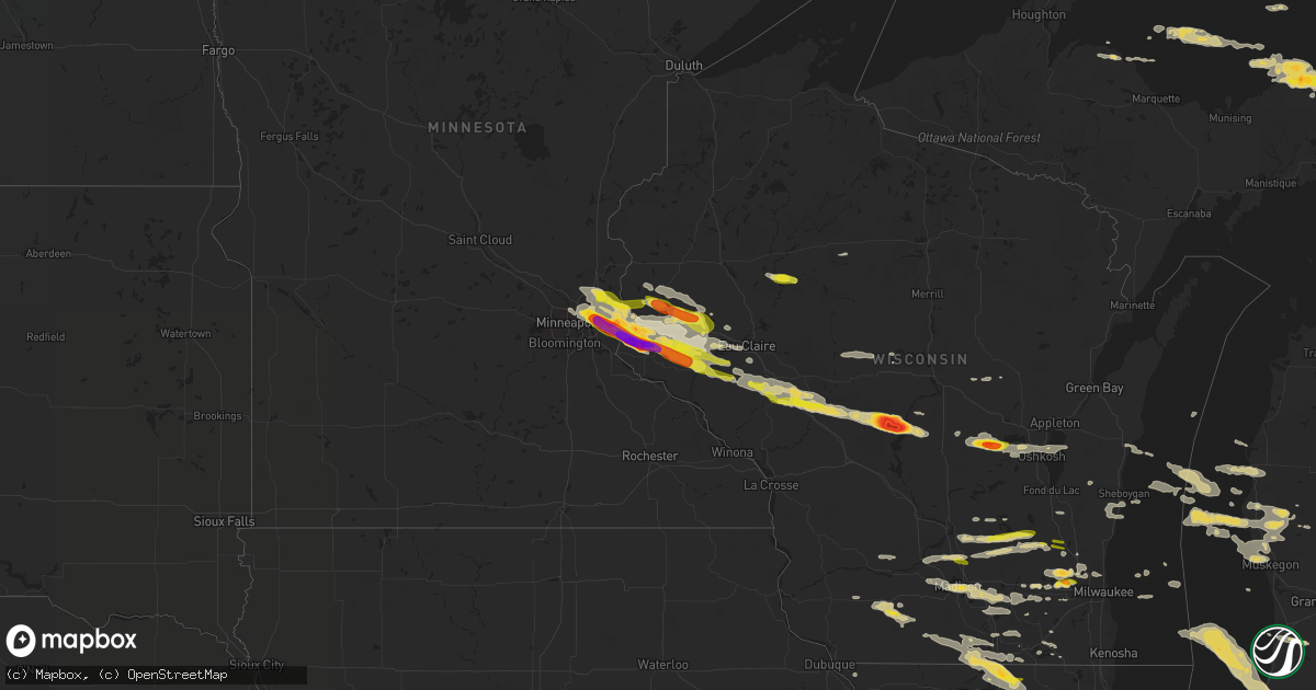
Hail Map on September 20, 2022
Get this storm
September 20 map
$229
one time, instant access
Download today. No call, no setup
Keep the $229
Bought the map and want the full workflow? Apply the entire $229 to a subscription within 7 days. None of it is wasted.
Every map, not just this one
This buys you this map. Subscription and you get every map we run, in the markets you choose from a few cities to whole states to nationwide. Plus real-time alerts the moment a storm fires.
Contact data
Name, contact info, occupancy, even credit band for addresses in the footprint. You go from where it hit to who to call.
Become the source they trust
Unlimited branding weather history reports on demand. You already have the documented answer ready for the property owner, and you are the one who showed up with it.
Property data and RoofTrace estimates
Pull up any address you have got, its value and the exact code rules for that jurisdiction, straight from One Click Code. Then RoofTrace estimates the squares, pitch, and roof value, priced the way you price.
States Impacted by Hail Map on September 20, 2022
Storm reports
Oregon
| Date | Description |
|---|---|
| 09/19/20228:41 PM CDT | At kbno |
Michigan
| Date | Description |
|---|---|
| 09/20/202212:29 PM CDT | Report from mping: quarter |
| 09/20/20227:53 AM CDT | At 1252 PM EDT, a severe thunderstorm was located near Paw Paw Lake, or 10 miles northeast of Benton Heights, moving southeast at 35 mph. HAZARD...60 mph wind gusts and quarter size hail. SOURCE...Radar indicated. IMPACT...Hail damage to vehicles is expected. Expect wind damage to roofs, siding, and trees. Locations impacted include... Benton Harbor, Benton Heights, Watervliet, Coloma, Lake Michigan Beach, Paw Paw Lake, Riverside, Spinks Corners and Millburg.This includes the following highways... Interstate 196 between mile markers 0 and 7. Interstate 94 in Michigan between mile markers 32 and 42. |
| 09/20/20227:24 AM CDT | At 1223 PM EDT, a severe thunderstorm was located 14 miles west of South Haven, moving southeast at 40 mph. HAZARD...60 mph wind gusts and quarter size hail. SOURCE...Radar indicated. IMPACT...Hail damage to vehicles is expected. Expect wind damage to roofs, siding, and trees. Locations impacted include... South Haven... Paw Paw... Hartford... Lawton... Bangor... Decatur... Van Buren SP... Lake Michigan Beach... Covert... Keeler... Lawrence... Breedsville... Grand Junction... South Haven Area Reg... Glenn... Lacota... |
| 09/19/20228:18 PM CDT | At 118 PM EDT, a severe thunderstorm was located near Decatur, or 7 miles north of Dowagiac, moving southeast at 30 mph. HAZARD...60 mph wind gusts and quarter size hail. SOURCE...Radar indicated. IMPACT...Hail damage to vehicles is expected. Expect wind damage to roofs, siding, and trees. Locations impacted include... Dowagiac, Cassopolis, Marcellus, Penn, Vandalia, Magician Lake, Dewey Lake, Dailey, La Grange, Paradise Lake, Calvin Center, Indian Lake, Donnell Lake, Sandy Beach, Spinks Corners, Jones, Diamond Lake, Shavehead Lake and Wakelee. |
Kansas
| Date | Description |
|---|---|
| 09/20/20223:11 AM CDT | At 811 PM CDT, a severe thunderstorm was located over Zurich, or 21 miles southeast of Hill City, moving east at 15 mph. HAZARD...60 mph wind gusts and nickel size hail. SOURCE...Radar indicated. IMPACT...Expect damage to roofs, siding, and trees. This severe thunderstorm will be near... Zurich around 820 PM CDT.Other locations in the path of this severe thunderstorm includePlainville. |
| 09/20/20222:55 AM CDT | At 755 PM CDT, severe thunderstorms were located along a line extending from near Esbon to 10 miles northeast of Portis to 6 miles south of Cedar, moving east at 20 mph. HAZARD...60 mph wind gusts. SOURCE...Radar indicated. IMPACT...Expect damage to roofs, siding, and trees. Severe thunderstorms will be near... Lebanon around 800 PM CDT. Esbon around 805 PM CDT. Gaylord around 815 PM CDT.Other locations in the path of these severe thunderstorms includeBurr Oak, Ionia, Harlan, Mankato, Glen Elder, Portis, Downs andJewell. |
| 09/20/20222:26 AM CDT | At 725 PM CDT, severe thunderstorms were located along a line extending from near Smith Center to 6 miles southeast of Speed, moving east at 15 mph. HAZARD...60 mph wind gusts and penny size hail. SOURCE...Radar indicated. IMPACT...Expect damage to roofs, siding, and trees. Severe thunderstorms will be near... Smith Center around 730 PM CDT.Other locations in the path of these severe thunderstorms includeBellaire, Lebanon and Kirwin. |
| 09/19/20227:22 PM CDT | A local report indicates 61 MPH wind near SMITH CENTER AIRPORT |
| 09/19/20227:20 PM CDT | A local report indicates 58 MPH wind near PHILLIPSBURG AIRPORT |
Illinois
| Date | Description |
|---|---|
| 09/20/20226:33 PM CDT | Picture shared on social media of an approximately 6 inch diameter tree down near butterfield rd and i-355. |
| 09/20/20226:12 PM CDT | Photo shared on social media of a large tree downed onto a house. |
| 09/20/20226:12 PM CDT | Spotter reports several 3 inch branches down. Time estimated from radar. |
| 09/20/20226:12 PM CDT | Tree and power line down near president and chase street. |
| 09/20/20226:05 PM CDT | Pictures shared on social media of several trees snapped along route 38. |
| 09/20/20226:00 PM CDT | Trees and several large branches downed. |
| 09/20/20225:59 PM CDT | Picture shared via social media of a snapped tree down on power lines just west of the intersection of corron and silver glenn roads. |
| 09/20/20225:59 PM CDT | Large branch downed. |
| 09/20/20225:50 PM CDT | Trees down near peck road. Relayed via social media. |
| 09/20/20225:29 PM CDT | Trees down at the intersection of plank road and route 47. Time estimate. |
| 09/20/20224:21 PM CDT | Spotter reports a 4 inch diameter tree branch down southeast of the intersection of highway 76 and highway 173. |
| 09/20/20223:57 PM CDT | Large tree downed. |
| 09/20/202212:34 AM CDT | At 534 PM CDT, a severe thunderstorm was located near Pingree Grove, or near Campton Hills, moving southeast at 30 mph. HAZARD...60 mph wind gusts and quarter size hail. SOURCE...Radar indicated. IMPACT...Hail damage to vehicles is expected. Expect wind damage to roofs, siding, and trees. Locations impacted include... Aurora, Naperville, Elgin, Wheaton, Downers Grove, Lombard, Bartlett, Carol Stream, Hanover Park, Addison, Glendale Heights, St. Charles, Glen Ellyn, West Chicago, Batavia, Huntley, Geneva, Campton Hills, Lisle and Bloomingdale.Including the following interstates... I-88 between mile markers 105 and 130. I-90 between mile markers 48 and 55. I-355 between mile markers 24 and 29.This includes... Aurora University, Benedictine University, Collegeof DuPage, DuPage County Fairgrounds, Elgin Community College,Fermilab, IL Math and Science Academy, Kane County Cougars Ballpark,Morton Arboretum, Waubonsee Community College, and Wheaton College. |
| 09/20/202212:31 AM CDT | At 530 PM CDT, a severe thunderstorm was located over Carpentersville, moving southeast at 30 mph. HAZARD...60 mph wind gusts and quarter size hail. SOURCE...Radar indicated. IMPACT...Hail damage to vehicles is expected. Expect wind damage to roofs, siding, and trees. Locations impacted include... Elgin, Arlington Heights, Schaumburg, Palatine, Des Plaines, Mount Prospect, Hoffman Estates, Glenview, Elmhurst, Buffalo Grove, Bartlett, Ohare Airport, Streamwood, Hanover Park, Wheeling, Park Ridge, Addison, Northbrook, Elk Grove Village and Niles.Including the following interstates... I-90 between mile markers 57 and 77. I-290 between mile markers 1 and 15. I-355 near mile marker 30.This includes... Oakton Community College, Schaumburg BoomersBaseball, and Harper College. |
| 09/19/202211:37 PM CDT | At 437 PM CDT, a severe thunderstorm was located over Rockford Airport, moving southeast at 30 mph. HAZARD...60 mph wind gusts and half dollar size hail. SOURCE...Radar indicated. IMPACT...Hail damage to vehicles is expected. Expect wind damage to roofs, siding, and trees. Locations impacted include... Rockford, Belvidere, Loves Park, Genoa, Rockford Airport, Cherry Valley, Davis Junction, Kirkland, Kingston, New Milford, Lindenwood, Monroe Center and Fairdale.Including the following interstates... I-39 between mile markers 107 and 123. I-90 between mile markers 15 and 31. |
| 09/19/202211:29 PM CDT | At 428 PM CDT, a severe thunderstorm was located near Poplar Grove, moving southeast at 30 mph. HAZARD...60 mph wind gusts and half dollar size hail. SOURCE...Radar indicated. IMPACT...Hail damage to vehicles is expected. Expect wind damage to roofs, siding, and trees. Locations impacted include... Elgin, Bartlett, Crystal Lake, Carpentersville, St. Charles, Algonquin, Lake in the Hills, McHenry, Woodstock, Huntley, Island Lake, Marengo, South Elgin, Cary, Pingree Grove, Gilberts, West Dundee, Hampshire, Fox River Grove and Barrington Hills.Including the following interstate... I-90 between mile markers 32 and 56. This includes... Elgin Community College, Mchenry County College,and Mchenry County Fairgrounds. |
| 09/19/202210:49 PM CDT | At 349 PM CDT, a severe thunderstorm was located near Beloit, moving east at 40 mph. HAZARD...Quarter size hail. SOURCE...Radar indicated. IMPACT...Damage to vehicles is expected. Locations impacted include... Janesville, Beloit, Clinton, Footville, Newark, Tiffany, Hanover, Foxhollow, Shopiere and Afton. |
| 09/19/202210:45 PM CDT | At 345 PM CDT, a severe thunderstorm was located near Rockton, moving southeast at 40 mph. HAZARD...60 mph wind gusts and quarter size hail. SOURCE...Radar indicated. IMPACT...Hail damage to vehicles is expected. Expect wind damage to roofs, siding, and trees. Locations impacted include... Rockford, Belvidere, Loves Park, Machesney Park, Roscoe, South Beloit, Rockton, Poplar Grove, Candlewick Lake, Capron, Timberlane, Garden Prairie, Caledonia, Shirland and Harrison.Including the following interstate... I-90 between mile markers 1 and 13, and between mile markers 26 and31. This includes... Boone County Fairgrounds, Rock Cut State Park,Rockford Aviators Baseball, and Rockford Speedway. |
Wisconsin
| Date | Description |
|---|---|
| 09/20/20223:50 PM CDT | Delayed report. Multiple reports of large trees down in beloit... Including one tree down on a truck. Time estimated from radar. |
| 09/20/20222:58 PM CDT | Sw side of lisbon...pictures via social media. |
| 09/20/20222:25 PM CDT | 7.3 ene of mineral point. |
| 09/20/20222:22 PM CDT | Report from mping. |
| 09/20/20221:39 PM CDT | Report from mping. |
| 09/20/20221:34 PM CDT | Report from mping. |
| 09/20/20221:27 PM CDT | Via social media with picture. |
| 09/20/20221:20 PM CDT | From woodland....via social media. |
| 09/20/20221:07 PM CDT | Report from mping. |
| 09/20/20221:07 PM CDT | Via social media...time est from radar. |
| 09/20/20221:00 PM CDT | Report from mping. |
| 09/20/20227:46 AM CDT | At 1246 PM CDT, a severe thunderstorm was located near Rio, or 10 miles northwest of Columbus, moving east at 35 mph. HAZARD...60 mph wind gusts and quarter size hail. SOURCE...Radar indicated. IMPACT...Hail damage to vehicles is expected. Expect wind damage to roofs, siding, and trees. Locations impacted include... Columbus, Randolph, Fall River, Rio, Cambria, Fox Lake, Wyocena, Otsego, Friesland, Doylestown, Danville and Astico. |
| 09/20/20225:17 AM CDT | At 1017 PM CDT, a severe thunderstorm was located near Sheldon, or 12 miles south of Ladysmith, moving east at 35 mph. HAZARD...Half dollar size hail. SOURCE...Radar indicated. IMPACT...Damage to vehicles is expected. This severe thunderstorm will be near... Sheldon around 1025 PM CDT. |
| 09/20/20225:00 AM CDT | At 1000 PM CDT, a severe thunderstorm was located 6 miles south of Woodville, or 16 miles east of River Falls, moving east at 45 mph. HAZARD...Half dollar size hail. SOURCE...Radar indicated. IMPACT...Damage to vehicles is expected. This severe thunderstorm will be near... Elmwood around 1010 PM CDT. Eau Galle around 1020 PM CDT. |
| 09/20/20224:54 AM CDT | At 953 PM CDT, a severe thunderstorm was located near Durand, or 10 miles northwest of Mondovi, moving southeast at 35 mph. HAZARD...Half dollar size hail. SOURCE...Radar indicated. IMPACT...Damage to vehicles is expected. This severe thunderstorm will be near... Mondovi around 1010 PM CDT. Strum around 1030 PM CDT. Whitehall around 1045 PM CDT.This includes Interstate 94 between mile markers 88 and 91. |
| 09/20/20224:28 AM CDT | At 927 PM CDT, severe thunderstorms were located along a line extending from 5 miles northwest of Chippewa Falls to 5 miles southwest of Elmwood, moving southeast at 35 mph. HAZARD...Two inch hail. SOURCE...Radar indicated. IMPACT...People and animals outdoors will be injured. Expect damage to roofs, siding, windows, and vehicles. Severe thunderstorms will be near... Chippewa Falls around 935 PM CDT. Lake Wissota around 940 PM CDT.Other locations in the path of these severe thunderstorms includeDurand, Cadott, Boyd and Stanley. |
| 09/20/20223:50 AM CDT | At 850 PM CDT, a severe thunderstorm was located near River Falls, moving east at 40 mph. HAZARD...Two inch hail. SOURCE...Radar indicated. IMPACT...People and animals outdoors will be injured. Expect damage to roofs, siding, windows, and vehicles. This severe thunderstorm will be near... Baldwin around 900 PM CDT. Woodville around 905 PM CDT.Other locations in the path of this severe thunderstorm includeElmwood and Eau Galle. |
| 09/20/20223:46 AM CDT | At 845 PM CDT, a severe thunderstorm was located over Wheeler, or 9 miles north of Menomonie, moving east at 40 mph. HAZARD...Ping pong ball size hail. SOURCE...Radar indicated. IMPACT...People and animals outdoors will be injured. Expect damage to roofs, siding, windows, and vehicles. This severe thunderstorm will be near... Colfax around 905 PM CDT.Other locations in the path of this severe thunderstorm include ElkMound, Lake Hallie, Chippewa Falls, Altoona and Lake Wissota. |
| 09/20/20223:13 AM CDT | At 813 PM CDT, a severe thunderstorm was located over White Bear Lake, or 8 miles northeast of St. Paul, moving east at 40 mph. HAZARD...Half dollar size hail. SOURCE...Radar indicated. IMPACT...Damage to vehicles is expected. This severe thunderstorm will be near... Woodbury, Stillwater, Lake Elmo and Afton around 825 PM CDT. Bayport around 830 PM CDT.Other locations in the path of this severe thunderstorm includeHudson, North Hudson and Roberts. |
| 09/20/20221:35 AM CDT | Report from mping. Half dollar sized hail. |
| 09/20/20221:30 AM CDT | Half dollar sized hail lasting approximately 3 minutes. |
| 09/20/20221:30 AM CDT | Most hailstones around 1 inch to 1 and a quarter inch. One hailstone was 1 and seven eighths inches long. |
| 09/20/202212:18 AM CDT | Hail lasted for 8 min. Cranberry/ag survey- divots. |
| 09/20/202212:10 AM CDT | Hail lasted for 10 min. Damage to vehicles. Pictures of sent via email. |
| 09/20/202212:00 AM CDT | Report via facebook photo. Time estimated from radar. |
| 09/19/202210:21 PM CDT | Localized ponding on roadways. Time estimated via radar. |
| 09/19/202210:10 PM CDT | Time estimated via radar. |
| 09/19/20229:56 PM CDT | At 255 PM CDT, severe thunderstorms were located along a line extending from near Lake Mills to near Cambridge, moving southeast at 25 mph. HAZARD...Quarter size hail. SOURCE...Radar indicated. IMPACT...Damage to vehicles is expected. Locations impacted include... Whitewater, Fort Atkinson, Jefferson, Lake Mills, Milton, Edgerton, Johnson Creek, Palmyra, Cambridge, Lake Ripley, Lake Koshkonong, Rome, La Grange, Albion, Hebron, Sullivan, Utica, Rockdale, Busseyville and Helenville. |
| 09/19/20229:24 PM CDT | At 224 PM CDT, a severe thunderstorm was located 8 miles northwest of Blanchardville, or 9 miles southeast of Dodgeville, moving east at 30 mph. HAZARD...Quarter size hail. SOURCE...Radar indicated. IMPACT...Damage to vehicles is expected. Locations impacted include... Western Madison, Fitchburg, Verona, Mount Horeb, Belleville, New Glarus, Blanchardville, Barneveld, Blue Mounds, Dayton, Waldwick, Hollandale, Attica, Paoli, Blue Mound St Park, Mount Vernon and Jonesdale.This includes the following Location York Memorial Church. |
| 09/19/20229:16 PM CDT | At 216 PM CDT, a severe thunderstorm was located over eastern Madison, moving east at 35 mph. HAZARD...Quarter size hail. SOURCE...Radar indicated. IMPACT...Damage to vehicles is expected. Locations impacted include... Madison, Sun Prairie, Fitchburg, McFarland, Monona, Lake Mills, Marshall, Waterloo, Cottage Grove, Deerfield, Shorewood Hills, Cambridge, Maple Bluff, Lake Ripley, Rockdale, Deansville, Camp Randall Stadium, Hubbleton, Henry Vilas Zoo and UW-Madison.This includes the following Location Wisconsin State Capitol. |
| 09/19/20229:10 PM CDT | Trained spotter measured quarter sized hail just north of menomonie. |
| 09/19/20228:54 PM CDT | Trained spotter measured tennis ball sized hail near river falls... Wi. |
| 09/19/20228:50 PM CDT | Report from mping: half dollar |
| 09/19/20228:46 PM CDT | A social media picture of 3 inch hail in river falls. There has been several calls from river falls of baseball size hail since 850 lst. |
| 09/19/20228:45 PM CDT | Trained spotter measured 3 inch hail one mile nw of river falls... Wi. |
| 09/19/20228:42 PM CDT | Hail between tennis ball and baseball size. |
| 09/19/20228:35 PM CDT | Trained spotter reported 1.5 inch hail 2 miles south of hudson. Time estimated by radar. |
| 09/19/20228:20 PM CDT | Trained spotter measured quarter sized hail in new richmond. Time estimated via radar. |
| 09/19/20228:14 PM CDT | At 113 PM CDT, a severe thunderstorm was located near Deforest, or near Windsor, moving east at 45 mph. HAZARD...60 mph wind gusts and quarter size hail. SOURCE...Radar indicated. IMPACT...Hail damage to vehicles is expected. Expect wind damage to roofs, siding, and trees. Locations impacted include... Sun Prairie, Watertown, Columbus, Marshall, Waterloo, Juneau, Deforest, Fall River, Arlington, Reeseville, Richwood, Clyman, Lowell, Deansville, East Bristol, Morrisonville, Hubbleton and Danville. |
| 09/19/20228:01 PM CDT | At 100 PM CDT, a severe thunderstorm was located near Beaver Dam, moving east at 40 mph. HAZARD...Golf ball size hail and 60 mph wind gusts. SOURCE...Radar indicated. IMPACT...People and animals outdoors will be injured. Expect hail damage to roofs, siding, windows, and vehicles. Expect wind damage to roofs, siding, and trees. Locations impacted include... Beaver Dam, Hartford, Mayville, Horicon, Juneau, Theresa, Hustisford, Iron Ridge, Burnett, Addison, Rubicon, Woodland, Neosho, Wayne, Clyman, Lowell, Kekoskee, Nenno, South Beaver Dam and Saint Lawrence. |
Minnesota
| Date | Description |
|---|---|
| 09/20/20223:01 AM CDT | At 801 PM CDT, a severe thunderstorm was located over Hugo, or 18 miles northeast of St. Paul, moving east at 40 mph. HAZARD...Half dollar size hail. SOURCE...Radar indicated. IMPACT...Damage to vehicles is expected. This severe thunderstorm will be near... Stillwater and Scandia around 810 PM CDT. Somerset around 820 PM CDT.Other locations in the path of this severe thunderstorm include NewRichmond and Star Prairie. |
| 09/19/20228:32 PM CDT | Report from mping: golf ball |
| 09/19/20228:29 PM CDT | A social media photo of several large hailstones northwest of afton... Mn. Estimated based on golf ball photo of 2 inch hail. |
| 09/19/20228:26 PM CDT | Trained spotter measured 1.25 inch hail one mile ese of woodbury. |
| 09/19/20228:25 PM CDT | Hail around ping pong ball sized. |
| 09/19/20228:22 PM CDT | Social media photo of golf ball size hail. Other large hail photos have been shown since the report. |
| 09/19/20228:20 PM CDT | Public report of half dollar sized hail in ene of north st. Paul. |
| 09/19/20228:20 PM CDT | Social media picture of hail larger than golf ball size. |
| 09/19/20228:12 PM CDT | Public reported quarter sized hail in little canada. Time estimated by radar. |
Florida
| Date | Description |
|---|---|
| 09/20/202212:36 AM CDT | At 536 PM EDT, a severe thunderstorm was located over East Toll Gate On Alligator Alley, or 12 miles northwest of Pembroke Pines, and is nearly stationary. HAZARD...60 mph wind gusts and torrential rainfall. SOURCE...Radar indicated. IMPACT...Expect damage to roofs, siding, and trees. Locations impacted include... Pembroke Pines, Davie, Sunrise, Weston and East Toll Gate On Allioreg and tator Alley. |
Indiana
| Date | Description |
|---|---|
| 09/20/20221:10 PM CDT | Tree down on elm road near elm road elementary. Report relayed to nws by abc57. Time estimated from radar. |
| 09/20/20221:14 AM CDT | At 613 PM CDT, a severe thunderstorm was located over Wheaton, moving southeast at 35 mph. These storms have a history of producing wind damage. HAZARD...60 mph wind gusts and nickel size hail. SOURCE...Social media and public reports. IMPACT...Expect damage to roofs, siding, and trees. Locations impacted include... Chicago, Naperville, Cicero, Hammond, Bolingbrook, Orland Park, Tinley Park, Oak Lawn, Berwyn, Downers Grove, Elmhurst, Lombard, Romeoville, Calumet City, Woodridge, Chicago Heights, Chicago Lawn, Englewood, South Shore and Roseland.This includes... Argonne National Laboratory, Brookfield Zoo, ToyotaPark, Windy City Thunderbolts Baseball, Benedictine University, FirstMidwest Bank Amphitheatre, Governors State University, HawthornePark, Moraine Valley Community College, Morton Arboretum, PrairieState College, and South Suburban College. |
Cities Impacted by Hail Map on September 20, 2022
- Bruce, WI
- Holcombe, WI
- Sheldon, WI
- Conrath, WI
- Wheeler, WI
- Colfax, WI
- Marion, MI
- Catawba, WI
- Manitowoc, WI
- Elk Mound, WI
- Cambria, WI
- Milwaukee, WI
- Fremont, MI
- Pine River, WI
- Wautoma, WI
- Berlin, WI
- Poy Sippi, WI
- Redgranite, WI
- Wild Rose, WI
- Watertown, WI
- Sullivan, WI
- Oconomowoc, WI
- Fremont, WI
- Omro, WI
- Winneconne, WI
- Butte Des Morts, WI
- Hilbert, WI
- Stockbridge, WI
- Oshkosh, WI
- Genoa City, WI
- Rockton, IL
- Roscoe, IL
- South Beloit, IL
- Clinton, WI
- Caledonia, IL
- Beloit, WI
- Poplar Grove, IL
- Galena, IL
- Quincy, OH
- De Graff, OH
- Perry, MI
- Williamston, MI
- Webberville, MI
- Lake Geneva, WI
- Palco, KS
- Plainville, KS
- Howell, MI
- Fowlerville, MI
- Ludington, MI
- Belle Center, OH
- Waynesfield, OH
- Roundhead, OH
- Hesperia, MI
- Eau Claire, WI
- Amherst Junction, WI
- Iola, WI
- Fox Lake, WI
- Amery, WI
- Deer Park, WI
- Star Prairie, WI
- Wisconsin Rapids, WI
- Hudson, WI
- Roberts, WI
- Wapakoneta, OH
- Lima, OH
- Cadillac, MI
- McBain, MI
- Janesville, WI
- Colgate, WI
- Hartland, WI
- Sussex, WI
- Hartford, WI
- Michigamme, MI
- Fall River, WI
- Doylestown, WI
- Horicon, WI
- Beaver Dam, WI
- Burnett, WI
- Rio, WI
- Columbus, WI
- Poynette, WI
- Juneau, WI
- Strum, WI
- Osseo, WI
- Black River Falls, WI
- Eleva, WI
- Humbird, WI
- Merrillan, WI
- Blair, WI
- Pittsville, WI
- Hixton, WI
- Alma Center, WI
- Twin Lake, MI
- Glenwood City, WI
- Muskegon, MI
- Rothbury, MI
- Hart, MI
- Whitehall, MI
- Shelby, MI
- New Era, MI
- Holton, MI
- Montague, MI
- Mears, MI
- Menomonie, WI
- Falmouth, MI
- Cambridge, WI
- Mcfarland, WI
- Cottage Grove, WI
- Lake Mills, WI
- Cross Plains, WI
- Black Earth, WI
- Middleton, WI
- Jefferson, WI
- Fort Atkinson, WI
- Helenville, WI
- Stoughton, WI
- Dousman, WI
- Madison, WI
- Deerfield, WI
- White Cloud, MI
- Delafield, WI
- Nashotah, WI
- Pewaukee, WI
- Rosewood, OH
- Urbana, OH
- Saint Paris, OH
- Middleville, MI
- Hastings, MI
- Baldwin, WI
- Wilson, WI
- Hammond, WI
- Knapp, WI
- Woodville, WI
- Spring Valley, WI
- Loyal, WI
- Marshfield, WI
- Spencer, WI
- Rubicon, WI
- Iron Ridge, WI
- Lowell, WI
- Hustisford, WI
- Reeseville, WI
- Newberry, MI
- Marion, WI
- Elkhart Lake, WI
- New Richmond, WI
- Paradise, MI
- Grand Marais, MI
- Eckerman, MI
- Sheboygan, WI
- Oostburg, WI
- Sheboygan Falls, WI
- Cedar Grove, WI
- Waldo, WI
- Tampa, FL
- Houghton Lake, MI
- Spring Green, WI
- Plain, WI
- Morrisonville, WI
- Sauk City, WI
- Mazomanie, WI
- Dane, WI
- Lodi, WI
- Deforest, WI
- Arlington, WI
- Six Lakes, MI
- Edmore, MI
- Lakeview, MI
- Brimley, MI
- Waukesha, WI
- Scottville, MI
- Cobb, WI
- Montfort, WI
- Highland, WI
- Whitewater, WI
- Greenville, MI
- Gowen, MI
- Jackson, WI
- Stratford, WI
- Randolph, WI
- Burlington, WI
- Elkhorn, WI
- Springfield, WI
- West Chicago, IL
- Wayne, IL
- Shelby, OH
- Manitou Beach, MI
- Adrian, MI
- Clayton, MI
- Ogdensburg, WI
- Slinger, WI
- Winnebago, IL
- Cherry Valley, IL
- Rockford, IL
- Auburndale, WI
- Hanover, MI
- Portage, OH
- Bowling Green, OH
- Stillwater, MN
- Downing, WI
- Andover, MN
- Afton, MN
- Circle Pines, MN
- Arkansaw, WI
- Houlton, WI
- Necedah, WI
- Neillsville, WI
- Durand, WI
- Somerset, WI
- Elmwood, WI
- Babcock, WI
- Eau Galle, WI
- Forest Lake, MN
- Beldenville, WI
- Mondovi, WI
- Bancroft, WI
- Whitehall, WI
- Fairchild, WI
- River Falls, WI
- Nekoosa, WI
- Lake Elmo, MN
- Clear Lake, WI
- Plum City, WI
- Saint Paul, MN
- Ellsworth, WI
- Bayport, MN
- Warrens, WI
- Lakeland, MN
- Minneapolis, MN
- Hancock, WI
- Boyceville, WI
- Hugo, MN
- Harrison, MI
- Gladwin, MI
- Edgerton, WI
- Mineral Point, WI
- Hollandale, WI
- Decatur, MI
- Blanchardville, WI
- Carpentersville, IL
- Barrington, IL
- Algonquin, IL
- Hampshire, IL
- Elgin, IL
- Saint Charles, IL
- Watervliet, MI
- Coloma, MI
- South Haven, MI
- Lawrence, MI
- Covert, MI
- Hartford, MI
- Eau Claire, MI
- Cassopolis, MI
- Bangor, MI
- Dowagiac, MI
- Benton Harbor, MI
- Eagle, WI
- Brodhead, WI
- Arcadia, OH
- Bloomdale, OH
- Plainfield, WI
- Almond, WI
- Machesney Park, IL
- Crystal Lake, IL
- Dundee, IL
- Huntley, IL
- Lake In The Hills, IL
- South Bend, IN
- North Liberty, IN
- Johnson Creek, WI
- Conover, OH
- Capron, IL
- Belvidere, IL
- Garden Prairie, IL
- Grover Hill, OH
- Spring Arbor, MI
- Horton, MI
- Jackson, MI
- Richfield, WI
- Lannon, WI
- Germantown, WI
- Menomonee Falls, WI
- Concord, MI
- Edwardsburg, MI
- Niles, MI
- Delavan, WI
- Milton, WI
- Marine On Saint Croix, MN
- Evansville, WI
- Footville, WI
- Hamilton, MI
- Orfordville, WI
- Monroe, WI
- Durand, IL
- Monticello, WI
- Loves Park, IL
- Albany, WI
- Marengo, IL
- South Elgin, IL
- Perrysburg, OH
- Tecumseh, MI
- Morrice, MI
- Dodgeville, WI
- Findlay, OH
- Nashville, MI
- Woodland, MI
- Vermontville, MI
- Campbellsport, WI
- Sharon, WI
- Bristol, IN
- Charlotte, MI
- Clarklake, MI
- Geneva, IL
- Holland, MI
- Hopkins, MI
- Paulding, OH
- Oakwood, OH
- Cloverdale, OH
- Williams Bay, WI
- Walworth, WI
- Woodstock, IL
- Union, IL
- Saugatuck, MI
- Brooklyn, MI
- Maple Park, IL
- Batavia, IL
- Wasco, IL
- Elburn, IL
- Barneveld, WI
- Caledonia, MI
- Allenton, WI