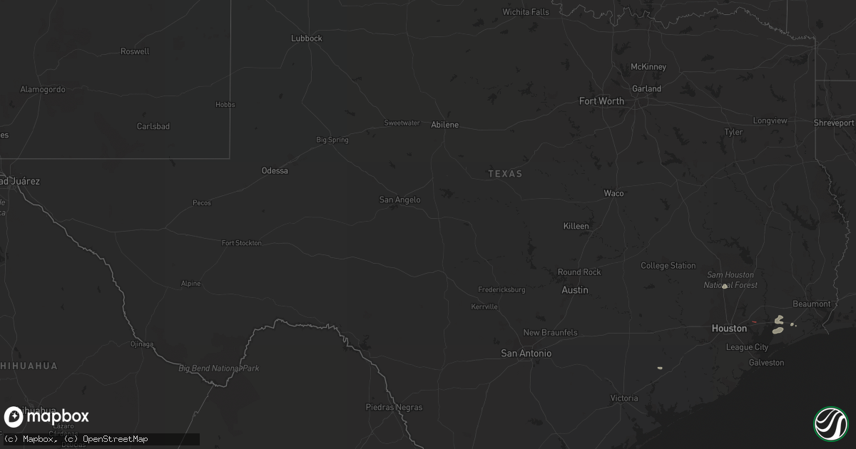
Hail Map in Texas on September 18, 2019
Get this storm
September 18 map
$229
one time, instant access
Download today. No call, no setup
Keep the $229
Bought the map and want the full workflow? Apply the entire $229 to a subscription within 7 days. None of it is wasted.
Every map, not just this one
This buys you this map. Subscription and you get every map we run, in the markets you choose from a few cities to whole states to nationwide. Plus real-time alerts the moment a storm fires.
Contact data
Name, contact info, occupancy, even credit band for addresses in the footprint. You go from where it hit to who to call.
Become the source they trust
Unlimited branding weather history reports on demand. You already have the documented answer ready for the property owner, and you are the one who showed up with it.
Property data and RoofTrace estimates
Pull up any address you have got, its value and the exact code rules for that jurisdiction, straight from One Click Code. Then RoofTrace estimates the squares, pitch, and roof value, priced the way you price.
Storm reports in Texas
Texas
| Date | Description |
|---|---|
| 09/18/20196:30 PM CDT | Spotter reported tornado on ground 4 miles nne of anahuac. |
| 09/18/20195:10 PM CDT | Tornado on ground photographed near n main and fm1942... West of mont belvieu. |
| 09/18/20195:05 PM CDT | Social media videos show structure... Tree and vehicle damage along n main st ne of highlands. |
| 09/18/20195:05 PM CDT | Tornado damage to barn near barbers hill rd and haney rd. |
| 09/18/20191:24 AM CDT | At 624 PM CDT, a severe thunderstorm was located over West Columbia, moving east at 30 mph. HAZARD...60 mph wind gusts. SOURCE...Radar indicated. IMPACT...Expect damage to roofs, siding, and trees. Locations impacted include... Lake Jackson, Angleton, Clute, West Columbia, Richwood, Brazoria, Danbury, Oyster Creek, Holiday Lakes, Bailey's Prairie, Bonney and Wild Peach Village. |
| 09/18/201912:54 AM CDT | At 554 PM CDT, a severe thunderstorm was located 7 miles southwest of Boling-Iago, or 11 miles southeast of Wharton, moving east at 15 mph. HAZARD...60 mph wind gusts. SOURCE...Radar indicated. IMPACT...Expect damage to roofs, siding, and trees. Locations impacted include... Van Vleck and Boling-Iago. |
All States Impacted by Hail Map on September 18, 2019
Cities Impacted by Hail Map on September 18, 2019
- Tigerton, WI
- Center Point, IA
- Emerson, NE
- Hubbard, NE
- Craig, NE
- Madison, NE
- North Bend, NE
- Dodge, NE
- Howells, NE
- Oakland, NE
- Montezuma, IA
- Searsboro, IA
- Galesville, WI
- Fairmont, MN
- Granada, MN
- Fremont, NE
- Ashland, NE
- Ithaca, NE
- Buffalo Center, IA
- Lakota, IA
- Clermont, IA
- Elgin, IA
- Postville, IA
- Hoskins, NE
- Pender, NE
- Osmond, NE
- Carroll, NE
- Thurston, NE
- Pilger, NE
- Pierce, NE
- Wakefield, NE
- Randolph, NE
- Norfolk, NE
- Mclean, NE
- Wayne, NE
- Winside, NE
- Stanton, NE
- Wisner, NE
- Neligh, NE
- Pampa, TX
- Anahuac, TX
- Winnie, TX
- Greenville, IA
- Webb, IA
- Sutherland, IA
- Hartley, IA
- Le Mars, IA
- Scotia, NE
- Ericson, NE
- Ord, NE
- Batavia, IA
- Eldon, IA
- Ottumwa, IA
- Agency, IA
- Youngstown, FL
- Panama City, FL
- Perry, FL
- Epworth, IA
- Valley, NE
- Nickerson, NE
- Mead, NE
- Arlington, NE
- Lincoln, NE
- Waverly, NE
- Adams, NE
- Hickman, NE
- Firth, NE
- Walton, NE
- Palmyra, NE
- Alvo, NE
- Greenwood, NE
- Elmwood, NE
- Cortland, NE
- Panama, NE
- Eagle, NE
- Bennet, NE
- Blencoe, IA
- Orchard, NE
- Clearwater, NE
- Reinbeck, IA
- Traer, IA
- Hudson, IA
- Farley, IA
- Scribner, NE
- Britt, IA
- Dorchester, IA
- Decorah, IA
- Elma, IA
- Sigourney, IA
- Hedrick, IA
- Ely, IA
- Mount Vernon, IA
- West Point, NE
- Guttenberg, IA
- Dow City, IA
- Charter Oak, IA
- Ute, IA
- Whigham, GA
- Denison, IA
- Soldier, IA
- Dunlap, IA
- Wallace, MI
- Lanesboro, MN
- Preston, MN
- Live Oak, FL
- Nora Springs, IA
- Rockwell, IA
- Lyons, NE
- Pocahontas, IA
- Rolfe, IA
- West Union, IA
- Fayette, IA
- New Sharon, IA
- Barnes City, IA
- New Vienna, IA
- Thompson, IA
- McAlpin, FL
- Buckingham, IA
- Kennard, NE
- Elkhorn, NE
- Bennington, NE
- Lamont, FL
- Plainview, NE
- Holy Cross, IA
- Riceville, IA
- Truesdale, IA
- Storm Lake, IA
- Hosford, FL
- Holmen, WI
- Onalaska, WI
- La Crescent, MN
- Brownsville, MN
- Hokah, MN
- Wilton, WI
- Arion, IA
- Sopchoppy, FL
- Dyersville, IA
- Floris, IA
- Mayo, FL
- Viroqua, WI
- Pelham, GA
- Thomasville, GA
- Norwalk, WI
- Ontario, WI
- Tomah, WI
- Kasson, MN
- Roca, NE
- Pisgah, IA
- Moorhead, IA
- Lancaster, WI
- Curlew, IA
- Miami, TX
- Woden, IA
- Crystal Lake, IA
- Oakdale, NE
- Elgin, NE
- Houston, MN
- Groom, TX
- Blountstown, FL
- Oskaloosa, IA
- Conroe, TX
- Chambers, NE
- Burwell, NE
- La Porte City, IA
- Emmons, MN
- Alden, MN
- Wells, MN
- Kiester, MN
- Eddyville, IA
- Lime Springs, IA
- Harmony, MN
- Chester, IA
- Le Roy, MN
- Corwith, IA
- Dysart, IA
- Leigh, NE
- Brunswick, NE
- Caledonia, MN
- Spring Grove, MN
- Bartlett, NE
- Burt, IA
- Earling, IA
- Defiance, IA
- Clarkson, NE
- Tallahassee, FL
- Monticello, FL
- Crawfordville, FL
- Osage, IA
- Carrabelle, FL
- Inglis, FL
- Creston, NE
- Cassville, WI
- Sioux Rapids, IA
- Belden, NE
- Waterbury, NE
- Bancroft, NE
- Gladbrook, IA
- Waterloo, IA
- Clarksville, FL
- Peterson, MN
- Rushford, MN
- Monroe City, MO
- Palmyra, MO
- Albert Lea, MN
- Onawa, IA
- Milford, IA
- Tekamah, NE
- Spencer, IA
- Royal, IA
- Kanawha, IA
- Rosalie, NE
- Day, FL
- Lake Mills, IA
- Northwood, IA
- Blair, NE
- Saint Marys, GA
- Whittemore, IA
- Algona, IA
- Hooper, NE
- Herman, NE
- Mabel, MN
- Galva, IA
- Alta, IA
- Wisconsin Dells, WI
- Lyndon Station, WI
- Yutan, NE
- Omaha, NE
- Louise, TX
- El Campo, TX
- Royal, NE
- Memphis, NE
- Ewing, NE
- Frost, MN
- Ettrick, WI
- Everly, IA
- Lake Park, IA
- La Crosse, WI
- West Salem, WI
- Glen Haven, WI
- Bloomington, WI
- Oneill, NE
- Sioux City, IA
- Hinton, IA
- Zwingle, IA
- East Dubuque, IL
- La Motte, IA
- Dubuque, IA
- Schuyler, NE
- Beemer, NE
- Rogers, NE
- Snyder, NE
- Grand Marsh, WI
- Waterloo, NE
- Decatur, NE
- Wallisville, TX
- Devers, TX
- Hankamer, TX
- Vinton, IA
- Cresco, IA
- Ionia, IA
- Alta Vista, IA
- Charles City, IA
- Brandon, IA
- Quincy, FL
- Daytona Beach, FL
- Crosby, TX
- Baytown, TX
- Bussey, IA


