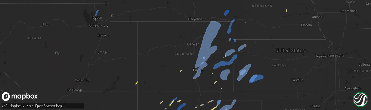
Hail Map in Colorado on September 17, 2024
The weather event in Colorado on September 17, 2024 includes Hail, Wind, and Tornado maps. 12 states and 313 cities were impacted and suffered possible damage. The total estimated number of properties impacted is 13.
Want more than just the map?
Turn this storm into a full workflow.
- Owner + property data so you know who to knock
- OnDemand branded weather history reports to win the "did we even have hail?" argument
- RoofTrace estimate so reps stop guessing numbers at the door
Bought this map? Upgrade within 7 days and we'll credit the $230. (10-15 min setup call)
Hail
Wind
Tornado
13
Estimated number of impacted properties by a 1.00" hail or larger0
Estimated number of impacted properties by a 1.75" hail or larger0
Estimated number of impacted properties by a 2.50" hail or largerStorm reports in Colorado
Colorado
| Date | Description |
|---|---|
| 09/17/20246:47 PM CDT | Asos station kitr burlington co airport. |
| 09/17/20246:45 PM CDT | Corrects previous tstm wnd gst report from 5 s burlington. Asos station kitr burlington co airport. 66 mph gusts lasted a duration of 10 minutes. |
| 09/17/20246:45 PM CDT | Mesonet station tt562 north sterling. |
| 09/17/20246:40 PM CDT | Mesonet station lam01 lamar no. 1. |
| 09/17/20246:38 PM CDT | Gobblers knob mesonet station along highway 287. |
| 09/17/20246:38 PM CDT | A local report indicates 72 MPH wind near 4 WSW Lamar |
| 09/17/20246:35 PM CDT | A local report indicates 64 MPH wind near 4 NW Iliff |
| 09/17/20246:30 PM CDT | Reports from prowers dispatch indicate multiple power poles were down throughout prowers county. Also structural damage |
| 09/17/20246:27 PM CDT | Mesonet station co035 i-76 sterl |
| 09/17/20246:27 PM CDT | Mesonet station co035 i-76 sterling. |
| 09/17/20246:05 PM CDT | Reported via social media. Tree limbs 3/4 inch in diameter snapped off and outdoor furniture overturned. Time is radar estimated. |
| 09/17/20245:28 PM CDT | A local report indicates 60 MPH wind near 18 E Wild Horse Point |
| 09/17/20245:15 PM CDT | Mesonet station co066 cedar point. |
| 09/17/20244:59 PM CDT | A local report indicates 60 MPH wind near 9 SW Agate |
| 09/17/20244:55 PM CDT | A local report indicates 60 MPH wind near 6 N Simla |
| 09/17/20244:53 PM CDT | A local report indicates 62 MPH wind near 14 NE Kiowa |
| 09/17/20244:37 PM CDT | A local report indicates 71 MPH wind near 3 SSW Yoder |
| 09/17/20244:34 PM CDT | A local report indicates 75 MPH wind near 9 NNW Rush |
| 09/17/20244:33 PM CDT | A local report indicates 65 MPH wind near 2 NNW Rush |
| 09/17/20244:29 PM CDT | A local report indicates 59 MPH wind near 2 WSW Yoder |
| 09/17/20244:26 PM CDT | A local report indicates 64 MPH wind near 3 N Peyton |
| 09/17/20244:19 PM CDT | A local report indicates 69 MPH wind near 5 SSW Peyton |
| 09/17/20244:18 PM CDT | Tree damage at location with 6 inch branches snapped. |
| 09/17/20244:16 PM CDT | A local report indicates 60 MPH wind near 6 E Falcon |
| 09/17/20244:06 PM CDT | Awos station kpub pueblo airport. |
| 09/17/20244:03 PM CDT | Asos station kcos colorado springs airport. |
| 09/17/20243:35 PM CDT | Mesonet station co029 025s066 apache city. (p |
| 09/17/20243:35 PM CDT | Mesonet station co029 025s066 apache city. |
| 09/17/20242:55 PM CDT | Sunlight mtn. |
| 09/17/202410:25 AM CDT | Asos station kdro durango la plata cnty airport. |
| 09/17/202410:23 AM CDT | Asos station keeo meeker airport. |
| 09/16/20248:55 PM CDT | Awos station k8v7 3 n springfield. |
| 09/16/20247:40 PM CDT | Mesonet station co048 us 385 holyoke. |
| 09/16/20247:28 PM CDT | Station up694. |
| 09/16/20247:07 PM CDT | Weatherlink site welp farms. |
All States Impacted by Hail Map on September 17, 2024
Cities Impacted by Hail Map on September 17, 2024
- Monticello, UT
- Blanding, UT
- Dove Creek, CO
- Nucla, CO
- Dulce, NM
- Moffat, CO
- Santa Fe, NM
- Chimayo, NM
- Espanola, NM
- Santa Cruz, NM
- Corona, NM
- Clearfield, UT
- Syracuse, UT
- Roy, UT
- Hooper, UT
- Picacho, NM
- Ribera, NM
- San Jose, NM
- Willard, UT
- Ogden, UT
- Brigham City, UT
- Hyrum, UT
- Wellsville, UT
- Mantua, UT
- La Loma, NM
- Las Vegas, NM
- Counselor, NM
- Santa Rosa, NM
- Cuba, NM
- Jemez Springs, NM
- Roswell, NM
- Yeso, NM
- Garita, NM
- Mosquero, NM
- Conchas Dam, NM
- Rye, CO
- Walsenburg, CO
- Colorado City, CO
- Pueblo, CO
- Avondale, CO
- Rio Rancho, NM
- Roy, NM
- Mcalister, NM
- Colorado Springs, CO
- Fountain, CO
- Peyton, CO
- Boone, CO
- Trementina, NM
- Elbert, CO
- Calhan, CO
- Yoder, CO
- Clayton, NM
- Vallecitos, NM
- San Jon, NM
- Grady, NM
- Kiowa, CO
- Olney Springs, CO
- Rush, CO
- Ramah, CO
- Bennett, CO
- Agate, CO
- Strasburg, CO
- Elizabeth, CO
- Byers, CO
- Deer Trail, CO
- Carson, NM
- Simla, CO
- Los Alamos, NM
- White Rock, NM
- Ponderosa, NM
- Pena Blanca, NM
- Cochiti Lake, NM
- Cochiti Pueblo, NM
- Embudo, NM
- Lewistown, MT
- Logan, NM
- Matheson, CO
- Limon, CO
- Ohkay Owingeh, NM
- Velarde, NM
- Dixon, NM
- Penasco, NM
- Chamisal, NM
- Vadito, NM
- Ranchos De Taos, NM
- Nara Visa, NM
- Pritchett, CO
- Orlando, FL
- Glendive, MT
- La Junta, CO
- Sedan, NM
- Wiggins, CO
- Fort Morgan, CO
- Roggen, CO
- Woodrow, CO
- Genoa, CO
- Arriba, CO
- Hugo, CO
- Lindon, CO
- Broadview, NM
- Fort Sumner, NM
- Arlington, CO
- Karval, CO
- Haswell, CO
- Kit Carson, CO
- Eads, CO
- Sugar City, CO
- Anton, CO
- Orchard, CO
- Weldona, CO
- Briggsdale, CO
- Brush, CO
- Akron, CO
- Log Lane Village, CO
- Snyder, CO
- Hillrose, CO
- Bloomfield, MT
- Texline, TX
- Dalhart, TX
- Brockton, MT
- Gallina, NM
- Coyote, NM
- Newcastle, WY
- Upton, WY
- Sundance, WY
- Moorcroft, WY
- Osage, WY
- New Raymer, CO
- Merino, CO
- Atwood, CO
- Stoneham, CO
- Sterling, CO
- Poplar, MT
- Portales, NM
- Stratford, TX
- Hartley, TX
- Stratton, CO
- Hemingford, NE
- Harrison, NE
- Richey, MT
- Flaxville, MT
- Felt, OK
- Boise City, OK
- Keyes, OK
- Cheyenne Wells, CO
- Sheridan Lake, CO
- Hasty, CO
- Holly, CO
- Wiley, CO
- Granada, CO
- Lamar, CO
- McClave, CO
- Burlington, CO
- Bethune, CO
- Fleming, CO
- Iliff, CO
- Padroni, CO
- Peetz, CO
- Aladdin, WY
- Beulah, WY
- Lead, SD
- Spearfish, SD
- Tierra Amarilla, NM
- Canjilon, NM
- Crawford, NE
- Scobey, MT
- Marsland, NE
- Adrian, TX
- Channing, TX
- Muleshoe, TX
- Whitney, NE
- Vida, MT
- Kanorado, KS
- Goodland, KS
- Vernon, CO
- Wray, CO
- Saint Francis, KS
- Haigler, NE
- Lisco, NE
- Lodgepole, NE
- Broadwater, NE
- Oshkosh, NE
- Chadron, NE
- Oelrichs, SD
- Belle Fourche, SD
- Wagon Mound, NM
- Wolf Point, MT
- Kim, CO
- Texhoma, OK
- Arapahoe, CO
- Weskan, KS
- Sharon Springs, KS
- Buffalo, SD
- Bird City, KS
- Edson, KS
- McDonald, KS
- Colby, KS
- Holyoke, CO
- Yuma, CO
- Haxtun, CO
- Julesburg, CO
- Amherst, CO
- Ovid, CO
- Big Springs, NE
- Venango, NE
- Brule, NE
- Rushville, NE
- Hay Springs, NE
- Pine Ridge, SD
- Tucumcari, NM
- Melrose, NM
- Sudan, TX
- Lambert, MT
- Johnson, KS
- Syracuse, KS
- Kendall, KS
- Tribune, KS
- Leoti, KS
- Lakin, KS
- Ulysses, KS
- Deerfield, KS
- Scott City, KS
- Marienthal, KS
- Holcomb, KS
- Garden City, KS
- Atwood, KS
- Levant, KS
- Manderson, SD
- Hermosa, SD
- Rapid City, SD
- Caputa, SD
- Box Elder, SD
- Whitetail, MT
- New Underwood, SD
- Owanka, SD
- Springer, NM
- Scenic, SD
- Buffalo Gap, SD
- Fairburn, SD
- Wasta, SD
- Peerless, MT
- Wallace, NE
- Grenville, NM
- Wall, SD
- Earth, TX
- Martin, SD
- Allen, SD
- Tuthill, SD
- Wanblee, SD
- Long Valley, SD
- Norris, SD
- White River, SD
- Piedmont, SD
- Ellsworth Afb, SD
- Sturgis, SD
- Enning, SD
- Howes, SD
- Newell, SD
- Union Center, SD
- Sublette, KS
- Copeland, KS
- Pierceville, KS
- Ingalls, KS
- Montezuma, KS
- Tryon, NE
- Oberlin, KS
- Milesville, SD
- Cherry Creek, SD
- Chinook, MT
- Cimarron, KS
- Dupree, SD
- Faith, SD
- White Owl, SD
- Mud Butte, SD
- Meadow, SD
- Cedar Rapids, NE
- Jetmore, KS
- Dodge City, KS
- Wright, KS
- Ensign, KS
- Spearville, KS
- Albion, NE
- Primrose, NE
- Ethan, SD
- Mitchell, SD
- Fulton, SD
- Tuttle, ND
- Lake Preston, SD
- Washburn, ND
- Perryton, TX
- Mcclusky, ND
- Douglas, ND
- Mercer, ND
- Denhoff, ND
- Hurdsfield, ND
- Ryder, ND
- Max, ND
- Garrison, ND
- Butte, ND
- Turtle Lake, ND
- Minot, ND
- Anamoose, ND
- New Rockford, ND
- Warwick, ND
- Alexandria, SD
- Artesian, SD
- Kyle, SD
- Porcupine, SD
- Lander, WY
- Evanston, WY
- Las Animas, CO
- Carlsbad, NM
- Loving, NM


