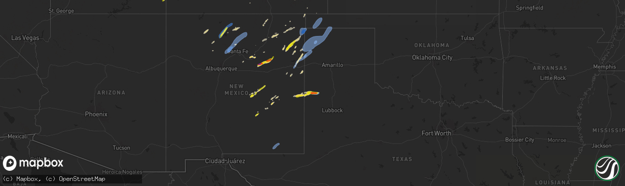
Hail Map on September 17, 2024
The weather event on September 17, 2024 includes Hail, Wind, and Tornado maps. 12 states and 313 cities were impacted and suffered possible damage. The total estimated number of properties impacted is 3,931.
Want more than just the map?
Turn this storm into a full workflow.
- Owner + property data so you know who to knock
- OnDemand branded weather history reports to win the "did we even have hail?" argument
- RoofTrace estimate so reps stop guessing numbers at the door
Bought this map? Upgrade within 7 days and we'll credit the $230. (10-15 min setup call)
Hail
Wind
Tornado
3,931
Estimated number of impacted properties by a 1.00" hail or larger384
Estimated number of impacted properties by a 1.75" hail or larger0
Estimated number of impacted properties by a 2.50" hail or largerStates Impacted by Hail Map on September 17, 2024
Storm reports
Utah
| Date | Description |
|---|---|
| 09/17/20242:20 PM CDT | Mesonet station swh sherwood hills. |
| 09/17/20241:20 PM CDT | A local report indicates 62 MPH wind near 2 SSW West Point |
Virginia
| Date | Description |
|---|---|
| 09/17/20244:57 PM CDT | Tree blocking part of road near the intersection of campbell dr and worthy blvd in saltville... Va. |
| 09/16/20248:19 PM CDT | Large tree down just south of intersection of soapstone rd and conner park ct. |
| 09/16/20248:19 PM CDT | Tree down on road near intersection of soapstone rd and greensboro rd. |
North Carolina
| Date | Description |
|---|---|
| 09/17/20246:30 PM CDT | Tree fell on nissan suv at temple baptist church at 3615 rockford st... Mount airy. |
| 09/17/20245:20 PM CDT | Tree down blocking both lanes on cook school road just north of tumbling creek ln. Powerlines also down in vicinity. |
| 09/17/20245:20 PM CDT | Tree down on the road near the intersection of slate rd and linville rd in flat rock. |
| 09/17/20243:30 PM CDT | Tree down across us 21 near dollar general. Reported by surry county sheriff office. |
| 09/17/20243:30 PM CDT | Tree down across us 21 near dollar general. Reported by surry county sheriff office. |
| 09/17/20243:20 PM CDT | Tree down on the road near the intersection of cook road and jessup grove church rd. Reported by the surry county sheriff office. |
| 09/17/20243:20 PM CDT | Tree down on road near intersection of cook school road and cook school ext road just west of westfield elementary school. Reported by surry county sheriff office. |
| 09/17/20242:20 PM CDT | Tree down blocking a lane on rockford road near stony knoll united methodist church. |
New Mexico
| Date | Description |
|---|---|
| 09/17/20246:45 PM CDT | Large tree branch down near nm-206 and moreland rd. Power outages reported throughout the area. |
| 09/17/20245:16 PM CDT | Several power lines down at the junction of us hwy 285 and helper rd. |
| 09/17/20245:10 PM CDT | Asos station kcnm carlsbad. |
| 09/17/20245:05 PM CDT | Severe wind gusts from storm heading directly toward texline blew thru clayton knocking out power for up to estimated 15hrs. Three power poles reported down by swecc. |
| 09/17/20245:00 PM CDT | Quay county sun reporter relayed that a roof was blown off the community center in nara visa. A social media post from burns ranch also showed a large section of metal |
| 09/17/20244:19 PM CDT | A local report indicates 60 MPH wind near 11 WNW San Jon |
| 09/17/20244:15 PM CDT | Quay county sun reporter relayed that up to 10 cmvs were blown over on i-40 due to high winds. A cmv driver estimated winds over 70 mph. I-40 was closed for several hou |
| 09/17/20244:08 PM CDT | Mesonet station twrn5 frijoles |
| 09/17/20241:25 PM CDT | Estimated severe wind gust caused large tree branches up to 2 inches in diameter to fall near downtown santa fe at the railyards. |
South Dakota
| Date | Description |
|---|---|
| 09/16/202410:35 PM CDT | A local report indicates 64 MPH wind near Usta |
| 09/16/202410:27 PM CDT | A local report indicates 93 MPH wind near 1 NNE Faith |
| 09/16/202410:26 PM CDT | A local report indicates 58 MPH wind near 1 ENE Mud Butte |
| 09/16/202410:25 PM CDT | Four outbuildings destroyed including a barn that was ripped out of the ground and tossed. Numerous large limbs and utility poles damaged. |
| 09/16/202410:25 PM CDT | Power poles down. Shed blew onto the highway |
| 09/16/202410:03 PM CDT | A local report indicates 64 MPH wind near Howes |
| 09/16/20249:36 PM CDT | A local report indicates 58 MPH wind near 1 ENE Mud Butte |
| 09/16/20249:30 PM CDT | A local report indicates 62 MPH wind near 7 E Wanblee |
| 09/16/20249:10 PM CDT | A local report indicates 74 MPH wind near 5 ENE Martin |
| 09/16/20249:10 PM CDT | A local report indicates 59 MPH wind near 3 NW Wasta |
| 09/16/20249:00 PM CDT | A local report indicates 58 MPH wind near 5 WNW New Underwood |
| 09/16/20248:50 PM CDT | A local report indicates 60 MPH wind near Rapid City Arpt |
| 09/16/20248:46 PM CDT | A local report indicates 59 MPH wind near 2 ENE Dwtn Rapid City |
| 09/16/20248:45 PM CDT | A local report indicates 58 MPH wind near 1 ESE Ladner |
| 09/16/20248:30 PM CDT | A local report indicates 58 MPH wind near 7 SSW Folsom |
| 09/16/20248:22 PM CDT | A local report indicates 61 MPH wind near 3 WSW Fairburn |
| 09/16/20248:20 PM CDT | A local report indicates 60 MPH wind near Sharps Corner |
| 09/16/20248:07 PM CDT | A local report indicates 59 MPH wind near 12 E Oelrichs |
| 09/16/20248:00 PM CDT | A local report indicates 60 MPH wind near 3 ESE Pine Ridge |
| 09/16/20247:57 PM CDT | A local report indicates 61 MPH wind near 12 E Oelrichs |
| 09/16/20247:56 PM CDT | A local report indicates 63 MPH wind near 27 WNW Castle Rock |
| 09/16/20247:47 PM CDT | A local report indicates 62 MPH wind near 12 E Oelrichs |
| 09/16/20247:37 PM CDT | A local report indicates 65 MPH wind near 12 E Oelrichs |
Montana
| Date | Description |
|---|---|
| 09/17/20246:53 PM CDT | Relayed via public facebook report. Time estimated by radar. |
| 09/17/20246:45 PM CDT | Mesonet gust to 61 mph. |
| 09/17/20246:10 PM CDT | Golf ball size hail around 5:10 pm. Wind gusts in the upper 40s. |
| 09/16/20249:12 PM CDT | Corrects previous non-tstm wnd gst report from 1 se baker. Asos station kbhk baker. |
| 09/16/20247:10 PM CDT | Relayed via public facebook image report of a tree falling on a car and fence. |
| 09/16/20247:10 PM CDT | Relayed via public facebook photo report. |
Nebraska
| Date | Description |
|---|---|
| 09/16/20248:46 PM CDT | A local report indicates 58 MPH wind near 3 NNE Kingsley Dam |
| 09/16/20248:19 PM CDT | A local report indicates 60 MPH wind near 15 NNW Rushville |
| 09/16/20247:35 PM CDT | Co-op observer estimated 70 mph wind gusts. |
| 09/16/20247:32 PM CDT | Kcdr asos reports 59mph wind gust. |
Oklahoma
| Date | Description |
|---|---|
| 09/17/20246:35 PM CDT | A local report indicates 67 MPH wind near 3 SSE Boise City |
Texas
| Date | Description |
|---|---|
| 09/17/20246:27 PM CDT | Wind gusts of 58 mph or greater were measured for 5 minutes beginning at 627 pm. |
| 09/17/20246:24 PM CDT | A local report indicates 76 MPH wind near 3 SW Dalhart |
| 09/17/20245:31 PM CDT | A local report indicates 94 MPH wind near 2 N Texline |
| 09/16/20249:45 PM CDT | Dozens of train cars derailed from downburst winds. Time estimated. |
| 09/16/20249:43 PM CDT | West texas mesonet. |
| 09/16/20247:28 PM CDT | Multiple 2 to 3 inch tree branches broken off in stratford. |
| 09/16/20247:24 PM CDT | A local report indicates 68 MPH wind near 4 WNW Stratford |
Colorado
| Date | Description |
|---|---|
| 09/17/20246:47 PM CDT | Asos station kitr burlington co airport. |
| 09/17/20246:45 PM CDT | Corrects previous tstm wnd gst report from 5 s burlington. Asos station kitr burlington co airport. 66 mph gusts lasted a duration of 10 minutes. |
| 09/17/20246:45 PM CDT | Mesonet station tt562 north sterling. |
| 09/17/20246:40 PM CDT | Mesonet station lam01 lamar no. 1. |
| 09/17/20246:38 PM CDT | A local report indicates 72 MPH wind near 4 WSW Lamar |
| 09/17/20246:38 PM CDT | Gobblers knob mesonet station along highway 287. |
| 09/17/20246:35 PM CDT | A local report indicates 64 MPH wind near 4 NW Iliff |
| 09/17/20246:30 PM CDT | Reports from prowers dispatch indicate multiple power poles were down throughout prowers county. Also structural damage |
| 09/17/20246:27 PM CDT | Mesonet station co035 i-76 sterling. |
| 09/17/20246:27 PM CDT | Mesonet station co035 i-76 sterl |
| 09/17/20246:05 PM CDT | Reported via social media. Tree limbs 3/4 inch in diameter snapped off and outdoor furniture overturned. Time is radar estimated. |
| 09/17/20245:28 PM CDT | A local report indicates 60 MPH wind near 18 E Wild Horse Point |
| 09/17/20245:15 PM CDT | Mesonet station co066 cedar point. |
| 09/17/20244:59 PM CDT | A local report indicates 60 MPH wind near 9 SW Agate |
| 09/17/20244:55 PM CDT | A local report indicates 60 MPH wind near 6 N Simla |
| 09/17/20244:53 PM CDT | A local report indicates 62 MPH wind near 14 NE Kiowa |
| 09/17/20244:37 PM CDT | A local report indicates 71 MPH wind near 3 SSW Yoder |
| 09/17/20244:34 PM CDT | A local report indicates 75 MPH wind near 9 NNW Rush |
| 09/17/20244:33 PM CDT | A local report indicates 65 MPH wind near 2 NNW Rush |
| 09/17/20244:29 PM CDT | A local report indicates 59 MPH wind near 2 WSW Yoder |
| 09/17/20244:26 PM CDT | A local report indicates 64 MPH wind near 3 N Peyton |
| 09/17/20244:19 PM CDT | A local report indicates 69 MPH wind near 5 SSW Peyton |
| 09/17/20244:18 PM CDT | Tree damage at location with 6 inch branches snapped. |
| 09/17/20244:16 PM CDT | A local report indicates 60 MPH wind near 6 E Falcon |
| 09/17/20244:06 PM CDT | Awos station kpub pueblo airport. |
| 09/17/20244:03 PM CDT | Asos station kcos colorado springs airport. |
| 09/17/20243:35 PM CDT | Mesonet station co029 025s066 apache city. (p |
| 09/17/20243:35 PM CDT | Mesonet station co029 025s066 apache city. |
| 09/17/20242:55 PM CDT | Sunlight mtn. |
| 09/17/202410:25 AM CDT | Asos station kdro durango la plata cnty airport. |
| 09/17/202410:23 AM CDT | Asos station keeo meeker airport. |
| 09/16/20248:55 PM CDT | Awos station k8v7 3 n springfield. |
| 09/16/20247:40 PM CDT | Mesonet station co048 us 385 holyoke. |
| 09/16/20247:28 PM CDT | Station up694. |
| 09/16/20247:07 PM CDT | Weatherlink site welp farms. |
Wyoming
| Date | Description |
|---|---|
| 09/17/20246:03 PM CDT | A local report indicates 60 MPH wind near 2 ENE Osage |
| 09/17/20245:54 PM CDT | A local report indicates 59 MPH wind near 5 NNW Dwtn Gillette |
| 09/17/20245:50 PM CDT | A local report indicates 60 MPH wind near 10 WSW Upton |
| 09/17/20245:44 PM CDT | A local report indicates 62 MPH wind near 5 NNW Dwtn Gillette |
| 09/17/20245:40 PM CDT | A local report indicates 62 MPH wind near 1 NE Echeta |
| 09/17/20243:10 PM CDT | A local report indicates 62 MPH wind near 5 ENE Almy |
| 09/17/20249:53 AM CDT | Asos station klnd lander airport. |
Kansas
| Date | Description |
|---|---|
| 09/17/20241:11 AM CDT | 3-inch tree limbs broken; power poles broken. |
| 09/16/20249:51 PM CDT | A local report indicates 63 MPH wind near 7 SSW Charleston |
| 09/16/20248:53 PM CDT | A local report indicates 59 MPH wind near 4 SW Friend |
| 09/16/20248:18 PM CDT | A local report indicates 79 MPH wind near 16 NNE Kendall |
| 09/16/20248:17 PM CDT | A local report indicates 79 MPH wind near 11 NW Lakin |
| 09/16/20248:16 PM CDT | A local report indicates 60 MPH wind near 11 NW Lakin |
| 09/16/20248:02 PM CDT | A local report indicates 60 MPH wind near 9 SSW Kendall |
| 09/16/20247:40 PM CDT | Estimated 60 to 65 mph winds over a 2 minute duration. |
| 09/16/20247:25 PM CDT | 50 to 60 mph estimated ongoing. |
Cities Impacted by Hail Map on September 17, 2024
- Monticello, UT
- Blanding, UT
- Dove Creek, CO
- Nucla, CO
- Dulce, NM
- Moffat, CO
- Santa Fe, NM
- Chimayo, NM
- Espanola, NM
- Santa Cruz, NM
- Corona, NM
- Clearfield, UT
- Syracuse, UT
- Roy, UT
- Hooper, UT
- Picacho, NM
- Ribera, NM
- San Jose, NM
- Willard, UT
- Ogden, UT
- Brigham City, UT
- Hyrum, UT
- Wellsville, UT
- Mantua, UT
- La Loma, NM
- Las Vegas, NM
- Counselor, NM
- Santa Rosa, NM
- Cuba, NM
- Jemez Springs, NM
- Roswell, NM
- Yeso, NM
- Garita, NM
- Mosquero, NM
- Conchas Dam, NM
- Rye, CO
- Walsenburg, CO
- Colorado City, CO
- Pueblo, CO
- Avondale, CO
- Rio Rancho, NM
- Roy, NM
- Mcalister, NM
- Colorado Springs, CO
- Fountain, CO
- Peyton, CO
- Boone, CO
- Trementina, NM
- Elbert, CO
- Calhan, CO
- Yoder, CO
- Clayton, NM
- Vallecitos, NM
- San Jon, NM
- Grady, NM
- Kiowa, CO
- Olney Springs, CO
- Rush, CO
- Ramah, CO
- Bennett, CO
- Agate, CO
- Strasburg, CO
- Elizabeth, CO
- Byers, CO
- Deer Trail, CO
- Carson, NM
- Simla, CO
- Los Alamos, NM
- White Rock, NM
- Ponderosa, NM
- Pena Blanca, NM
- Cochiti Lake, NM
- Cochiti Pueblo, NM
- Embudo, NM
- Lewistown, MT
- Logan, NM
- Matheson, CO
- Limon, CO
- Ohkay Owingeh, NM
- Velarde, NM
- Dixon, NM
- Penasco, NM
- Chamisal, NM
- Vadito, NM
- Ranchos De Taos, NM
- Nara Visa, NM
- Pritchett, CO
- Orlando, FL
- Glendive, MT
- La Junta, CO
- Sedan, NM
- Wiggins, CO
- Fort Morgan, CO
- Roggen, CO
- Woodrow, CO
- Genoa, CO
- Arriba, CO
- Hugo, CO
- Lindon, CO
- Broadview, NM
- Fort Sumner, NM
- Arlington, CO
- Karval, CO
- Haswell, CO
- Kit Carson, CO
- Eads, CO
- Sugar City, CO
- Anton, CO
- Orchard, CO
- Weldona, CO
- Briggsdale, CO
- Brush, CO
- Akron, CO
- Log Lane Village, CO
- Snyder, CO
- Hillrose, CO
- Bloomfield, MT
- Texline, TX
- Dalhart, TX
- Brockton, MT
- Gallina, NM
- Coyote, NM
- Newcastle, WY
- Upton, WY
- Sundance, WY
- Moorcroft, WY
- Osage, WY
- New Raymer, CO
- Merino, CO
- Atwood, CO
- Stoneham, CO
- Sterling, CO
- Poplar, MT
- Portales, NM
- Stratford, TX
- Hartley, TX
- Stratton, CO
- Hemingford, NE
- Harrison, NE
- Richey, MT
- Flaxville, MT
- Felt, OK
- Boise City, OK
- Keyes, OK
- Cheyenne Wells, CO
- Sheridan Lake, CO
- Hasty, CO
- Holly, CO
- Wiley, CO
- Granada, CO
- Lamar, CO
- McClave, CO
- Burlington, CO
- Bethune, CO
- Fleming, CO
- Iliff, CO
- Padroni, CO
- Peetz, CO
- Aladdin, WY
- Beulah, WY
- Lead, SD
- Spearfish, SD
- Tierra Amarilla, NM
- Canjilon, NM
- Crawford, NE
- Scobey, MT
- Marsland, NE
- Adrian, TX
- Channing, TX
- Muleshoe, TX
- Whitney, NE
- Vida, MT
- Kanorado, KS
- Goodland, KS
- Vernon, CO
- Wray, CO
- Saint Francis, KS
- Haigler, NE
- Lisco, NE
- Lodgepole, NE
- Broadwater, NE
- Oshkosh, NE
- Chadron, NE
- Oelrichs, SD
- Belle Fourche, SD
- Wagon Mound, NM
- Wolf Point, MT
- Kim, CO
- Texhoma, OK
- Arapahoe, CO
- Weskan, KS
- Sharon Springs, KS
- Buffalo, SD
- Bird City, KS
- Edson, KS
- McDonald, KS
- Colby, KS
- Holyoke, CO
- Yuma, CO
- Haxtun, CO
- Julesburg, CO
- Amherst, CO
- Ovid, CO
- Big Springs, NE
- Venango, NE
- Brule, NE
- Rushville, NE
- Hay Springs, NE
- Pine Ridge, SD
- Tucumcari, NM
- Melrose, NM
- Sudan, TX
- Lambert, MT
- Johnson, KS
- Syracuse, KS
- Kendall, KS
- Tribune, KS
- Leoti, KS
- Lakin, KS
- Ulysses, KS
- Deerfield, KS
- Scott City, KS
- Marienthal, KS
- Holcomb, KS
- Garden City, KS
- Atwood, KS
- Levant, KS
- Manderson, SD
- Hermosa, SD
- Rapid City, SD
- Caputa, SD
- Box Elder, SD
- Whitetail, MT
- New Underwood, SD
- Owanka, SD
- Springer, NM
- Scenic, SD
- Buffalo Gap, SD
- Fairburn, SD
- Wasta, SD
- Peerless, MT
- Wallace, NE
- Grenville, NM
- Wall, SD
- Earth, TX
- Martin, SD
- Allen, SD
- Tuthill, SD
- Wanblee, SD
- Long Valley, SD
- Norris, SD
- White River, SD
- Piedmont, SD
- Ellsworth Afb, SD
- Sturgis, SD
- Enning, SD
- Howes, SD
- Newell, SD
- Union Center, SD
- Sublette, KS
- Copeland, KS
- Pierceville, KS
- Ingalls, KS
- Montezuma, KS
- Tryon, NE
- Oberlin, KS
- Milesville, SD
- Cherry Creek, SD
- Chinook, MT
- Cimarron, KS
- Dupree, SD
- Faith, SD
- White Owl, SD
- Mud Butte, SD
- Meadow, SD
- Cedar Rapids, NE
- Jetmore, KS
- Dodge City, KS
- Wright, KS
- Ensign, KS
- Spearville, KS
- Albion, NE
- Primrose, NE
- Ethan, SD
- Mitchell, SD
- Fulton, SD
- Tuttle, ND
- Lake Preston, SD
- Washburn, ND
- Perryton, TX
- Mcclusky, ND
- Douglas, ND
- Mercer, ND
- Denhoff, ND
- Hurdsfield, ND
- Ryder, ND
- Max, ND
- Garrison, ND
- Butte, ND
- Turtle Lake, ND
- Minot, ND
- Anamoose, ND
- New Rockford, ND
- Warwick, ND
- Alexandria, SD
- Artesian, SD
- Kyle, SD
- Porcupine, SD
- Lander, WY
- Evanston, WY
- Las Animas, CO
- Carlsbad, NM
- Loving, NM