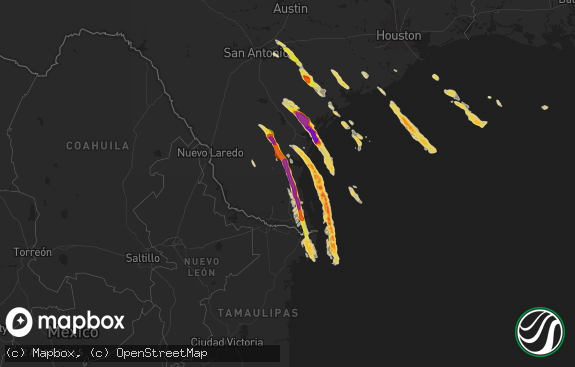
Hail Map in Texas on September 17, 2016
The weather event in Texas on September 17, 2016 includes Hail map. 9 states and 246 cities were impacted and suffered possible damage. The total estimated number of properties impacted is 58,096.

Hail
58,096
Estimated number of impacted properties by a 1.00" hail or larger32,196
Estimated number of impacted properties by a 1.75" hail or larger13,732
Estimated number of impacted properties by a 2.50" hail or largerStorm reports in Texas
Texas
| Date | Description |
|---|---|
| 09/17/20166:55 PM CDT | A local report indicates 1.00 inch wind near BIG SPRING |
| 09/17/20166:55 PM CDT | Pea to quarter size hail covering the ground with heavy rain for 20 minutes south-southeast of texline. |
| 09/17/20166:42 PM CDT | Golf ball hail reported at the intersection of ranch road 33 and highway 87 south of big spring. |
| 09/17/20166:23 PM CDT | A local report indicates 1.25 inch wind near LEES |
| 09/17/20166:00 PM CDT | 70-80 mph winds from downburst. |
| 09/17/20165:59 PM CDT | Quarter size hail and 60 mph wind gusts. |
| 09/17/20165:59 PM CDT | Quarter size hail and 60 mph wind gusts. |
| 09/17/20163:00 PM CDT | Several trees were blown down and a barn was damaged along highway 259 just north of highway 155 north of ore city. |
| 09/17/20161:35 PM CDT | A local report indicates 60 MPH wind near MCLEAN |
| 09/17/20161:35 PM CDT | A local report indicates 2.00 inch wind near 1 NNE MCLEAN |
| 09/17/20161:35 PM CDT | Numerous large tree limbs snapped around a farmhouse complex. One large tree was uprotted landing on pickup temporarily trapping a resident inside. Half of metal barn c |
| 09/17/20161:35 PM CDT | A local report indicates 1.00 inch wind near MCLEAN |
| 09/17/201612:31 PM CDT | A local report indicates 1.00 inch wind near PANHANDLE |
| 09/17/20163:25 AM CDT | A local report indicates 58 MPH wind near SHEPPARD AFB |
| 09/17/20163:10 AM CDT | Power line/poles down in burkburnett |
| 09/17/201612:09 AM CDT | 59 mph wind gust from the kvii schoolnet at friemel farms west-northwest of groom. |
| 09/16/201611:19 PM CDT | A local report indicates 63 MPH wind near 1 SSW PANHANDLE |
| 09/16/20169:47 PM CDT | Nws survey team found 1.2 mile long damage path. Shed destroyed... Widespread tree damage... Roof damage to a mobile home. |
| 09/16/20169:41 PM CDT | Rope tornado touched down briefly two times in rapid succession |
| 09/16/20169:07 PM CDT | Golfball size hail on us 87 2 miles west of dumas. |
| 09/16/20168:39 PM CDT | Quarter size hail reported on interstate 20 at mile marker 121. |
| 09/16/20168:34 PM CDT | Occurred on 11th street |
| 09/16/20168:30 PM CDT | Reported near odessa college |
| 09/16/20168:25 PM CDT | A local report indicates 1.00 inch wind near WEST ODESSA |
| 09/16/20168:15 PM CDT | A local report indicates 61 MPH wind near 3 SW DALHART |
| 09/16/20168:13 PM CDT | A local report indicates 1.75 inch wind near 3 E DALHART |
| 09/16/20168:13 PM CDT | A local report indicates 60 MPH wind near 3 SW DALHART |
| 09/16/20168:13 PM CDT | Hail is ongoing. |
| 09/16/20167:54 PM CDT | Hail up to the size of half dollars 3 miles northwest of dalhart on us 87. |
| 09/16/20167:50 PM CDT | Baseball size hail knocked out windows and damaged the north side of house. |
| 09/16/20167:32 PM CDT | A local report indicates 1.00 inch wind near TEXLINE |
| 09/16/20167:15 PM CDT | A local report indicates a tornado near 8 NW GOLDSMITH |
All States Impacted by Hail Map on September 17, 2016
Cities Impacted by Hail Map on September 17, 2016
- Artesia, NM
- Mena, AR
- Sheridan Lake, CO
- Saint Francis, KS
- Canadian, TX
- Higgins, TX
- Pritchett, CO
- Kim, CO
- McCamey, TX
- Crane, TX
- Fort Sumner, NM
- Garden City, TX
- Big Spring, TX
- Shamrock, TX
- Sedan, NM
- Clarendon, TX
- Groom, TX
- Channing, TX
- Panhandle, TX
- Grenville, NM
- Dalhart, TX
- Clayton, NM
- Hartley, TX
- Masterson, TX
- Mclean, TX
- Wheeler, TX
- Pampa, TX
- White Deer, TX
- Amarillo, TX
- Dumas, TX
- Texline, TX
- Wellington, TX
- Crawford, OK
- Tribune, KS
- Wayne, OK
- Wynnewood, OK
- Stratford, OK
- Paoli, OK
- Pauls Valley, OK
- Andrews, TX
- Alex, OK
- Ninnekah, OK
- Tupelo, OK
- Wapanucka, OK
- Maysville, OK
- Ada, OK
- Purcell, OK
- Davis, OK
- Mill Creek, OK
- Stonewall, OK
- Chickasha, OK
- Bradley, OK
- Milburn, OK
- Sulphur, OK
- Blanchard, OK
- Tishomingo, OK
- Lindsay, OK
- Roff, OK
- De Queen, AR
- Maud, OK
- Konawa, OK
- Asher, OK
- Tinnie, NM
- Lexington, OK
- Stratton, CO
- Kanorado, KS
- Burlington, CO
- Van Horn, TX
- Sierra Blanca, TX
- La Crosse, KS
- Rush Center, KS
- Mountain View, OK
- Carnegie, OK
- Big Springs, NE
- Seminole, TX
- Whitesboro, TX
- Midland, TX
- Arapahoe, CO
- Monahans, TX
- Leedey, OK
- Goodland, KS
- Goldsmith, TX
- Antlers, OK
- Snow, OK
- Clayton, OK
- Norman, OK
- Oklahoma City, OK
- Mertzon, TX
- Sayre, OK
- Bard, NM
- Tarzan, TX
- Ringold, OK
- Fort Towson, OK
- Rattan, OK
- Holly, CO
- Pecos, TX
- Mentone, TX
- Ira, TX
- Valentine, TX
- Lake Arthur, NM
- Cordell, OK
- Adrian, TX
- Deerfield, KS
- Lakin, KS
- Yuma, CO
- Cope, CO
- Otis, CO
- Elk City, OK
- Cheyenne, OK
- Coahoma, TX
- Odessa, TX
- Jal, NM
- Leoti, KS
- Winona, KS
- Balmorhea, TX
- Ackerly, TX
- Lamesa, TX
- Kermit, TX
- Anadarko, OK
- Westfield, NY
- North East, PA
- Ripley, NY
- Snyder, TX
- Gail, TX
- Salt Flat, TX
- Quail, TX
- Apache, OK
- Gotebo, OK
- Cyril, OK
- Fort Cobb, OK
- Friona, TX
- Fort Davis, TX
- Roswell, NM
- Oberlin, KS
- Sterling City, TX
- Prescott, AR
- Bluff City, AR
- Chidester, AR
- Rosston, AR
- Holcomb, KS
- Erick, OK
- Cheyenne Wells, CO
- Bethune, CO
- Arnett, OK
- Idalia, CO
- Bird City, KS
- Edson, KS
- Clovis, NM
- Alleene, AR
- Foreman, AR
- Ashdown, AR
- McCracken, KS
- Nekoma, KS
- Larned, KS
- Coleman, OK
- Texico, NM
- Stringtown, OK
- Raton, NM
- Eunice, NM
- Hobbs, NM
- Durham, OK
- Stratford, TX
- Big Lake, TX
- Lyons, KS
- Rufe, OK
- Broken Bow, OK
- Atoka, OK
- Moyers, OK
- Garvin, OK
- Finley, OK
- Valliant, OK
- Wright City, OK
- Idabel, OK
- Kirk, CO
- Eagletown, OK
- Midkiff, TX
- Quanah, TX
- Gruver, TX
- Portales, NM
- Boise City, OK
- Yukon, OK
- Lovington, NM
- Carlsbad, NM
- Haxtun, CO
- Granite, OK
- Willow, OK
- Newcastle, OK
- Syracuse, KS
- Miami, TX
- Watonga, OK
- Clarksville, TX
- Smithville, OK
- Notrees, TX
- Wanette, OK
- Byars, OK
- Delight, AR
- Kenton, OK
- Lamar, CO
- Skellytown, TX
- Arthur, NE
- Allen, TX
- Winthrop, AR
- Horatio, AR
- Taloga, OK
- Grandfalls, TX
- Tecumseh, OK
- Weskan, KS
- Brewster, KS
- Buckner, AR
- Whitewright, TX
- Princeton, TX
- Atwood, OK
- Canute, OK
- Sasakwa, OK
- Wray, CO
- Reydon, OK
- Oakwood, OK
- Fay, OK
- Daisy, OK
- Mobeetie, TX
- Stinnett, TX
- Wardville, OK
- Kiowa, OK
- Stuart, OK
- Joes, CO
- Lenorah, TX
- Stanton, TX
- Anton, CO
- Spearman, TX
- Garden City, KS
- Kendall, KS
- Marienthal, KS
- Haworth, OK
- El Reno, OK
- Okarche, OK
- Carter, OK
- Newalla, OK
- Piedmont, OK
- Mulhall, OK
- Borger, TX
- Geary, OK
- Holyoke, CO
- Mosquero, NM
- Des Moines, NM
- Mayhill, NM
- Loving, NM


