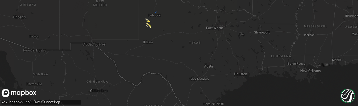
Hail Map in Texas on September 15, 2022
The weather event in Texas on September 15, 2022 includes Hail and Wind maps. 8 states and 120 cities were impacted and suffered possible damage. The total estimated number of properties impacted is 7,893.
Want more than just the map?
Turn this storm into a full workflow.
- Owner + property data so you know who to knock
- OnDemand branded weather history reports to win the "did we even have hail?" argument
- RoofTrace estimate so reps stop guessing numbers at the door
Bought this map? Upgrade within 7 days and we'll credit the $230. (10-15 min setup call)
Hail
Wind
7,893
Estimated number of impacted properties by a 1.00" hail or larger4,758
Estimated number of impacted properties by a 1.75" hail or larger0
Estimated number of impacted properties by a 2.50" hail or largerStorm reports in Texas
Texas
| Date | Description |
|---|---|
| 09/15/20226:05 PM CDT | A local report indicates 70 MPH wind near 6 E NEW DEAL |
| 09/15/20225:49 PM CDT | A local report indicates 1.50 inch wind near 6 WNW WASHBURN |
| 09/15/20225:42 PM CDT | A local report indicates 1.75 inch wind near 7 SW PANTEX |
| 09/15/20225:41 PM CDT | A local report indicates 1.50 inch wind near 6 WNW WASHBURN |
| 09/15/20225:36 PM CDT | A local report indicates 62 MPH wind near 8 W LIPSCOMB |
| 09/15/20225:34 PM CDT | A local report indicates 58 MPH wind near 2 S BROWNFIELD |
| 09/15/20225:26 PM CDT | Golf ball sized hail reported in downtown brownfield. |
| 09/15/20221:45 AM CDT | At 645 PM CDT, a severe thunderstorm was located near Welch, or 19 miles northwest of Lamesa, moving southeast at 15 mph. HAZARD...60 mph wind gusts and quarter size hail. SOURCE...Radar indicated. IMPACT...Hail damage to vehicles is expected. Expect wind damage to roofs, siding, and trees. Locations impacted include... Lamesa, Welch, Lamesa Municipal Airport, Los Ybanez, Punkin Center, Arvana and Hancock. |
| 09/15/202212:46 AM CDT | At 545 PM CDT, a severe thunderstorm was located 4 miles northwest of Washburn, or 12 miles east of Amarillo, moving east at 20 mph. HAZARD...60 mph wind gusts and half dollar size hail. SOURCE...Public. IMPACT...Minor damage to roofs, siding, and trees is possible. Hail damage to vehicles is expected. Locations impacted include... Amarillo, Panhandle, Claude, Washburn and Pantex. |
| 09/15/202212:28 AM CDT | At 528 PM CDT, a severe thunderstorm was located over Brownfield, moving northeast at 5 mph. HAZARD...Golf ball size hail and 60 mph wind gusts. SOURCE...Trained weather spotters. At 526 PM CDT, golf ball sized hail was reported in Brownfield. IMPACT...People and animals outdoors will be injured. Expect hail damage to roofs, siding, windows, and vehicles. Expect wind damage to roofs, siding, and trees. Locations impacted include... Brownfield and Meadow. |
| 09/14/202211:23 PM CDT | At 423 PM CDT, a severe thunderstorm was located 10 miles southeast of Wolf Creek Park, or 15 miles northwest of Canadian, moving east at 15 mph. HAZARD...60 mph wind gusts and half dollar size hail. SOURCE...Radar indicated. IMPACT...Minor damage to roofs, siding, and trees is possible. Hail damage to vehicles is expected. Locations impacted include... Lipscomb. |
All States Impacted by Hail Map on September 15, 2022
Cities Impacted by Hail Map on September 15, 2022
- Primrose, NE
- McDonald, KS
- Rush, CO
- Burwell, NE
- Atwood, KS
- Oberlin, KS
- Wright, KS
- Selden, KS
- Ellis, KS
- Cimarron, KS
- Elm Creek, NE
- Overton, NE
- Perryton, TX
- Booker, TX
- Canadian, TX
- Amarillo, TX
- Maywood, NE
- McCook, NE
- Colorado Springs, CO
- Spalding, NE
- Ludell, KS
- Herndon, KS
- Kismet, KS
- Liberal, KS
- Satanta, KS
- Hugoton, KS
- Meade, KS
- Plains, KS
- Moscow, KS
- Sublette, KS
- Jennings, KS
- Dresden, KS
- Natoma, KS
- Catharine, KS
- Gorham, KS
- Victoria, KS
- Paradise, KS
- Plainville, KS
- Hays, KS
- Arcadia, NE
- Cambridge, NE
- Holbrook, NE
- Bucklin, KS
- Ashland, KS
- Mullinville, KS
- Englewood, KS
- Minneola, KS
- Morland, KS
- Leoti, KS
- Kit Carson, CO
- Otis, KS
- Eustis, NE
- Elwood, NE
- Lexington, NE
- Bertrand, NE
- Smithfield, NE
- Brownfield, TX
- Stockton, KS
- Albion, NE
- Stinnett, TX
- Winona, KS
- Clarendon, TX
- Cairo, NE
- Kearney, NE
- Ravenna, NE
- Shelton, NE
- Gibbon, NE
- Riverdale, NE
- Amherst, NE
- Jetmore, KS
- Welch, TX
- Seagraves, TX
- Cozad, NE
- McCracken, KS
- Park, KS
- Kiowa, CO
- Jordan Valley, OR
- Malta, ID
- Garden City, KS
- Wendover, UT
- Holdrege, NE
- Genoa, CO
- Limon, CO
- Higgins, TX
- Arapahoe, NE
- Kensington, KS
- Kirwin, KS
- Calhan, CO
- Dugway, UT
- Protection, KS
- Palco, KS
- Gove, KS
- Healy, KS
- Ingalls, KS
- Wakeeney, KS
- Pioche, NV
- Norton, KS
- Penokee, KS
- Hill City, KS
- Grinnell, KS
- Grainfield, KS
- Meadow, TX
- Dighton, KS
- Panhandle, TX
- Eddyville, NE
- Indianola, NE
- Claude, TX
- Pleasanton, NE
- Comstock, NE
- Curtis, NE
- Loop, TX
- Yoder, CO
- Scott City, KS
- Oakley, KS
- Ogallah, KS
- Minden, NE
- Wood River, NE
- Grand Island, NE
- Lubbock, TX
- Idalou, TX


