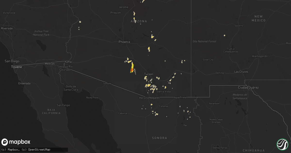
Hail Map on September 12, 2022
Get this storm
September 12 map
$229
one time, instant access
Download today. No call, no setup
Keep the $229
Bought the map and want the full workflow? Apply the entire $229 to a subscription within 7 days. None of it is wasted.
Every map, not just this one
This buys you this map. Subscription and you get every map we run, in the markets you choose from a few cities to whole states to nationwide. Plus real-time alerts the moment a storm fires.
Contact data
Name, contact info, occupancy, even credit band for addresses in the footprint. You go from where it hit to who to call.
Become the source they trust
Unlimited branding weather history reports on demand. You already have the documented answer ready for the property owner, and you are the one who showed up with it.
Property data and RoofTrace estimates
Pull up any address you have got, its value and the exact code rules for that jurisdiction, straight from One Click Code. Then RoofTrace estimates the squares, pitch, and roof value, priced the way you price.
Storm reports
Maryland
| Date | Description |
|---|---|
| 09/12/20224:12 PM CDT | Tree down near the intersection of nicodemus road and quarry view court |
| 09/12/20225:02 AM CDT | At 1002 PM EDT, a severe thunderstorm was located over Berlin, or 7 miles west of Ocean City, moving east at 25 mph. HAZARD...60 mph wind gusts. SOURCE...Radar indicated. IMPACT...Expect damage to trees and powerlines. This severe thunderstorm will be near... Ocean Pines around 1010 PM EDT. Cape Isle Of Wight around 1015 PM EDT. Ocean City around 1020 PM EDT.Other locations impacted by this severe thunderstorm includeIronshire, West Ocean City, Whaleyville, Showell and Ocean CityMunicipality. |
| 09/12/20222:45 AM CDT | At 745 PM EDT, a severe thunderstorm was located over Tilghman Island, or 10 miles southeast of Shady Side, moving northeast at 40 mph. HAZARD...60 mph wind gusts. SOURCE...Radar indicated. IMPACT...Damage to roofs, siding, trees, and power lines is possible. Locations impacted include... Easton, Centerville, Talbot, Denton, Centreville, Romancoke, Ridgely, St. Michaels, Queen Anne, Grasonville, Starr, Tilghman Island, Skipton, Copperville, Jumptown, Matthews, Wye Mills, Griffin, Cordova and Carville. |
| 09/12/20221:28 AM CDT | At 628 PM EDT, a severe thunderstorm was located near Colonial Beach, moving northeast at 25 mph. HAZARD...60 mph wind gusts and quarter size hail. SOURCE...Radar indicated. IMPACT...Damaging winds will cause some trees and large branches to fall. This could injure those outdoors, as well as damage homes and vehicles. Roadways may become blocked by downed trees. Localized power outages are possible. Unsecured light objects may become projectiles. Locations impacted include... Wicomico River, Golden Beach, Wicomico, Hughesville, Mechanicsville, Charlotte Hall, Cobb Island, Bryantown, Rock Point, Bushwood, Clements, Issue, Morganza, Tompkinsville, Hillville, Chaptico, Mount Victoria, Swan Point, Maddox and Avenue. |
| 09/11/202211:28 PM CDT | At 428 PM EDT, a severe thunderstorm was located near Triangle, or 7 miles west of Quantico, moving east at 15 mph. HAZARD...60 mph wind gusts. SOURCE...Radar indicated. IMPACT...Damaging winds will cause some trees and large branches to fall. This could injure those outdoors, as well as damage homes and vehicles. Roadways may become blocked by downed trees. Localized power outages are possible. Unsecured light objects may become projectiles. Locations impacted include... Quantico, Montclair, Triangle, Dumfries, Cherry Hill, Potomac Heights, Rison and Marbury. |
North Carolina
| Date | Description |
|---|---|
| 09/12/20226:39 PM CDT | Power outage caused by fallen trees or limbs damaging equipment. |
| 09/12/20225:05 PM CDT | Duke energy reported multiple trees down causing power outages at multiple locations including near hillside dairy road and alston road. Time estimated by radar. |
| 09/12/20224:40 PM CDT | Tree down in road on nc-24. |
| 09/12/20224:40 PM CDT | Tree down in road on j dowdy rd. |
| 09/12/20223:56 PM CDT | Report from mping: 1-inch tree limbs broken; shingles blown off. |
| 09/12/20223:14 PM CDT | Report from mping: trees uprooted or snapped; roof blown off. |
| 09/12/20223:12 PM CDT | Report from mping: trees uprooted or snapped; roof blown off. |
| 09/12/20222:55 PM CDT | A tree was reported down at schley rd. And mincey rd. |
| 09/12/20222:58 AM CDT | At 758 PM EDT, a severe thunderstorm was located near Garner, or 12 miles south of Raleigh, moving east at 25 mph. HAZARD...60 mph wind gusts. SOURCE...Radar indicated. IMPACT...Expect damage to roofs, siding, and trees. Locations impacted include... Garner, Clayton, Zebulon, Knightdale, Wendell, Emit, Flowers and Lake Benson. |
| 09/12/202212:41 AM CDT | At 541 PM EDT, a severe thunderstorm was located 9 miles southwest of Goldston, or 12 miles south of Siler City, moving northeast at 30 mph. HAZARD...60 mph wind gusts. SOURCE...Radar indicated. IMPACT...Expect damage to roofs, siding, and trees. Locations impacted include... Sanford, Pittsboro, Siler City, Goldston, Broadway, Gum Springs, Harpers Crossroads, Highfalls, Bynum and Moncure. |
| 09/11/202211:51 PM CDT | At 449 PM EDT, a severe thunderstorm was located near Troy, moving northeast at 30 mph. HAZARD...60 mph wind gusts. SOURCE...Radar indicated. IMPACT...Expect damage to roofs, siding, and trees. Locations impacted include... Troy, Biscoe, Seagrove, Robbins, Star, Steeds, Harpers Crossroads, Highfalls, Coleridge and Glendon. |
| 09/11/202211:19 PM CDT | At 418 PM EDT, a severe thunderstorm was located near Louisburg, moving east at 25 mph. HAZARD...60 mph wind gusts and penny size hail. SOURCE...Radar indicated. IMPACT...Expect damage to roofs, siding, and trees. Locations impacted include... Louisburg, Castalia, Centerville, Arcola, Ingleside and Aventon. |
| 09/11/202210:55 PM CDT | At 355 PM EDT, a severe thunderstorm was located near Hillsborough, moving east at 30 mph. HAZARD...60 mph wind gusts and penny size hail. SOURCE...Radar indicated. IMPACT...Expect damage to roofs, siding, and trees. Locations impacted include... Durham, Butner, Rougemont, Stem, Lake Michie, Lake Butner, Moriah, Eno River State Park, Berea and Bahama. |
Pennsylvania
| Date | Description |
|---|---|
| 09/12/20225:15 PM CDT | Tree down in houtzdale. |
Virginia
| Date | Description |
|---|---|
| 09/12/20222:05 PM CDT | Tree down near the intersection of cherry hill road and fiery run road |
| 09/12/20221:25 PM CDT | Numerous trees down near the intersection of farley road and alanthus road. |
| 09/12/20226:38 AM CDT | At 1138 PM EDT, a severe thunderstorm was located near Wingina, or 7 miles northwest of Buckingham, moving northeast at 30 mph. HAZARD...60 mph wind gusts and quarter size hail. SOURCE...Radar indicated. IMPACT...Hail damage to vehicles is expected. Expect wind damage to roofs, siding, and trees. Locations impacted include... Buckingham... Wingina... New Canton... Gold Hill... and Centenary. |
| 09/11/202211:25 PM CDT | Tree down between bremo bluff and fork union. |
| 09/11/202211:13 PM CDT | Multiple tress down in the arvonia area. |
| 09/11/202211:13 PM CDT | Corrects previous tstm wnd dmg report from 2 wsw new canton. Multiple trees down in the arvonia area. |
| 09/11/202210:58 PM CDT | Multiple trees down along route 652. |
| 09/11/20229:08 PM CDT | At 208 PM EDT, a severe thunderstorm was located near Culpeper, moving east at 15 mph. HAZARD...60 mph wind gusts. SOURCE...Radar indicated. IMPACT...Damaging winds will cause some trees and large branches to fall. This could injure those outdoors, as well as damage homes and vehicles. Roadways may become blocked by downed trees. Localized power outages are possible. Unsecured light objects may become projectiles. Locations impacted include... Culpeper, Bealeton, Opal, Remington, Catalpa, Elkwood, Cardova, Brandy Station, Rixeyville and Alanthus. |
California
| Date | Description |
|---|---|
| 09/12/20225:53 PM CDT | Telephone or power pole leaning in lanes. |
| 09/11/202210:04 PM CDT | At 304 PM MST, a severe thunderstorm was located near Parker, moving north at 20 mph. HAZARD...60 mph wind gusts and penny size hail. SOURCE...Radar indicated. IMPACT...Expect damage to roofs, siding, and trees. Locations impacted include... Parker and Buckskin Mountain Park. This includes the following highways...AZ Route 72 between mile markers 14 and 15.AZ Route 95 between mile markers 131 and 146, between mile markers148 and 154, and between mile markers 156 and 160. |
| 09/11/20228:45 PM CDT | At 145 PM PDT, a severe thunderstorm was located 10 miles southeast of Daggett, moving northeast at 10 mph. HAZARD...60 mph wind gusts and quarter size hail. SOURCE...Radar indicated. IMPACT...Hail damage to vehicles is expected. Expect wind damage to roofs, siding, and trees. This severe thunderstorm will remain over mainly rural areas of San Bernardino County. |
Delaware
| Date | Description |
|---|---|
| 09/12/20224:14 AM CDT | Emergency management reports uprooted trees and power outages in the henlopen acres area north of rehoboth beach. Time estimated from radar. |
| 09/12/20224:14 AM CDT | Corrects time from previous tstm wnd dmg report from rehoboth beach. Emergency management reports numerous trees uprooted... Large tree limbs down... And power outages |
| 09/12/20224:10 AM CDT | Emergency management reports numerous trees uprooted... Large tree limbs down... And power outages mainly across the southern side of town. Notably impacted areas were |
| 09/12/20223:27 AM CDT | At 827 PM EDT, a severe thunderstorm was located over Centreville, or over Centerville, moving northeast at 30 mph. HAZARD...60 mph wind gusts. SOURCE...Radar indicated. IMPACT...Damage to roofs, siding, trees, and power lines is possible. Locations impacted include... Centerville, Chestertown, Centreville, Church Hill, Millington, Sudlersville, Old Town, Starr, Starkey Corner, Morgnec, Massey, Crumpton, Carville, Kennedyville, Hope, Galena, Barclay and Kingstown. |
Arizona
| Date | Description |
|---|---|
| 09/12/20227:49 AM CDT | At 1248 PM MST, an area of severe thunderstorms was located near Green Valley, moving north at 15 mph, with another just east of Three Points. HAZARD...60 mph wind gusts and quarter size hail. SOURCE...Radar indicated. IMPACT...Hail damage to vehicles is expected. Expect wind damage to roofs, siding, and trees. Locations impacted include... Sahuarita, Green Valley, Davis-Monthan Air Force Base, Drexel Heights, South Tucson, Three Points, Pascua Pueblo Yaqui Reservation, Summit, Tucson Estates, Corona De Tucson, Tucson International Airport, Saguaro National Park West, San Xavier Mission, Ryan AirField and Arivaca Junction. |
| 09/12/20226:42 AM CDT | At 1141 PM MST, a severe thunderstorm was located near Childs Power Plant, or 19 miles northwest of Payson, moving north at 20 mph. HAZARD...60 mph wind gusts and quarter size hail. SOURCE...Radar indicated. IMPACT...Hail damage to vehicles is expected. Expect wind damage to roofs, siding, and trees. Locations impacted include... Childs Power Plant and Clear Creek Campgrounds. This includes State Route 260 between mile markers 227 and 242. |
| 09/12/20221:14 AM CDT | At 614 PM MST, a severe thunderstorm was located 8 miles northwest of Chui-Chu, or 11 miles southwest of Casa Grande, moving north at 10 mph. HAZARD...60 mph wind gusts and quarter size hail. SOURCE...Radar indicated. IMPACT...Hail damage to vehicles is expected. Expect wind damage to roofs, siding, and trees. Locations impacted include... Casa Grande, Arizola and Stanfield. This includes the following highways...AZ Interstate 10 between mile markers 187 and 190.AZ Interstate 8 between mile markers 155 and 176.AZ Route 347 between mile markers 161 and 167. |
| 09/11/202211:23 PM CDT | At 422 PM MST, a severe thunderstorm was located 12 miles south of Arizona City, or 23 miles south of Casa Grande, moving north at 20 mph. HAZARD...60 mph wind gusts and half dollar size hail. SOURCE...Radar indicated. IMPACT...Hail damage to vehicles is expected. Expect wind damage to roofs, siding, and trees. Locations impacted include... Eloy, Picacho, Chui-Chu, Shopishk and East Chui-Chu. |
| 09/11/202211:01 PM CDT | At 401 PM MST, a severe thunderstorm was located near Sonoita, or 17 miles east of Tubac, moving northeast at 10 mph. HAZARD...60 mph wind gusts and quarter size hail. SOURCE...Radar indicated. IMPACT...Hail damage to vehicles is expected. Expect wind damage to roofs, siding, and trees. Locations impacted include... Rio Rico, Patagonia, Sonoita and Patagonia Lake State Park. |
| 09/11/202210:54 PM CDT | At 353 PM MST, a severe thunderstorm was located 9 miles south of Willcox, moving northeast at 10 mph. HAZARD...60 mph wind gusts and quarter size hail. SOURCE...Radar indicated. IMPACT...Hail damage to vehicles is expected. Expect wind damage to roofs, siding, and trees. Locations impacted include... Willcox, Cochise and Kansas Settlement. |
| 09/11/202210:50 PM CDT | At 350 PM MST, a severe thunderstorm was located near Amado, or about 8 miles north of Tubac, moving northeast at 10 mph. HAZARD...60 mph wind gusts. SOURCE...Radar indicated. IMPACT...Expect damage to roofs, siding, and trees. Locations impacted include... Sahuarita, Green Valley, Amado and Arivaca Junction. |
| 09/11/202210:33 PM CDT | At 332 PM MST, a severe thunderstorm was located 20 miles east of Santa Rosa, or 32 miles north of Sells, moving north at 25 mph. HAZARD...60 mph wind gusts and half dollar size hail. SOURCE...Radar indicated. IMPACT...Hail damage to vehicles is expected. Expect wind damage to roofs, siding, and trees. This severe thunderstorm will remain over mainly remote areas of north central Pima and south central Pinal Counties. |
| 09/11/202210:27 PM CDT | At 325 PM MST, a severe thunderstorm was located near and southwest of Elgin, or 22 miles northwest of Sierra Vista, moving northeast at 10 mph. Additional storms were developing along an outflow through eastern Santa Cruz county and southwest Cochise county. HAZARD...60 mph wind gusts and quarter size hail. SOURCE...Radar indicated. IMPACT...Hail damage to vehicles is expected. Expect wind damage to roofs, siding, and trees. Locations impacted include... Sierra Vista, Whetstone, Huachuca City, Patagonia, Sonoita, Elgin, Fort Huachuca, Parker Canyon Lake, Patagonia Lake State Park, Fairbank and Canelo. |
| 09/11/202210:13 PM CDT | At 312 PM PDT/312 PM MST/, a severe thunderstorm was located over Parker Dam, moving north at 20 mph. HAZARD...60 mph wind gusts. SOURCE...Radar indicated. IMPACT...Expect damage to roofs and trees. Locations impacted include... Lake Havasu City, Parker Dam, Three Dunes Campground, Cattail Cove State Park, Desert Hills, Black Meadow Landing Campground, Earp and Big River. |
| 09/11/202210:06 PM CDT | At 306 AM MST, a severe thunderstorm was located 13 miles southwest of Wickenburg, moving north at 15 mph. HAZARD...60 mph wind gusts and quarter size hail. SOURCE...Radar indicated. IMPACT...Hail damage to vehicles is expected. Expect wind damage to roofs, siding, and trees. Locations impacted include... Wickenburg.This includes US Highway 60 between mile markers 92 and 113. |
| 09/11/20229:59 PM CDT | At 259 PM MST, a severe thunderstorm was located over Rimmy Jims, or 19 miles west of Winslow, moving northeast at 20 mph. HAZARD...60 mph wind gusts and penny size hail. SOURCE...Radar indicated. IMPACT...Expect damage to roofs, siding, and trees. Locations impacted include... Two Guns, Rimmy Jims and Meteor Crater. This includes the following highways... Interstate 40 between mile markers 226 and 243. State Route 99 between mile markers 55 and 69. |
| 09/11/20229:48 PM CDT | At 247 PM MST, a severe thunderstorm was located 8 miles south of Dragoon, or 14 miles east of Benson, moving north at 5 to 10 mph, with another storm 10 miles northeast of Sierra Vista. HAZARD...60 mph wind gusts and quarter size hail. SOURCE...Radar indicated. IMPACT...Hail damage to vehicles is expected. Expect wind damage to roofs, siding, and trees. Locations impacted include... Whetstone, St. David, Tombstone, Dragoon, Pearce-Sunsites and Fairbank. |
| 09/11/20229:31 PM CDT | At 231 PM MST, a severe thunderstorm was located near Two Guns, or 25 miles west of Winslow, moving northeast at 30 mph. HAZARD...60 mph wind gusts and quarter size hail. SOURCE...Radar indicated. IMPACT...Hail damage to vehicles is expected. Expect wind damage to roofs, siding, and trees. Locations impacted include... Two Guns and Rimmy Jims. This includes the following highways... Interstate 40 between mile markers 222 and 235. State Route 99 between mile markers 65 and 67. |
| 09/11/20229:05 PM CDT | At 205 PM MST, a severe thunderstorm was located near Green Valley, moving north at 5 mph. HAZARD...60 mph wind gusts and quarter size hail. SOURCE...Radar indicated. IMPACT...Hail damage to vehicles is expected. Expect wind damage to roofs, siding, and trees. Locations impacted include... Sahuarita, Green Valley, East Sahuarita and Arivaca Junction. |
| 09/11/20228:32 PM CDT | At 132 PM MST, a severe thunderstorm was located 11 miles northwest of Benson with another developing over Benson, moving north at 10 mph. HAZARD...60 mph wind gusts and quarter size hail. SOURCE...Radar indicated. IMPACT...Hail damage to vehicles is expected. Expect wind damage to roofs, siding, and trees. Locations impacted include... Benson, Saguaro National Park East and Mescal. |
| 09/11/20228:28 PM CDT | At 127 PM MST, a severe thunderstorm was located over Pascua Pueblo Yaqui Reservation, or 13 miles northwest of Sahuarita, moving north at 10 mph. HAZARD...60 mph wind gusts and quarter size hail. SOURCE...Radar indicated. IMPACT...Hail damage to vehicles is expected. Expect wind damage to roofs, siding, and trees. Locations impacted include... Southwest Tucson, Drexel Heights, South Tucson, Three Points, Pascua Pueblo Yaqui Reservation, Valencia West, Tucson Estates, Saguaro National Park West, San Xavier Mission and Ryan AirField. |
New Mexico
| Date | Description |
|---|---|
| 09/12/20222:19 AM CDT | At 719 PM MDT, severe thunderstorms were located along a line extending from 6 miles east of Mosquero to 16 miles northeast of Conchas Dam, moving southeast at 25 mph. HAZARD...60 mph wind gusts and quarter size hail. SOURCE...Radar indicated. IMPACT...Hail damage to vehicles is expected. Expect wind damage to roofs, siding, and trees. These severe thunderstorms will remain over mainly rural areas of northeastern San Miguel and southeastern Harding Counties.This includes State Road 104 near Mile Marker 97. |
| 09/12/20221:57 AM CDT | At 657 PM MDT, severe thunderstorms were located along a line extending from 6 miles southeast of Maes to 16 miles north of Conchas Dam, and are nearly stationary. HAZARD...60 mph wind gusts and half dollar size hail. SOURCE...Radar indicated. IMPACT...Hail damage to vehicles is expected. Expect wind damage to roofs, siding, and trees. Locations impacted include... Maes, Bell Ranch and Trementina. This includes State Road 104 between Mile Markers 36 and 47. |
| 09/12/20221:35 AM CDT | At 635 PM MDT, a severe thunderstorm was located 11 miles southeast of Maes, or 29 miles southwest of Mosquero, moving southeast at 5 mph. HAZARD...60 mph wind gusts and quarter size hail. SOURCE...Radar indicated. IMPACT...Hail damage to vehicles is expected. Expect wind damage to roofs, siding, and trees. This severe thunderstorm will remain over mainly rural areas of north central San Miguel County.This includes State Road 104 near Mile Marker 51. |
| 09/11/202211:15 PM CDT | At 415 PM MDT, a severe thunderstorm was located 8 miles southeast of Gladstone, or 29 miles north of Mosquero, moving south at 10 mph. HAZARD...60 mph wind gusts and quarter size hail. SOURCE...Radar indicated. IMPACT...Hail damage to vehicles is expected. Expect wind damage to roofs, siding, and trees. Locations impacted include... Yates. |
| 09/11/202210:13 PM CDT | At 313 PM MDT, a severe thunderstorm was located 22 miles north of Monticello, moving north at 5 mph. HAZARD...60 mph wind gusts and half dollar size hail. SOURCE...Radar indicated. IMPACT...Hail damage to vehicles is expected. Expect wind damage to roofs, siding, and trees. This severe thunderstorm will remain over mainly rural areas of southwestern Socorro County. |
Florida
| Date | Description |
|---|---|
| 09/12/20224:55 PM CDT | Video provided from fox 35 showed at least a dozen power poles snapped along the west side of u.s. 27 from riddick grove rd extending south for a few hundred yards. |
| 09/12/202212:56 AM CDT | At 555 PM EDT, a severe thunderstorm was located 6 miles south of Lake Louisa, moving east at 15 mph. HAZARD...60 mph wind gusts. SOURCE...Radar indicated. IMPACT...Expect damage to roofs, siding, and trees. Locations impacted include... Bay Lake, Horizon West, and Lake Buena Vista. |
Cities Impacted by Hail Map on September 12, 2022
- Gladstone, NM
- Delmar, DE
- Laurel, DE
- Vail, AZ
- Conchas Dam, NM
- Parker, AZ
- Bowie, AZ
- San Simon, AZ
- Green Valley, AZ
- Amado, AZ
- Tombstone, AZ
- Huachuca City, AZ
- Sierra Vista, AZ
- Sonoita, AZ
- Elgin, AZ
- Trementina, NM
- Young, AZ
- Amherst, VA
- Madison Heights, VA
- Tumacacori, AZ
- Willcox, AZ
- Tucson, AZ
- Patagonia, AZ
- Scottsville, VA
- Arvonia, VA
- Dillwyn, VA
- Cochise, AZ
- Sahuarita, AZ
- Kearny, AZ
- Georgetown, DE
- Tubac, AZ
- Delmar, MD
- Mardela Springs, MD
- Hebron, MD
- Culpeper, VA
- Brandy Station, VA
- Eloy, AZ
- Sedona, AZ
- Nogales, AZ
- Clayton, NM
- Columbia, VA
- Palmyra, VA
- Bremo Bluff, VA
- Gladstone, VA
- New Canton, VA
- Louisa, VA
- Buckingham, VA
- Howardsville, VA
- Wingina, VA
- Fork Union, VA
- Kents Store, VA
- Berlin, MD
- Saint David, AZ
- Casa Grande, AZ
- Maricopa, AZ
- Harbeson, DE
- Millsboro, DE
- Milton, DE
- Vienna, MD
- Rehoboth Beach, DE
- Lewes, DE
- Bethel, DE
- Salisbury, MD
- Dagsboro, DE
- Rio Rico, AZ
- Ash Fork, AZ
- Payson, AZ
- Marana, AZ