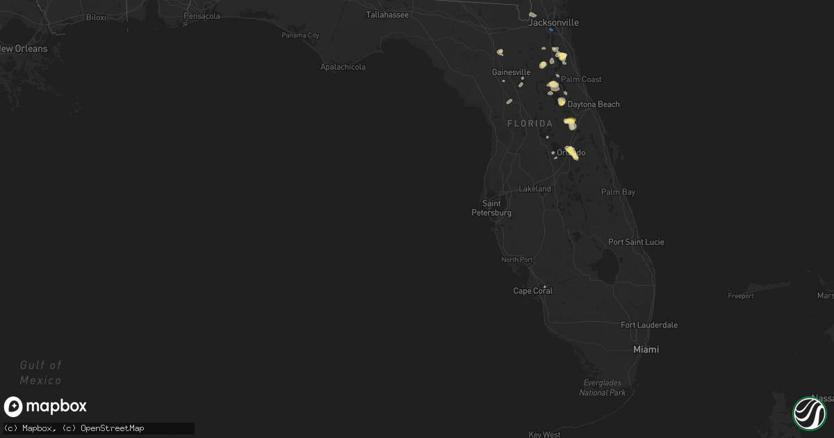
Hail Map in Florida on September 11, 2023
Get this storm
September 11 map
$229
one time, instant access
Download today. No call, no setup
Keep the $229
Bought the map and want the full workflow? Apply the entire $229 to a subscription within 7 days. None of it is wasted.
Every map, not just this one
This buys you this map. Subscription and you get every map we run, in the markets you choose from a few cities to whole states to nationwide. Plus real-time alerts the moment a storm fires.
Contact data
Name, contact info, occupancy, even credit band for addresses in the footprint. You go from where it hit to who to call.
Become the source they trust
Unlimited branding weather history reports on demand. You already have the documented answer ready for the property owner, and you are the one who showed up with it.
Property data and RoofTrace estimates
Pull up any address you have got, its value and the exact code rules for that jurisdiction, straight from One Click Code. Then RoofTrace estimates the squares, pitch, and roof value, priced the way you price.
Storm reports in Florida
Florida
| Date | Description |
|---|---|
| 09/11/20236:56 PM CDT | Orange county fire/rescue reported a tree down at 203 south wekiwa springs rd. |
| 09/11/20236:55 PM CDT | Orange county fire/rescue reported wires down at 1203 pine st. |
| 09/11/20235:58 PM CDT | Corrects previous tstm wnd dmg report from 1 s palatka. Powerline down. Location 1506 husfon ave. |
| 09/11/20235:57 PM CDT | Trees reported down caused by thunderstorm winds. |
| 09/11/20235:55 PM CDT | Power lines down at 477 s hwy 17. |
| 09/11/20235:50 PM CDT | Trees reported down at intersection of elm street and 11th ave. |
| 09/11/20235:10 PM CDT | Corrects previous tstm wnd dmg report from 4 s bakersville. Photos from social media shows barn roof damage... Porta potty blown over over...updated time based off rada |
| 09/11/20234:55 PM CDT | Photos from social media shows barn roof damage... Porta potty blown over over...time base off radar estimate. |
| 09/11/20234:47 PM CDT | Trees snapped and fell on 13a north of molasses junction. Time estimated by radar. |
| 09/11/20233:40 PM CDT | Updates previous tstm wnd dmg report from 5 sse san marco. Reports of several trees down near st. Augustine rd near san jose... Some blocking the road. Time estimated f |
| 09/11/20233:40 PM CDT | Reports of several trees down near st. Augustine rd near san jose... Some blocking the road. Time estimated from radar. |
| 09/11/20233:31 PM CDT | Awos station knip jacksonville nas. |
| 09/11/20233:30 PM CDT | Report of large tree down across vehicle on lofty pine circle in ortega. |
| 09/11/20233:30 PM CDT | Adds hard top of gazebo blown off to previous tstm wnd dmg report from 2 sse ortega. Report of a tree down off roosevelt blvd near timuquana rd. Time estimated from rad |
| 09/11/20233:25 PM CDT | Report of roof blown off. |
| 09/11/20233:25 PM CDT | Corrects previous tstm wnd dmg report from 1 nw ortega. Report of roof blown off. Location at intersection of blanding blvd and shirley avenue. |
| 09/10/20239:00 PM CDT | Powerline down. Location 1506 husfon ave. |
| 09/10/20238:27 PM CDT | Orange county fire rescue reported damage to several mobile homes along jean drive in the gulfstream harbor mobile home park. Time estimated based on radar. |
| 09/10/20238:22 PM CDT | Orange county fire/rescue reported wires down at 4556 landing drive |
| 09/10/20238:20 PM CDT | Orange county fire rescue reported a tree down at 1719 hoffner ave... |
| 09/10/20238:20 PM CDT | Emergency manager estimates quarter size hail near the orlando executive airport. |
| 09/10/20238:19 PM CDT | Trained spotter estimates quarter size hail near fern park. |
| 09/10/20238:17 PM CDT | Orange county fire/rescue reported a tree down at south conway rd. And stonewall dr. |
| 09/10/20238:15 PM CDT | Orange county fire rescue reported wires down at 2703 page. Ave. |
| 09/10/20238:15 PM CDT | Orange county fire rescue reported a tree down on east crystal lake ave. At counway gardens rd. |
| 09/10/20237:58 PM CDT | Broadcast media estimates quarter size hail in downtown orlando. |
| 09/10/20237:45 PM CDT | Orange county fire/rescue reported wires down on north kirkman rd. And west central blvd. |
| 09/10/20237:45 PM CDT | Trained spotter estimates a thunderstorm wind gust of 50kts/58mph and reports dime size hail. |
All States Impacted by Hail Map on September 11, 2023
Cities Impacted by Hail Map on September 11, 2023
- Dagsboro, DE
- Jacksonville, FL
- Matador, TX
- Corona, NM
- Dickens, TX
- Afton, TX
- Floydada, TX
- Mcadoo, TX
- Saint Augustine, FL
- Elkton, FL
- Paducah, TX
- Aspermont, TX
- Roswell, NM
- Old Glory, TX
- Deland, FL
- Eustis, FL
- Pierson, FL
- Orange City, FL
- Rochester, TX
- O'Brien, TX
- Rule, TX
- Post, TX
- Ralls, TX
- Haskell, TX
- Crosbyton, TX
- Vaughn, NM
- Green Cove Springs, FL
- Paisley, FL
- Lockney, TX
- Silverton, TX
- Palatka, FL
- Encino, NM
- Blackshear, GA
- Flomot, TX
- Florahome, FL
- Interlachen, FL
- Conchas Dam, NM
- Hilliard, FL
- Plains, TX
- Pomona Park, FL
- Satsuma, FL
- Welaka, FL
- Goose Creek, SC
- Saint George, SC
- Waycross, GA
- Archer, FL
- Ocala, FL
- Dunnellon, FL
- Morriston, FL
- Dorchester, SC
- Savannah, GA
- Bryceville, FL
- Wadley, GA
- Midville, GA
- Lake Butler, FL
- Lake City, FL
- Alachua, FL
- Fort Stewart, GA
- Walker, MN
- Hawthorne, FL
- Micanopy, FL
- Quitaque, TX
- Salem, SC
- Stamford, TX
- Lueders, TX
- Avoca, TX
- Albany, TX
- Justiceburg, TX
- Lovington, NM
- Denver City, TX
- Maitland, FL
- Orlando, FL
- Winter Park, FL
- Loraine, TX
- Roscoe, TX
- Colorado City, TX
- Westbrook, TX
- Trent, TX
- Tye, TX
- Sweetwater, TX
- Abilene, TX
- Clyde, TX
- Merkel, TX
- Moran, TX
- Seminole, TX
- Breckenridge, TX
- Cross Plains, TX
- Baird, TX
- Cisco, TX
- San Angelo, TX
- Meadow, TX
- Seville, FL
- Crescent City, FL
- Andrews, TX
- Wrens, GA
- Stapleton, GA
- Maryneal, TX
- Gibson, GA
- Avera, GA
- Slaton, TX
- Lorenzo, TX
- Paint Rock, TX
- Mereta, TX
- Mayhill, NM
- Coahoma, TX
- Whiteface, TX
- Snyder, TX
- Walterboro, SC
- Green Pond, SC
- Hermleigh, TX
- Tinnie, NM
- Spur, TX
- Throckmorton, TX
- Weinert, TX
- Munday, TX
- Goree, TX
- Georgetown, FL
- Debary, FL
- Seymour, TX
- Stanton, TX
- Fort McCoy, FL
- Fort Myers, FL
- Apopka, FL
- San Mateo, FL
- Lubbock, TX
- Charleston, SC
- Lenorah, TX
- Winter Garden, FL
- Clermont, FL
- Tavares, FL
- Vancourt, TX
- Swainsboro, GA
- Brownwood, TX
- May, TX
- Rising Star, TX
- Winters, TX
- Sterling City, TX
- Burkett, TX
- Hinesville, GA
- Fargo, GA
- Carlsbad, TX
- Eastland, TX
- Ranger, TX
- Dryden, TX
- Mertzon, TX
- Mingus, TX
- Fort Stockton, TX


