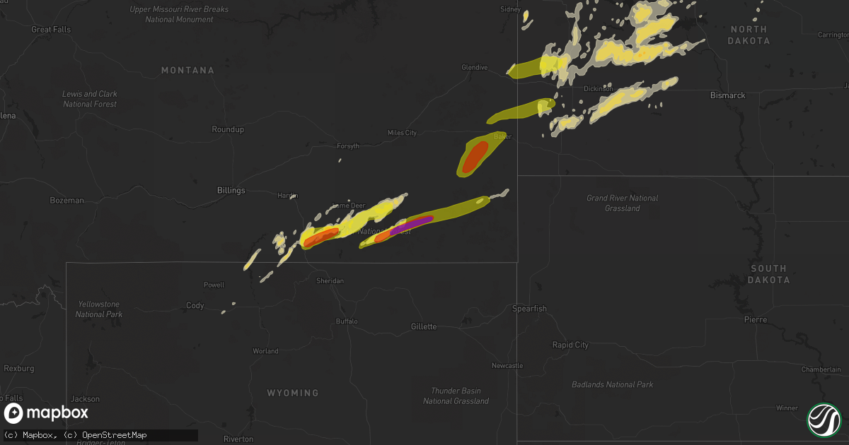
Hail Map on September 5, 2015
Get this storm
September 5 map
$229
one time, instant access
Download today. No call, no setup
Keep the $229
Bought the map and want the full workflow? Apply the entire $229 to a subscription within 7 days. None of it is wasted.
Every map, not just this one
This buys you this map. Subscription and you get every map we run, in the markets you choose from a few cities to whole states to nationwide. Plus real-time alerts the moment a storm fires.
Contact data
Name, contact info, occupancy, even credit band for addresses in the footprint. You go from where it hit to who to call.
Become the source they trust
Unlimited branding weather history reports on demand. You already have the documented answer ready for the property owner, and you are the one who showed up with it.
Property data and RoofTrace estimates
Pull up any address you have got, its value and the exact code rules for that jurisdiction, straight from One Click Code. Then RoofTrace estimates the squares, pitch, and roof value, priced the way you price.
States Impacted by Hail Map on September 5, 2015
Storm reports
North Dakota
| Date | Description |
|---|---|
| 09/05/20152:26 AM CDT | Partially built garage was damaged by the strong winds. |
| 09/05/20151:55 AM CDT | Measured wind gust from mafb observation site. |
| 09/05/20151:42 AM CDT | Measured wind gust from mafb observation site. |
| 09/05/201512:03 AM CDT | A pole barn with a shed attached was blown over onto a vehicle...smashing the roof. Another shed attached to a building was destroyed |
| 09/05/201512:03 AM CDT | A pole barn with a shed attached was blown over onto a vehicle...smashing the roof. Another shed attached to a building was destroyed |
| 09/05/201512:00 AM CDT | A local report indicates 60 MPH wind near GRASSY BUTTE |
| 09/04/201511:45 PM CDT | Hail to the size of quarters lasted 5 minutes. |
| 09/04/201511:10 PM CDT | Approximately two dozen telephone poles were snapped. An empty grain bin was displaced 80 to 100 yards and destroyed. Winds estimated at 80 mph. |
| 09/04/201510:49 PM CDT | Hail lasted about 3 minutes until 1052 pm cdt. Wind gusts 30 to 40 mph. |
Mississippi
| Date | Description |
|---|---|
| 09/05/20156:25 PM CDT | Multiple trees down along highway 603 north of kiln. |
| 09/05/20155:30 PM CDT | Hail just smaller than golfball reported along yankee town rd and arms road south of saucier. |
| 09/05/20155:30 PM CDT | Multiple large tree limbs down and power outages south of saucier. |
Indiana
| Date | Description |
|---|---|
| 09/05/20156:14 PM CDT | A few trees down near interstate 65. |
Alabama
| Date | Description |
|---|---|
| 09/05/20152:00 PM CDT | One tree down on a house. Winds off radar 40 to 50 mph. |
| 09/05/20151:45 PM CDT | Trees and powerlines down on homes in hueytown along brooklane dr near davey allison blvd and commerce ave. Also roof damage to a business and one garage door blown out |
| 09/04/20158:40 PM CDT | Trees blown down in the skipperville area. |
| 09/04/20158:40 PM CDT | Trees blown down in the ozark area. Some accidents reported due to the fallen trees. |
Kentucky
| Date | Description |
|---|---|
| 09/04/20159:07 PM CDT | Trees reported down at tanglewood and dakota road. |
| 09/04/20158:12 PM CDT | Frankfort plant board reported multiple power outages over southwest franklin county. Cloverdale and leawood subdivisions were impacted. |
Florida
| Date | Description |
|---|---|
| 09/05/20156:40 PM CDT | Power line blown down on the side of the road started a fire along bluestar highway |
| 09/05/20151:55 PM CDT | Light pole knocked down along sw 127th avenue near 88th street. Report received via social media. |
| 09/05/20151:52 PM CDT | Large branch blocking northbound sw 112th avenue at sw 96th st on north side of miami dade college kendall campus. |
| 09/05/20151:52 PM CDT | Large tree uprooted near sw 106th ave and 99th st. |
| 09/05/20151:51 PM CDT | Measured at miami dade college |
| 09/05/20151:50 PM CDT | Measured at miami dade college |
| 09/05/20151:40 PM CDT | Tree branch blocked roadway near mercado avenue and red road. Report received via social media. |
| 09/05/20151:40 PM CDT | Tree branch blocked road at siena avenue and red road. Report received via social media. |
| 09/04/20157:00 PM CDT | Tree down near crystal road in the vicinity of howell road |
Montana
| Date | Description |
|---|---|
| 09/04/201511:15 PM CDT | Glendive airport awos measured a 64 mph wind gust. |
| 09/04/201510:40 PM CDT | A local report indicates 1.00 inch wind near 3 WSW OLLIE |
| 09/04/201510:08 PM CDT | A local report indicates 1.75 inch wind near 22 SSW PLEVNA |
| 09/04/20159:37 PM CDT | A local report indicates 2.00 inch wind near 4 NE BROADUS |
| 09/04/20159:36 PM CDT | A local report indicates 2.50 inch wind near BROADUS |
| 09/04/20159:32 PM CDT | A local report indicates 1.50 inch wind near BROADUS |
| 09/04/20159:28 PM CDT | A local report indicates 1.75 inch wind near 3 WNW BROADUS |
| 09/04/20159:24 PM CDT | A local report indicates 1.75 inch wind near 10 W BROADUS |
| 09/04/20159:05 PM CDT | A local report indicates 60 MPH wind near 10 N BIRNEY |
| 09/04/20158:40 PM CDT | A local report indicates 1.00 inch wind near 4 NE OTTER |
| 09/04/20158:25 PM CDT | A local report indicates 1.75 inch wind near 20 S BUSBY |
| 09/04/20158:21 PM CDT | A local report indicates 1.00 inch wind near 17 SSE BIRNEY |
North Carolina
| Date | Description |
|---|---|
| 09/05/20151:20 PM CDT | Smokey mountain campground had quarter sized hail which damaged some awnings. Nearby deep creek tube center had dime to nickel sized hail. Also a storm spotter in the s |
Georgia
| Date | Description |
|---|---|
| 09/05/20156:25 PM CDT | Several trees down in decatur county |
| 09/05/20152:18 PM CDT | Burke county sheriff reported trees down on hickson road |
| 09/05/20152:17 PM CDT | Burke county sheriff reported trees down on george perkins road northwest of waynesboro |
Cities Impacted by Hail Map on September 5, 2015
- Dodge, ND
- Hazen, ND
- Garrison, ND
- Golden Valley, ND
- Zap, ND
- Beulah, ND
- Halliday, ND
- Skipperville, AL
- Ariton, AL
- Ozark, AL
- Sentinel Butte, ND
- Rhame, ND
- New England, ND
- Amidon, ND
- Medora, ND
- Birney, MT
- Taylor, ND
- Killdeer, ND
- Manning, ND
- Dunn Center, ND
- Gladstone, ND
- Otter, MT
- Lodge Grass, MT
- Churchs Ferry, ND
- Devils Lake, ND
- Esmond, ND
- Maddock, ND
- Minnewaukan, ND
- Penn, ND
- Saucier, MS
- Busby, MT
- Decker, MT
- Wyola, MT
- Keysville, GA
- Hephzibah, GA
- Pensacola, FL
- Brainerd, MN
- Picayune, MS
- Kiln, MS
- Panama City, FL
- Plaza, ND
- Parshall, ND
- Grant Park, IL
- Cartwright, ND
- Douglas, ND
- Minot, ND
- Alsen, ND
- Edmore, ND
- Osnabrock, ND
- Nekoma, ND
- Bay Minette, AL
- Monterey, TN
- Keene, ND
- Fairfield, ND
- Belfield, ND
- Scottsburg, IN
- Austin, IN
- Goshen, KY
- Seymour, IN
- Brownstown, IN
- Hammond, MT
- Ekalaka, MT
- Stanton, ND
- York, ND
- Fairland, IN
- Franklin, IN
- Boggstown, IN
- Needham, IN
- Gulfport, MS
- Sylacauga, AL
- Childersburg, AL
- Cicero, IL
- Valparaiso, IN
- Westville, IN
- East Chicago, IN
- Portage, IN
- Hobart, IN
- Lake Station, IN
- Chesterton, IN
- Gary, IN
- Hammond, IN
- Michigan City, IN
- Chicago, IL
- Beverly Shores, IN
- Miami, FL
- Quincy, FL
- Freetown, IN
- Anderson, IN
- Pendleton, IN
- Markleville, IN
- Crosby, ND
- Noonan, ND
- Monrovia, IN
- Baton Rouge, LA
- New Salem, ND
- Glen Ullin, ND
- Clayton, IN
- Augusta, GA
- Milroy, IN
- Greensburg, IN
- Lefor, ND
- Dickinson, ND
- Henryville, IN
- Borden, IN
- Lame Deer, MT
- Ashland, MT
- Des Lacs, ND
- Ellijay, GA
- Bowman, ND
- Sneedville, TN
- Thorn Hill, TN
- Attica, IN
- Otterbein, IN
- Floyds Knobs, IN
- Memphis, IN
- Sellersburg, IN
- Ohatchee, AL
- Beach, ND
- Jamestown, TN
- Ryder, ND
- Richardton, ND
- Ochlocknee, GA
- Rugby, ND
- Lovell, WY
- Campbellsburg, IN
- Vallonia, IN
- Otisco, IN
- Charlestown, IN
- Shelbyville, IN
- Volborg, MT
- Durango, CO
- Covington, LA
- Abita Springs, LA
- Summersville, WV
- Live Oak, FL
- Donovan, IL
- Morocco, IN
- South Heart, ND
- Max, ND
- Oberon, ND
- Carriere, MS
- Roseglen, ND
- Glenburn, ND
- Tignall, GA
- Stilesville, IN
- Burlington, ND
- Berthold, ND
- Statesboro, GA
- Weaver, AL
- Anniston, AL
- Jacksonville, AL
- Alexandria, AL
- New Palestine, IN
- Fountaintown, IN
- Indianapolis, IN
- Greenfield, IN
- Wellington, IL
- Hoopeston, IL
- Franklinton, LA
- Folsom, LA
- Mooresburg, TN
- Rogersville, TN
- Milford, IL
- Starkweather, ND
- Garryowen, MT
- Aurora, IN
- Silverhill, AL
- Robertsdale, AL
- Karlsruhe, ND
- Balfour, ND
- Pine Village, IN
- Dunseith, ND
- Wewahitchka, FL
- Calera, AL
- Alabaster, AL
- Talladega, AL
- Grassy Butte, ND
- Alamo, ND
- Motley, MN
- Cushing, MN
- Harvey, ND
- Martin, ND
- Hamilton, OH
- Havana, FL
- Browerville, MN
- Long Prairie, MN
- Pass Christian, MS
- Biloxi, MS
- Mccordsville, IN
- Fortville, IN
- Commiskey, IN
- Watford City, ND
- Poplarville, MS
- Ironton, MN
- Frankfort, KY
- New Town, ND
- Mandaree, ND
- Drake, ND
- Cairo, GA
- Thomasville, GA
- Wilmington, IL
- Wibaux, MT
- Leeds, ND
- Hebron, ND
- Regent, ND
- Crothersville, IN
- Anamoose, ND
- Bessemer, AL
- Perkinston, MS
- Watseka, IL
- Sheldon, IL
- Cass Lake, MN
- Walker, MN
- Laporte, MN
- Lake City, FL
- Mcclusky, ND
- Denhoff, ND
- Homestead, FL
- Waynesboro, GA
- Greybull, WY
- Wolford, ND
- Knox, ND
- Bush, LA
- Bogalusa, LA
- Underwood, ND
- Washburn, ND
- Bryson City, NC
- Roseboro, NC
- Fowler, IN
- Oxford, IN
- Medora, IN
- Stockton, AL
- Stanley, ND
- Cando, ND
- Hollywood, FL
- Saint Gabriel, LA
- Cookeville, TN
- Lillian, AL
- Benedict, ND
- Granville, ND
- Saint Paul, IN
- Rocky Ford, GA
- Sylvania, GA
- Crow Agency, MT
- Columbiana, AL
- Crossville, TN
- Franklin, NC
- Greenville, AL
- Connersville, IN
- Fairfield, OH
- Eastanollee, GA
- Orleans, IN
- Grand Bay, AL
- Crawford, TN
- McHenry, MS
- Broadus, MT
- Olive, MT
- Biddle, MT
- Boyes, MT
- Plevna, MT
- Ismay, MT
- Baker, MT
- Willard, MT
- Golva, ND