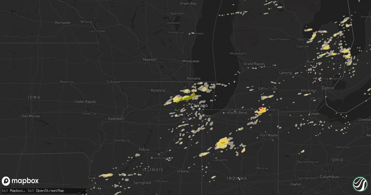
Hail Map on September 5, 2014
Get this storm
September 5 map
$229
one time, instant access
Download today. No call, no setup
Keep the $229
Bought the map and want the full workflow? Apply the entire $229 to a subscription within 7 days. None of it is wasted.
Every map, not just this one
This buys you this map. Subscription and you get every map we run, in the markets you choose from a few cities to whole states to nationwide. Plus real-time alerts the moment a storm fires.
Contact data
Name, contact info, occupancy, even credit band for addresses in the footprint. You go from where it hit to who to call.
Become the source they trust
Unlimited branding weather history reports on demand. You already have the documented answer ready for the property owner, and you are the one who showed up with it.
Property data and RoofTrace estimates
Pull up any address you have got, its value and the exact code rules for that jurisdiction, straight from One Click Code. Then RoofTrace estimates the squares, pitch, and roof value, priced the way you price.
States Impacted by Hail Map on September 5, 2014
Storm reports
Michigan
| Date | Description |
|---|---|
| 09/05/20146:58 PM CDT | Grand blank fire dept reports trees down and partial collapse of house on crest knoll drive |
| 09/05/20146:58 PM CDT | 4 to 6 inch diameter branches and power poles down |
| 09/05/20146:57 PM CDT | Measured at detroit metro airport /kdtw/ |
| 09/05/20146:56 PM CDT | 5 inch diameter tree branch down blocking a lane at saginaw and cook road |
| 09/05/20146:55 PM CDT | Large tree limbs down around wayne and cherry hill roads. |
| 09/05/20146:53 PM CDT | Multiple trees down |
| 09/05/20146:49 PM CDT | Also 0.5 diameter hail |
| 09/05/20146:48 PM CDT | Wires and small branches down at 5 mile and merriman |
| 09/05/20146:47 PM CDT | At bunton and textile. Small limbs down |
| 09/05/20146:47 PM CDT | 2 foot diameter tree uprooted. |
| 09/05/20146:44 PM CDT | Measured at whittaker and judd rd |
| 09/05/20146:39 PM CDT | Multiple trees down and shingles removed from roof at austin south of michigan ave |
| 09/05/20146:39 PM CDT | Numerous trees and wires down |
| 09/05/20146:39 PM CDT | 1 foot limb down at moon and bemis rds |
| 09/05/20146:38 PM CDT | Numerous 2 inch diameter branches down |
| 09/05/20146:34 PM CDT | Two 10 inch diameter trees down...one on a vehicle. Relayed by washtenaw county em |
| 09/05/20146:32 PM CDT | Tree and roof damage. Relayed from washtenaw county em |
| 09/05/20146:31 PM CDT | Bent tree in half |
| 09/05/20146:30 PM CDT | Multiple trees and power lines down |
| 09/05/20146:28 PM CDT | 1 foot diameter tree down and causing traffic to be diverted on us-127 just south of w barnes road. |
| 09/05/20146:27 PM CDT | 6 inch diameter trees down blocking zeeb road north of territorial |
| 09/05/20146:27 PM CDT | 2 to 3 inch diameter branches down. Also pea size hail. |
| 09/05/20146:20 PM CDT | A local report indicates 62 MPH wind near 3 W MANCHESTER |
| 09/05/20146:20 PM CDT | A local report indicates 59 MPH wind near EDWARDSBURG |
| 09/05/20146:19 PM CDT | 1 foot diameter trees down blocking road |
| 09/05/20146:15 PM CDT | A local report indicates 60 MPH wind near PINCKNEY |
| 09/05/20146:15 PM CDT | 15 inch diameter tree snapped off. Roof damage to roof under construction. |
| 09/05/20146:12 PM CDT | Large tree limb and power line down. |
| 09/05/20146:10 PM CDT | A couple of trees down |
| 09/05/20146:10 PM CDT | 1 foot diameter tree down at coon lake and county farm rds in marion twp |
| 09/05/20145:59 PM CDT | Power pole down |
| 09/05/20145:57 PM CDT | Tree down over the road at waverly and holt roads |
| 09/05/20145:53 PM CDT | Benches flipped and canopies blown over in downtown park |
| 09/05/20145:53 PM CDT | A few trees on houses in eaton rapids. A family fare sign is gone. Widespread tree damage and power is out in the downtown area. |
| 09/05/20145:51 PM CDT | 1 foot diameter tree broke off halfway at groveland and dixie hwy near holly |
| 09/05/20145:51 PM CDT | Barn destroyed along bellevue hwy in eaton rapids |
| 09/05/20145:50 PM CDT | Tree down on us 12 in the village of allen. |
| 09/05/20145:50 PM CDT | Power lines reported down. |
| 09/05/20145:43 PM CDT | Several large trees down in the pine lake area. |
| 09/05/20145:31 PM CDT | 6 inch trees down with power out in area at torrey and north rds |
| 09/05/20145:30 PM CDT | Tree snapped on capital ave just south of cascade drive in battle creek |
| 09/05/20145:28 PM CDT | Several large branches down and power is out on w main st and n 9th st. On the west side of kalamazoo |
| 09/05/20145:16 PM CDT | 3-4 tree branches snapped. |
| 09/05/20145:15 PM CDT | Trees and wires down in bedford twp. Also trees down in emmett twp. |
| 09/05/20145:14 PM CDT | Multiple trees down. |
| 09/05/20145:13 PM CDT | Tree down and blocking road. |
| 09/05/20145:10 PM CDT | Trees down at kellogg community college. Time estimated by radar. |
| 09/05/20145:07 PM CDT | Asos station w k kellogg airport /btl/ |
| 09/05/20145:06 PM CDT | Tree branches snapped in springfield. |
| 09/05/20145:05 PM CDT | Tree branches and a few larger healthy limbs down |
| 09/05/20145:05 PM CDT | Dozens of trees down in fort custer state park. Time estimated from radar. |
| 09/05/20145:03 PM CDT | Several healthy trees down. Up to 2 feet in diameter. |
| 09/05/20144:58 PM CDT | Damage to a barn |
| 09/05/20144:55 PM CDT | 1 foot diameter tree snapped |
| 09/05/20144:55 PM CDT | At least 8 reports of trees down blocking roadways in se kent county including several trees down in alaska |
| 09/05/20144:52 PM CDT | A local report indicates 1.00 inch wind near STURGIS |
| 09/05/20144:50 PM CDT | Multiple trees and wires fell in the city of otsego. Time estimated by radar. |
| 09/05/20144:48 PM CDT | Public tweeted picutre of estimated 2 inch diameter hail. |
| 09/05/20144:40 PM CDT | Power pole down on a truck. Time estimated by radar. |
| 09/05/20144:35 PM CDT | 2 foot diameter tree limb down at norway lake rd and scholtz rd |
| 09/05/20144:35 PM CDT | Multiple trees down |
| 09/05/20144:33 PM CDT | Two trees down |
| 09/05/20144:32 PM CDT | Significant narrow swath of tree damage caused by severe straight-line winds. Large... Healthy oaks and pines downed. Time estimated from radar. |
| 09/05/20144:30 PM CDT | Tree down on a car with a person trapped. Multiple trees down in the area. Time estimated by radar. |
| 09/05/20144:18 PM CDT | Time estimated from radar |
| 09/05/20144:18 PM CDT | Multiple trees down |
| 09/05/20144:05 PM CDT | Reports of trees down in the area. Some reports up to 4 in diameter. |
| 09/05/20143:54 PM CDT | Multiple trees down |
| 09/05/20143:39 PM CDT | Multiple trees down |
| 09/05/20143:28 PM CDT | Several large limbs down along with a few trees. Report via facebook. |
| 09/05/20143:28 PM CDT | Measured at huron county memorial airport /kbax/ |
| 09/05/20143:27 PM CDT | Large tree down on mckenzie between bad axe rd and barrie rd. Corrected time. |
| 09/05/20143:15 PM CDT | 8 inch diameter branches down on south main st |
| 09/05/20143:05 PM CDT | Wires down west of akron |
| 09/04/20147:25 PM CDT | Via facebook |
| 09/04/20147:18 PM CDT | Trees...large limbs...and wires down at i-94 and moross in detroit |
| 09/04/20147:15 PM CDT | Large limbs down |
| 09/04/20147:14 PM CDT | Measured at konz airport |
| 09/04/20147:13 PM CDT | Large limbs down near 11 mile and hoover |
| 09/04/20147:12 PM CDT | Measured at detroit city airport /kdet/ |
| 09/04/20147:10 PM CDT | A spotter reported several large trees down throughout the norheast section of detroit. |
| 09/04/20147:10 PM CDT | Small branches down |
| 09/04/20147:10 PM CDT | Number of trees down and two large tents destroyed...one is now on a roof. |
| 09/04/20147:10 PM CDT | At joy road and evergreen in detroit |
| 09/04/20147:10 PM CDT | 3 inch diameter branches down |
| 09/04/20147:09 PM CDT | Event tent fell over and injured 5 people. |
| 09/04/20147:08 PM CDT | Wires down at wadhams and frith in kimball twp |
| 09/04/20147:06 PM CDT | Tree fell on car |
| 09/04/20147:06 PM CDT | 18 inch diameter tree down. |
| 09/04/20147:06 PM CDT | 4 inch diameter branch down at 13 mile and main in royal oak |
| 09/04/20147:03 PM CDT | Multiple large tree limbs down. |
| 09/04/20147:03 PM CDT | 1.5 foot diameter tree down |
| 09/04/20147:03 PM CDT | Numerous large trees down in entire subdivision - at least on vehicle damaged by tree. Subdivision directly across m-15 has large trees down on homes. |
| 09/04/20147:03 PM CDT | 10 inch diameter tree snapped...multiple large limbs down |
| 09/04/20147:01 PM CDT | Powerlines down at telegraph and wick in taylor |
| 09/04/20147:00 PM CDT | Trees and limbs down in nottingham forest subdivision in beverly hills. One tree was a 30 ft tall blue spruce. Time estimated from radar. |
Florida
| Date | Description |
|---|---|
| 09/05/20141:44 PM CDT | A weatherflow station near the intersections of sr-434 and sr-436 in altamonte springs recorded a 58 mph wind gust out of the northwest. |
Illinois
| Date | Description |
|---|---|
| 09/05/20145:50 PM CDT | Elkart fire dept estimated winds. |
| 09/05/20145:33 PM CDT | Power lines down on a house in town. |
| 09/05/20145:30 PM CDT | Tree blown across the winchester/glasgow blacktop. |
| 09/05/20145:25 PM CDT | Large tree limb down south of ill route 123 and 97 junction |
| 09/05/20145:15 PM CDT | Near the cass/menard county line |
| 09/05/20145:10 PM CDT | A local report indicates 70 MPH wind near ASHLAND |
| 09/05/20144:55 PM CDT | Roof damaged at school. |
| 09/05/20144:55 PM CDT | Machine shed destroyed |
| 09/05/20144:45 PM CDT | Large tree limbs blown down. |
| 09/05/20144:44 PM CDT | Large tree limbs down greater than 2 inch diameter. |
| 09/05/20144:42 PM CDT | Trees and powerlines blown down |
| 09/05/20143:00 PM CDT | Light pole and multiple trees and branches down. Received via twitter. |
| 09/05/20142:55 PM CDT | Wind gust at oakton community college. |
| 09/05/20142:55 PM CDT | *** 1 fatal *** media reports a large tree was blown down and according to media reports struck and killed a bicyclist on bike trail. |
| 09/05/20142:55 PM CDT | A local report indicates 63 MPH wind near WHEELING |
| 09/05/20142:55 PM CDT | A local report indicates 70 MPH wind near NILES |
| 09/05/20142:55 PM CDT | Near harlem and devon |
| 09/05/20142:55 PM CDT | *** 4 inj *** building under renovation collapsed by winds...4 workers inside trapped had to be rescued and had minor injuries. |
| 09/05/20142:55 PM CDT | Tree limbs down 15 to 20 ft in length. Numerous fences down. Est wind gusts to 58 mph. Delayed report. |
| 09/05/20142:50 PM CDT | Corner of palatine rd and webster. Large tree limbs and branches down. Several branches down throughout neighborhood. |
| 09/05/20142:50 PM CDT | Trees and large branches down blocking street. Near uclid st and camp mcdonald rd. |
| 09/05/20142:50 PM CDT | A local report indicates 80 MPH wind near NORTHBROOK |
| 09/05/20142:48 PM CDT | Large tree down blocking butterfield road north of il route 176 |
| 09/05/20142:45 PM CDT | A local report indicates 71 MPH wind near 3 SE HOFFMAN ESTATES |
| 09/05/20142:45 PM CDT | A wooden frame building under construction was collapsed by thunderstorm winds near the intersection of barrington rd and schaumburg rd. |
| 09/05/20142:45 PM CDT | Large trees downed. Estimated winds of at least 70 mph. |
| 09/05/20142:44 PM CDT | Est wind gusts 50 to 65 mph along with pea size hail. |
| 09/05/20142:42 PM CDT | Estimated gusts 50 to 60 mph with small tree branches down. |
| 09/05/20142:40 PM CDT | Several periods with gusts of 60+ mph. Large tree branches down. Power outages. |
| 09/05/20142:30 PM CDT | 4 to 6 inch tree limbs down 1 mile west of randall rd south of bogues rd. Also lightning struck house at bowes creek country club. |
| 09/05/20142:30 PM CDT | Medium to large branches down. Near intersection of state st. And s. Elgin blvd. |
| 09/05/20142:25 PM CDT | Numerous trees down. |
| 09/05/20142:00 PM CDT | Est wind gusts 55-60 mph. Also pea size hail. Minor flooding on lincoln hwy. |
| 09/04/20148:30 PM CDT | 5 inch diameter branch blown down. Estimated 60 mph wind gusts. |
| 09/04/20147:44 PM CDT | Tree fell across road block and power went out from thunderstorms. Crews took 3 hours to clean up the tree. |
| 09/04/20147:05 PM CDT | Multiple tree limbs around 3 to 9 inches in diameter downed in the middle of town. One tree limb took a power line down in town. One tree 10 inches in diameter was down |
| 09/04/20147:00 PM CDT | 12 to 15 inch diameter tree branches were blown down on the southeast side of hoopeston. |
Kansas
| Date | Description |
|---|---|
| 09/05/20146:55 PM CDT | Broadcast media reported 60 mph wind gusts that lasted approximately 10 minutes. |
| 09/05/20146:51 PM CDT | Local tv station measured a 62 mph wind gust. |
Alabama
| Date | Description |
|---|---|
| 09/05/20142:55 PM CDT | 8 inch diamater tree limbs were knocked down by thunderstorm winds between highway 72 and capshaw along old railroad bed road. |
Missouri
| Date | Description |
|---|---|
| 09/05/20146:19 PM CDT | Large tree limb blown down on south side of town. |
| 09/05/20146:15 PM CDT | Large tree limb blown down on south side of town. |
| 09/05/20145:53 PM CDT | County 911 reports trees down in warsaw. |
| 09/05/20145:40 PM CDT | Co-op observer estimated 60 mph wind gusts south of warsaw |
| 09/05/20145:01 PM CDT | Public reporting 50 to 60 mph winds near northwest 800 road...half way between appleton city and johnson city |
| 09/05/20144:15 PM CDT | Large tree snapped. Picture on social media. |
| 09/05/20143:51 PM CDT | Tree over the roadway blocking one lane of traffic on highway 28 and highway pp |
| 09/04/20148:35 PM CDT | Small tree limbs blown down. |
| 09/04/20147:33 PM CDT | A couple of trees down...size unknown. At intersection of hawthorne blvd and milton blvd. |
| 09/04/20147:30 PM CDT | A few trees blown down...unknown size at this time. |
| 09/04/20147:00 PM CDT | Tree damage reported from west to south of festus. Tree on a house in the sunset pointe mobile home park. Time estimated from radar. |
Ohio
| Date | Description |
|---|---|
| 09/05/20146:50 PM CDT | Report of downed branches on powerlines. |
| 09/05/20146:40 PM CDT | Trees down on powerlines. |
Indiana
| Date | Description |
|---|---|
| 09/05/20146:24 PM CDT | Reported at angola high school. Hail lasted for 3 minutes. |
| 09/05/20146:24 PM CDT | Reported at angola high school. Hail lasted for 3 minutes. |
| 09/05/20146:15 PM CDT | 2 ft diameter tree down. Took powerlines down with it. |
| 09/05/20145:26 PM CDT | Trees and tree limbs down. No structural damage reported so far. |
| 09/05/20145:20 PM CDT | Public sent picture of measured hail. |
| 09/05/20145:10 PM CDT | Several reports of trees downed in the area. |
| 09/05/20145:08 PM CDT | Trees down at 1050 north and 350 east. |
| 09/05/20145:08 PM CDT | Large tree limbs down. |
| 09/05/20145:08 PM CDT | Trees reported down between 750 and 800 w on old us 30 |
| 09/05/20144:50 PM CDT | A local report indicates 1.00 inch wind near ETNA GREEN |
| 09/05/20144:42 PM CDT | Hail ranged from pea to 1 diameter before rapid change to 1.5 diameter. |
| 09/05/20144:42 PM CDT | Hail ranged from pea to 1 diameter before rapid change to 1.5 diameter. |
| 09/05/20144:40 PM CDT | A local report indicates 1.00 inch wind near BOURBON |
| 09/04/20148:45 PM CDT | Fifteen utility poles down with wires across mobile homes. Winds recorded at 33 mph just south of scene. Time estimated. |
| 09/04/20147:12 PM CDT | 50 to 60 mph wind gusts and several 4 to 5 inch diameter tree limbs down |
Texas
| Date | Description |
|---|---|
| 09/05/20145:50 PM CDT | Traveler on hwy 304 reported large oak trees blown down and sheet metal debris by roadway |
Arkansas
| Date | Description |
|---|---|
| 09/05/20142:32 PM CDT | Building materials in a construction area were thrown around...causing damage to a motel and vehicles in the parking lot of the motel. This occurred near oaklawn park. |
| 09/05/20142:25 PM CDT | Boat docks on hurricane lake were damaged. |
Cities Impacted by Hail Map on September 5, 2014
- Wapakoneta, OH
- Beardstown, IL
- Frederick, IL
- Chandlerville, IL
- Virginia, IL
- Fenton, MI
- Linden, MI
- Lake Bluff, IL
- Lake Forest, IL
- Commerce Township, MI
- Fife Lake, MI
- Dixon, MO
- Newellton, LA
- Highland, IL
- Alhambra, IL
- Troy, IL
- Saint Jacob, IL
- Hermann, MO
- Delta, OH
- Hickory, KY
- Boaz, KY
- Herod, IL
- Equality, IL
- Waldo, KS
- Pearl, IL
- Winchester, IL
- Hillview, IL
- Roodhouse, IL
- Holly, MI
- Schell City, MO
- Ypsilanti, MI
- Belleville, MI
- Bad Axe, MI
- Dyer, IN
- Saint John, IN
- Demotte, IN
- Lima, OH
- Harrod, OH
- Waynesfield, OH
- Richards, MO
- Arnold, MO
- Memphis, MI
- Smithboro, IL
- Greenville, IL
- Donnellson, IL
- Pocahontas, IL
- Mulberry Grove, IL
- Timewell, IL
- Howe, IN
- Lagrange, IN
- Elkton, MI
- Rhineland, MO
- Santa Fe, MO
- Perry, MO
- Stoutsville, MO
- Washington, KS
- Linn, KS
- Morrowville, KS
- Quincy, IL
- Blackwell, MO
- De Soto, MO
- Cadet, MO
- Ashley, IL
- Richview, IL
- Grand Rapids, MI
- Monticello, IN
- Buffalo, IN
- Star City, IN
- Winamac, IN
- Hallsville, MO
- Cromwell, IN
- Syracuse, IN
- Ligonier, IN
- Beecher, IL
- Burnettsville, IN
- Wolcott, IN
- Monon, IN
- Reynolds, IN
- Idaville, IN
- Royal Center, IN
- Francesville, IN
- Centralia, MO
- Clark, MO
- Rushville, IL
- Camden, IL
- Waterloo, IL
- Valmeyer, IL
- Arlington Heights, IL
- Palatine, IL
- Bloomingdale, MI
- Gobles, MI
- Snover, MI
- Decker, MI
- New London, MO
- Shipshewana, IN
- Saline, MI
- Le Roy, IL
- Ellsworth, IL
- Downs, IL
- Port Saint Lucie, FL
- Du Quoin, IL
- Hamler, OH
- Holgate, OH
- Crown Point, IN
- Omaha, IL
- Collinsville, IL
- Imperial, MO
- Saint Louis, MO
- Quitman, LA
- Chatham, LA
- Cabery, IL
- Emington, IL
- Kempton, IL
- La Porte, IN
- West Unity, OH
- Osborne, KS
- North Branch, MI
- Western Springs, IL
- Brookfield, IL
- La Grange Park, IL
- Oak Brook, IL
- Lyons, IL
- Hinsdale, IL
- La Grange, IL
- Westchester, IL
- Cullom, IL
- Homer Glen, IL
- Lemont, IL
- Stover, MO
- Fremont, OH
- Helena, OH
- Swartz Creek, MI
- Davison, MI
- Deckerville, MI
- Sandusky, MI
- Nashville, IL
- Malinta, OH
- McClure, OH
- Napoleon, OH
- Grelton, OH
- Augusta, MI
- Sorento, IL
- Union Hill, IL
- Reddick, IL
- Herscher, IL
- Buckingham, IL
- Armstrong, MO
- Higbee, MO
- Fayette, MO
- Red Bud, IL
- Wawaka, IN
- Albion, IN
- Malta, IL
- Dekalb, IL
- Cortland, IL
- Hampshire, IL
- Sycamore, IL
- Maple Park, IL
- Wauconda, IL
- Mundelein, IL
- Grayslake, IL
- Barrington, IL
- Lake Zurich, IL
- Naperville, IL
- Caledonia, MI
- Festus, MO
- Morrison, MO
- Sturgis, KY
- Lake City, MI
- Manton, MI
- Peru, IN
- Bunker Hill, IN
- Miami, IN
- Pleasant Plains, AR
- Hebron, IN
- Wheatfield, IN
- Bonne Terre, MO
- Mineral Point, MO
- Yorkville, IL
- Foley, MO
- Winfield, MO
- Brown City, MI
- Harbor Beach, MI
- Sturgeon, MO
- Paris, MO
- Marine, IL
- Edwardsville, IL
- Port Sanilac, MI
- Carsonville, MI
- South Lyon, MI
- Northville, MI
- Alto, MI
- Lowell, MI
- Fowler, IN
- Medinah, IL
- Roselle, IL
- Itasca, IL
- Elk Grove Village, IL
- Crystal City, MO
- Hillsboro, MO
- Bridgeview, IL
- Justice, IL
- Chicago, IL
- Summit Argo, IL
- Kingston, MI
- Marlette, MI
- Clifford, MI
- Channahon, IL
- Elwood, IL
- Flint, MI
- Bowling Green, OH
- Waterville, OH
- Wewahitchka, FL
- Blountstown, FL
- Mattawan, MI
- Paw Paw, MI
- Kalamazoo, MI
- Clyde, OH
- Glen Ellyn, IL
- Momence, IL
- Grant Park, IL
- Fort Wayne, IN
- Milan, MI
- Norwalk, OH
- Kewanna, IN
- Lenzburg, IL
- Akron, MI
- Burr Oak, MI
- Cuba, IL
- White Pigeon, MI
- Crescent City, IL
- Rankin, IL
- Hoopeston, IL
- Calliham, TX
- Palos Park, IL
- Lombard, IL
- Villa Park, IL
- Elmhurst, IL
- Addison, IL
- Braidwood, IL
- Gardner, IL
- Essex, IL
- Braceville, IL
- Wilmington, IL
- Bunkie, LA
- Washington, LA
- Jay, FL
- Covington, IN
- White Hall, IL
- Lindsey, OH
- Oak Harbor, OH
- Colfax, IL
- Chenoa, IL
- Roscommon, MI
- Orland, IN
- Bronson, MI
- Peck, MI
- Melvin, MI
- Sturgis, MI
- Hobart, IN
- Merrillville, IN
- Madison, MO
- Moberly, MO
- Colon, MI
- Marshall, MI
- Burlington, MI
- Union City, MI
- Sherwood, MI
- Fulton, MI
- Athens, MI
- Vicksburg, MI
- Leonidas, MI
- Mendon, MI
- Tekonsha, MI
- Scotts, MI
- Milford, IL
- Ambia, IN
- Wellington, IL
- Yale, MI
- Imlay City, MI
- Croswell, MI
- Columbiaville, MI
- Lapeer, MI
- Fostoria, OH
- Fair Haven, MI
- Millersburg, IN
- Topeka, IN
- Mangham, LA
- Minden City, MI
- Palms, MI
- Walton, IN
- Burlington, IL
- Saint Charles, IL
- Elgin, IL
- Valparaiso, IN
- Delphi, IN
- Port Huron, MI
- New London, OH
- Brewton, AL
- Wilmette, IL
- Skokie, IL
- Evanston, IL
- Gilberts, IL
- South Elgin, IL
- Algonquin, IL
- Carpentersville, IL
- Huntley, IL
- Dundee, IL
- Sheboygan Falls, WI
- Otterville, MO
- Unionville, MI
- Vermilion, OH
- Logansport, IN
- Mexico, IN
- Denver, IN
- Monterey, IN
- Algonac, MI
- New Bloomfield, MO
- Tebbetts, MO
- Du Bois, IL
- Prairie Du Rocher, IL
- Fults, IL
- Deford, MI
- Clinton, KY
- Holland, MI
- Round Lake, IL
- Bettsville, OH
- Burgoon, OH
- Tiffin, OH
- Kansas, OH
- Osceola, MO
- Tipton, MO
- Fortuna, MO
- East Saint Louis, IL
- Bourbonnais, IL
- Bradley, IL
- Cedar Lake, IN
- Lowell, IN
- Manteno, IL
- Kankakee, IL
- Immokalee, FL
- Marshall, IN
- Crawfordsville, IN
- Keenes, IL
- Reese, MI
- Fairgrove, MI
- Clyde, KS
- Peoria, IL
- Farmington, MI
- West Bloomfield, MI
- Franklin, MI
- Bloomfield Hills, MI
- Alvada, OH
- Clinton, MO
- Monroe City, MO
- Cole Camp, MO
- Rolling Prairie, IN
- Lexington, MI
- Hicksville, OH
- Potosi, MO
- Irondale, MO
- Tippecanoe, IN
- Argos, IN
- Clewiston, FL
- Millstadt, IL
- Greenwell Springs, LA
- Baton Rouge, LA
- Baker, LA
- Port Hope, MI
- Port Austin, MI
- Attica, IN
- Williamsport, IN
- Lebanon, IL
- O'Fallon, IL
- Trenton, IL
- Lake Orion, MI
- Oxford, MI
- Litchfield, MI
- Spencerville, IN
- Saint Joe, IN
- Butler, IN
- Manistee, MI
- Woodville, OH
- Elmore, OH
- Gibsonburg, OH
- Fostoria, MI
- Otter Lake, MI
- Bonfield, IL
- Windsor, MO
- Leesburg, IN
- Warsaw, IN
- Center, MO
- Barnhart, MO
- Bourbon, IN
- Rockville, MO
- Genoa, IL
- Columbus, MI
- Saint Clair, MI
- Ransom, IL
- Kinsman, IL
- Burbank, OK
- Wyoming, MI
- Byron Center, MI
- Grandville, MI
- Mokena, IL
- New Lenox, IL
- Ubly, MI
- Amboy, IN
- Morris, IL
- Manhattan, IL
- Coal City, IL
- Deepwater, MO
- Northbrook, IL
- Deerfield, IL
- Paducah, KY
- Columbus, KS
- Bay Port, MI
- Sebewaing, MI
- Pigeon, MI
- Streamwood, IL
- Mayville, MI
- Ruth, MI
- Arrowsmith, IL
- Clifton, IL
- Lockport, IL
- Romeoville, IL
- Berlin Heights, OH
- Collins, OH
- Wakeman, OH
- Pinckneyville, IL
- Tamaroa, IL
- Agenda, KS
- Concordia, KS
- Meredosia, IL
- Chapin, IL
- Addieville, IL
- Abbeville, LA
- Erath, LA
- Kokomo, IN
- Galveston, IN
- South Whitley, IN
- Huntington, IN
- Steedman, MO
- Mokane, MO
- Fulton, MO
- Riverdale, IL
- Harvey, IL
- Dolton, IL
- Jefferson City, MO
- Sterling Heights, MI
- Clinton Township, MI
- Edwardsburg, MI
- Goshen, IN
- New Paris, IN
- Chicago Heights, IL
- Lansing, IL
- Vermont, IL
- Ipava, IL
- Zion, IL
- Greenville, FL
- Mount Sterling, IL
- Clayton, IL
- Camp Point, IL
- Lewistown, IL
- Labelle, FL
- Winnetka, IL
- New Canton, IL
- Peotone, IL
- Hartsburg, IL
- Toledo, OH
- Holland, OH
- Metamora, MI
- Ponca City, OK
- Potomac, IL
- Petersburg, IL
- Saunemin, IL
- Gaines, MI
- Waukegan, IL
- Hudson, IL
- Normal, IL
- Carlock, IL
- Bloomington, IL
- Monroeville, OH
- Cass City, MI
- Mound Valley, KS
- Altamont, KS
- Amherst, OH
- Eros, LA
- East Chicago, IN
- Hammond, IN
- Saint Marks, FL
- Crawfordville, FL
- Thornton, IL
- Calumet City, IL
- South Holland, IL
- Glenwood, IL
- Junction, IL
- Ramsey, IL
- South Fulton, TN
- Montrose, MO
- Warrenville, IL
- Lisle, IL
- Aurora, IL
- Oswego, IL
- Plainfield, IL
- Sandwich, IL
- Plano, IL
- Somonauk, IL
- Gagetown, MI
- Owendale, MI
- Applegate, MI
- Fort Gratiot, MI
- Angola, IN
- Lowry City, MO
- Seneca, IL
- Verona, IL
- Grand Rapids, OH
- Asbury, MO
- Arenzville, IL
- Indianapolis, IN
- Milton, FL
- Auburn Hills, MI
- Clarkston, MI
- Waterford, MI
- Webberville, MI
- Williamston, MI
- Fowlerville, MI
- Caro, MI
- Silverwood, MI
- Galena, KS
- Joliet, IL
- Crest Hill, IL
- Warsaw, MO
- Troy, MO
- Quincy, MI
- Smithton, MO
- Sedalia, MO
- Mora, MO
- Manchester, MI
- Johnsonville, IL
- Franklin, IL
- Jacksonville, IL
- Ashland, IL
- Tallula, IL
- Grand Blanc, MI
- Pemberville, OH
- Wayne, OH
- Portage, OH
- Eaton Rapids, MI
- Charlotte, MI
- Middlebury, IN
- White Lake, MI
- Davisburg, MI
- Iuka, IL
- Green Valley, IL
- Dwight, IL
- Lucerne, IN
- Wabash, IN
- Converse, IN
- Uniontown, KY
- Waverly, KY
- Frankfort, IL
- Tinley Park, IL
- Henley, MO
- Climax, MI
- Pittsford, MI
- Osseo, MI
- Charleston, MO
- Oswego, KS
- Grand Ridge, IL
- Litchfield, IL
- Beulah, MI
- Plymouth, WI
- Watseka, IL
- Martinton, IL
- Donovan, IL
- South Bend, IN
- Belgrade, MO
- Crestwood, IL
- Alsip, IL
- Hazel Crest, IL
- Markham, IL
- Palos Heights, IL
- Oak Forest, IL
- Midlothian, IL
- Evergreen Park, IL
- Oak Lawn, IL
- Country Club Hills, IL
- Robbins, IL
- Blue Island, IL
- Greenview, IL
- Athens, IL
- Bloomingdale, IN
- Richmond, MI
- Hudsonville, MI
- Clifton, KS
- Greenleaf, KS
- Carleton, MI
- Maybee, MI
- Monroe, MI
- Romeo, MI
- Griffith, IN
- Gary, IN
- Schererville, IN
- Brethren, MI
- Smiths Creek, MI
- Baldwin, IL
- Capac, MI
- Mazon, IL
- Lincoln, MO
- Indiantown, FL
- Chebanse, IL
- Waveland, IN
- Hannibal, MO
- Hillsboro, IN
- Kingman, IN
- Waynetown, IN
- Clarksville, MO
- Eolia, MO
- Ada, MI
- Bardwell, KY
- Wellston, MI
- Canton, IL
- Kenilworth, IL
- Des Plaines, IL
- Niles, IL
- Glenview, IL
- Park Ridge, IL
- Morton Grove, IL
- Golf, IL
- Glencoe, IL
- Annada, MO
- Elsberry, MO
- Winfield, IL
- West Chicago, IL
- Wheaton, IL
- Brookston, IN
- Chalmers, IN
- Mason City, IL
- Laddonia, MO
- Calhoun, MO
- Mayfield, KY
- Marion, KY
- Milford, IN
- Easton, IL
- Griggsville, IL
- Bluffs, IL
- Saybrook, IL
- Anchor, IL
- Hull, IL
- West Lebanon, IN
- Grass Lake, MI
- Springboro, PA
- Albion, PA
- McBain, MI
- Cadillac, MI
- Fairview Heights, IL
- Belleville, IL
- Ochopee, FL
- Hoagland, IN
- Port Gibson, MS
- New Athens, IL
- Bradner, OH
- Remington, IN
- Goodland, IN
- Goodrich, MI
- Pittsburg, KS
- Weir, KS
- Wingo, KY
- Manitou Beach, MI
- Rutland, IL
- Onarga, IL
- Littleton, IL
- Lyons, MI
- Ionia, MI
- Chamois, MO
- Newark, IL
- Sheridan, IL
- Millbrook, IL
- Essexville, MI
- Munger, MI
- Bay City, MI
- Etna Green, IN
- Hoffman Estates, IL
- Murrayville, IL
- Walled Lake, MI
- Holts Summit, MO
- Saint Anne, IL
- Aroma Park, IL
- Paulding, OH
- Oakwood, OH
- Ionia, MO
- Zionsville, IN
- Carmel, IN
- East Carondelet, IL
- Cedar Vale, KS
- Saint Mary, MO
- Sainte Genevieve, MO
- Coatsburg, IL
- Island Lake, IL
- Libertyville, IL
- Vernon Hills, IL
- Cary, IL
- Crystal Lake, IL
- Mchenry, IL
- Willis, MI
- Glasford, IL
- Manito, IL
- Mapleton, IL
- Kingston Mines, IL
- Weston, OH
- Elm Grove, LA
- New Holland, IL
- Minier, IL
- South Boardman, MI
- Houghton Lake, MI
- Cicero, IL
- Berwyn, IL
- Jonesboro, LA
- Payson, IL
- Crocker, MO
- Kilbourne, IL
- Odell, IL
- Cayuga, IN
- Portland, MI
- Eugene, MO
- West Lafayette, IN
- Shawneetown, IL
- Ortonville, MI
- Olivet, MI
- Bellevue, MI
- Ogden, IL
- Saint Joseph, IL
- Wixom, MI
- Novi, MI
- Howell, MI
- Swanton, OH
- Lohman, MO
- Russellville, MO
- Bartlett, IL
- Mount Prospect, IL
- Hanover Park, IL
- Highland Park, IL
- Rolling Meadows, IL
- Schaumburg, IL
- Highwood, IL
- Wheeling, IL
- Prospect Heights, IL