Hail Map on September 2, 2012
Get this storm
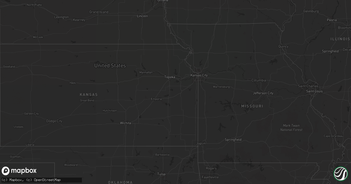
September 2 map
$229
one time, instant access
Download today. No call, no setup
Keep the $229
Bought the map and want the full workflow? Apply the entire $229 to a subscription within 7 days. None of it is wasted.
Every map, not just this one
This buys you this map. Subscription and you get every map we run, in the markets you choose from a few cities to whole states to nationwide. Plus real-time alerts the moment a storm fires.
Contact data
Name, contact info, occupancy, even credit band for addresses in the footprint. You go from where it hit to who to call.
Become the source they trust
Unlimited branding weather history reports on demand. You already have the documented answer ready for the property owner, and you are the one who showed up with it.
Property data and RoofTrace estimates
Pull up any address you have got, its value and the exact code rules for that jurisdiction, straight from One Click Code. Then RoofTrace estimates the squares, pitch, and roof value, priced the way you price.
States Impacted by Hail Map on September 2, 2012
Storm reports
North Carolina
| Date | Description |
|---|---|
| 09/02/20126:50 PM CDT | One tree was blown down near 200 lasalle way. |
| 09/02/20126:41 PM CDT | One tree down and several large tree limbs down on snatchburg road |
| 09/02/20126:30 PM CDT | Tree down on car at 3915 battleground ave. |
| 09/02/20126:28 PM CDT | Trained spotter received report of 5 inch dia tree down on rd at banner whitehead rd and farlowe davis rd |
| 09/02/20126:28 PM CDT | Trained spotter received report of tree down on us311 near loflin dairy rd |
| 09/02/20124:52 PM CDT | Multiple trees and power lines down on liberty church road near us hwy 601. |
| 09/02/20124:51 PM CDT | One tree down at the intersection of westfield road and hollingsworth road |
| 09/02/20124:16 PM CDT | One tree down at the intersection of nurse road and tom jones road |
| 09/02/20124:12 PM CDT | One tree down on old rockford road |
| 09/02/20124:12 PM CDT | One tree down at the intersection of marion street and freeman street |
| 09/02/20122:03 PM CDT | 2 trees down on power lines and blocking the roadway. |
| 09/02/20122:03 PM CDT | One tree down on bowmantown rd at mayo lake. Time estimated. |
| 09/02/20121:38 PM CDT | One tree down at the 9600 block of oxford rd. Time estimated. |
| 09/01/20128:15 PM CDT | Downed tree blocking one lane at the intersection of quail roost farm road and n. Roxboro road. |
| 09/01/20128:05 PM CDT | One tree down on ralph winstead rd. Time and location estimated. |
| 09/01/20128:02 PM CDT | One tree down at rolling hills rd and hester store rd. Time estimated. |
| 09/01/20127:45 PM CDT | One tree down on highway 119 |
| 09/01/20127:29 PM CDT | 911 center received report of several trees down at greenwood dr and union ridge rd in northern alamance county |
| 09/01/20127:28 PM CDT | One tree down on foster road |
| 09/01/20127:27 PM CDT | 911 center received report of tree down on rd at albright ave in graham |
| 09/01/20127:09 PM CDT | One tree was blown down at 6734 keansburg road. |
Mississippi
| Date | Description |
|---|---|
| 09/01/20129:25 PM CDT | Roof and building damage to a restaurant east northeast of sherman. |
| 09/01/20129:15 PM CDT | Tree fell on house on highway 348. |
| 09/01/20129:10 PM CDT | Trees down in new albany. Relayed by wtva news. |
| 09/01/20128:38 PM CDT | Numerous trees and powerlines down across the county |
| 09/01/20128:28 PM CDT | Numerous trees and powerlines down across the county. |
| 09/01/20128:14 PM CDT | Some trees down between ripley and dumas. |
| 09/01/20128:03 PM CDT | A local report indicates 65 MPH wind near RIPLEY |
| 09/01/20128:00 PM CDT | Large number of powerlines and trees down centered around the town of ripley. Nearly 2000 were without power. Current reports near 100 without power. |
| 09/01/20127:43 PM CDT | 2 miles east of hack cross road on goodman road. Gate on fence blown down with boards broken. Wind speed is unknown. |
Arizona
| Date | Description |
|---|---|
| 09/02/20126:48 PM CDT | 20ft tree down... Partially in road |
| 09/02/20126:20 PM CDT | Report of trees down in median |
Georgia
| Date | Description |
|---|---|
| 09/02/20124:45 PM CDT | The jefferson county 911 center reported that half a dozen or so trees were blown down in the northern part of the county. |
Alabama
| Date | Description |
|---|---|
| 09/02/20126:56 PM CDT | Power lines were blown down. |
| 09/02/20126:15 PM CDT | Trees were knocked down onto highway 33 in bankhead national forest. |
| 09/02/20125:55 PM CDT | Power lines reported down. |
| 09/02/20125:43 PM CDT | A tree was blown down. |
| 09/02/20125:38 PM CDT | Power poles reported down |
| 09/02/20125:37 PM CDT | Power lines reported down. |
| 09/02/20125:36 PM CDT | Lightning struck a house catching it on fire. |
| 09/02/20125:20 PM CDT | A tree was blown down on main street |
| 09/02/20125:20 PM CDT | A tree was blown down on main street |
| 09/02/20125:10 PM CDT | A tree was blown down at the intersection of cr 236 and cr 101. |
| 09/02/20125:10 PM CDT | A tree was blown down at the intersection of cr 236 and cr 101. |
| 09/02/20125:05 PM CDT | A tree was reported down on a residence. |
| 09/02/20125:05 PM CDT | A tree was reported down on a residence. |
| 09/02/20124:42 PM CDT | Trees were blown down on fairview road. |
| 09/02/20124:30 PM CDT | Trees blown down near the doublehead resort. |
| 09/02/20124:05 PM CDT | Powerlines down at piney chapel road and elkton road. |
| 09/02/20124:00 PM CDT | Power lines and branches 2 to 3 inches in diameter reported down. |
| 09/02/20124:00 PM CDT | Trees and powerlines down along coleman avenue in athens. |
| 09/02/20123:50 PM CDT | Power lines and branches 2 to 3 inches in diameter reported down. |
| 09/02/20123:50 PM CDT | Power lines and branches 2 to 3 inches in diameter reported down. |
| 09/02/20123:43 PM CDT | Trees and powerlines down near intersection of easter ferry road and myers road. Time estimated from radar. |
| 09/02/20123:40 PM CDT | A tree was blown down on barnes lane and old lee highway. |
| 09/02/20123:34 PM CDT | Trees down across baker hill road near the intersection of elk river mills road. |
| 09/02/20123:25 PM CDT | A tree was blown down. |
| 09/02/20123:25 PM CDT | Trees were blown down over power lines. |
| 09/02/20123:09 PM CDT | Estimated wind gust of 60 mph near us 72 and cr 31 |
| 09/02/20122:53 PM CDT | Lightning struck a house catching it on fire. |
| 09/01/20129:48 PM CDT | Tree down on county road 649 near cr 648. Time estimated from radar. |
| 09/01/20127:10 PM CDT | One tree down across state highway 253 south of hackleburg. |
| 09/01/20127:05 PM CDT | A tree was blown down on cr 36 |
| 09/01/20127:05 PM CDT | A tree was blown down on cr 36 |
| 09/01/20127:03 PM CDT | Power lines were blown down. |
Virginia
| Date | Description |
|---|---|
| 09/02/20126:37 PM CDT | One tree down on henry road near m and l mart |
| 09/02/20126:33 PM CDT | One tree down at the intersection of carter street and wilson street |
| 09/02/20126:33 PM CDT | One tree down near the intersection of skillet road and franklin street |
| 09/02/20126:30 PM CDT | Power outage... Tree down on power line |
| 09/02/20126:28 PM CDT | Power lines down on morgan ford road |
| 09/02/20126:28 PM CDT | One power line down on old leaksville road |
| 09/02/20126:25 PM CDT | Large tree down on kellos mill road |
| 09/02/20126:24 PM CDT | Two trees down on morehead avenue |
| 09/02/20124:16 PM CDT | One large tree limb down along albert street |
| 09/02/201212:15 PM CDT | Trees down on grassy hill road. Time estimated by radar. |
| 09/01/20127:30 PM CDT | Tree down on mountain road |
| 09/01/20127:25 PM CDT | Tree down at gilmore and henderson. Time estimated by radar. |
| 09/01/20127:11 PM CDT | One tree down on power dam road |
Kentucky
| Date | Description |
|---|---|
| 09/02/20124:00 PM CDT | Huge limb from tree down. Time estimated from radar. |
| 09/02/20123:45 PM CDT | Tree down on highway 191 at mile marker 9 between trent and highway 1010. Time estimated off of radar. |
| 09/02/20122:21 PM CDT | Tree down on highway 490. Time estimated off of radar. |
Nebraska
| Date | Description |
|---|---|
| 09/02/20126:58 AM CDT | Large gas grill overturned and basketball goal blown over. Estimated gust to 55mph. Power outage due to storm. |
| 09/02/20126:55 AM CDT | Changed location to agree with report location at intersection of highways 15 and 32 |
| 09/02/20126:55 AM CDT | Changed location to agree with report location at intersection of highways 15 and 32 |
| 09/02/20126:55 AM CDT | A local report indicates 1.50 inch wind near 9 NW HOWELLS |
Cities Impacted by Hail Map on September 2, 2012
- Bayboro, NC
- Smithfield, VA
- Ivor, VA
- Windsor, VA
- Ridgeway, VA
- Avera, GA
- Stapleton, GA
- Louisville, GA
- Bayfield, WI
- Rice, VA
- Olive Branch, MS
- Somerville, AL
- Laceys Spring, AL
- Myrtle, MS
- Potts Camp, MS
- Plantersville, MS
- Tupelo, MS
- Oxford, MS
- Calumet, MI
- Lake Linden, MI
- Hubbell, MI
- Hancock, MI
- Howells, NE
- Stanton, NE
- Memphis, TN
- Southaven, MS
- Blue Springs, MS
- Belden, MS
- Kenbridge, VA
- Canvas, WV
- Nettie, WV
- Phil Campbell, AL
- Baldwyn, MS
- Athens, AL
- Pittsboro, NC
- Hodges, AL
- Roxboro, NC
- Oriental, NC
- Arapahoe, NC
- Seligman, AZ
- Belleville, WV
- Tuscumbia, AL
- Houston, AL
- Double Springs, AL
- Arley, AL
- Wisner, NE
- Dodge, NE
- Clarkson, NE
- Timberlake, NC
- Rougemont, NC
- University, MS
- Coldwater, MS
- Hernando, MS
- Davisboro, GA
- Bartow, GA
- Oak Ridge, NC
- Fulton, MS
- Como, MS
- South Boston, VA
- Harvest, AL
- Toney, AL
- Water Valley, MS
- Vina, AL
- Tremont, MS
- Haleyville, AL
- Russellville, AL
- Moulton, AL
- Spruce Pine, AL
- Toivola, MI
- Atlantic Mine, MI
- Leigh, NE
- New Albany, MS
- Golden, MS
- Dennis, MS
- Belmont, MS
- Red Bay, AL
- Welch, MN
- Red Wing, MN
- Goodhue, MN
- Addison, AL
- Tucson, AZ
- Boulder, UT
- Blue Mountain, MS
- Ripley, MS
- Flagstaff, AZ
- Sanford, NC
- Senatobia, MS
- Waterford, MS
- Holly Springs, MS
- Carthage, NC
- Robbins, NC
- Emporia, VA
- Freeman, VA
- Cannon Falls, MN
- Batesville, MS
- Alton, VA
- Abbeville, MS
- Reidsville, NC
- Havelock, NC
- Merritt, NC
- Grantsboro, NC
- Stoneville, NC
- Eden, NC
- Mohawk, MI
- Byhalia, MS
- Oxford, NC
- Mantachie, MS
- Ashland, MS
- Sarona, WI
- Shell Lake, WI
- Fremont, NC
- Stantonsburg, NC
- Coolville, OH
- Reedsville, OH
- Iuka, MS
- Houghton, MI
- Dollar Bay, MI
- Vernal, UT
- La Grange, NC
- Kinston, NC
- Aurora, NC
- Farmville, NC
- Walstonburg, NC
- Mount Hope, AL
- West Memphis, AR
- Ahmeek, MI
- Allouez, MI
- Hackleburg, AL
- South Hill, VA
- Lunenburg, VA
- Barronett, WI
- Victoria, VA
- Sedley, VA
- Courtland, VA
- Delavan, MN
- Oakland, MS
- Washington, WV
- Chiefland, FL
- Guntown, MS
- Saltillo, MS
- Semora, NC
- Vinemont, AL
- Falkville, AL
- Cullman, AL
- Etta, MS
- Thaxton, MS
- Myton, UT
- Randolph, MN
- Milton, NC
- Blanch, NC
- Coffeeville, MS
- Courtland, MS
- Lawrenceville, VA
- Marietta, MS
- Nettleton, MS
- Pontotoc, MS
- Ecru, MS
- Amory, MS
- Northfield, MN
- Leasburg, NC
- Wakefield, VA
- Dobson, NC
- Hickory Flat, MS
- Marion, AR
- Colfax, NC
- Kernersville, NC
- Greensboro, NC
- Parks, AZ
- Clarksville, FL
- Altha, FL
- Stokesdale, NC
- Bear Creek, NC
- Nesbit, MS
- Yanceyville, NC
- Booneville, MS
- Hamilton, AL
- Broadway, NC
- Lillington, NC