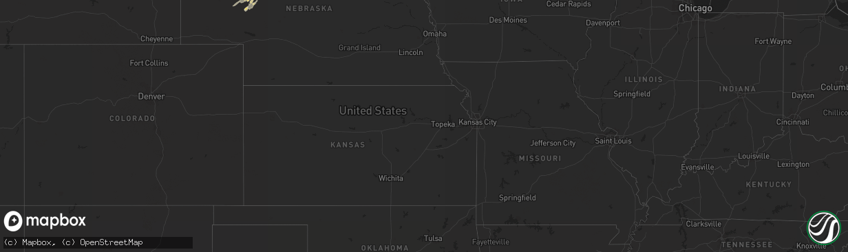
Hail Map in North Dakota on August 31, 2011
The weather event in North Dakota on August 31, 2011 includes Hail map. 9 states and 277 cities were impacted and suffered possible damage. The total estimated number of properties impacted is 0.
Want more than just the map?
Turn this storm into a full workflow.
- Owner + property data so you know who to knock
- OnDemand branded weather history reports to win the "did we even have hail?" argument
- RoofTrace estimate so reps stop guessing numbers at the door
Bought this map? Upgrade within 7 days and we'll credit the $230. (10-15 min setup call)
Hail
0
Estimated number of impacted properties by a 1.00" hail or larger0
Estimated number of impacted properties by a 1.75" hail or larger0
Estimated number of impacted properties by a 2.50" hail or largerStorm reports in North Dakota
North Dakota
| Date | Description |
|---|---|
| 08/31/20112:45 AM CDT | Extensive damage in grafton. More than 50 large trees down...including some 60 to 70 foot tall evergreens. Five houses and multiple vehicles damaged by trees falling on |
| 08/31/20112:44 AM CDT | A local report indicates 64 MPH wind near 2 ESE GRAFTON |
| 08/31/20112:44 AM CDT | A local report indicates 64 MPH wind near GRAFTON |
| 08/31/20112:42 AM CDT | Extensive damage in grafton. More than 50 large trees down...including some 60 to 70 foot tall evergreens. Five houses and multiple vehicles damaged by trees falling on |
| 08/31/20112:40 AM CDT | Several large tree branches were broken down in shelter belts along nd highway 66. |
| 08/31/20112:39 AM CDT | Several large tree branches and tree limbs were snapped off in shelter belts along u.s. Highway 81. |
| 08/31/20112:15 AM CDT | Shed destroyed and 2 grain bins blown off slab. Power poles down. Relayed via off duty park river volunteer fire dept personnel. Peak winds estimated to 105 mph. |
| 08/31/20112:15 AM CDT | Shed destroyed and 2 grain bins blown off slab. Power poles down. Relayed via off duty park river volunteer fire dept personnel. |
| 08/31/20112:05 AM CDT | Numerous large trees in excess of 18 inch diameter were broken down in a farm shelter belt. |
| 08/31/20111:45 AM CDT | A local report indicates 60 MPH wind near 10 W HAMPDEN |
| 08/31/20111:30 AM CDT | Hail size was a mixture of quarters and nickels. |
| 08/31/20111:05 AM CDT | Large tree branch down |
| 08/31/201112:54 AM CDT | Media reported multiple small tree limbs down after estimated 60 mph wind gusts. |
| 08/31/201112:13 AM CDT | Winds lasted for 10 minutes. Brief power outages were reported. Rain gutters were blown off of a building. |
| 08/31/201112:00 AM CDT | Late report. Several trees snapped and others uprooted. Barn damaged. Wind speed and times are estimated. Damage also in the town of mercer...mclean county. |
| 08/30/201111:55 PM CDT | Estimated winds at 60 mph...trees bent over but not snapped... |
| 08/30/201111:51 PM CDT | A local report indicates 60 MPH wind near CROWN BUTTE LAKE |
| 08/30/201111:50 PM CDT | 64 mph gust from a weather station. |
| 08/30/201111:20 PM CDT | Near exit 120 i-94 barn roof torn off. Auger tipped over. 2 x 4 embedded in house. Straight line wind damage. |
| 08/30/201111:20 PM CDT | Sustained winds of 46 mph. |
| 08/30/201111:10 PM CDT | Public estimates 60 to 65 mph. |
| 08/30/201111:00 PM CDT | Also had pea size hail. Event lasted a few minutes. |
| 08/30/201110:55 PM CDT | Estimated winds at 60 mph...trees bent over but not snapped... |
| 08/30/201110:35 PM CDT | Hail lasted 2 minutes. |
| 08/30/201110:26 PM CDT | A local report indicates 62 MPH wind near TAYLOR |
| 08/30/201110:20 PM CDT | Hail lasted until 925 pm cdt. Also had 40 mph winds. |
| 08/30/201110:07 PM CDT | Mesonet relayed by emergency manager |
| 08/30/201110:04 PM CDT | A local report indicates 60 MPH wind near DICKINSON REGIONAL AIRP |
| 08/30/20119:51 PM CDT | State agency |
| 08/30/20119:43 PM CDT | Report relayed by wso williston. |
| 08/30/20119:43 PM CDT | 1 to 2 inch diameter tree branches broken off. Wooden fences blown down. |
| 08/30/20119:40 PM CDT | Relayed by emergency manager. Also golfball hail in the city of rhame. |
| 08/30/20119:25 PM CDT | Late report. Very brief hail...lasted a few minutes at most. |
| 08/30/20119:22 PM CDT | Hail broke windows |
All States Impacted by Hail Map on August 31, 2011
Cities Impacted by Hail Map on August 31, 2011
- Grand Forks, ND
- Colfax, ND
- Wolverton, MN
- Wahpeton, ND
- Barnesville, MN
- Christine, ND
- Walcott, ND
- Livingston, MT
- Stephen, MN
- Strandquist, MN
- Antelope, MT
- Reserve, MT
- Hebron, ND
- Amidon, ND
- Glen Ullin, ND
- Regent, ND
- Mott, ND
- Gladstone, ND
- New England, ND
- Taylor, ND
- Bowman, ND
- Rhame, ND
- Scranton, ND
- Lefor, ND
- Richardton, ND
- Dickinson, ND
- Thomasville, GA
- Tallahassee, FL
- Oslo, MN
- Alvarado, MN
- Park River, ND
- Edinburg, ND
- Beulah, ND
- Crary, ND
- Hazen, ND
- Stanton, ND
- New Salem, ND
- Center, ND
- Lansford, ND
- Mohall, ND
- Judith Gap, MT
- Columbus, MI
- Garrison, ND
- Puposky, MN
- Watford City, ND
- Arnegard, ND
- Bingham, NE
- Merriman, NE
- Ashby, NE
- Oshkosh, NE
- Hyannis, NE
- Poplar, MT
- Trenton, FL
- Oberon, ND
- Fosston, MN
- Clearbrook, MN
- Westhope, ND
- Lavina, MT
- Forsyth, MT
- Hinsdale, MT
- Plummer, MN
- Martinsdale, MT
- Two Dot, MT
- Rocklake, ND
- Bagley, MN
- Mcintosh, MN
- Carrington, ND
- Alexander, ND
- Mylo, ND
- Belcourt, ND
- Bottineau, ND
- Souris, ND
- Brockton, MT
- Plaza, ND
- Medicine Lake, MT
- White Sulphur Springs, MT
- Gilby, ND
- Brocket, ND
- Minto, ND
- Argyle, MN
- Grafton, ND
- Drayton, ND
- Alamo, ND
- Williston, ND
- Zahl, ND
- Volborg, MT
- Flaxville, MT
- Wolf Point, MT
- Peerless, MT
- Scobey, MT
- Richey, MT
- Hannah, ND
- Belfield, ND
- Redstone, MT
- Tucson, AZ
- Thief River Falls, MN
- Munich, ND
- Epping, ND
- Ray, ND
- Manvel, ND
- Lambert, MT
- Bighorn, MT
- Custer, MT
- Hardin, MT
- Nashua, MT
- Dahlen, ND
- Petersburg, ND
- Niagara, ND
- Fordville, ND
- Inkster, ND
- Maxbass, ND
- Fortuna, ND
- Gordon, NE
- Arvilla, ND
- Calvin, ND
- Langdon, ND
- Starkweather, ND
- Egeland, ND
- Alsen, ND
- Valentine, NE
- Cody, NE
- Chiefland, FL
- Erskine, MN
- Winger, MN
- Rolette, ND
- Benson, AZ
- Ringling, MT
- Mcgregor, ND
- Tioga, ND
- Fairview, MT
- Grenora, ND
- Emerado, ND
- Crosby, ND
- Wildrose, ND
- Colquitt, GA
- Homestead, MT
- New Town, ND
- Halliday, ND
- Manning, ND
- Dunn Center, ND
- Dodge, ND
- Killdeer, ND
- Wilsall, MT
- Saco, MT
- Maddock, ND
- Leonard, MN
- Park Rapids, MN
- Frazer, MT
- Cartwright, ND
- Sidney, MT
- Dunseith, ND
- Hobson, MT
- Palermo, ND
- East Grand Forks, MN
- Warren, MN
- Euclid, MN
- Woodworth, ND
- Saint Hilaire, MN
- Washburn, ND
- Gully, MN
- Trail, MN
- Nenzel, NE
- Kilgore, NE
- Red Lake Falls, MN
- Oklee, MN
- Shevlin, MN
- Lakota, ND
- Glasgow, MT
- Bemidji, MN
- Pettibone, ND
- Bisbee, ND
- Rosebud, MT
- Buffalo, MT
- Grygla, MN
- Warwick, ND
- Zap, ND
- Bronson, FL
- Fertile, MN
- Esmond, ND
- Rio Rico, AZ
- Hoople, ND
- Adams, ND
- Wales, ND
- Green Valley, AZ
- Perth, ND
- Westby, MT
- Reeder, ND
- New Leipzig, ND
- Goodridge, MN
- Gonvick, MN
- Plentywood, MT
- Old Town, FL
- Parshall, ND
- Turtle Lake, ND
- Dagmar, MT
- Berthold, ND
- Minnewaukan, ND
- Richmond, MI
- Mcclusky, ND
- Peridot, AZ
- Willow City, ND
- Keene, ND
- Columbus, ND
- Lignite, ND
- Brooks, MN
- Pisek, ND
- Townsend, MT
- Sarles, ND
- Butte, ND
- Crookston, MN
- Cleveland, OH
- Gates Mills, OH
- South Heart, ND
- Greenville, FL
- Richland, MT
- Roberts, MT
- Fishtail, MT
- Mentor, MN
- Ruso, ND
- Michigan, ND
- Forest River, ND
- Fisher, MN
- Lankin, ND
- Mekinock, ND
- Larimore, ND
- Carpio, ND
- Roscoe, MT
- Coleharbor, ND
- Underwood, ND
- Lawton, ND
- Donnybrook, ND
- Oracle, AZ
- San Manuel, AZ
- Rolla, ND
- Solway, MN
- Saint John, ND
- Chesterland, OH
- Powers Lake, ND
- Saint Marie, MT
- Devils Lake, ND
- Billings, MT
- Melville, MT
- Big Timber, MT
- Kramer, ND
- Cairo, GA
- Pingree, ND
- Deer River, MN
- Cooperstown, ND
- Walhalla, ND
- Hines, MN
- Blackduck, MN
- Opheim, MT
- Rugby, ND
- Glenfield, ND
- Medora, ND
- Almont, ND
- Denton, MT
- Middle River, MN
- Newfolden, MN
- Huntley, MT
- Stanley, ND
- Raymond, MT
- Outlook, MT
- Joliet, MT
- Hampden, ND
- Toston, MT
- Culbertson, MT
- Tenstrike, MN
- Monticello, FL
- Ross, ND
- Perry, FL
- Churchs Ferry, ND
- Leeds, ND
- Whitetail, MT
- Homosassa, FL
- Edmore, ND
- Anamoose, ND


