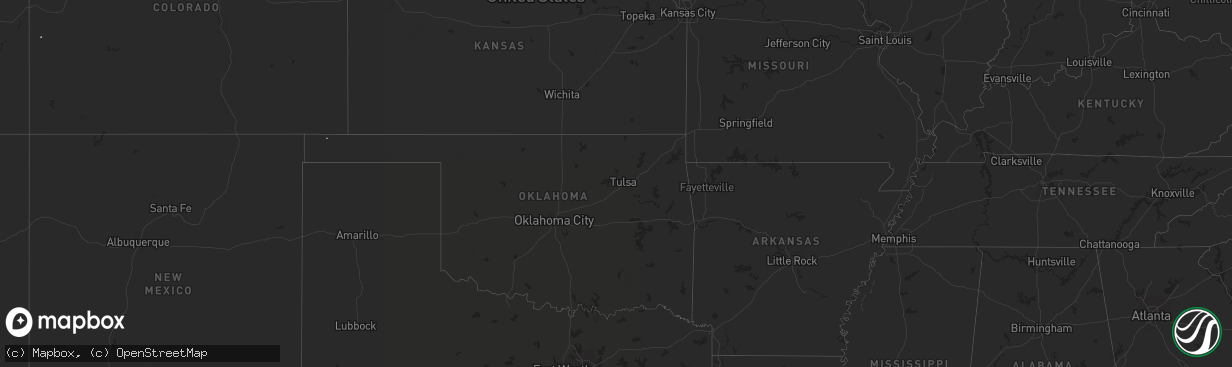
Hail Map on August 31, 2011
The weather event on August 31, 2011 includes Hail map. 9 states and 277 cities were impacted and suffered possible damage. The total estimated number of properties impacted is 0.
Want more than just the map?
Turn this storm into a full workflow.
- Owner + property data so you know who to knock
- OnDemand branded weather history reports to win the "did we even have hail?" argument
- RoofTrace estimate so reps stop guessing numbers at the door
Bought this map? Upgrade within 7 days and we'll credit the $230. (10-15 min setup call)
Hail
0
Estimated number of impacted properties by a 1.00" hail or larger0
Estimated number of impacted properties by a 1.75" hail or larger0
Estimated number of impacted properties by a 2.50" hail or largerStates Impacted by Hail Map on August 31, 2011
Storm reports
Wyoming
| Date | Description |
|---|---|
| 08/30/201110:34 PM CDT | A local report indicates 59 MPH wind near NATRONA COUNTY AIRPORT |
North Dakota
| Date | Description |
|---|---|
| 08/31/20112:45 AM CDT | Extensive damage in grafton. More than 50 large trees down...including some 60 to 70 foot tall evergreens. Five houses and multiple vehicles damaged by trees falling on |
| 08/31/20112:44 AM CDT | A local report indicates 64 MPH wind near 2 ESE GRAFTON |
| 08/31/20112:44 AM CDT | A local report indicates 64 MPH wind near GRAFTON |
| 08/31/20112:42 AM CDT | Extensive damage in grafton. More than 50 large trees down...including some 60 to 70 foot tall evergreens. Five houses and multiple vehicles damaged by trees falling on |
| 08/31/20112:40 AM CDT | Several large tree branches were broken down in shelter belts along nd highway 66. |
| 08/31/20112:39 AM CDT | Several large tree branches and tree limbs were snapped off in shelter belts along u.s. Highway 81. |
| 08/31/20112:15 AM CDT | Shed destroyed and 2 grain bins blown off slab. Power poles down. Relayed via off duty park river volunteer fire dept personnel. Peak winds estimated to 105 mph. |
| 08/31/20112:15 AM CDT | Shed destroyed and 2 grain bins blown off slab. Power poles down. Relayed via off duty park river volunteer fire dept personnel. |
| 08/31/20112:05 AM CDT | Numerous large trees in excess of 18 inch diameter were broken down in a farm shelter belt. |
| 08/31/20111:45 AM CDT | A local report indicates 60 MPH wind near 10 W HAMPDEN |
| 08/31/20111:30 AM CDT | Hail size was a mixture of quarters and nickels. |
| 08/31/20111:05 AM CDT | Large tree branch down |
| 08/31/201112:54 AM CDT | Media reported multiple small tree limbs down after estimated 60 mph wind gusts. |
| 08/31/201112:13 AM CDT | Winds lasted for 10 minutes. Brief power outages were reported. Rain gutters were blown off of a building. |
| 08/31/201112:00 AM CDT | Late report. Several trees snapped and others uprooted. Barn damaged. Wind speed and times are estimated. Damage also in the town of mercer...mclean county. |
| 08/30/201111:55 PM CDT | Estimated winds at 60 mph...trees bent over but not snapped... |
| 08/30/201111:51 PM CDT | A local report indicates 60 MPH wind near CROWN BUTTE LAKE |
| 08/30/201111:50 PM CDT | 64 mph gust from a weather station. |
| 08/30/201111:20 PM CDT | Sustained winds of 46 mph. |
| 08/30/201111:20 PM CDT | Near exit 120 i-94 barn roof torn off. Auger tipped over. 2 x 4 embedded in house. Straight line wind damage. |
| 08/30/201111:10 PM CDT | Public estimates 60 to 65 mph. |
| 08/30/201111:00 PM CDT | Also had pea size hail. Event lasted a few minutes. |
| 08/30/201110:55 PM CDT | Estimated winds at 60 mph...trees bent over but not snapped... |
| 08/30/201110:35 PM CDT | Hail lasted 2 minutes. |
| 08/30/201110:26 PM CDT | A local report indicates 62 MPH wind near TAYLOR |
| 08/30/201110:20 PM CDT | Hail lasted until 925 pm cdt. Also had 40 mph winds. |
| 08/30/201110:07 PM CDT | Mesonet relayed by emergency manager |
| 08/30/201110:04 PM CDT | A local report indicates 60 MPH wind near DICKINSON REGIONAL AIRP |
| 08/30/20119:51 PM CDT | State agency |
| 08/30/20119:43 PM CDT | Report relayed by wso williston. |
| 08/30/20119:43 PM CDT | 1 to 2 inch diameter tree branches broken off. Wooden fences blown down. |
| 08/30/20119:40 PM CDT | Relayed by emergency manager. Also golfball hail in the city of rhame. |
| 08/30/20119:25 PM CDT | Late report. Very brief hail...lasted a few minutes at most. |
| 08/30/20119:22 PM CDT | Hail broke windows |
Arizona
| Date | Description |
|---|---|
| 08/31/20114:45 PM CDT | Downed trees and some power lines down in rio rico between km markers 17 and 22 on i-19. |
| 08/30/20117:45 PM CDT | Tree uprooted near w. Magee rd and n. La canada dr. |
Nebraska
| Date | Description |
|---|---|
| 08/31/20111:51 AM CDT | This appeared to be a downburst associated with a thunderstorm south of valentine. Temperature went up with the gust from 72f to 82f. |
| 08/31/20111:06 AM CDT | This appeared to be a downburst associated with a thunderstorm south of valentine. Temperature went up with the gust from 72f to 82f. |
Montana
| Date | Description |
|---|---|
| 08/30/20119:25 PM CDT | Hail broke a bedroom window. Lots of quarter-sized hail as well. |
| 08/30/20119:14 PM CDT | Spotter travelling near the brush lake turn-off observed hail mixed with heavy rain. |
| 08/30/20119:05 PM CDT | A local report indicates 65 MPH wind near 8 ESE WEBSTER |
| 08/30/20118:55 PM CDT | 31 mph winds with 63 mph gust. |
| 08/30/20118:53 PM CDT | 44 mph winds with 58 mph gust |
| 08/30/20118:35 PM CDT | Estimated 70 mph wind gust with a little penny hail. |
| 08/30/20118:30 PM CDT | Estimated 70 to 80 mph wind gust with slushy dime hail. |
| 08/30/20118:20 PM CDT | Estimated 55 to 60 mph wind gust with pea hail. |
| 08/30/20118:13 PM CDT | Dime and nickel hail with a 71 mph wind gust |
| 08/30/20118:00 PM CDT | Winds were sustained between 40 to 60 mph. |
| 08/30/20117:51 PM CDT | 52 mph winds with 66 mph gust |
| 08/30/20117:41 PM CDT | Sustained 45 mph with 61 mph gust |
Minnesota
| Date | Description |
|---|---|
| 08/31/20114:50 AM CDT | Numerous nickle to quarter sized hail fell during very heavy rains and strong winds. |
| 08/31/20113:50 AM CDT | Large tree branches down |
| 08/31/20113:43 AM CDT | Numerous large tree branches were broken down and several large trees...both oak and poplar... Were snapped off in shelter belts and groves across portions of deer and |
| 08/31/20113:33 AM CDT | Peak wind measured at the ndawn site west of greenbush on cr4. |
| 08/31/20113:26 AM CDT | Numerous large tree branches were broken down and several large trees... Both oak and poplar... Were snapped off in shelter belts and groves across portions of arveson |
| 08/31/20113:25 AM CDT | Numerous large tree branches were broken down and several large trees... Both oak and poplar... Were snapped off in shelter belts and groves across portions of central |
| 08/31/20113:15 AM CDT | Numerous large tree branches were broken down and several large trees... Both oak and poplar... Were snapped off in shelter belts and groves near highway 11 through por |
| 08/31/20113:11 AM CDT | A local report indicates 64 MPH wind near HALLOCK |
| 08/31/20113:07 AM CDT | Several large tree branches were broken down in shelter belts along u.s. Highway 75. Intermittent tree damage continued into and north of stephen... From northern tamar |
| 08/31/20113:05 AM CDT | Three farm grade steel grain bins were torn off their foundations and blown out into a field. Three more steel bins at the farm yard were severely dented in and partial |
| 08/31/20113:04 AM CDT | Two large commercial grade steel bins and their horizontal tranfer system were torn out from the city grain elevator facility and were splayed to the east... Partially |
| 08/31/20113:03 AM CDT | Four grain bins blown down. Trees down in beet field. |
| 08/31/20113:03 AM CDT | Four grain bins blown down. Trees down in beet field. |
| 08/31/20113:03 AM CDT | Peak westerly winds to 121 mph were measured at the rwis site located along highway 11 and were reported from 303 am cdt to 314 am cdt. Damage to downwind fields...farm |
Cities Impacted by Hail Map on August 31, 2011
- Grand Forks, ND
- Colfax, ND
- Wolverton, MN
- Wahpeton, ND
- Barnesville, MN
- Christine, ND
- Walcott, ND
- Livingston, MT
- Stephen, MN
- Strandquist, MN
- Antelope, MT
- Reserve, MT
- Hebron, ND
- Amidon, ND
- Glen Ullin, ND
- Regent, ND
- Mott, ND
- Gladstone, ND
- New England, ND
- Taylor, ND
- Bowman, ND
- Rhame, ND
- Scranton, ND
- Lefor, ND
- Richardton, ND
- Dickinson, ND
- Thomasville, GA
- Tallahassee, FL
- Oslo, MN
- Alvarado, MN
- Park River, ND
- Edinburg, ND
- Beulah, ND
- Crary, ND
- Hazen, ND
- Stanton, ND
- New Salem, ND
- Center, ND
- Lansford, ND
- Mohall, ND
- Judith Gap, MT
- Columbus, MI
- Garrison, ND
- Puposky, MN
- Watford City, ND
- Arnegard, ND
- Bingham, NE
- Merriman, NE
- Ashby, NE
- Oshkosh, NE
- Hyannis, NE
- Poplar, MT
- Trenton, FL
- Oberon, ND
- Fosston, MN
- Clearbrook, MN
- Westhope, ND
- Lavina, MT
- Forsyth, MT
- Hinsdale, MT
- Plummer, MN
- Martinsdale, MT
- Two Dot, MT
- Rocklake, ND
- Bagley, MN
- Mcintosh, MN
- Carrington, ND
- Alexander, ND
- Mylo, ND
- Belcourt, ND
- Bottineau, ND
- Souris, ND
- Brockton, MT
- Plaza, ND
- Medicine Lake, MT
- White Sulphur Springs, MT
- Gilby, ND
- Brocket, ND
- Minto, ND
- Argyle, MN
- Grafton, ND
- Drayton, ND
- Alamo, ND
- Williston, ND
- Zahl, ND
- Volborg, MT
- Flaxville, MT
- Wolf Point, MT
- Peerless, MT
- Scobey, MT
- Richey, MT
- Hannah, ND
- Belfield, ND
- Redstone, MT
- Tucson, AZ
- Thief River Falls, MN
- Munich, ND
- Epping, ND
- Ray, ND
- Manvel, ND
- Lambert, MT
- Bighorn, MT
- Custer, MT
- Hardin, MT
- Nashua, MT
- Dahlen, ND
- Petersburg, ND
- Niagara, ND
- Fordville, ND
- Inkster, ND
- Maxbass, ND
- Fortuna, ND
- Gordon, NE
- Arvilla, ND
- Calvin, ND
- Langdon, ND
- Starkweather, ND
- Egeland, ND
- Alsen, ND
- Valentine, NE
- Cody, NE
- Chiefland, FL
- Erskine, MN
- Winger, MN
- Rolette, ND
- Benson, AZ
- Ringling, MT
- Mcgregor, ND
- Tioga, ND
- Fairview, MT
- Grenora, ND
- Emerado, ND
- Crosby, ND
- Wildrose, ND
- Colquitt, GA
- Homestead, MT
- New Town, ND
- Halliday, ND
- Manning, ND
- Dunn Center, ND
- Dodge, ND
- Killdeer, ND
- Wilsall, MT
- Saco, MT
- Maddock, ND
- Leonard, MN
- Park Rapids, MN
- Frazer, MT
- Cartwright, ND
- Sidney, MT
- Dunseith, ND
- Hobson, MT
- Palermo, ND
- East Grand Forks, MN
- Warren, MN
- Euclid, MN
- Woodworth, ND
- Saint Hilaire, MN
- Washburn, ND
- Gully, MN
- Trail, MN
- Nenzel, NE
- Kilgore, NE
- Red Lake Falls, MN
- Oklee, MN
- Shevlin, MN
- Lakota, ND
- Glasgow, MT
- Bemidji, MN
- Pettibone, ND
- Bisbee, ND
- Rosebud, MT
- Buffalo, MT
- Grygla, MN
- Warwick, ND
- Zap, ND
- Bronson, FL
- Fertile, MN
- Esmond, ND
- Rio Rico, AZ
- Hoople, ND
- Adams, ND
- Wales, ND
- Green Valley, AZ
- Perth, ND
- Westby, MT
- Reeder, ND
- New Leipzig, ND
- Goodridge, MN
- Gonvick, MN
- Plentywood, MT
- Old Town, FL
- Parshall, ND
- Turtle Lake, ND
- Dagmar, MT
- Berthold, ND
- Minnewaukan, ND
- Richmond, MI
- Mcclusky, ND
- Peridot, AZ
- Willow City, ND
- Keene, ND
- Columbus, ND
- Lignite, ND
- Brooks, MN
- Pisek, ND
- Townsend, MT
- Sarles, ND
- Butte, ND
- Crookston, MN
- Cleveland, OH
- Gates Mills, OH
- South Heart, ND
- Greenville, FL
- Richland, MT
- Roberts, MT
- Fishtail, MT
- Mentor, MN
- Ruso, ND
- Michigan, ND
- Forest River, ND
- Fisher, MN
- Lankin, ND
- Mekinock, ND
- Larimore, ND
- Carpio, ND
- Roscoe, MT
- Coleharbor, ND
- Underwood, ND
- Lawton, ND
- Donnybrook, ND
- Oracle, AZ
- San Manuel, AZ
- Rolla, ND
- Solway, MN
- Saint John, ND
- Chesterland, OH
- Powers Lake, ND
- Saint Marie, MT
- Devils Lake, ND
- Billings, MT
- Melville, MT
- Big Timber, MT
- Kramer, ND
- Cairo, GA
- Pingree, ND
- Deer River, MN
- Cooperstown, ND
- Walhalla, ND
- Hines, MN
- Blackduck, MN
- Opheim, MT
- Rugby, ND
- Glenfield, ND
- Medora, ND
- Almont, ND
- Denton, MT
- Middle River, MN
- Newfolden, MN
- Huntley, MT
- Stanley, ND
- Raymond, MT
- Outlook, MT
- Joliet, MT
- Hampden, ND
- Toston, MT
- Culbertson, MT
- Tenstrike, MN
- Monticello, FL
- Ross, ND
- Perry, FL
- Churchs Ferry, ND
- Leeds, ND
- Whitetail, MT
- Homosassa, FL
- Edmore, ND
- Anamoose, ND