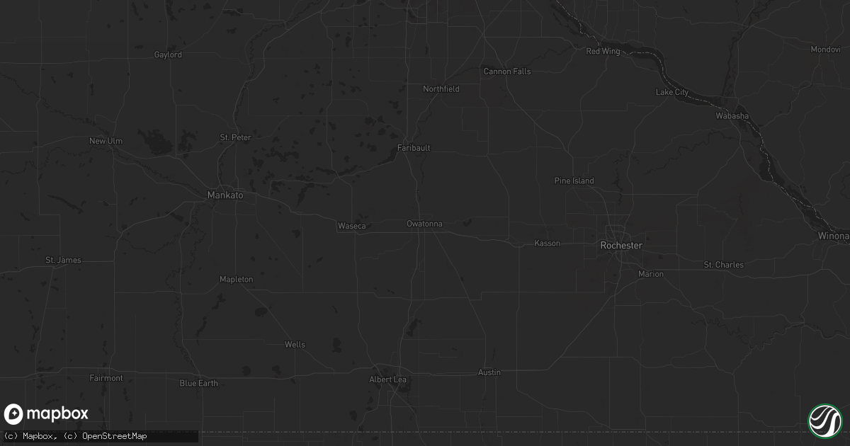
Hail Map in Rapid City, SD on August 30, 2013
Get this storm
August 30 map
$229
one time, instant access
Download today. No call, no setup
Keep the $229
Bought the map and want the full workflow? Apply the entire $229 to a subscription within 7 days. None of it is wasted.
Every map, not just this one
This buys you this map. Subscription and you get every map we run, in the markets you choose from a few cities to whole states to nationwide. Plus real-time alerts the moment a storm fires.
Contact data
Name, contact info, occupancy, even credit band for addresses in the footprint. You go from where it hit to who to call.
Become the source they trust
Unlimited branding weather history reports on demand. You already have the documented answer ready for the property owner, and you are the one who showed up with it.
Property data and RoofTrace estimates
Pull up any address you have got, its value and the exact code rules for that jurisdiction, straight from One Click Code. Then RoofTrace estimates the squares, pitch, and roof value, priced the way you price.
Storm reports in Rapid City, SD
Rapid City, SD
| Date | Description |
|---|---|
| 08/30/20133:35 PM CDT | A local report indicates 2.00 inch wind near 3 SE DOWNTOWN RAPID CIT |
| 08/30/20133:33 PM CDT | A local report indicates 58 MPH wind near 4 S DOWNTOWN RAPID CITY |
| 08/30/20133:30 PM CDT | A local report indicates 1.50 inch wind near 3 SE DOWNTOWN RAPID CIT |
| 08/30/20133:30 PM CDT | A local report indicates 2.25 inch wind near 2 SSE DOWNTOWN RAPID CI |
| 08/30/20133:30 PM CDT | A local report indicates 1.75 inch wind near 1 E DOWNTOWN RAPID CITY |
| 08/30/20133:10 PM CDT | A local report indicates 1.75 inch wind near 2 WSW DOWNTOWN RAPID CI |
| 08/30/20133:10 PM CDT | A local report indicates 1.50 inch wind near 1 E DOWNTOWN RAPID CITY |
| 08/30/20133:10 PM CDT | A local report indicates 1.75 inch wind near 3 W DOWNTOWN RAPID CITY |
| 08/30/20133:05 PM CDT | A local report indicates 1.50 inch wind near 4 SSW DOWNTOWN RAPID CI |
| 08/30/20133:05 PM CDT | A local report indicates 1.50 inch wind near 3 WSW DOWNTOWN RAPID CI |
| 08/30/20133:01 PM CDT | A local report indicates 1.50 inch wind near 2 SW DOWNTOWN RAPID CIT |
| 08/30/20133:00 PM CDT | Mostly hail with some rain. |
| 08/30/20132:45 PM CDT | Dented car and damaged shingles |
All States Impacted by Hail Map on August 30, 2013
All Cities Impacted by Hail Map on August 30, 2013
- New Salem, ND
- Glen Ullin, ND
- Beulah, ND
- Galion, OH
- Gordon, NE
- Hermosa, SD
- Towner, ND
- Mud Butte, SD
- Faith, SD
- Union Center, SD
- Caledonia, IL
- Hartland, WI
- Delafield, WI
- Nashotah, WI
- Bayard, NE
- Gering, NE
- Minot, ND
- Sawyer, ND
- Max, ND
- Rapid City, SD
- Fort Atkinson, WI
- Bismarck, ND
- Menoken, ND
- Winnett, MT
- Pine Ridge, SD
- Forsyth, MT
- Hazen, ND
- Rosebud, MT
- Sycamore, IL
- Dekalb, IL
- Cortland, IL
- Hinckley, IL
- Maple Park, IL
- North Platte, NE
- Miles City, MT
- Kinsey, MT
- Zap, ND
- Whitewater, WI
- Delavan, WI
- Elkhorn, WI
- Darien, WI
- Erie, MI
- Dickens, NE
- Chicago, IL
- East Chicago, IN
- Hammond, IN
- Wilton, ND
- Newark, OH
- Saint Louisville, OH
- Freeport, IL
- Pearl City, IL
- Romulus, MI
- Trenton, MI
- Flat Rock, MI
- Detroit, MI
- Canton, MI
- Taylor, MI
- Southgate, MI
- Riverview, MI
- Belleville, MI
- Ypsilanti, MI
- New Boston, MI
- Wayne, MI
- Epworth, IA
- Luxemburg, IA
- Hopkinton, IA
- Farley, IA
- Holy Cross, IA
- New Vienna, IA
- Delhi, IA
- Earlville, IA
- Durango, IA
- Worthington, IA
- Sherrill, IA
- Guttenberg, IA
- Dyersville, IA
- Colesburg, IA
- Dubuque, IA
- Warm Springs, AR
- Tallahassee, FL
- Lemont, IL
- Palos Park, IL
- Port Clinton, OH
- Davis Junction, IL
- Monroe Center, IL
- Colquitt, GA
- Mandan, ND
- Ringwood, IL
- Spring Grove, IL
- Mchenry, IL
- Richmond, IL
- Oral, SD
- Buffalo Gap, SD
- Mendota, IL
- La Moille, IL
- Sublette, IL
- Mullen, NE
- Tryon, NE
- Center, ND
- Utica, OH
- Mitchell, NE
- Scottsbluff, NE
- Warwick, GA
- Sylvester, GA
- Morrison, IL
- Fulton, IL
- Monroe, WI
- Milton, WI
- Pleasureville, KY
- Eminence, KY
- Ellsworth, NE
- Graytown, OH
- Rocky Ridge, OH
- Oak Harbor, OH
- Ransom, IL
- Platteville, WI
- Cuba City, WI
- Halliday, ND
- Dodge, ND
- Baldwin, ND
- Regan, ND
- Arlington, GA
- Edison, GA
- Bluffton, GA
- Waukesha, WI
- Okauchee, WI
- Lebanon, WI
- Watertown, WI
- Juneau, WI
- Oconomowoc, WI
- Hartford, WI
- Ixonia, WI
- Neosho, WI
- Ashippun, WI
- Rubicon, WI
- Pewaukee, WI
- Cairo, GA
- Pelham, GA
- Hay Springs, NE
- Bentley, MI
- Sabina, OH
- Washington Court House, OH
- Fostoria, OH
- Bloomdale, OH
- Rugby, ND
- New Riegel, OH
- Marseilles, IL
- Ottawa, IL
- Durand, IL
- Davis, IL
- Addison, IL
- Hershey, NE
- Wing, ND
- South Solon, OH
- Northport, MI
- Upham, ND
- Bantry, ND
- Wauneta, NE
- Fremont, OH
- Green Springs, OH
- Evergreen Park, IL
- Hometown, IL
- Orangeville, IL
- Juda, WI
- Rock City, IL
- Sand Springs, MT
- Esmond, ND
- Mosby, MT
- Brusett, MT
- Angela, MT
- Ida, MI
- Monroe, MI
- La Salle, MI
- Oshkosh, NE
- Lisco, NE
- Douglas, ND
- Jesup, GA
- Greenfield, OH
- Leesburg, OH
- Arnold, NE
- Madrid, NE
- Grant, NE
- Black Hawk, SD
- Fayetteville, AR
- Salem, WI
- Lake Villa, IL
- Wadsworth, IL
- Antioch, IL
- Bristol, WI
- Plymouth, MI
- Rochelle, IL
- Ashton, IL
- Steward, IL
- Chadron, NE
- Rushville, NE
- Utica, IL
- Sheridan, IL
- Paw Paw, IL
- Earlville, IL
- Triumph, IL
- Leland, IL
- West Brooklyn, IL
- Compton, IL
- Belvidere, IL
- Kingston, IL
- Kirkland, IL
- Cherry Valley, IL
- Crawfordville, FL
- Lakeside, NE
- Pemberville, OH
- Bradner, OH
- Jeffersonville, OH
- Caputa, SD
- Martin, OH
- Curtice, OH
- Velva, ND
- Clyde, OH
- Oxford, MI
- Michigantown, IN
- Frankfort, IN
- Lapeer, MI
- Attica, MI
- Kansasville, WI
- Kenosha, WI
- Round Lake, IL
- Burlington, WI
- Union Grove, WI
- Rochester, WI
- Grayslake, IL
- Trevor, WI
- Waterford, WI
- Gurnee, IL
- Fitzgerald, GA
- Milan, GA
- Lanark, IL
- Shannon, IL
- Seneca, IL
- Kinsman, IL
- Verona, IL
- Dwight, IL
- Mazon, IL
- Gardner, IL
- Sterling, ND
- Venango, NE
- Houghton Lake, MI
- Flasher, ND
- Clare, IL
- Bainbridge, OH
- Chana, IL
- Kyle, SD
- Walker, IA
- Coggon, IA
- Cicero, IL
- Lyman, NE
- Evansville, WI
- Albany, WI
- Fayetteville, OH
- Mount Orab, OH
- Lynchburg, OH
- Valdosta, GA
- Kansas, OH
- Tiffin, OH
- Bettsville, OH
- Burgoon, OH
- Wapakoneta, OH
- Waynesfield, OH
- Stanton, ND
- Winter Garden, FL
- Park Ridge, IL
- Lincolnwood, IL
- Morton Grove, IL
- Skokie, IL
- Winnetka, IL
- Wilmette, IL
- Elmwood Park, IL
- Glenview, IL
- Golf, IL
- Northbrook, IL
- Niles, IL
- Harwood Heights, IL
- Jefferson, WI
- Wounded Knee, SD
- Ryder, ND
- Saline, MI
- Britton, MI
- Julesburg, CO
- Covert, MI
- Schererville, IN
- Highland, IN
- Merrillville, IN
- Munster, IN
- Gary, IN
- Crown Point, IN
- Griffith, IN
- Ozark, AL
- Frazeysburg, OH
- Sheridan, IN
- Lomira, WI
- Richardton, ND
- Hebron, ND
- Unadilla, GA
- Doniphan, MO
- Prairie City, SD
- Eagle, WI
- Dousman, WI
- Palmyra, WI
- Wayne, OH
- Portage, OH
- Polo, IL
- Springfield, OH
- Luckey, OH
- Yoder, WY
- Torrington, WY
- Ismay, MT
- Volborg, MT
- Linton, ND
- Cass City, MI
- Hebron, IN
- Elizabeth, IL
- Wheatfield, IN
- Demotte, IN
- Bellville, OH
- Dayton, OH
- Waverly, OH
- Cardington, OH
- Mount Gilead, OH
- Dunseith, ND
- Souris, ND
- Bottineau, ND
- Des Plaines, IL
- Mount Prospect, IL
- Midland, MI
- Livonia, MI
- Westland, MI
- South Wayne, WI
- Browntown, WI
- Merriman, NE
- Blakely, GA
- Attalla, AL
- Golden Valley, ND
- Monticello, WI
- South Pittsburg, TN
- Caliente, NV
- Sunbury, OH
- Bowling Green, OH
- Rudolph, OH
- Bingham, NE
- Helenville, WI
- Wales, WI
- Washburn, ND
- Amboy, IL
- O'Brien, FL
- Bisbee, ND
- Dixon, IL
- Imlay City, MI
- Mylo, ND
- Tecumseh, MI
- Harrisburg, NE
- Palm City, FL
- Paxton, NE
- Scenic, SD
- South Charleston, OH
- Elmore, OH
- Woodville, OH
- Centerburg, OH
- Croton, OH
- Esmond, IL
- Genoa, IL
- Camilla, GA
- Montgomery, AL
- Garden Prairie, IL
- Williamsburg, OH
- Bushnell, NE
- Douglas, GA
- Karlsruhe, ND
- Roseglen, ND
- Voltaire, ND
- Granville, ND
- Malta, IL
- Smithwick, SD
- Nashport, OH
- Lake Zurich, IL
- Palatine, IL
- Barrington, IL
- London, OH
- Manderson, SD
- Porcupine, SD
- Batesland, SD
- La Fayette, GA
- South Beloit, IL
- Clinton, WI
- Hebron, IL
- Johnson Creek, WI
- Capron, IL
- Loves Park, IL
- Roscoe, IL
- Janesville, WI
- Avalon, WI
- Marengo, IL
- Poplar Grove, IL
- East Troy, WI
- Big Rock, IL
- Union, IL
- Walworth, WI
- Hampshire, IL
- Lake Geneva, WI
- Waterman, IL
- Mukwonago, WI
- Woodstock, IL
- Sullivan, WI
- Williams Bay, WI
- Beloit, WI
- Elburn, IL
- Sharon, WI
- Harvard, IL
- Machesney Park, IL
- Fontana, WI
- Yorkville, IL
- Plano, IL
- Sandwich, IL
- Rockford, IL
- North Branch, MI
- Grayling, MI
- Roscommon, MI
- Sterling, IL
- Waycross, GA
- Henagar, AL
- Ider, AL
- Iron Ridge, WI
- Baconton, GA
- Leland, MI
- Helena, OH
- Gibsonburg, OH
- Perrysburg, OH
- Risingsun, OH
- Mott, ND
- Peosta, IA
- Surrency, GA
- Masonville, IA
- Manchester, IA
- Cordele, GA
- Vienna, GA
- Batavia, IL
- Geneva, IL
- German Valley, IL
- Serena, IL
- Lee, IL
- Farmington, MI
- Northville, MI
- Novi, MI
- Wixom, MI
- Redford, MI
- Southfield, MI
- Bridgeport, NE
- Tiro, OH
- New Washington, OH
- Ashley, OH
- Marengo, OH
- Anamoose, ND
- Ovid, CO
- Odell, IL
- Wray, GA
- Albion, MI
- Concord, MI
- Richwood, OH
- Hayes Center, NE
- Stamping Ground, KY
- Xenia, OH
- Jamestown, OH
- Cedarville, OH
- Brundidge, AL
- Johnsonville, IL
- Bellevue, OH
- Reynolds, GA
- Moffit, ND
- Damascus, GA
- Deering, ND
- Wallace, NE
- Coleharbor, ND
- Dundee, MI
- Carey, OH
- Bridgeview, IL
- La Grange, IL
- Justice, IL
- Hickory Hills, IL
- Willowbrook, IL
- Willow Springs, IL
- Oak Lawn, IL
- Burbank, IL
- Newell, SD
- Sequatchie, TN
- Indianapolis, IN
- Fishers, IN
- Carmel, IN
- Dakota, IL
- Albany, GA
- Brown City, MI
- Kintyre, ND
- Wyandotte, MI
- Snover, MI
- Leonard, MI
- La Rue, OH
- Braddock, ND
- Harbor View, OH
- Toledo, OH
- Oregon, OH
- Pine Bluffs, WY
- Blanchardville, WI
- Du Pont, GA
- Fargo, GA
- Marysville, OH
- Hanover, MI
- Jonesville, MI
- Columbia, AL
- Casstown, OH
- Mount Vernon, OH
- Fredericktown, OH
- Mansfield, OH
- Cuthbert, GA
- Melvindale, MI
- Allen Park, MI
- Dearborn Heights, MI
- Dearborn, MI
- Scottsboro, AL
- West Green, GA
- Egeland, ND
- Fort Payne, AL
- Petersburg, MI
- Spencerville, OH
- Huntley, IL
- Crystal Lake, IL
- Stockton, IL
- Streamwood, IL
- Elgin, IL
- Hoffman Estates, IL
- Bartlett, IL
- Lafayette, IN
- Romney, IN
- Campbellsport, WI
- Galena, OH
- Benkelman, NE
- Glen Ellyn, IL
- Glendale Heights, IL
- Bloomingdale, IL
- Hague, ND
- Rockton, IL
- Rowley, IA
- Maywood, NE
- South Salem, OH
- Valley Head, AL
- Pecatonica, IL
- Perrysville, OH
- Butler, OH
- Freeland, MI
- Ridott, IL
- Baileyville, IL
- Saint Mary, MO
- Brodhead, WI
- Clay Center, OH
- Millbury, OH
- Williston, OH
- Genoa, OH
- West Chicago, IL
- Perryville, MO
- Newton, GA
- Poplar Bluff, MO
- Hartford, MI
- Watervliet, MI
- Manor, GA
- Zionsville, IN
- Westfield, IN
- Forreston, IL
- Shullsburg, WI
- Dolton, IL
- Lansing, IL
- Hobart, IN
- Calumet City, IL
- Riverdale, IL
- Dyer, IN
- Homer, MI
- New Leipzig, ND
- Cincinnati, OH
- Martin, SD
- Monticello, FL
- Crestline, OH
- Chadwick, IL
- Mount Carroll, IL
- Milledgeville, IL
- Oregon, IL
- Highland Park, IL
- River Forest, IL
- Deerfield, IL
- Saint John, IN
- Wheeling, IL
- South Holland, IL
- Harvey, IL
- Blue Island, IL
- Glencoe, IL
- Valparaiso, IN
- Prospect Heights, IL
- Berwyn, IL
- Oak Park, IL
- Evanston, IL
- Sainte Genevieve, MO
- Melvin, MI
- Bristol, GA
- Mershon, GA
- New Castle, KY
- Underwood, ND
- Lake Forest, IL
- Urbana, OH
- Potosi, WI
- Maricopa, AZ
- Bullhead City, AZ
- Oxly, MO
- Mayville, WI
- Wilmot, WI
- Silver Lake, WI
- Burnett, WI
- Big Bend, WI
- Theresa, WI
- Waukegan, IL
- Lowell, WI
- Lake Bluff, IL
- Muskego, WI
- Sussex, WI
- Clyman, WI
- Horicon, WI
- Hustisford, WI
- Twin Lakes, WI
- Ingleside, IL
- Libertyville, IL
- Genoa City, WI
- North Prairie, WI
- Batavia, OH
- Amelia, OH
- Lake City, FL
- Blackshear, GA
- Erie, IL
- Gambier, OH
- Schiller Park, IL
- Franklin Park, IL
- Fenton, IL
- Prophetstown, IL
- Lyndon, IL
- Clinton, IA
- Whitehall, MI
- Muskegon, MI
- Palisade, NE
- Winslow, IL
- Riga, MI
- Ottawa Lake, MI
- Rainbow City, AL
- Ashville, AL
- Jasper, FL
- Jesup, IA
- Kent, IL
- Cedarville, IL
- Shirland, IL
- Gratiot, WI
- Warren, IL
- Leaf River, IL
- Mount Morris, IL
- Winnebago, IL
- McConnell, IL
- Lena, IL
- Turtle Lake, ND
- Highland Park, MI
- Hamtramck, MI
- Hazelton, ND
- Ann Arbor, MI
- Newburgh, IN
- Steele, AL
- Hillsboro, OH
- Rainsville, AL
- Lewistown, MT
- Solen, ND
- Huntsville, AL
- Ipswich, SD
- Ludowici, GA
- Garrison, ND
- Yale, MI
- Capac, MI
- Wauconda, IL
- Mundelein, IL
- Royal Oak, MI
- Madison Heights, MI
- Warren, MI
- Sterling Heights, MI
- Franklin, MI
- Clawson, MI
- Center Line, MI
- Troy, MI
- Birmingham, MI
- Ryan, IA
- Moultrie, GA
- Milan, MI
- Bloomingburg, OH
- Algonquin, IL
- Carpentersville, IL
- Dundee, IL
- Doerun, GA
- Willard, OH
- Attica, OH
- Starke, FL
- Lawtey, FL
- Lindsey, OH
- Walbridge, OH
- Northwood, OH
- Temperance, MI
- Hazel Green, WI
- Fyffe, AL
- McKean, PA
- Edinboro, PA
- Frederic, MI
- Perry, FL
- Rolling Meadows, IL
- Schaumburg, IL
- Arlington Heights, IL
- Elk Grove Village, IL
- Abbeville, GA
- Decker, MI
- Marlette, MI
- Sandusky, MI
- Holland, MI
- Delphos, OH
- Lima, OH
- Saint Charles, IL
- Brownsville, WI
- Sale City, GA
- Piedmont, SD


