Hail Map in Illinois on August 30, 2013
Get this storm
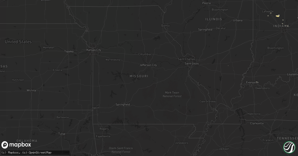
August 30 map
$229
one time, instant access
Download today. No call, no setup
Keep the $229
Bought the map and want the full workflow? Apply the entire $229 to a subscription within 7 days. None of it is wasted.
Every map, not just this one
This buys you this map. Subscription and you get every map we run, in the markets you choose from a few cities to whole states to nationwide. Plus real-time alerts the moment a storm fires.
Contact data
Name, contact info, occupancy, even credit band for addresses in the footprint. You go from where it hit to who to call.
Become the source they trust
Unlimited branding weather history reports on demand. You already have the documented answer ready for the property owner, and you are the one who showed up with it.
Property data and RoofTrace estimates
Pull up any address you have got, its value and the exact code rules for that jurisdiction, straight from One Click Code. Then RoofTrace estimates the squares, pitch, and roof value, priced the way you price.
Storm reports in Illinois
Illinois
| Date | Description |
|---|---|
| 08/30/20136:16 PM CDT | Estimated 70 mph thunderstorm wind gust. Montrose and lake shore drive. |
| 08/30/20136:09 PM CDT | At irving and north kostner avenue. Dime sized hail. Trees down and blinding rain. |
| 08/30/20136:02 PM CDT | Heavy rain too. |
| 08/30/20136:00 PM CDT | Large tree limbs down from from 1 inch to 8 inches in diameter down across edison park. Multiple tree limbs split off from trees. Some are blocking roads and have falle |
| 08/30/20135:56 PM CDT | Possible wall cloud northwest skokie. Dempster and gross point road. |
| 08/30/20135:52 PM CDT | A local report indicates 70 MPH wind near S EVANSTON |
| 08/30/20135:52 PM CDT | South evanston. |
| 08/30/20135:50 PM CDT | Three large trees down on homes |
| 08/30/20135:50 PM CDT | Estimated thunderstorm wind gust 60 to 70 mph. Tree branches snapped. Some street flooding. Via facebook. |
| 08/30/20135:45 PM CDT | 15inch diameter tree down on lake street east of butterfield rd. |
| 08/30/20135:40 PM CDT | Two to three inch diameter tree limbs down near church and oriole. |
| 08/30/20135:30 PM CDT | A local report indicates 60 MPH wind near ELK GROVE VILLAGE |
| 08/30/20135:26 PM CDT | A large tree fell on a car. |
| 08/30/20135:21 PM CDT | Multiple trees down 12 inches in diameter plus at the intersection of route 45 and casey road. |
| 08/30/20135:20 PM CDT | Numerous trees down 20 plus near the intersection of route 45 and and w rollins road in gurnee. |
| 08/30/20135:15 PM CDT | Power lines down. Small trees down and large branches. Scattered structural damage. |
| 08/30/20135:14 PM CDT | Mutiple trees down 12 inches in diameter at the intersection of deep lake road and route 132. |
| 08/30/20135:05 PM CDT | Mutiple trees down at least 18 inches in diameter at the intersection of hammmond and seymour. Report relayed by lake county ema. |
| 08/30/20135:00 PM CDT | 600 block stuart st. Numerous branches down. |
| 08/30/20135:00 PM CDT | A local report indicates 1.00 inch wind near HARVARD |
| 08/30/20134:59 PM CDT | Limbs and large trees blown down. Via facebook. |
| 08/30/20134:56 PM CDT | Grand ave and almond dr |
| 08/30/20134:53 PM CDT | Lake and washington. |
| 08/30/20134:45 PM CDT | A local report indicates 1.00 inch wind near 2 N ROUND LAKE |
| 08/29/20139:55 PM CDT | A local report indicates 61 MPH wind near PONTIAC |
| 08/29/20139:47 PM CDT | Trees were blown down in the leisure time estates near henning rd. |
| 08/29/20139:45 PM CDT | 1 to 2 inch diameter limbs blown. Rainfall 0.35 inches. Time estimated from radar |
| 08/29/20139:42 PM CDT | Trees were blown down in kickapoo state park...200 people are without power...wind gusts were measured up to 51 mph. |
| 08/29/20139:42 PM CDT | Trees were blown down in danville...200 people are without power...wind gusts were measured up to 51 mph on the northwest side of danville. |
| 08/29/20139:40 PM CDT | Sheriff relayed a report from the public of damage to trees and crops near il-52 and il-23 north of ottawa. |
| 08/29/20138:00 PM CDT | Hail was pea to quaater sized and began at 735 cdt. Lasted for about 20 minutes. Report received via espotter. |
| 08/29/20137:44 PM CDT | Hail falling for 3 to 4 mintues at the time of the report. |
| 08/29/20137:36 PM CDT | Dime to quarter hail. |
| 08/29/20137:35 PM CDT | Began at 734 |
| 08/29/20137:32 PM CDT | A local report indicates 1.00 inch wind near FREEPORT |
| 08/29/20137:30 PM CDT | Extensive tree damage and cars damaged |
All States Impacted by Hail Map on August 30, 2013
Cities Impacted by Hail Map on August 30, 2013
- New Salem, ND
- Glen Ullin, ND
- Beulah, ND
- Galion, OH
- Gordon, NE
- Hermosa, SD
- Towner, ND
- Mud Butte, SD
- Faith, SD
- Union Center, SD
- Caledonia, IL
- Hartland, WI
- Delafield, WI
- Nashotah, WI
- Bayard, NE
- Gering, NE
- Minot, ND
- Sawyer, ND
- Max, ND
- Rapid City, SD
- Fort Atkinson, WI
- Bismarck, ND
- Menoken, ND
- Winnett, MT
- Pine Ridge, SD
- Forsyth, MT
- Hazen, ND
- Rosebud, MT
- Sycamore, IL
- Dekalb, IL
- Cortland, IL
- Hinckley, IL
- Maple Park, IL
- North Platte, NE
- Miles City, MT
- Kinsey, MT
- Zap, ND
- Whitewater, WI
- Delavan, WI
- Elkhorn, WI
- Darien, WI
- Erie, MI
- Dickens, NE
- Chicago, IL
- East Chicago, IN
- Hammond, IN
- Wilton, ND
- Newark, OH
- Saint Louisville, OH
- Freeport, IL
- Pearl City, IL
- Romulus, MI
- Trenton, MI
- Flat Rock, MI
- Detroit, MI
- Canton, MI
- Taylor, MI
- Southgate, MI
- Riverview, MI
- Belleville, MI
- Ypsilanti, MI
- New Boston, MI
- Wayne, MI
- Epworth, IA
- Luxemburg, IA
- Hopkinton, IA
- Farley, IA
- Holy Cross, IA
- New Vienna, IA
- Delhi, IA
- Earlville, IA
- Durango, IA
- Worthington, IA
- Sherrill, IA
- Guttenberg, IA
- Dyersville, IA
- Colesburg, IA
- Dubuque, IA
- Warm Springs, AR
- Tallahassee, FL
- Lemont, IL
- Palos Park, IL
- Port Clinton, OH
- Davis Junction, IL
- Monroe Center, IL
- Colquitt, GA
- Mandan, ND
- Ringwood, IL
- Spring Grove, IL
- Mchenry, IL
- Richmond, IL
- Oral, SD
- Buffalo Gap, SD
- Mendota, IL
- La Moille, IL
- Sublette, IL
- Mullen, NE
- Tryon, NE
- Center, ND
- Utica, OH
- Mitchell, NE
- Scottsbluff, NE
- Warwick, GA
- Sylvester, GA
- Morrison, IL
- Fulton, IL
- Monroe, WI
- Milton, WI
- Pleasureville, KY
- Eminence, KY
- Ellsworth, NE
- Graytown, OH
- Rocky Ridge, OH
- Oak Harbor, OH
- Ransom, IL
- Platteville, WI
- Cuba City, WI
- Halliday, ND
- Dodge, ND
- Baldwin, ND
- Regan, ND
- Arlington, GA
- Edison, GA
- Bluffton, GA
- Waukesha, WI
- Okauchee, WI
- Lebanon, WI
- Watertown, WI
- Juneau, WI
- Oconomowoc, WI
- Hartford, WI
- Ixonia, WI
- Neosho, WI
- Ashippun, WI
- Rubicon, WI
- Pewaukee, WI
- Cairo, GA
- Pelham, GA
- Hay Springs, NE
- Bentley, MI
- Sabina, OH
- Washington Court House, OH
- Fostoria, OH
- Bloomdale, OH
- Rugby, ND
- New Riegel, OH
- Marseilles, IL
- Ottawa, IL
- Durand, IL
- Davis, IL
- Addison, IL
- Hershey, NE
- Wing, ND
- South Solon, OH
- Northport, MI
- Upham, ND
- Bantry, ND
- Wauneta, NE
- Fremont, OH
- Green Springs, OH
- Evergreen Park, IL
- Hometown, IL
- Orangeville, IL
- Juda, WI
- Rock City, IL
- Sand Springs, MT
- Esmond, ND
- Mosby, MT
- Brusett, MT
- Angela, MT
- Ida, MI
- Monroe, MI
- La Salle, MI
- Oshkosh, NE
- Lisco, NE
- Douglas, ND
- Jesup, GA
- Greenfield, OH
- Leesburg, OH
- Arnold, NE
- Madrid, NE
- Grant, NE
- Black Hawk, SD
- Fayetteville, AR
- Salem, WI
- Lake Villa, IL
- Wadsworth, IL
- Antioch, IL
- Bristol, WI
- Plymouth, MI
- Rochelle, IL
- Ashton, IL
- Steward, IL
- Chadron, NE
- Rushville, NE
- Utica, IL
- Sheridan, IL
- Paw Paw, IL
- Earlville, IL
- Triumph, IL
- Leland, IL
- West Brooklyn, IL
- Compton, IL
- Belvidere, IL
- Kingston, IL
- Kirkland, IL
- Cherry Valley, IL
- Crawfordville, FL
- Lakeside, NE
- Pemberville, OH
- Bradner, OH
- Jeffersonville, OH
- Caputa, SD
- Martin, OH
- Curtice, OH
- Velva, ND
- Clyde, OH
- Oxford, MI
- Michigantown, IN
- Frankfort, IN
- Lapeer, MI
- Attica, MI
- Kansasville, WI
- Kenosha, WI
- Round Lake, IL
- Burlington, WI
- Union Grove, WI
- Rochester, WI
- Grayslake, IL
- Trevor, WI
- Waterford, WI
- Gurnee, IL
- Fitzgerald, GA
- Milan, GA
- Lanark, IL
- Shannon, IL
- Seneca, IL
- Kinsman, IL
- Verona, IL
- Dwight, IL
- Mazon, IL
- Gardner, IL
- Sterling, ND
- Venango, NE
- Houghton Lake, MI
- Flasher, ND
- Clare, IL
- Bainbridge, OH
- Chana, IL
- Kyle, SD
- Walker, IA
- Coggon, IA
- Cicero, IL
- Lyman, NE
- Evansville, WI
- Albany, WI
- Fayetteville, OH
- Mount Orab, OH
- Lynchburg, OH
- Valdosta, GA
- Kansas, OH
- Tiffin, OH
- Bettsville, OH
- Burgoon, OH
- Wapakoneta, OH
- Waynesfield, OH
- Stanton, ND
- Winter Garden, FL
- Park Ridge, IL
- Lincolnwood, IL
- Morton Grove, IL
- Skokie, IL
- Winnetka, IL
- Wilmette, IL
- Elmwood Park, IL
- Glenview, IL
- Golf, IL
- Northbrook, IL
- Niles, IL
- Harwood Heights, IL
- Jefferson, WI
- Wounded Knee, SD
- Ryder, ND
- Saline, MI
- Britton, MI
- Julesburg, CO
- Covert, MI
- Schererville, IN
- Highland, IN
- Merrillville, IN
- Munster, IN
- Gary, IN
- Crown Point, IN
- Griffith, IN
- Ozark, AL
- Frazeysburg, OH
- Sheridan, IN
- Lomira, WI
- Richardton, ND
- Hebron, ND
- Unadilla, GA
- Doniphan, MO
- Prairie City, SD
- Eagle, WI
- Dousman, WI
- Palmyra, WI
- Wayne, OH
- Portage, OH
- Polo, IL
- Springfield, OH
- Luckey, OH
- Yoder, WY
- Torrington, WY
- Ismay, MT
- Volborg, MT
- Linton, ND
- Cass City, MI
- Hebron, IN
- Elizabeth, IL
- Wheatfield, IN
- Demotte, IN
- Bellville, OH
- Dayton, OH
- Waverly, OH
- Cardington, OH
- Mount Gilead, OH
- Dunseith, ND
- Souris, ND
- Bottineau, ND
- Des Plaines, IL
- Mount Prospect, IL
- Midland, MI
- Livonia, MI
- Westland, MI
- South Wayne, WI
- Browntown, WI
- Merriman, NE
- Blakely, GA
- Attalla, AL
- Golden Valley, ND
- Monticello, WI
- South Pittsburg, TN
- Caliente, NV
- Sunbury, OH
- Bowling Green, OH
- Rudolph, OH
- Bingham, NE
- Helenville, WI
- Wales, WI
- Washburn, ND
- Amboy, IL
- O'Brien, FL
- Bisbee, ND
- Dixon, IL
- Imlay City, MI
- Mylo, ND
- Tecumseh, MI
- Harrisburg, NE
- Palm City, FL
- Paxton, NE
- Scenic, SD
- South Charleston, OH
- Elmore, OH
- Woodville, OH
- Centerburg, OH
- Croton, OH
- Esmond, IL
- Genoa, IL
- Camilla, GA
- Montgomery, AL
- Garden Prairie, IL
- Williamsburg, OH
- Bushnell, NE
- Douglas, GA
- Karlsruhe, ND
- Roseglen, ND
- Voltaire, ND
- Granville, ND
- Malta, IL
- Smithwick, SD
- Nashport, OH
- Lake Zurich, IL
- Palatine, IL
- Barrington, IL
- London, OH
- Manderson, SD
- Porcupine, SD
- Batesland, SD
- La Fayette, GA
- South Beloit, IL
- Clinton, WI
- Hebron, IL
- Johnson Creek, WI
- Capron, IL
- Loves Park, IL
- Roscoe, IL
- Janesville, WI
- Avalon, WI
- Marengo, IL
- Poplar Grove, IL
- East Troy, WI
- Big Rock, IL
- Union, IL
- Walworth, WI
- Hampshire, IL
- Lake Geneva, WI
- Waterman, IL
- Mukwonago, WI
- Woodstock, IL
- Sullivan, WI
- Williams Bay, WI
- Beloit, WI
- Elburn, IL
- Sharon, WI
- Harvard, IL
- Machesney Park, IL
- Fontana, WI
- Yorkville, IL
- Plano, IL
- Sandwich, IL
- Rockford, IL
- North Branch, MI
- Grayling, MI
- Roscommon, MI
- Sterling, IL
- Waycross, GA
- Henagar, AL
- Ider, AL
- Iron Ridge, WI
- Baconton, GA
- Leland, MI
- Helena, OH
- Gibsonburg, OH
- Perrysburg, OH
- Risingsun, OH
- Mott, ND
- Peosta, IA
- Surrency, GA
- Masonville, IA
- Manchester, IA
- Cordele, GA
- Vienna, GA
- Batavia, IL
- Geneva, IL
- German Valley, IL
- Serena, IL
- Lee, IL
- Farmington, MI
- Northville, MI
- Novi, MI
- Wixom, MI
- Redford, MI
- Southfield, MI
- Bridgeport, NE
- Tiro, OH
- New Washington, OH
- Ashley, OH
- Marengo, OH
- Anamoose, ND
- Ovid, CO
- Odell, IL
- Wray, GA
- Albion, MI
- Concord, MI
- Richwood, OH
- Hayes Center, NE
- Stamping Ground, KY
- Xenia, OH
- Jamestown, OH
- Cedarville, OH
- Brundidge, AL
- Johnsonville, IL
- Bellevue, OH
- Reynolds, GA
- Moffit, ND
- Damascus, GA
- Deering, ND
- Wallace, NE
- Coleharbor, ND
- Dundee, MI
- Carey, OH
- Bridgeview, IL
- La Grange, IL
- Justice, IL
- Hickory Hills, IL
- Willowbrook, IL
- Willow Springs, IL
- Oak Lawn, IL
- Burbank, IL
- Newell, SD
- Sequatchie, TN
- Indianapolis, IN
- Fishers, IN
- Carmel, IN
- Dakota, IL
- Albany, GA
- Brown City, MI
- Kintyre, ND
- Wyandotte, MI
- Snover, MI
- Leonard, MI
- La Rue, OH
- Braddock, ND
- Harbor View, OH
- Toledo, OH
- Oregon, OH
- Pine Bluffs, WY
- Blanchardville, WI
- Du Pont, GA
- Fargo, GA
- Marysville, OH
- Hanover, MI
- Jonesville, MI
- Columbia, AL
- Casstown, OH
- Mount Vernon, OH
- Fredericktown, OH
- Mansfield, OH
- Cuthbert, GA
- Melvindale, MI
- Allen Park, MI
- Dearborn Heights, MI
- Dearborn, MI
- Scottsboro, AL
- West Green, GA
- Egeland, ND
- Fort Payne, AL
- Petersburg, MI
- Spencerville, OH
- Huntley, IL
- Crystal Lake, IL
- Stockton, IL
- Streamwood, IL
- Elgin, IL
- Hoffman Estates, IL
- Bartlett, IL
- Lafayette, IN
- Romney, IN
- Campbellsport, WI
- Galena, OH
- Benkelman, NE
- Glen Ellyn, IL
- Glendale Heights, IL
- Bloomingdale, IL
- Hague, ND
- Rockton, IL
- Rowley, IA
- Maywood, NE
- South Salem, OH
- Valley Head, AL
- Pecatonica, IL
- Perrysville, OH
- Butler, OH
- Freeland, MI
- Ridott, IL
- Baileyville, IL
- Saint Mary, MO
- Brodhead, WI
- Clay Center, OH
- Millbury, OH
- Williston, OH
- Genoa, OH
- West Chicago, IL
- Perryville, MO
- Newton, GA
- Poplar Bluff, MO
- Hartford, MI
- Watervliet, MI
- Manor, GA
- Zionsville, IN
- Westfield, IN
- Forreston, IL
- Shullsburg, WI
- Dolton, IL
- Lansing, IL
- Hobart, IN
- Calumet City, IL
- Riverdale, IL
- Dyer, IN
- Homer, MI
- New Leipzig, ND
- Cincinnati, OH
- Martin, SD
- Monticello, FL
- Crestline, OH
- Chadwick, IL
- Mount Carroll, IL
- Milledgeville, IL
- Oregon, IL
- Highland Park, IL
- River Forest, IL
- Deerfield, IL
- Saint John, IN
- Wheeling, IL
- South Holland, IL
- Harvey, IL
- Blue Island, IL
- Glencoe, IL
- Valparaiso, IN
- Prospect Heights, IL
- Berwyn, IL
- Oak Park, IL
- Evanston, IL
- Sainte Genevieve, MO
- Melvin, MI
- Bristol, GA
- Mershon, GA
- New Castle, KY
- Underwood, ND
- Lake Forest, IL
- Urbana, OH
- Potosi, WI
- Maricopa, AZ
- Bullhead City, AZ
- Oxly, MO
- Mayville, WI
- Wilmot, WI
- Silver Lake, WI
- Burnett, WI
- Big Bend, WI
- Theresa, WI
- Waukegan, IL
- Lowell, WI
- Lake Bluff, IL
- Muskego, WI
- Sussex, WI
- Clyman, WI
- Horicon, WI
- Hustisford, WI
- Twin Lakes, WI
- Ingleside, IL
- Libertyville, IL
- Genoa City, WI
- North Prairie, WI
- Batavia, OH
- Amelia, OH
- Lake City, FL
- Blackshear, GA
- Erie, IL
- Gambier, OH
- Schiller Park, IL
- Franklin Park, IL
- Fenton, IL
- Prophetstown, IL
- Lyndon, IL
- Clinton, IA
- Whitehall, MI
- Muskegon, MI
- Palisade, NE
- Winslow, IL
- Riga, MI
- Ottawa Lake, MI
- Rainbow City, AL
- Ashville, AL
- Jasper, FL
- Jesup, IA
- Kent, IL
- Cedarville, IL
- Shirland, IL
- Gratiot, WI
- Warren, IL
- Leaf River, IL
- Mount Morris, IL
- Winnebago, IL
- McConnell, IL
- Lena, IL
- Turtle Lake, ND
- Highland Park, MI
- Hamtramck, MI
- Hazelton, ND
- Ann Arbor, MI
- Newburgh, IN
- Steele, AL
- Hillsboro, OH
- Rainsville, AL
- Lewistown, MT
- Solen, ND
- Huntsville, AL
- Ipswich, SD
- Ludowici, GA
- Garrison, ND
- Yale, MI
- Capac, MI
- Wauconda, IL
- Mundelein, IL
- Royal Oak, MI
- Madison Heights, MI
- Warren, MI
- Sterling Heights, MI
- Franklin, MI
- Clawson, MI
- Center Line, MI
- Troy, MI
- Birmingham, MI
- Ryan, IA
- Moultrie, GA
- Milan, MI
- Bloomingburg, OH
- Algonquin, IL
- Carpentersville, IL
- Dundee, IL
- Doerun, GA
- Willard, OH
- Attica, OH
- Starke, FL
- Lawtey, FL
- Lindsey, OH
- Walbridge, OH
- Northwood, OH
- Temperance, MI
- Hazel Green, WI
- Fyffe, AL
- McKean, PA
- Edinboro, PA
- Frederic, MI
- Perry, FL
- Rolling Meadows, IL
- Schaumburg, IL
- Arlington Heights, IL
- Elk Grove Village, IL
- Abbeville, GA
- Decker, MI
- Marlette, MI
- Sandusky, MI
- Holland, MI
- Delphos, OH
- Lima, OH
- Saint Charles, IL
- Brownsville, WI
- Sale City, GA
- Piedmont, SD


