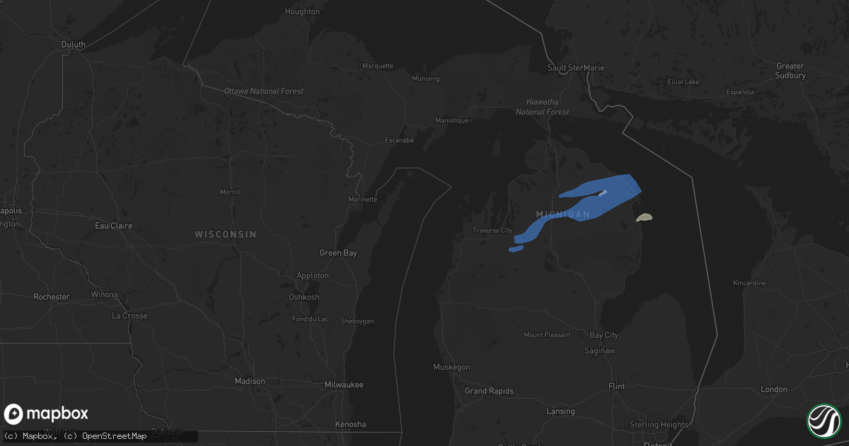
Hail Map in Michigan on August 29, 2021
Get this storm
August 29 map
$229
one time, instant access
Download today. No call, no setup
Keep the $229
Bought the map and want the full workflow? Apply the entire $229 to a subscription within 7 days. None of it is wasted.
Every map, not just this one
This buys you this map. Subscription and you get every map we run, in the markets you choose from a few cities to whole states to nationwide. Plus real-time alerts the moment a storm fires.
Contact data
Name, contact info, occupancy, even credit band for addresses in the footprint. You go from where it hit to who to call.
Become the source they trust
Unlimited branding weather history reports on demand. You already have the documented answer ready for the property owner, and you are the one who showed up with it.
Property data and RoofTrace estimates
Pull up any address you have got, its value and the exact code rules for that jurisdiction, straight from One Click Code. Then RoofTrace estimates the squares, pitch, and roof value, priced the way you price.
Storm reports in Michigan
Michigan
| Date | Description |
|---|---|
| 08/29/20216:59 PM CDT | Tree down near marsh rd and high rd in clay twp. |
| 08/29/20216:09 PM CDT | Tree snapped causing power outages in the city of adrian near miles and division st. |
| 08/29/20216:08 PM CDT | Multiple trees down. Time estimated by radar. |
| 08/29/20215:47 PM CDT | Tree damage reported via central dispatch. |
| 08/29/20215:36 PM CDT | Several trees reported down across milford and highland twp via central dispatch. |
| 08/29/20215:01 PM CDT | Trees down over the road near the intersection of m-46 and phillips road. |
| 08/29/20215:00 PM CDT | Large tree branches had to be cleared from roads in delhi township. Time estimated from nearby automated wind sensor. |
| 08/29/20215:00 PM CDT | Large tree branches had to be cleared from roads. Time estimated from nearby automated wind sensor. |
| 08/29/20214:45 PM CDT | Large tree split and fell on porch. Time estimated from nearest automated wind sensor. |
| 08/29/20214:37 PM CDT | A couple large trees down over the road near the intersection of gregory road and allen road. |
| 08/29/20214:33 PM CDT | Trees down including a tree down on a vehicle. Time estimated by radar. |
| 08/29/20214:32 PM CDT | Trees and wires reported down along pinkerton road. Time estimated based on radar. |
| 08/29/20214:32 PM CDT | A couple large trees down over the road near the intersection of gregory road and allen road. |
| 08/29/20214:20 PM CDT | Trees down. Time estimated by radar. |
| 08/29/20214:10 PM CDT | Trees down. Time estimated from radar. |
| 08/29/20213:20 PM CDT | Downed trees across 23 in ossineke. Time estimated from radar. |
| 08/29/20213:05 PM CDT | A local report indicates 60 MPH wind near 2 S PRESCOTT |
| 08/29/20212:42 PM CDT | Trees down. |
| 08/29/20212:30 PM CDT | Tree down at parnell avenue at bailey dr. |
| 08/29/20212:18 PM CDT | Report from mping: 1-inch tree limbs broken; shingles blown off. |
| 08/29/20212:05 PM CDT | Report from mping: 1-inch tree limbs broken; shingles blown off. |
| 08/29/20212:05 PM CDT | Trees down on east mullet lake rd. |
| 08/29/20211:45 PM CDT | Trees down. |
| 08/29/20211:37 PM CDT | Report from mping: 1-inch tree limbs broken; shingles blown off. |
| 08/29/20211:17 PM CDT | Delayed report. Trees down in cadillac area. Time estimated from radar. |
| 08/29/20212:00 AM CDT | At 700 PM EDT, severe thunderstorms were located along a line extending from near Grass Lake to 6 miles west of Manchester to near Onsted, moving east at 40 mph. HAZARD...60 mph wind gusts. SOURCE...Radar indicated. IMPACT...Expect damage to roofs, siding, and trees. Severe thunderstorms will be near... Manchester around 710 PM EDT. Chelsea around 715 PM EDT. Saline and Dexter around 730 PM EDT. Ann Arbor and Milan around 735 PM EDT. Ypsilanti, Dixboro, Willis and Whitmore Lake around 745 PM EDT. Salem around 755 PM EDT.Other locations impacted by these severe thunderstorms includePittsfield Township, Whittaker, Hudson Mills Metropark, Bridgewater,Delhi Mills, Pleasant Lake and Barton Hills.People attending Chelsea Community Fair should seek safe shelterimmediately! |
| 08/29/20211:45 AM CDT | At 645 PM EDT, severe thunderstorms were located along a line extending from near Cement City to near Addison to 7 miles west of Pioneer, moving east at 40 mph. HAZARD...60 mph wind gusts. SOURCE...Radar indicated. IMPACT...Expect damage to roofs, siding, and trees. Severe thunderstorms will be near... Hudson, Onsted, Addison, Cement City and Clayton around 650 PM EDT. Adrian around 710 PM EDT. Tecumseh around 715 PM EDT. Morenci around 720 PM EDT. Britton around 725 PM EDT. Blissfield around 750 PM EDT. Deerfield around 755 PM EDT.Other locations impacted by these severe thunderstorms includeSeneca, Manitou Beach-Devils Lake, Macon, Lime Creek, Munson, OgdenCenter, Canandaigua, Ridgeway, Palmyra and Tipton. |
| 08/29/20211:37 AM CDT | At 636 PM EDT, severe thunderstorms were located along a line extending from near Brown City to near Dryden to near Clarkston to near Novi, moving east at 40 mph. HAZARD...60 mph wind gusts. SOURCE...Radar indicated. IMPACT...Expect damage to roofs, siding, and trees. Severe thunderstorms will be near... Capac around 655 PM EDT. Romeo, Sterling Heights, Clinton and Emmett around 705 PM EDT. Memphis and Macomb Township around 710 PM EDT. Warren around 715 PM EDT. New Baltimore and Richmond around 725 PM EDT. Mount Clemens, Lakeport and Marysville around 730 PM EDT. St. Clair Shores and Port Huron around 735 PM EDT. St. Clair and Marine City around 745 PM EDT.Other locations impacted by these severe thunderstorms includeAnchorville, North Street, Roseville, Shelby Township, Lynn Township,Ray Center, Brockway, Utica, Washington and Fort Gratiot. |
| 08/29/20211:13 AM CDT | At 613 PM EDT, severe thunderstorms were located along a line extending from 6 miles southwest of Ubly to near Cass City to near Marlette, moving east at 40 mph. HAZARD...60 mph wind gusts. SOURCE...Radar indicated. IMPACT...Expect damage to roofs, siding, and trees. Severe thunderstorms will be near... Argyle around 630 PM EDT. Sandusky and Peck around 640 PM EDT. Deckerville around 645 PM EDT. Forestville and Carsonville around 650 PM EDT. Croswell and Applegate around 655 PM EDT. Lexington and Port Sanilac around 700 PM EDT.Other locations impacted by these severe thunderstorms include BirchBeach, McGregor, Amador, Snover, Juhl, Elmer, Valley Center, NewGreenleaf, Tyre and Decker. |
| 08/29/20211:00 AM CDT | At 600 PM EDT, a severe thunderstorm was located near Owendale, or 8 miles north of Cass City, moving east at 35 mph. HAZARD...60 mph wind gusts. SOURCE...Radar indicated. IMPACT...Expect damage to roofs, siding, and trees. This severe thunderstorm will be near... Bad Axe and Ubly around 615 PM EDT. Harbor Beach around 645 PM EDT.Other locations impacted by this severe thunderstorm include Ruth,Redman, Filion, Parisville, Helena, White Rock, Ivanhoe, Rapson andVerona. |
| 08/29/202112:58 AM CDT | At 558 PM EDT, severe thunderstorms were located along a line extending from Mayville to Davison to Fenton, moving east at 40 mph. HAZARD...60 mph wind gusts. SOURCE...Radar indicated. IMPACT...Expect damage to roofs, siding, and trees. Severe thunderstorms will be near... North Branch, Columbiaville and Clifford around 610 PM EDT. Lapeer around 615 PM EDT. Hadley and Lum around 625 PM EDT. Imlay City around 630 PM EDT. Metamora around 635 PM EDT. Brown City around 640 PM EDT. Dryden around 645 PM EDT. Almont around 655 PM EDT.Other locations impacted by these severe thunderstorms includeGoodland Township, Burnside, Attica, Elba, Kings Mill, Silverwood andThornville.People attending Metamora Country Days should seek safe shelterimmediately! |
| 08/29/202112:56 AM CDT | At 556 PM EDT, severe thunderstorms were located along a line extending from Lake Fenton to near Hartland to near Pinckney, moving east at 35 mph. HAZARD...60 mph wind gusts. SOURCE...Radar indicated. IMPACT...Expect damage to roofs, siding, and trees. Severe thunderstorms will be near... Holly around 600 PM EDT. Milford and Ortonville around 615 PM EDT. Oxford around 630 PM EDT. Clarkston around 635 PM EDT. Pontiac and Novi around 645 PM EDT. West Bloomfield around 650 PM EDT. Troy around 655 PM EDT. Southfield, Royal Oak, Birmingham and Rochester around 700 PM EDT.Other locations impacted by these severe thunderstorms includeFranklin, Keego Harbor, Waterford, Orchard Lake, Holly StateRecreation Area, Commerce, Rose Center, Lathrup Village, Auburn Hillsand Bingham Farms.People attending Meadow Brook Amphitheatre should seek safe shelterimmediately! |
| 08/29/202112:25 AM CDT | At 525 PM EDT, severe thunderstorms were located along a line extending from near Perry to near Williamston to near Stockbridge, moving east at 40 mph. HAZARD...60 mph wind gusts. SOURCE...Radar indicated. IMPACT...Expect damage to roofs, siding, and trees. Severe thunderstorms will be near... Fowlerville around 540 PM EDT. Howell around 550 PM EDT. Cohoctah and Oak Grove around 555 PM EDT. Brighton around 605 PM EDT. Hartland around 610 PM EDT.Other locations impacted by these severe thunderstorms includeParkers Corners, Chilson, Plainfield, Conway Township, TyroneTownship and Deerfield Township. |
| 08/29/202112:21 AM CDT | At 521 PM EDT, severe thunderstorms were located along a line extending from 5 miles northwest of Williamston to 6 miles east of Leslie, moving east at 35 mph. HAZARD...60 mph wind gusts. SOURCE...Radar indicated. IMPACT...Expect damage to roofs, siding, and trees. Locations impacted include... Williamston... Stockbridge... Bunker Hill... Webberville... Dansville... Fitchburg... Bell Oak... Haslett... Okemos... |
| 08/29/202112:11 AM CDT | At 510 PM EDT, severe thunderstorms were located along a line extending from near Zilwaukee to 7 miles east of St. Charles to near Owosso, moving east at 35 mph. HAZARD...60 mph wind gusts. SOURCE...Radar indicated. IMPACT...Expect damage to roofs, siding, and trees. Severe thunderstorms will be near... Montrose and Munger around 520 PM EDT. Reese around 525 PM EDT. Clio and Quanicassee around 530 PM EDT. Fairgrove and Lennon around 540 PM EDT. Akron around 545 PM EDT. Flushing, Caro, Vassar, Millington and Swartz Creek around 550 PM EDT. Mount Morris and Beecher around 600 PM EDT. Flint, Grand Blanc, Mayville and Crossroads Village around 605 PM EDT.Other locations impacted by these severe thunderstorms include Atlas,East Dayton, Tuscola, Rankin, Colling, Wilmot, Wisner, Ellington,Gilford and Argentine.People attending Ally Golf Tournament should seek safe shelterimmediately! |
| 08/28/202111:58 PM CDT | At 458 PM EDT, a severe thunderstorm was located near Pigeon, or 7 miles southwest of Caseville, moving east at 45 mph. HAZARD...60 mph wind gusts. SOURCE...Radar indicated. IMPACT...Expect damage to roofs, siding, and trees. This severe thunderstorm will be near... Caseville around 505 PM EDT. Elkton around 510 PM EDT. Bad Axe around 520 PM EDT. Kinde around 525 PM EDT. Port Hope around 540 PM EDT.Other locations impacted by this severe thunderstorm include Redman,Parisville, Huron City, White Rock, Ivanhoe, Rapson, Grindstone City,Bay Port, Pinnebog and Ruth. |
| 08/28/202111:30 PM CDT | At 430 PM EDT, severe thunderstorms were located along a line extending from near Merrill to 9 miles north of St. Johns to 7 miles northwest of Dewitt, moving east at 35 mph. HAZARD...60 mph wind gusts. SOURCE...Radar indicated. IMPACT...Expect damage to roofs, siding, and trees. Severe thunderstorms will be near... Merrill around 435 PM EDT. Marion Springs around 455 PM EDT. Laingsburg around 500 PM EDT. Zilwaukee, Oakley and Bridgeport around 505 PM EDT. Saginaw, Chesaning and St. Charles around 510 PM EDT. Owosso around 515 PM EDT. Corunna and Henderson around 520 PM EDT. New Lothrop and Lennon around 535 PM EDT.Other locations impacted by these severe thunderstorms include Brant,Nelson, Carrollton, Garfield, Arthur, Fenmore, Burt, Gera, BuenaVista Township and Layton Corners.People attending Huntington Event Park should seek safe shelterimmediately! |
| 08/28/202111:04 PM CDT | At 404 PM EDT, a severe thunderstorm was located near Portland, moving east at 40 mph. HAZARD...60 mph wind gusts and penny size hail. SOURCE...Radar indicated. IMPACT...Expect damage to roofs, siding, and trees. Locations impacted include... St. Johns... Portland... Elsie... Eureka... Ovid... Fowler... Westphalia... Lyons... Muir... Pewamo... |
| 08/28/202110:36 PM CDT | At 336 PM EDT, severe thunderstorms were located along a line extending from near Garland to near Luzerne to St. Helen, moving east at 50 mph. HAZARD...60 mph wind gusts. SOURCE...Radar indicated. IMPACT...Expect damage to roofs, siding, and trees. Severe thunderstorms will be near... Mio, Comins and Mack Lake around 345 PM EDT. Fairview around 350 PM EDT. McKinley and Rose City around 355 PM EDT.Other locations in the path of these severe thunderstorms includeRose Township, Lupton and Rifle River State Park. |
| 08/28/202110:26 PM CDT | At 326 PM EDT, a severe thunderstorm was located 6 miles south of Lowell, moving east at 25 mph. HAZARD...60 mph wind gusts and penny size hail. SOURCE...Radar indicated. IMPACT...Expect damage to roofs, siding, and trees. Locations impacted include... Lowell... Lake Odessa... Saranac... Freeport... Woodland... Clarksville... Woodbury... Alto... |
| 08/28/202110:22 PM CDT | At 322 PM EDT, severe thunderstorms were located along a line extending from near Forty Mile Point to 6 miles southwest of Bisma Township to Garland, moving northeast at 35 mph. HAZARD...60 mph wind gusts. SOURCE...Radar indicated. IMPACT...Expect damage to roofs, siding, and trees. Severe thunderstorms will be near... P H Hoeft State Park around 325 PM EDT. Royston around 330 PM EDT. Bisma Township around 335 PM EDT. Loud Township and Hawks around 340 PM EDT.Other locations in the path of these severe thunderstorms includeAtlanta, Metz, Lockwood Lake, Posen, Hagensville, Rogers City andFletcher Pond. |
| 08/28/202110:18 PM CDT | At 317 PM EDT, a severe thunderstorm was located 13 miles west of Roosevelt Park, or 14 miles west of Muskegon, moving east at 45 mph. HAZARD...60 mph wind gusts and quarter size hail. SOURCE...Radar indicated. IMPACT...Hail damage to vehicles is expected. Expect wind damage to roofs, siding, and trees. Locations impacted include... Muskegon... Muskegon Heights... Roosevelt Park... North Muskegon... Lakewood Club... Fruitport... Norton Shores... Dalton... Holton... Sullivan... Brunswick... Muskegon SP... Wolf Lake... Duck Lake SP... Twin Lake... Cloverville... |
| 08/28/202110:01 PM CDT | At 301 PM EDT, severe thunderstorms were located along a line extending from near Grayling to near North Higgins Lake to 6 miles north of Moddersville, moving northeast at 50 mph. HAZARD...60 mph wind gusts. SOURCE...Radar indicated. IMPACT...Expect damage to roofs, siding, and trees. Severe thunderstorms will be near... Grayling and North Higgins Lake around 305 PM EDT. Higgins Lake and Roscommon County Airport around 320 PM EDT.Other locations in the path of these severe thunderstorms includeLovells, South Higgins Lake, Roscommon, Garland, Lewiston, Red Oak,South Branch Township and Luzerne. |
| 08/28/20219:55 PM CDT | At 254 PM EDT, severe thunderstorms were located along a line extending from near Wolverine to near Vanderbilt to near Waters, moving northeast at 55 mph. HAZARD...60 mph wind gusts. SOURCE...Radar indicated. IMPACT...Expect damage to roofs, siding, and trees. Severe thunderstorms will be near... Wolverine and Afton around 300 PM EDT. Pickerel Lake and Eastern Corwith Township around 305 PM EDT. Johannesburg and Tower around 310 PM EDT.Other locations in the path of these severe thunderstorms includeHetherton, Ocqueoc, Allis Township, Tomahawk Creek Flooding, Onaway,Briley Township, Atlanta, Millersburg, Canada Creek Ranch and FortyMile Point. |
| 08/28/20219:28 PM CDT | At 228 PM EDT, severe thunderstorms were located along a line extending from near Jordan Township to near Clam River to near Williamsburg, moving northeast at 55 mph. HAZARD...60 mph wind gusts. SOURCE...Radar indicated. IMPACT...Expect damage to roofs, siding, and trees. Severe thunderstorms will be near... Warner Township around 235 PM EDT. Vanderbilt and Jordan Township around 245 PM EDT.Other locations in the path of these severe thunderstorms includeAlba, Elmira and Gaylord. |
| 08/28/20219:17 PM CDT | At 217 PM EDT, severe thunderstorms were located along a line extending from near Clarion to Young State Park to near East Jordan, moving northeast at 45 mph. HAZARD...60 mph wind gusts. SOURCE...Radar indicated. IMPACT...Expect damage to roofs, siding, and trees. Severe thunderstorms will be near... Walloon Lake and Oden around 225 PM EDT. Alanson and Clarion around 230 PM EDT.Other locations in the path of these severe thunderstorms includeVanderbilt and Wolverine. |
| 08/28/20219:16 PM CDT | At 215 AM EDT, a severe thunderstorm was located over Midland, moving northeast at 30 mph. HAZARD...60 mph wind gusts and penny size hail. SOURCE...Radar indicated. IMPACT...Expect damage to roofs, siding, and trees. This severe thunderstorm will be near... Auburn around 225 AM EDT. Kawkawlin and Linwood around 240 AM EDT. Pinconning around 255 AM EDT.Other locations impacted by this severe thunderstorm include Crump,Willard and Bay City State Recreation Area. |
| 08/28/20219:12 PM CDT | At 212 PM EDT, severe thunderstorms were located along a line extending from near South Boardman to near Fife Lake to near Meauwataka, moving northeast at 50 mph. HAZARD...60 mph wind gusts. SOURCE...Radar indicated. IMPACT...Expect damage to roofs, siding, and trees. Severe thunderstorms will be near... Kalkaska and South Boardman around 220 PM EDT. Darragh around 225 PM EDT.Other locations in the path of these severe thunderstorms includeSigma, Sharon and Moorestown. |
| 08/28/20218:58 PM CDT | At 158 PM EDT, severe thunderstorms were located along a line extending from near Levering to near Pleasant View to near Bayshore, moving east at 40 mph. HAZARD...60 mph wind gusts. SOURCE...Radar indicated. IMPACT...Expect damage to roofs, siding, and trees. Severe thunderstorms will be near... Carp Lake and Levering around 205 PM EDT. Pellston and Brutus around 210 PM EDT.Other locations in the path of these severe thunderstorms includeCheboygan, Reasoners Corner, Alanson, Burt Lake, Mullet Lake, BurtLake State Park, Indian River, Topinabee, Alverno, Cheboygan StatePark, Aloha, Aloha State Park, Nine Mile Point and Koehler Township. |
| 08/28/20218:39 PM CDT | At 138 PM EDT, severe thunderstorms were located along a line extending from near Kinross to 8 miles east of Allenville to near Wilderness State Park, moving northeast at 45 mph. HAZARD...60 mph wind gusts. SOURCE...Radar indicated. IMPACT...Expect damage to roofs, siding, and trees. Severe thunderstorms will be near... Barbeau and Donaldson around 150 PM EDT. Straits State Park around 155 PM EDT.Other locations in the path of these severe thunderstorms include St.Ignace, Mackinac Island, Evergreen Shores, Pickford, Kelden,Munuscong, Hessel and Cedarville. |
| 08/28/20218:37 PM CDT | At 136 PM EDT, severe thunderstorms were located along a line extending from near Fishermans Island State Park to Peshawbestown to near Lake Ann, moving northeast at 50 mph. HAZARD...60 mph wind gusts. SOURCE...Radar indicated. IMPACT...Expect damage to roofs, siding, and trees. Severe thunderstorms will be near... Charlevoix and Fishermans Island State Park around 140 PM EDT. Norwood, Bayshore and Mapleton around 150 PM EDT. Elk Rapids, Harbor Springs and Ironton around 155 PM EDT.Other locations in the path of these severe thunderstorms includeHorton Bay, Kewadin, Petoskey, Torch Lake, Central Lake, Clarion,Walloon Lake, Ellsworth, Bay View, Petoskey State Park, Boyne City,East Jordan, Conway, Alanson, Oden, Young State Park and JordanTownship. |
All States Impacted by Hail Map on August 29, 2021
Cities Impacted by Hail Map on August 29, 2021
- Union, MI
- Vandalia, MI
- Cassopolis, MI
- Jones, MI
- Stout, OH
- Quincy, KY
- Elkview, WV
- Carrolltown, PA
- Elmora, PA
- Thurman, OH
- Bidwell, OH
- Wellston, OH
- Jackson, OH
- Oak Hill, OH
- Vinton, OH
- Homer, IL
- Fairmount, IL
- Leon, WV
- Eolia, MO
- Bowling Green, MO
- Gallipolis, OH
- West Columbia, WV
- Cheshire, OH
- Point Pleasant, WV
- Burdett, KS
- Macy, IN
- Balko, OK
- Beaver, OK
- Monticello, IN
- Clendenin, WV
- Dundee, IL
- Carpentersville, IL
- Barrington, IL
- Hot Springs, VA
- Perryton, TX
- Spearman, TX
- Kendallville, IN
- Bremen, OH
- Lancaster, OH
- Logan, OH
- Sugar Grove, OH
- Covington, VA
- Yucca, AZ
- Peterstown, WV
- Given, WV
- Alum Creek, WV
- Belleville, MI
- Romulus, MI
- West Newton, PA
- Hiwassee, VA
- Pulaski, VA
- Gandeeville, WV
- Constantine, MI
- Nicktown, PA
- Saint Benedict, PA
- Marsteller, PA
- Northern Cambria, PA
- Ebensburg, PA
- Parkersburg, WV
- Mineral Wells, WV
- Northfork, WV
- Goodman, MO
- Neosho, MO
- Coolville, OH
- Guysville, OH
- Stewart, OH
- Cutler, OH
- Waynesburg, PA
- Jenera, OH
- Bluffton, OH
- Elwood, IN
- Tipton, IN
- Frankfort, IN
- Hinton, WV
- Pipestem, WV
- Jefferson, CO
- Noblesville, IN
- Cicero, IN
- Walker, WV
- Elizabeth, WV
- Bowling Green, OH
- Wellton, AZ
- Lehigh Acres, FL
- Fort Myers, FL
- Alderson, WV
- Talcott, WV
- Pence Springs, WV
- Athens, OH
- The Plains, OH
- North Vernon, IN
- Indore, WV
- Maysel, WV
- Procious, WV
- Hillman, MI
- Charleston, WV
- Cherry Tree, PA
- Colver, PA
- Alverda, PA
- Hastings, PA
- Spangler, PA
- Clymer, PA
- Mentcle, PA
- Floyd, VA
- Riner, VA
- Pilot, VA
- Nitro, WV
- Saint Albans, WV
- Gambier, OH
- Martinsburg, OH
- Howard, OH
- Nashport, OH
- Hopewell, OH
- Zanesville, OH
- Anderson, IN
- Frankton, IN
- Alexandria, IN
- Aliquippa, PA
- Decatur, IN
- Hoagland, IN
- Niles, MI
- Edwardsburg, MI
- Stinnett, TX
- Morrow, OH
- Smithton, PA
- Rillton, PA
- Belle Vernon, PA
- Herminie, PA
- Darragh, PA
- Irwin, PA
- Koshkonong, MO
- Petersburg, IN
- Otwell, IN
- Clarksville, OH
- Sheridan, IN
- Westfield, IN
- Davisville, WV
- Ossineke, MI
- Dolan Springs, AZ
- Sharpsville, PA
- Clark, PA
- Transfer, PA
- Fredonia, PA
- Windfall, IN
- Pearisburg, VA
- Blacksburg, VA
- Parrott, VA
- Chalmette, LA
- Stennis Space Center, MS
- Vacherie, LA
- Folsom, LA
- Long Beach, MS
- Baton Rouge, LA
- Monticello, MS
- Livingston, LA
- Berwick, LA
- Kenner, LA
- Addis, LA
- Houma, LA
- Abita Springs, LA
- Reserve, LA
- Walker, LA
- Meadville, MS
- Baker, LA
- Covington, LA
- Zachary, LA
- Morgan City, LA
- Lockport, LA
- Belle Chasse, LA
- Angie, LA
- Port Allen, LA
- Theriot, LA
- Des Allemands, LA
- Loranger, LA
- Golden Meadow, LA
- Denham Springs, LA
- Sandy Hook, MS
- Montegut, LA
- Geismar, LA
- Metairie, LA
- Sunshine, LA
- Gray, LA
- Pride, LA
- Pass Christian, MS
- Destrehan, LA
- Pine Grove, LA
- Ruth, MS
- Jayess, MS
- Tylertown, MS
- Summit, MS
- Fluker, LA
- Smithdale, MS
- Clinton, LA
- Diamondhead, MS
- Labadieville, LA
- Cut Off, LA
- Gibson, LA
- Port Sulphur, LA
- Norwood, LA
- New Orleans, LA
- Kiln, MS
- Sorrento, LA
- Ponchatoula, LA
- Tickfaw, LA
- Pearlington, MS
- Greensburg, LA
- Marrero, LA
- Norco, LA
- Violet, LA
- Paradis, LA
- Donaldsonville, LA
- Carriere, MS
- Mount Airy, LA
- Barataria, LA
- Bay Saint Louis, MS
- Greenwell Springs, LA
- Raceland, LA
- Franklinton, LA
- Bude, MS
- Pearl River, LA
- Arabi, LA
- Mandeville, LA
- Jackson, LA
- Osyka, MS
- Boutte, LA
- Ethel, LA
- Lacombe, LA
- Saint Rose, LA
- White Castle, LA
- Edgard, LA
- Schriever, LA
- Kokomo, MS
- Pierre Part, LA
- Gheens, LA
- Bogalusa, LA
- La Place, LA
- Ama, LA
- Gramercy, LA
- Saucier, MS
- Wesson, MS
- Gonzales, LA
- Donner, LA
- Garyville, LA
- Centreville, MS
- Galliano, LA
- Prairieville, LA
- Bush, LA
- Crosby, MS
- Columbia, MS
- Plaquemine, LA
- Gretna, LA
- Lafitte, LA
- Robert, LA
- Paulina, LA
- Saint Gabriel, LA
- Holden, LA
- McCall Creek, MS
- Independence, LA
- Slidell, LA
- Wilson, LA
- Belle Rose, LA
- Napoleonville, LA
- Carville, LA
- Saint Amant, LA
- Liberty, MS
- Amite, LA
- Bogue Chitto, MS
- Picayune, MS
- Roxie, MS
- Biloxi, MS
- Buras, LA
- Mount Hermon, LA
- Bourg, LA
- Meraux, LA
- Hammond, LA
- Albany, LA
- Perkinston, MS
- Magnolia, MS
- Gloster, MS
- Convent, LA
- Grand Isle, LA
- Husser, LA
- Sontag, MS
- Poplarville, MS
- Madisonville, LA
- Brookhaven, MS
- Slaughter, LA
- Dulac, LA
- Roseland, LA
- Luling, LA
- Darrow, LA
- Larose, LA
- Waveland, MS
- Foxworth, MS
- Harvey, LA
- Mccomb, MS
- Saint James, LA
- Gulfport, MS
- Lutcher, LA
- Venice, LA
- Chauvin, LA
- Thibodaux, LA
- Union Church, MS
- Kentwood, LA
- Mathews, LA
- French Settlement, LA
- Westwego, LA
- Springfield, LA
- Plattenville, LA
- Maurepas, LA
- Saint Bernard, LA
- Braithwaite, LA
- Hahnville, LA
- Gulf Shores, AL
- Vancleave, MS
- Ocean Springs, MS
- Gautier, MS
- Coden, AL
- Theodore, AL
- Chunchula, AL
- Deer Park, AL
- McIntosh, AL
- Citronelle, AL
- Wagarville, AL
- Moss Point, MS
- Dickinson, AL
- Stockton, AL
- Gainestown, AL
- Whatley, AL
- Satsuma, AL
- Saraland, AL
- Uriah, AL
- Little River, AL
- Jackson, AL
- Thomasville, AL
- Creola, AL
- Mobile, AL
- Lower Peach Tree, AL
- Grove Hill, AL
- Troy, AL
- Panama City, FL
- Panama City Beach, FL
- Sandersville, GA
- Warthen, GA
- Mitchell, GA
- Gibson, GA
- Avera, GA
- Dothan, AL
- Casar, NC
- Mooresboro, NC
- Ellenboro, NC
- Shelby, NC
- Lawndale, NC
- Rutherfordton, NC
- Mill Spring, NC
- Radford, VA
- Christiansburg, VA
- Newton, AL
- Slocomb, AL
- Midland City, AL
- Fife Lake, MI
- South Boardman, MI
- Posen, MI
- Frederic, MI
- Onaway, MI
- Kalkaska, MI
- Lewiston, MI
- Hawks, MI
- Herron, MI
- Atlanta, MI
- Comins, MI
- Gaylord, MI
- Mancelona, MI
- Rogers City, MI
- Johannesburg, MI
- Alpena, MI
- Lachine, MI
- Millersburg, MI
- Vanderbilt, MI
- Presque Isle, MI
- Vaughn, NM


