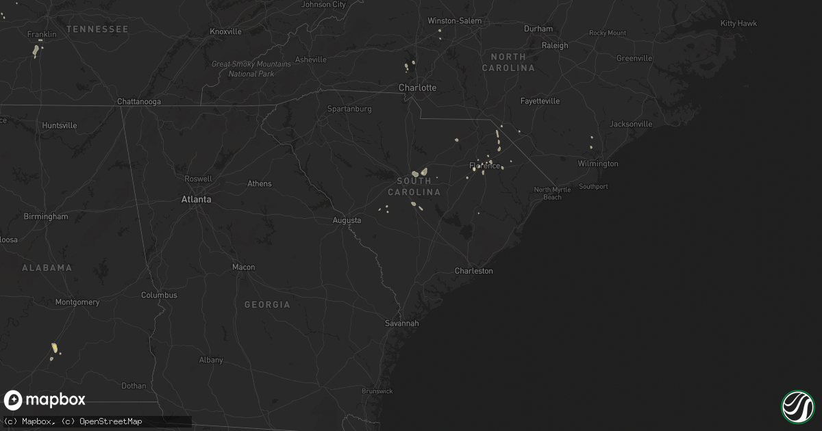
Hail Map in South Carolina on August 26, 2023
Get this storm
August 26 map
$229
one time, instant access
Download today. No call, no setup
Keep the $229
Bought the map and want the full workflow? Apply the entire $229 to a subscription within 7 days. None of it is wasted.
Every map, not just this one
This buys you this map. Subscription and you get every map we run, in the markets you choose from a few cities to whole states to nationwide. Plus real-time alerts the moment a storm fires.
Contact data
Name, contact info, occupancy, even credit band for addresses in the footprint. You go from where it hit to who to call.
Become the source they trust
Unlimited branding weather history reports on demand. You already have the documented answer ready for the property owner, and you are the one who showed up with it.
Property data and RoofTrace estimates
Pull up any address you have got, its value and the exact code rules for that jurisdiction, straight from One Click Code. Then RoofTrace estimates the squares, pitch, and roof value, priced the way you price.
Storm reports in South Carolina
South Carolina
| Date | Description |
|---|---|
| 08/26/20236:35 PM CDT | Tree down blocking both lanes on columbia rd near big beaver creek rd. Time estimated based on radar. |
| 08/26/20236:20 PM CDT | Report of tree down near britton rd and boots branch rd. And another on camp branch rd. Time estimated based on radar. |
| 08/26/20235:30 PM CDT | Tree down near fireson rd and charles jackson st. Time estimated based on radar. |
| 08/26/20235:21 PM CDT | Emergency manager and media reports with photos of a roof blown off a commercial building at charleston highway and lafayette ave. Time estimated. |
| 08/26/20235:19 PM CDT | Severe reports of trees and large limbs down with minor structural damage in west columbia... From arlington avenue to b avenue. Time estimated. |
| 08/26/20235:00 PM CDT | Multiple trees down in sesquicentennial state park. |
| 08/26/20234:57 PM CDT | Sc highway patrol reported powerlines in roadway on clemson road and i20. Time estimated. |
| 08/26/20234:24 PM CDT | Nazareth road impassable due to large tree down on roadway. |
| 08/26/20234:15 PM CDT | Tree and power lines down near us 321 and wildflower rd. |
| 08/26/20233:43 PM CDT | Trained spotter relayed trees down and power outages in the johnston hwy/burton rd area. Time estimated by spotter. Another spotter provided pictures of social media of |
| 08/25/202310:22 PM CDT | One tree blown down just east of highway 18 off of corinth road. |
| 08/25/20237:37 PM CDT | Trees down on vance rd near the intersections with camden rd and old number six hwy. Time estimated based on radar. |
| 08/25/20237:37 PM CDT | Trees down on vance rd near the intersections with camden rd and old number six hwy. Time est |
All States Impacted by Hail Map on August 26, 2023
Cities Impacted by Hail Map on August 26, 2023
- Mokane, MO
- Fulton, MO
- Jerseyville, IL
- Grafton, IL
- Portage Des Sioux, MO
- Alton, MO
- Wichita Falls, TX
- Sheppard Afb, TX
- Waurika, OK
- Duncan, OK
- Marlow, OK
- Couch, MO
- Saint Amant, LA
- Irwin, ID
- Doniphan, MO
- Florence, SC
- Batesville, AR
- Sidney, AR
- Cave City, AR
- Horseshoe Bend, AR
- Evening Shade, AR
- Poplar Bluff, MO
- Martin, TN
- Dresden, TN
- Montello, NV
- Oakley, ID
- Benton, KY
- Mammoth Spring, AR
- Ravenden, AR
- Dickson, TN
- Swan Valley, ID
- Pocahontas, AR
- Ravenden Springs, AR
- Warm Springs, AR
- Malad City, ID
- Myrtle, MO
- Laurinburg, NC
- Sturkie, AR
- Cadiz, KY
- Latta, SC
- Smithville, AR
- Strawberry, AR
- Baton Rouge, LA
- Wingo, KY
- Sedalia, KY
- Fulton, KY
- Sulphur Rock, AR
- Greenville, AL
- Fancy Farm, KY
- Fair Grove, MO
- Strafford, MO
- Burgaw, NC
- Willard, NC
- Marshfield, MO
- Williamsville, MO
- Franklinton, LA
- Amite, LA
- Palmyra, TN
- Judsonia, AR
- Searcy, AR
- Charlotte, TN
- Kuttawa, KY
- Sikeston, MO
- Benton, MO
- Oran, MO
- Charleston, MO
- Bauxite, AR
- England, AR
- Marble Hill, MO
- Chaffee, MO
- Whitewater, MO
- Advance, MO
- Cherokee Village, AR
- Hardy, AR
- Romance, AR
- Mount Vernon, AR
- Williford, AR
- El Paso, AR
- Napoleonville, LA
- Moody, MO
- Rowland, NC
- Mountain View, AR
- Newark, AR
- Charlotte, AR
- Cord, AR
- Salem, AR
- West Plains, MO
- Winnfield, LA
- Quitman, AR
- Ash Flat, AR
- Darlington, SC
- Currie, NC
- Driggs, ID
- Tetonia, ID
- Marion, SC
- Broseley, MO
- Fisk, MO
- Enterprise, OR
- Saint James, LA
- Springfield, LA
- Hickory, KY
- Boaz, KY
- Caulfield, MO
- South Fulton, TN
- Timmonsville, SC
- Cairo, IL
- Dover, TN
- Big Rock, TN
- Indian Mound, TN
- Thompsons Station, TN
- Spring Hill, TN
- Qulin, MO
- Mayfield, KY
- Gatewood, MO
- New Concord, KY
- Murray, KY
- Cunningham, TN
- Gonzales, LA
- Prairieville, LA
- Elizabethtown, IL
- Franklin, TN
- Bertrand, MO
- Hazel, KY
- Woodlawn, TN
- Clarksville, TN
- Glenallen, MO
- Patton, MO
- Beebe, AR
- Harrisburg, AR
- Fremont, MO
- Columbia, TN
- Clio, SC
- McColl, SC
- Hartman, AR
- Clarksville, AR
- Ryan, OK
- Ririe, ID
- Tiline, KY
- Grand Rivers, KY
- Smithland, KY
- Mount Pleasant, AR
- Grandin, MO
- Eddyville, KY
- McBee, SC
- Tishomingo, OK
- Davis, OK
- Sulphur, OK
- Dougherty, OK
- Springer, OK
- Ardmore, OK
- Turrell, AR
- Lonoke, AR
- Florence, AL
- Montpelier, ID
- Carlisle, AR
- Salley, SC
- Wagener, SC
- Dalzell, SC
- Rembert, SC
- Burley, ID
- Rose Bud, AR
- Scott, AR
- Saint Matthews, SC
- Pearl River, LA
- Snowville, UT
- Des Arc, AR
- Heber Springs, AR
- Soda Springs, ID
- Lugoff, SC
- Columbia, SC
- Rogersville, MO
- McKenzie, AL
- Georgiana, AL
- Hazen, AR
- Burns, OR
- Biscoe, AR
- Greenbrier, AR
- Damascus, AR
- Tucker, AR
- Loveland, OK
- Effingham, SC
- Salters, SC
- Marion, AR
- Ratliff City, OK
- Iron City, TN
- Howell, UT
- Comanche, TX
- Mocksville, NC
- Trumann, AR
- Jessieville, AR
- Mountain Pine, AR
- Pangburn, AR
- Kuna, ID
- Denver, NC
- Lynchburg, SC
- Stanley, NC
- Mooresville, NC
- Orangeburg, SC
- Altheimer, AR
- West Memphis, AR
- Richland, GA
- Aubrey, AR
- Marianna, AR
- Moro, AR
- Memphis, TN
- Helena, AR
- West Helena, AR
- Bumpus Mills, TN
- Boise, ID


