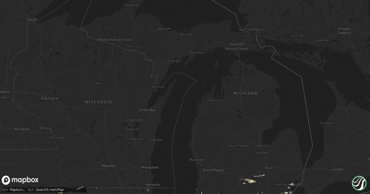
Hail Map in Michigan on August 26, 2014
Get this storm
August 26 map
$229
one time, instant access
Download today. No call, no setup
Keep the $229
Bought the map and want the full workflow? Apply the entire $229 to a subscription within 7 days. None of it is wasted.
Every map, not just this one
This buys you this map. Subscription and you get every map we run, in the markets you choose from a few cities to whole states to nationwide. Plus real-time alerts the moment a storm fires.
Contact data
Name, contact info, occupancy, even credit band for addresses in the footprint. You go from where it hit to who to call.
Become the source they trust
Unlimited branding weather history reports on demand. You already have the documented answer ready for the property owner, and you are the one who showed up with it.
Property data and RoofTrace estimates
Pull up any address you have got, its value and the exact code rules for that jurisdiction, straight from One Click Code. Then RoofTrace estimates the squares, pitch, and roof value, priced the way you price.
Storm reports in Michigan
Michigan
| Date | Description |
|---|---|
| 08/26/20144:30 PM CDT | Two 6 inch diameter branches down at 19 mile and schoenherr |
| 08/26/20144:22 PM CDT | Front door blown off of a rite aid store at 15 and gratiot. Time estimated from radar. |
| 08/26/20144:15 PM CDT | A large tree limb fell onto a power line on carol ave. Several tree limbs down throughout the neighborhood. Estimated wind speed near 70 mph. |
| 08/26/20144:14 PM CDT | 30 inch diameter trees downed |
| 08/26/20144:10 PM CDT | Metal fence and gate was partially blown over and power lines were blown down. |
| 08/26/20144:09 PM CDT | 6.5 inch diameter tree downed at davis and 8th |
| 08/26/20144:00 PM CDT | Numerous large limbs up to 2 feet in diameter down across berkley |
| 08/26/20143:55 PM CDT | Picture sent of large tree uprooted |
| 08/26/20143:54 PM CDT | 8 inch diameter trees down at 9 mile and greenfield roads. Also pea sized hail. |
| 08/26/20143:50 PM CDT | Large limb down. Picture sent via facebook. |
| 08/26/20143:50 PM CDT | Picture sent of large tree uprooted |
| 08/26/20143:46 PM CDT | 2 foot diameter tree down. Warren rd and outer drive area. |
| 08/26/20143:45 PM CDT | Several trees down at 13 1/2 mile and telegraph |
| 08/26/20143:45 PM CDT | Numerous branches 4 to 8 inches in diameter down on niagra lane in bloomfield township |
| 08/26/20143:40 PM CDT | Tree limb the size of a car down near cherry hill and wayne rd. Time estimated from radar. |
| 08/26/20143:37 PM CDT | 2 inch tree limbs downed at west chicago and farmington roads |
| 08/26/20143:34 PM CDT | A local report indicates 60 MPH wind near 5 ENE CANTON |
| 08/26/20143:30 PM CDT | Multiple 6 inch trees down. |
| 08/26/20143:20 PM CDT | Estimated at i-94 and state street |
| 08/26/20143:18 PM CDT | 6 to 8 inch diameter tree limbs down. |
| 08/26/20143:15 PM CDT | Multiple trees and power lines down. Corrected time. |
| 08/26/20142:25 PM CDT | A local report indicates 60 MPH wind near 1 NW OKEMOS |
| 08/26/20142:15 PM CDT | Multiple trees and power lines down. |
| 08/26/20141:47 PM CDT | Tree limbs of 2 inch diameter and greater reported down. |
| 08/26/201412:20 PM CDT | South haven glerl site. |
All States Impacted by Hail Map on August 26, 2014
Cities Impacted by Hail Map on August 26, 2014
- Salina, KS
- Conway, MO
- Long Lane, MO
- Clifton, KS
- Louisburg, MO
- Urbana, MO
- Hopkins, MO
- Maryville, MO
- Burlington Junction, MO
- Pickering, MO
- Clearmont, MO
- Las Animas, CO
- Kim, CO
- Chugwater, WY
- Rensselaer, IN
- Remington, IN
- Williamston, MI
- Yucca, AZ
- Bagdad, AZ
- Phillipsburg, MO
- Pine Ridge, SD
- Harrison, NE
- Hay Springs, NE
- Pittsburg, KS
- Weir, KS
- Cherokee, KS
- Manderson, SD
- Allen, SD
- Rushville, NE
- Batesland, SD
- Porcupine, SD
- Chadron, NE
- Wounded Knee, SD
- Concordia, KS
- South Bend, IN
- New Carlisle, IN
- North Liberty, IN
- Parker, AZ
- Gypsum, KS
- Monticello, IN
- Wilsonville, NE
- Crawford, NE
- Whitney, NE
- Hurricane, UT
- Lake In The Hills, IL
- Algonquin, IL
- Huntley, IL
- Oxford, IN
- Templeton, IN
- Otterbein, IN
- Viola, KS
- Cheney, KS
- Rutherford, TN
- Dyer, TN
- Richland, MO
- Winamac, IN
- Kensington, KS
- Linn, MO
- Freeburg, MO
- Loose Creek, MO
- Culver, IN
- Council Grove, KS
- Gering, NE
- Scottsbluff, NE
- Mayhill, NM
- El Dorado Springs, MO
- Sheldon, MO
- Selden, KS
- Muscatine, IA
- Davenport, IA
- Blue Grass, IA
- Illinois City, IL
- Montpelier, IA
- Jamestown, KS
- Dowagiac, MI
- Supai, AZ
- Colorado City, AZ
- Prescott, AZ
- Walkerton, IN
- Plymouth, IN
- Congress, AZ
- Kirkland, AZ
- Whiteriver, AZ
- Bennett, CO
- Watkins, CO
- Skull Valley, AZ
- Crete, IL
- Bristol, IN
- Middlebury, IN
- Morgan, UT
- La Porte, IN
- Oxford, NE
- Lafayette, IN
- Preston, MO
- Cascade, IA
- Marsland, NE
- Genoa, IL
- Garden Prairie, IL
- Union, IL
- Belvidere, IL
- Hampshire, IL
- Cherry Valley, IL
- Rockford, IL
- Marengo, IL
- Danville, IL
- German Valley, IL
- Abilene, KS
- Lebanon, MO
- Seguin, TX
- Stoutland, MO
- Westboro, MO
- Tarkio, MO
- Rock Port, MO
- Kewanna, IN
- Star City, IN
- Macy, IN
- Evergreen, CO
- Morrison, CO
- Lebanon, NE
- Union Mills, IN
- Newburg, MO
- Rolla, MO
- Rossville, IN
- Mulberry, IN
- Willshire, OH
- Berne, IN
- Decatur, IN
- Rockford, OH
- Celina, OH
- Coldwater, OH
- Geneva, IN
- Monroe, IN
- Brookville, KS
- Harper, KS
- Norwich, KS
- Matteson, IL
- Monee, IL
- Richton Park, IL
- Northboro, IA
- Shenandoah, IA
- Coin, IA
- Farragut, IA
- Blanchard, IA
- Crocker, MO
- Morris, IL
- Lamar, CO
- Veedersburg, IN
- Clarinda, IA
- Syracuse, KS
- Marshfield, MO
- Knox, IN
- Wilmington, IL
- Braidwood, IL
- Joliet, IL
- New Lenox, IL
- Monon, IN
- Wolcott, IN
- Reynolds, IN
- Chalmers, IN
- Albany, MO
- Darlington, MO
- Okemos, MI
- Wadsworth, IL
- Lake Villa, IL
- Gardner, IL
- Mazon, IL
- Winslow, IL
- Worthington, IA
- Farley, IA
- Kingman, IN
- Prophetstown, IL
- Glendale, UT
- Pine Village, IN
- Saint Louis, MO
- Bartley, NE
- Gaines, MI
- Byron, MI
- Bancroft, MI
- Linden, MI
- Columbia, MO
- Rochester, IN
- Kentland, IN
- Morocco, IN
- Brook, IN
- Donovan, IL
- Hopkinton, IA
- Paxico, KS
- Alma, KS
- East Dubuque, IL
- Galena, IL
- Grosse Pointe, MI
- Detroit, MI
- Pecatonica, IL
- Ridott, IL
- Baileyville, IL
- Freeport, IL
- Milford, IL
- Ambia, IN
- Belleville, KS
- Falcon, MO
- Heartwell, NE
- Morrice, MI
- Perry, MI
- Romulus, MI
- Belleville, MI
- Cambridge, NE
- Clearwater, KS
- West Lafayette, IN
- Maquoketa, IA
- Stockton, MO
- Chelsea, MI
- New Paris, IN
- Syracuse, IN
- Goshen, IN
- Fowler, IN
- Earl Park, IN
- Buffalo, MO
- Auburn, KS
- Topeka, KS
- Oracle, AZ
- Wamego, KS
- Maple Hill, KS
- McFarland, KS
- Mooreland, OK
- Attica, IN
- Medaryville, IN
- Bernard, IA
- Tunas, MO
- Fort Supply, OK
- Covington, IN
- Palmer, KS
- Linn, KS
- Elmo, MO
- Braddyville, IA
- Wheatfield, IN
- Edison, NE
- Shannon, IL
- Hamlet, IN
- Hanna, IN
- Bangor, MI
- Grand Junction, MI
- Dresden, KS
- Camdenton, MO
- Montreal, MO
- Eagleville, MO
- Hatfield, MO
- Williamsburg, IN
- Moundridge, KS
- Overbrook, KS
- Quenemo, KS
- Royal Center, IN
- Lake Village, IN
- Channahon, IL
- South Haven, MI
- Crown Point, IN
- Merrillville, IN
- Shorewood, IL
- Crest Hill, IL
- Schneider, IN
- Rockville, MO
- Chamois, MO
- Morrison, MO
- Chrisman, IL
- Ridge Farm, IL
- Georgetown, IL
- Indianola, IL
- Metcalf, IL
- Dana, IN
- Cayuga, IN
- Watson, MO
- Woodward, OK
- Harrison Township, MI
- Mount Clemens, MI
- Clinton Township, MI
- Hermann, MO
- Winnebago, IL
- Martinsville, MO
- Yorkville, IL
- Oswego, IL
- Plainfield, IL
- Minooka, IL
- Benton Harbor, MI
- Eau Claire, MI
- Fountain City, IN
- Lansing, MI
- East Lansing, MI
- Fowlerville, MI
- Mason, MI
- Webberville, MI
- Miles, IA
- Sabula, IA
- Hillsdale, IL
- Mishawaka, IN
- Granger, IN
- Denver, MO
- Kingman, KS
- Murdock, KS
- Colby, KS
- Macks Creek, MO
- Valparaiso, IN
- Wanatah, IN
- Kouts, IN
- Perrysville, IN
- Sheridan Lake, CO
- Weston, CO
- Trinidad, CO
- Des Plaines, IL
- Elkhart, IN
- Grovespring, MO
- New Hampton, MO
- La Crosse, IN
- Grant Park, IL
- Oakland, IL
- Hume, IL
- Brocton, IL
- McCook, NE
- Shipshewana, IN
- Dow, IL
- Godfrey, IL
- Jerseyville, IL
- Elkland, MO
- Williamsport, IN
- Bismarck, IL
- Newark, IL
- Freeport, KS
- Argonia, KS
- Goodland, IN
- Coal City, IL
- Harsens Island, MI
- Belle, MO
- Essex, IA
- Mount Carroll, IL
- Savanna, IL
- Westville, IN
- Holt, MI
- Dimondale, MI
- Bellevue, IA
- La Motte, IA
- Paris, IL
- Argos, IN
- Cromwell, IN
- Warren, MI
- Roseville, MI
- Minatare, NE
- Eldridge, MO
- Homer Glen, IL
- Lockport, IL
- Monterey, IN
- Peosta, IA
- Zwingle, IA
- Dubuque, IA
- Fairfax, MO
- Dwight, KS
- Dayton, IN
- Dexter, MI
- Spivey, KS
- Athol, KS
- Denver, CO
- Lowell, IN
- Mill Creek, IN
- Rolling Prairie, IN
- Blockton, IA
- Parnell, MO
- Sheridan, MO
- Bedford, IA
- Ravenwood, MO
- Saint Henry, OH
- Doniphan, NE
- Bolingbrook, IL
- Romeoville, IL
- Holbrook, NE
- Scales Mound, IL
- Shullsburg, WI
- Battle Ground, IN
- Brookston, IN
- Carpentersville, IL
- Crystal Lake, IL
- Indian Hills, CO


