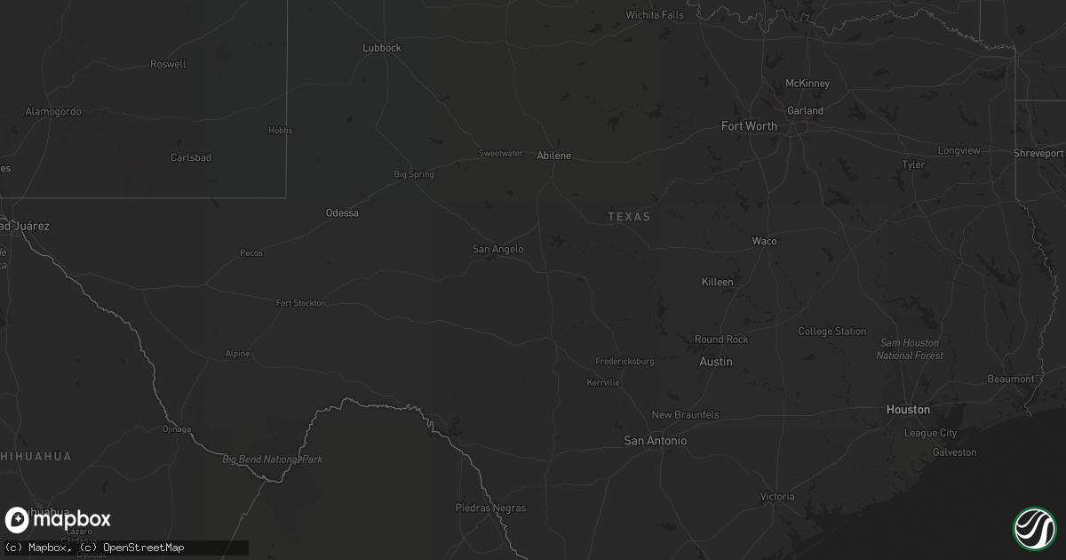
Hail Map in Texas on August 24, 2019
Get this storm
August 24 map
$229
one time, instant access
Download today. No call, no setup
Keep the $229
Bought the map and want the full workflow? Apply the entire $229 to a subscription within 7 days. None of it is wasted.
Every map, not just this one
This buys you this map. Subscription and you get every map we run, in the markets you choose from a few cities to whole states to nationwide. Plus real-time alerts the moment a storm fires.
Contact data
Name, contact info, occupancy, even credit band for addresses in the footprint. You go from where it hit to who to call.
Become the source they trust
Unlimited branding weather history reports on demand. You already have the documented answer ready for the property owner, and you are the one who showed up with it.
Property data and RoofTrace estimates
Pull up any address you have got, its value and the exact code rules for that jurisdiction, straight from One Click Code. Then RoofTrace estimates the squares, pitch, and roof value, priced the way you price.
Storm reports in Texas
Texas
| Date | Description |
|---|---|
| 08/24/20195:09 PM CDT | Two anchored deer blinds were blown onto the highway from a store display nearby... Just south of the bridge between falcon lake estates and the city of zapata. Estimat |
| 08/24/20191:30 AM CDT | At 630 PM CDT, a severe thunderstorm was located 7 miles west of Wheeless, or 22 miles north of Clayton, moving southeast at 20 mph. HAZARD...60 mph wind gusts and half dollar size hail. SOURCE...Radar indicated. IMPACT...Minor damage to roofs, siding, and trees is possible. Hail damage to vehicles is expected. Locations impacted include... Felt and Wheeless. |
| 08/24/201912:14 AM CDT | At 513 PM MDT, a severe thunderstorm was located 7 miles southwest of Kenton, or 26 miles north of Clayton, moving south at 20 mph. HAZARD...Golf ball size hail and 60 mph wind gusts. SOURCE...Radar indicated. IMPACT...People and animals outdoors will be injured. Expect hail damage to roofs, siding, windows, and vehicles. Expect wind damage to roofs, siding, and trees. Locations impacted include... Seneca, Moses, and portions of New Mexico State Highway 406. |
| 08/23/201911:49 PM CDT | At 448 PM CDT, a severe thunderstorm was located over the Medina addition near moving southeast at 10 mph. HAZARD...60 mph wind gusts and quarter size hail. SOURCE...Radar indicated. IMPACT...Hail damage to vehicles is expected. Expect wind damage to roofs, siding, and trees. Locations impacted include... Zapata, Medina, Zapata High School, Zapata County Fire Department, Zapata Middle School, Siesta Shores, Zapata County Public Library, Las Palmas, Falcon Mesa and Morales-Sanchez.This includes US Highway 83 between mile markers 764 and 778. |
| 08/23/201911:05 PM CDT | At 405 PM CDT, a severe thunderstorm was located near Lyford, moving south at 15 mph. HAZARD...60 mph wind gusts and quarter size hail. SOURCE...Radar indicated. IMPACT...Hail damage to vehicles is expected. Expect wind damage to roofs, siding, and trees. Locations impacted include... Raymondville, Lyford, Sebastian, Lyford Elementary School, Lyford City Hall, Lyford High School, Raymondville Golf Course, Raymondville High School, Los Coyotes and Lasana.This includes Interstate Highway 69 E between mile markers 32 and 47. |
| 08/23/201910:35 PM CDT | At 334 PM CDT, a severe thunderstorm was located near San Perlita High School, or near Raymondville, moving southwest at 15 mph. HAZARD...60 mph wind gusts and quarter size hail. SOURCE...Radar indicated. IMPACT...Hail damage to vehicles is expected. Expect wind damage to roofs, siding, and trees. Locations impacted include... Raymondville, Lyford, San Perlita, Reber Memorial Library, Raymondville High School, Raymondville Police Department, Lyford Elementary School, Lyford City Hall, San Perlita High School and Lyford High School.This includes Interstate Highway 69 E between mile markers 42 and 50. |
All States Impacted by Hail Map on August 24, 2019
Cities Impacted by Hail Map on August 24, 2019
- Plains, KS
- Rio Grande City, TX
- Plaza, ND
- Herington, KS
- Bogue, KS
- Hill City, KS
- Burdett, KS
- Larned, KS
- Kinsley, KS
- Ellis, KS
- Allen, OK
- Rosston, OK
- Wildrose, ND
- Satanta, KS
- Sublette, KS
- Macon, GA
- Lakin, KS
- Fargo, OK
- Buffalo, OK
- Fort Supply, OK
- Hahira, GA
- Valdosta, GA
- Springfield, CO
- Esbon, KS
- Cawker City, KS
- Downs, KS
- Hoisington, KS
- Dorrance, KS
- Wilson, KS
- Claflin, KS
- Kendall, KS
- Ulysses, KS
- Johnson, KS
- Syracuse, KS
- Carmen, OK
- Aline, OK
- Crawfordville, FL
- Waldo, KS
- Elsie, NE
- Shamrock, TX
- Wellington, TX
- Wilsey, KS
- Burdick, KS
- White City, KS
- Soperton, GA
- Chase, KS
- Wilmore, KS
- Kiowa, KS
- Garfield, KS
- Haviland, KS
- Coldwater, KS
- Lake City, KS
- Medicine Lodge, KS
- Hanston, KS
- Sun City, KS
- Greensburg, KS
- Alva, OK
- Lewis, KS
- Hardtner, KS
- Stockton, KS
- Taloga, OK
- Leedey, OK
- Vici, OK
- Camargo, OK
- Dresden, KS
- Grenville, NM
- Pritchett, CO
- Penokee, KS
- Morland, KS
- Windom, KS
- Mcpherson, KS
- Olmitz, KS
- Blanchard, OK
- Moultrie, GA
- Rush Center, KS
- Bunker Hill, KS
- Sylvan Grove, KS
- Berthold, ND
- Quinter, KS
- Collyer, KS
- Hoxie, KS
- Scott City, KS
- Abilene, KS
- Solomon, KS
- Stanley, ND
- Sterling, KS
- Fairview, OK
- Jennings, KS
- McCracken, KS
- Otis, KS
- Bison, KS
- Palco, KS
- Ogallah, KS
- Selden, KS
- Hays, KS
- Wakeeney, KS
- Brownell, KS
- Albert, KS
- La Crosse, KS
- Great Bend, KS
- Oberlin, KS
- Pawnee Rock, KS
- Coats, KS
- Pratt, KS
- Byers, KS
- Macksville, KS
- New Town, ND
- Griffin, GA
- Brooks, GA
- Williamson, GA
- Saint Francis, KS
- Haigler, NE
- Champion, NE
- Beeler, KS
- Marienthal, KS
- Leoti, KS
- Deerfield, KS
- Dighton, KS
- Garden City, KS
- Healy, KS
- Holcomb, KS
- Zapata, TX
- Eustis, NE
- Elwood, NE
- Walsh, CO
- Norton, KS
- Lewistown, MT
- Victoria, KS
- Hudson, KS
- Raymond, KS
- Sylvia, KS
- Ellinwood, KS
- Stockville, NE
- Wheeler, TX
- Gate, OK
- Phillipsburg, KS
- Alamo, ND
- Kensington, KS
- Agra, KS
- Cherokee, OK
- Longdale, OK
- Southard, OK
- Keene, ND
- Lenora, KS
- Brookville, KS
- Damar, KS
- Little River, KS
- Marquette, KS
- Buhler, KS
- Hutchinson, KS
- Hayes Center, NE
- Kanopolis, KS
- Ellsworth, KS
- Dacoma, OK
- Weatherford, OK
- Hydro, OK
- Tuttle, OK
- Sharon, OK
- Almena, KS
- Clayton, KS
- Holyrood, KS
- Tescott, KS
- Lorraine, KS
- Salina, KS
- Geneseo, KS
- Russell, KS
- Bazine, KS
- Palermo, ND
- Parshall, ND
- Woodston, KS
- Lyons, KS
- Hillsboro, KS
- Prairie View, KS
- Junction City, KS
- Lucas, KS
- Canadian, TX
- Meade, KS
- Shattuck, OK
- Franklin, GA
- Watonga, OK
- Laverne, OK
- Arapahoe, NE
- Alton, KS
- Plainville, KS
- Marion, KS
- Luray, KS
- Paradise, KS
- Mobeetie, TX
- Minco, OK
- Athol, KS
- Jacksonville, GA
- Woodward, OK
- May, OK
- Kenton, OK
- Lost Springs, KS
- Waynoka, OK
- Kirwin, KS
- Glade, KS
- Iuka, KS
- St John, KS
- Turon, KS
- Clayton, NM
- Hazelton, KS
- Ness City, KS
- Amorita, OK
- Offerle, KS
- Sawyer, KS
- Burlington, OK
- Lyford, TX
- Raymondville, TX
- Walker, KS
- Gorham, KS
- Stafford, KS
- Portis, KS
- Mankato, KS
- Peabody, KS
- Beverly, KS
- Lincolnville, KS
- Strong City, KS
- Cleo Springs, OK
- Ringwood, OK
- Whiteriver, AZ
- Orleans, NE
- Alma, NE
- Denton, MT
- Cedar, KS
- San Carlos, AZ
- Gaylord, KS
- Osborne, KS
- Hilger, MT
- Natoma, KS
- Chapman, KS
- Hinton, OK
- Ray City, GA
- Donnybrook, ND
- Englewood, KS
- Smith Center, KS
- Liebenthal, KS
- Nekoma, KS
- Rozel, KS
- Alexander, KS
- Newton, KS
- Walton, KS
- Arapaho, OK
- Custer City, OK
- Williston, ND
- Pfeifer, KS
- Bushton, KS
- Cumming, GA
- Schoenchen, KS
- Felt, OK
- Boise City, OK
- Peachtree City, GA
- Alamo, GA
- Chauncey, GA
- McRae Helena, GA
- Cadwell, GA
- Milan, GA
- Eastman, GA
- Lagrange, GA


