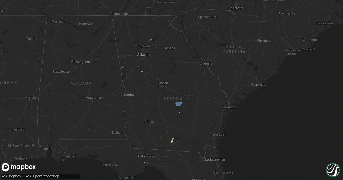
Hail Map in Georgia on August 24, 2019
Get this storm
August 24 map
$229
one time, instant access
Download today. No call, no setup
Keep the $229
Bought the map and want the full workflow? Apply the entire $229 to a subscription within 7 days. None of it is wasted.
Every map, not just this one
This buys you this map. Subscription and you get every map we run, in the markets you choose from a few cities to whole states to nationwide. Plus real-time alerts the moment a storm fires.
Contact data
Name, contact info, occupancy, even credit band for addresses in the footprint. You go from where it hit to who to call.
Become the source they trust
Unlimited branding weather history reports on demand. You already have the documented answer ready for the property owner, and you are the one who showed up with it.
Property data and RoofTrace estimates
Pull up any address you have got, its value and the exact code rules for that jurisdiction, straight from One Click Code. Then RoofTrace estimates the squares, pitch, and roof value, priced the way you price.
Storm reports in Georgia
Georgia
| Date | Description |
|---|---|
| 08/24/20196:35 PM CDT | A tree and power line were down in the city of valdosta. |
| 08/24/20193:00 PM CDT | Two large trees downed across fisher rd. Closest side road is jones mountain rd. |
| 08/24/20192:02 PM CDT | Tree down along sc cadwell road. |
| 08/24/20191:50 PM CDT | Public sent picture of quarter sized hail at the intersection of pilgrim mill rd and still rd. |
| 08/24/20191:50 PM CDT | Several trees down with damage to a fence along williams circle from pictures sent by public. |
| 08/24/20191:48 PM CDT | Several trees reported down along new bethel church road. |
| 08/24/20191:42 PM CDT | A local report indicates 62 MPH wind near PEACHTREE CITY |
| 08/24/20193:21 AM CDT | At 821 PM EDT, a severe thunderstorm was located near Franklin, moving north at 5 mph. HAZARD...60 mph wind gusts and quarter size hail. SOURCE...Radar indicated. IMPACT...Hail damage to vehicles is expected. Expect wind damage to roofs, siding, and trees. Locations impacted include... Franklin, Ephesus, Centralhatchee, Frolona, Roosterville and Plant Wansley. |
| 08/24/20192:11 AM CDT | At 711 PM EDT, a severe thunderstorm was located near Valdosta, moving southwest at 25 mph. HAZARD...60 mph wind gusts and nickel size hail. SOURCE...Radar indicated. IMPACT...Expect damage to roofs, siding, and trees. Locations impacted include... Lake Park, Quitman, Valdosta, Hahira, I-75 At Exit 16, Moody Air Force Base, Remerton, Dasher, Twin Lakes, Valdosta Regional Airport, Kinderlou, I-75 At Exit 5, Clyattville, Brooks Co A/p, Blue Springs, I-75 At Exit 22 and I-75 At Exit 11. |
| 08/24/201912:49 AM CDT | At 549 PM EDT, a severe thunderstorm was located over Skipperton, or 8 miles south of Macon, and is nearly stationary. HAZARD...60 mph wind gusts and quarter size hail. SOURCE...Radar indicated. IMPACT...Hail damage to vehicles is expected. Expect wind damage to roofs, siding, and trees. Locations impacted include... Macon, Middle Georgia Regional Airport, Skipperton and Rutland. |
| 08/24/201912:34 AM CDT | At 534 PM EDT, a severe thunderstorm was located over Snellville, or 9 miles southwest of Lawrenceville, and is nearly stationary. HAZARD...60 mph wind gusts and quarter size hail. SOURCE...Radar indicated. IMPACT...Hail damage to vehicles is expected. Expect wind damage to roofs, siding, and trees. Locations impacted include... Lawrenceville, Snellville, Lilburn, Tucker and Mountain Park. |
| 08/23/201910:29 PM CDT | At 329 PM EDT, a severe thunderstorm was located over Talona, or 8 miles northwest of Jasper, moving southeast at 15 mph. HAZARD...60 mph wind gusts and quarter size hail. SOURCE...Radar indicated. IMPACT...Hail damage to vehicles is expected. Expect wind damage to roofs, siding, and trees. Locations impacted include... Jasper, Nelson, Talking Rock, Sequoyah Lake, Talona, Blaine, Lake Tamarack, Marblehill, Tate and Roundtop. |
| 08/23/20199:37 PM CDT | At 237 PM EDT, a severe thunderstorm was located near Achord, or near McRae, and is nearly stationary. HAZARD...60 mph wind gusts. SOURCE...Radar indicated. IMPACT...Expect damage to roofs, siding, and trees. Locations impacted include... McRae, Helena, Chauncey, Jay Bird Springs, Little Ocmulgee State Park and Achord. |
| 08/23/20197:53 PM CDT | Multiple trees down in glenn. |
All States Impacted by Hail Map on August 24, 2019
Cities Impacted by Hail Map on August 24, 2019
- Plains, KS
- Rio Grande City, TX
- Plaza, ND
- Herington, KS
- Bogue, KS
- Hill City, KS
- Burdett, KS
- Larned, KS
- Kinsley, KS
- Ellis, KS
- Allen, OK
- Rosston, OK
- Wildrose, ND
- Satanta, KS
- Sublette, KS
- Macon, GA
- Lakin, KS
- Fargo, OK
- Buffalo, OK
- Fort Supply, OK
- Hahira, GA
- Valdosta, GA
- Springfield, CO
- Esbon, KS
- Cawker City, KS
- Downs, KS
- Hoisington, KS
- Dorrance, KS
- Wilson, KS
- Claflin, KS
- Kendall, KS
- Ulysses, KS
- Johnson, KS
- Syracuse, KS
- Carmen, OK
- Aline, OK
- Crawfordville, FL
- Waldo, KS
- Elsie, NE
- Shamrock, TX
- Wellington, TX
- Wilsey, KS
- Burdick, KS
- White City, KS
- Soperton, GA
- Chase, KS
- Wilmore, KS
- Kiowa, KS
- Garfield, KS
- Haviland, KS
- Coldwater, KS
- Lake City, KS
- Medicine Lodge, KS
- Hanston, KS
- Sun City, KS
- Greensburg, KS
- Alva, OK
- Lewis, KS
- Hardtner, KS
- Stockton, KS
- Taloga, OK
- Leedey, OK
- Vici, OK
- Camargo, OK
- Dresden, KS
- Grenville, NM
- Pritchett, CO
- Penokee, KS
- Morland, KS
- Windom, KS
- Mcpherson, KS
- Olmitz, KS
- Blanchard, OK
- Moultrie, GA
- Rush Center, KS
- Bunker Hill, KS
- Sylvan Grove, KS
- Berthold, ND
- Quinter, KS
- Collyer, KS
- Hoxie, KS
- Scott City, KS
- Abilene, KS
- Solomon, KS
- Stanley, ND
- Sterling, KS
- Fairview, OK
- Jennings, KS
- McCracken, KS
- Otis, KS
- Bison, KS
- Palco, KS
- Ogallah, KS
- Selden, KS
- Hays, KS
- Wakeeney, KS
- Brownell, KS
- Albert, KS
- La Crosse, KS
- Great Bend, KS
- Oberlin, KS
- Pawnee Rock, KS
- Coats, KS
- Pratt, KS
- Byers, KS
- Macksville, KS
- New Town, ND
- Griffin, GA
- Brooks, GA
- Williamson, GA
- Saint Francis, KS
- Haigler, NE
- Champion, NE
- Beeler, KS
- Marienthal, KS
- Leoti, KS
- Deerfield, KS
- Dighton, KS
- Garden City, KS
- Healy, KS
- Holcomb, KS
- Zapata, TX
- Eustis, NE
- Elwood, NE
- Walsh, CO
- Norton, KS
- Lewistown, MT
- Victoria, KS
- Hudson, KS
- Raymond, KS
- Sylvia, KS
- Ellinwood, KS
- Stockville, NE
- Wheeler, TX
- Gate, OK
- Phillipsburg, KS
- Alamo, ND
- Kensington, KS
- Agra, KS
- Cherokee, OK
- Longdale, OK
- Southard, OK
- Keene, ND
- Lenora, KS
- Brookville, KS
- Damar, KS
- Little River, KS
- Marquette, KS
- Buhler, KS
- Hutchinson, KS
- Hayes Center, NE
- Kanopolis, KS
- Ellsworth, KS
- Dacoma, OK
- Weatherford, OK
- Hydro, OK
- Tuttle, OK
- Sharon, OK
- Almena, KS
- Clayton, KS
- Holyrood, KS
- Tescott, KS
- Lorraine, KS
- Salina, KS
- Geneseo, KS
- Russell, KS
- Bazine, KS
- Palermo, ND
- Parshall, ND
- Woodston, KS
- Lyons, KS
- Hillsboro, KS
- Prairie View, KS
- Junction City, KS
- Lucas, KS
- Canadian, TX
- Meade, KS
- Shattuck, OK
- Franklin, GA
- Watonga, OK
- Laverne, OK
- Arapahoe, NE
- Alton, KS
- Plainville, KS
- Marion, KS
- Luray, KS
- Paradise, KS
- Mobeetie, TX
- Minco, OK
- Athol, KS
- Jacksonville, GA
- Woodward, OK
- May, OK
- Kenton, OK
- Lost Springs, KS
- Waynoka, OK
- Kirwin, KS
- Glade, KS
- Iuka, KS
- St John, KS
- Turon, KS
- Clayton, NM
- Hazelton, KS
- Ness City, KS
- Amorita, OK
- Offerle, KS
- Sawyer, KS
- Burlington, OK
- Lyford, TX
- Raymondville, TX
- Walker, KS
- Gorham, KS
- Stafford, KS
- Portis, KS
- Mankato, KS
- Peabody, KS
- Beverly, KS
- Lincolnville, KS
- Strong City, KS
- Cleo Springs, OK
- Ringwood, OK
- Whiteriver, AZ
- Orleans, NE
- Alma, NE
- Denton, MT
- Cedar, KS
- San Carlos, AZ
- Gaylord, KS
- Osborne, KS
- Hilger, MT
- Natoma, KS
- Chapman, KS
- Hinton, OK
- Ray City, GA
- Donnybrook, ND
- Englewood, KS
- Smith Center, KS
- Liebenthal, KS
- Nekoma, KS
- Rozel, KS
- Alexander, KS
- Newton, KS
- Walton, KS
- Arapaho, OK
- Custer City, OK
- Williston, ND
- Pfeifer, KS
- Bushton, KS
- Cumming, GA
- Schoenchen, KS
- Felt, OK
- Boise City, OK
- Peachtree City, GA
- Alamo, GA
- Chauncey, GA
- McRae Helena, GA
- Cadwell, GA
- Milan, GA
- Eastman, GA
- Lagrange, GA


