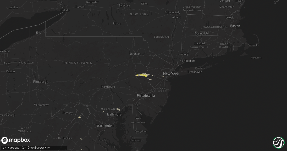
Hail Map on August 22, 2022
Get this storm
August 22 map
$229
one time, instant access
Download today. No call, no setup
Keep the $229
Bought the map and want the full workflow? Apply the entire $229 to a subscription within 7 days. None of it is wasted.
Every map, not just this one
This buys you this map. Subscription and you get every map we run, in the markets you choose from a few cities to whole states to nationwide. Plus real-time alerts the moment a storm fires.
Contact data
Name, contact info, occupancy, even credit band for addresses in the footprint. You go from where it hit to who to call.
Become the source they trust
Unlimited branding weather history reports on demand. You already have the documented answer ready for the property owner, and you are the one who showed up with it.
Property data and RoofTrace estimates
Pull up any address you have got, its value and the exact code rules for that jurisdiction, straight from One Click Code. Then RoofTrace estimates the squares, pitch, and roof value, priced the way you price.
States Impacted by Hail Map on August 22, 2022
Storm reports
Florida
| Date | Description |
|---|---|
| 08/21/202210:15 PM CDT | At 315 PM EDT, a severe thunderstorm was located 7 miles south of Fernandina Beach, moving northeast at 20 mph. HAZARD...60 mph wind gusts and quarter size hail. SOURCE...Radar indicated. IMPACT...Hail damage to vehicles is expected. Expect wind damage to roofs, siding, and trees. Locations impacted include... Fernandina Beach and Yulee. |
Louisiana
| Date | Description |
|---|---|
| 08/21/20228:37 PM CDT | At 136 PM CDT, a severe thunderstorm was located over Burkeville, moving northeast at 25 mph. HAZARD...60 mph wind gusts and quarter size hail. SOURCE...Radar indicated. IMPACT...Hail damage to vehicles is expected. Expect wind damage to roofs, siding, and trees. Locations impacted include... Toledo Bend Dam, Burkeville, Burr Ferry, Wiergate and Evans. |
North Carolina
| Date | Description |
|---|---|
| 08/22/20227:00 AM CDT | Corrects previous tstm wnd gst report from 2 wnw oriental. Local weatherflow site near winding creek measured 50 knot gust. |
| 08/22/20227:00 AM CDT | Local weatherflow site near winding creek measured 50 knot gust. |
Texas
| Date | Description |
|---|---|
| 08/22/20224:56 PM CDT | Measured wind gust at del rio international airport. |
| 08/22/202210:25 AM CDT | Trees reported down and structural damage to one building in the hussy circle area; possible tornado. |
| 08/22/202210:25 AM CDT | Corrects previous tstm wnd dmg report from winona. Trees reported down and structural damage to one building in the hussy circle area; update to confirmed tornado. |
| 08/21/202210:26 PM CDT | An ef-1 tornado with an estimated 95 mph winds touched down nearby winona independent school district... Tossing a metal outbuilding across cr-345 and uprooting trees. |
| 08/21/20228:48 PM CDT | At 147 PM CDT, a severe thunderstorm was located over Burr Ferry, or 8 miles southeast of Toledo Bend Dam, moving northeast at 50 mph. HAZARD...60 mph wind gusts. SOURCE...Radar indicated. IMPACT...Expect damage to roofs, siding, and trees. Locations impacted include... Leesville, Anacoco, Slagle, Fort Polk, New Llano, Hornbeck, Kurthwood, Burr Ferry and Evans. |
Pennsylvania
| Date | Description |
|---|---|
| 08/22/20224:55 PM CDT | Report from mping: quarter |
| 08/22/20224:55 PM CDT | Dime to quarter size hail on the south side of easton. Time estimated from radar. |
| 08/22/20224:48 PM CDT | Several large limbs blown down. Damaged a roof of a residence. Time estimated from radar. |
| 08/22/20224:40 PM CDT | Hail ranging from dime to quarter size. |
| 08/22/20224:15 PM CDT | Hail ranging from dime to quarter size fell for about 14 minutes. Time estimated from radar. |
| 08/22/20224:12 PM CDT | A local report indicates 1.00 inch wind near COPLAY |
| 08/22/20224:01 PM CDT | Several reports of dime to quarter size hail in the whitehall area. |
| 08/22/202212:44 AM CDT | At 544 PM EDT, a severe thunderstorm was located over Old Orchard, or near Easton, moving east at 20 mph. HAZARD...60 mph wind gusts and quarter size hail. SOURCE...Radar indicated. IMPACT...Minor damage to vehicles is possible. Wind damage to roofs, siding, trees, and power lines is possible. Locations impacted include... Easton, Bethlehem, Forks, Wilson, Hellertown, Nazareth, Bath, Belvidere, Harmony, Oxford, Alpha, Belfast, West Easton, Tatamy, Bloomsbury, Riegelsville, Steuben, Glendon, Brass Castle and Pleasant Valley.This includes the following highways... Interstate 78 in Pennsylvania between mile markers 68 and 76. Interstate 78 in New Jersey between mile markers 0 and 12. |
| 08/22/202212:01 AM CDT | At 501 PM EDT, a severe thunderstorm was located over Northampton, or near Allentown, moving east at 15 mph. HAZARD...60 mph wind gusts and quarter size hail. SOURCE...Radar indicated. IMPACT...Minor damage to vehicles is possible. Wind damage to roofs, siding, trees, and power lines is possible. Locations impacted include... Allentown, Bethlehem, Northampton, Hellertown, Nazareth, Slatington, Bath, Walnutport, Steuben, Coffeetown, Beersville, Lehigh University, Catasauqua, Fountain Hill, Coplay, North Catasauqua, Freemansburg, Chapman, Fullerton and Hokendauqua.This includes the following highways... Northeast Extension between mile markers 57 and 64. Interstate 78 in Pennsylvania between mile markers 52 and 54, andbetween mile markers 64 and 69. |
Virginia
| Date | Description |
|---|---|
| 08/22/20226:55 PM CDT | The right lane and right shoulder are closed on i-64 near mm 166 in goochland county due to weather. Time estimated from radar data. |
| 08/22/20226:45 PM CDT | Tree down on route 250 in the vicinity of old fredericksburg road. Time estimated from radar data. |
| 08/22/20226:30 PM CDT | Power lines down. Time estimated from radar data. |
| 08/22/20224:39 PM CDT | Tree down blocking roadway near the intersection of waterford road and korea road. |
| 08/22/20224:28 PM CDT | Trees blew down in the 9400 block of us-15 james madison highway... Including a large pine tree that blocked all travel lanes. |
| 08/22/20223:49 PM CDT | Tree down on front royal pike near bufflick road. |
| 08/22/20222:11 AM CDT | At 710 PM EDT, severe thunderstorms were located along a line extending from Louisa to near Ferncliff to near Palmyra, moving southeast at 20 mph. HAZARD...60 mph wind gusts. SOURCE...Radar indicated. IMPACT...Expect damage to trees and powerlines. Severe thunderstorms will be near... Mineral around 725 PM EDT. Hadensville and Columbia around 730 PM EDT. Fife around 745 PM EDT. Gum Spring around 750 PM EDT. Goochland around 800 PM EDT.Other locations impacted by these severe thunderstorms includeOrchid, Dixie, Pendleton, Sandy Hook, Louisa Airport, Rock Castle,Stage Junction, Three Square, Irwin and Cuckoo. |
| 08/22/202212:21 AM CDT | At 521 PM EDT, a severe thunderstorm was located 7 miles west of Culpeper, moving southeast at 15 mph. HAZARD...60 mph wind gusts and quarter size hail. SOURCE...Radar indicated. IMPACT...Damaging winds will cause some trees and large branches to fall. This could injure those outdoors, as well as damage homes and vehicles. Roadways may become blocked by downed trees. Localized power outages are possible. Unsecured light objects may become projectiles. Locations impacted include... Culpeper, Madison, Brightwood, Raccoon Ford, Catalpa, Stevensburg, Rhoadesville, Rapidan, Oakpark, Everona, Verdiersville, Burr Hill, Pratts, Winston, Lignum, Mitchells, Reva, Fordsville, Twymans Mill and Leon. |
California
| Date | Description |
|---|---|
| 08/21/20228:27 PM CDT | At 127 AM MST/127 AM PDT/, severe thunderstorms were located along a line extending from near Kinter to near Winterhaven to near Algodones Dunes, moving southwest at 30 mph. HAZARD...60 mph wind gusts. SOURCE...Radar indicated. IMPACT...Expect damage to roofs, siding, and trees. Locations impacted include... Yuma, Somerton, Gadsden, Fortuna Foothills, San Luis, Blaisdell, Gordon's Well, Algodones Dunes, Kinter, Andrade, Winterhaven and Araby.This includes the following highways...AZ Interstate 8 between mile markers 1 and 17.CA Interstate 8 between mile markers 69 and 96.AZ Route 95 between mile markers 29 and 56. |
Utah
| Date | Description |
|---|---|
| 08/22/20226:17 PM CDT | Time of report estimated. |
| 08/22/202212:16 AM CDT | At 515 PM MDT, a severe thunderstorm was located near St George, or 18 miles northeast of Virgin River Gorge, moving southeast at 25 mph. HAZARD...60 mph wind gusts and quarter size hail. SOURCE...Radar indicated. IMPACT...Hail damage to vehicles is expected. Expect wind damage to roofs, siding, and trees. Locations impacted include... St George, Washington and Bloomington. This includes the following highways... Interstate 15 between mile markers 1 and 8. Utah Route 18 between mile markers 0 and 1. |
| 08/21/202211:27 PM CDT | At 426 PM MDT, a severe thunderstorm was located 25 miles northeast of Montello, moving east at 25 mph. HAZARD...60 mph wind gusts and quarter size hail. SOURCE...Radar indicated. IMPACT...Hail damage to vehicles is expected. Expect wind damage to roofs, siding, and trees. This severe thunderstorm will remain over mainly rural areas of west central Box Elder County.This includes Utah Route 30 between mile markers 11 and 33. |
Arizona
| Date | Description |
|---|---|
| 08/22/20227:34 AM CDT | At 1234 AM MST/1234 AM PDT/, severe thunderstorms were located along a line extending from 20 miles west of Palo Verde to 9 miles south of Cibola to 11 miles northeast of Yuma Proving Ground, moving southwest at 30 mph. HAZARD...70 mph wind gusts. SOURCE...Radar indicated. IMPACT...Expect considerable tree damage. Damage is likely to mobile homes, roofs, and outbuildings. Locations impacted include... Yuma, Somerton, Martinez Lake, Gadsden, Fortuna Foothills, Wellton, Cibola, Palo Verde, Gordon's Well, Algodones Dunes, Kinter, Andrade, Winterhaven, Araby and Yuma Proving Ground.This includes the following highways...AZ Interstate 8 between mile markers 1 and 32.CA Interstate 8 between mile markers 55 and 96.AZ Route 95 between mile markers 29 and 90. |
| 08/22/202212:42 AM CDT | At 542 PM MST, a severe thunderstorm was located near St. David, or near Benson, moving south at 5 mph. HAZARD...60 mph wind gusts and quarter size hail. SOURCE...Radar indicated. IMPACT...Hail damage to vehicles is expected. Expect wind damage to roofs, siding, and trees. Locations impacted include... Benson, St. David, Kartchner Caverns State Park and Mescal. |
| 08/21/202211:45 PM CDT | At 444 PM MST, a severe thunderstorm was located near Top-Of-The-World, or 9 miles west of Globe, moving west at 10 mph. HAZARD...60 mph wind gusts and quarter size hail. SOURCE...Radar indicated. IMPACT...Hail damage to vehicles is expected. Expect wind damage to roofs, siding, and trees. Locations impacted include... Globe, Superior, Miami, Top Of The World, Central Heights-Midland City, Top-Of-The-World, Claypool and Inspiration.This includes the following highways...US Highway 60 between mile markers 225 and 251.AZ Route 177 between mile markers 166 and 167.AZ Route 188 between mile markers 214 and 221. |
| 08/21/202211:05 PM CDT | At 405 PM MST, a severe thunderstorm was located over Cutter, or 9 miles east of Globe, moving south at 15 mph. HAZARD...60 mph wind gusts and quarter size hail. SOURCE...Radar indicated. IMPACT...Hail damage to vehicles is expected. Expect wind damage to roofs, siding, and trees. Locations impacted include... Globe, San Carlos and Cutter. This includes the following highways...US Highway 60 between mile markers 252 and 255.AZ Route 70 between mile markers 253 and 270.AZ Route 77 between mile markers 148 and 170. |
| 08/21/202210:45 PM CDT | At 338 PM MST, a severe thunderstorm was located 22 miles southeast of Aravaipa Canyon Wilderness, or 27 miles east of Mammoth, and is nearly stationary. HAZARD...60 mph wind gusts and quarter size hail. SOURCE...Radar indicated. IMPACT...Hail damage to vehicles is expected. Expect wind damage to roofs, siding, and trees. Locations impacted include... Klondyke. |
| 08/21/202210:15 PM CDT | At 314 PM MST, a severe thunderstorm was located near Fort Grant, or 22 miles north of Willcox, moving south at 10 mph. HAZARD...60 mph wind gusts and penny size hail. SOURCE...Radar indicated. IMPACT...Expect damage to roofs, siding, and trees. Locations impacted include... Fort Grant and Bonita. |
| 08/21/20229:09 PM CDT | At 208 PM MST, a severe thunderstorm was located 13 miles southeast of Young, moving southeast at 10 mph. HAZARD...60 mph wind gusts and quarter size hail. SOURCE...Radar indicated. IMPACT...Hail damage to vehicles is expected. Expect wind damage to roofs, siding, and trees. This severe thunderstorm will remain over mainly rural areas of Gila and Navajo Counties. |
Nevada
| Date | Description |
|---|---|
| 08/22/20226:41 PM CDT | The kane springs raws site gusted to 76 mph at approximately 441pm. |
| 08/21/202211:52 PM CDT | At 450 PM PDT, a severe thunderstorm was located 23 miles southwest of Cabin Pines Campground, or 27 miles east of Alamo, moving south at 10 mph. HAZARD...70 mph wind gusts. SOURCE...Radar indicated. IMPACT...Expect considerable tree damage. Damage is likely to mobile homes, roofs, and outbuildings. Locations impacted include... Remote areas of Lincoln County including Kane Springs Road and Carp |
West Virginia
| Date | Description |
|---|---|
| 08/21/202211:49 PM CDT | At 449 PM EDT, a severe thunderstorm was located over Winchester, moving east at 15 mph. HAZARD...60 mph wind gusts and quarter size hail. SOURCE...Radar indicated. IMPACT...Damaging winds will cause some trees and large branches to fall. This could injure those outdoors, as well as damage homes and vehicles. Roadways may become blocked by downed trees. Localized power outages are possible. Unsecured light objects may become projectiles. Locations impacted include... Winchester, Millwood Pike, Berryville, Boyce, Brucetown, Greenwood, Gainesboro, Cedar Grove, Clear Brook, Briggs, Stephenson, Wadesville, Albin and Stringtown. |
Idaho
| Date | Description |
|---|---|
| 08/22/20222:36 PM CDT | At the sawtooth national recreation area building. Time estimated via radar. |
| 08/21/202211:15 PM CDT | At 415 PM MDT, a severe thunderstorm was located 23 miles north of Monteview, or 23 miles west of Dubois, moving east at 10 mph. HAZARD...Quarter size hail. SOURCE...Radar indicated. IMPACT...Damage to vehicles is expected. Locations impacted include... Edie School. |
Cities Impacted by Hail Map on August 22, 2022
- Annandale, NJ
- Lebanon, NJ
- Selfridge, ND
- Peridot, AZ
- Benson, AZ
- Coplay, PA
- Allentown, PA
- Whitehall, PA
- Ketchum, ID
- Saint George, UT
- Washington, UT
- Columbia, VA
- Palmyra, VA
- Kents Store, VA
- Catasauqua, PA
- Northampton, PA
- Milford, NJ
- Bloomsbury, NJ
- Bath, PA
- Hellertown, PA
- Phillipsburg, NJ
- Orefield, PA
- Easton, PA
- Stewartsville, NJ
- Bethlehem, PA
- Schnecksville, PA
- Asbury, NJ
- Nazareth, PA
- Naples, FL
- Winchester, VA
- Immokalee, FL
- Germansville, PA
- Culpeper, VA
- Rapidan, VA
- Brightwood, VA
- Kingsville, MD
- Upper Falls, MD
- Joppa, MD
- Augusta, MT
- Hilton Head Island, SC
- Fork, MD
- Baldwin, MD
- Glen Arm, MD
- Edgewood, MD
- Hydes, MD
- Fallston, MD
- Woodbine, MD
- Mount Airy, MD
- Snowville, UT
- Bluffton, SC
- Scotch Plains, NJ
- Plainfield, NJ
- Clark, NJ
- Comstock, TX
- Clear Brook, VA
- Mason, TX
- Heart Butte, MT
- Gordonsville, VA
- Louisa, VA
- Flemington, NJ
- Frenchtown, NJ
- Pittstown, NJ
- Troy, VA
- Hampton, NJ
- Winona, TX