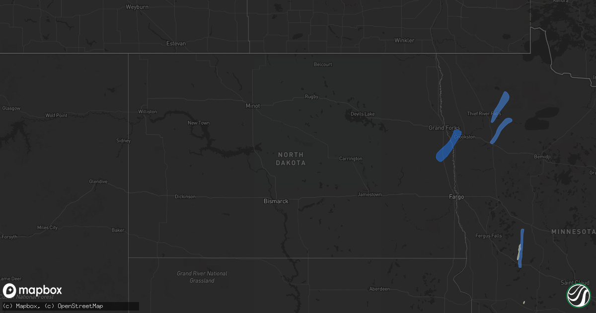
Hail Map in North Dakota on August 20, 2021
Get this storm
August 20 map
$229
one time, instant access
Download today. No call, no setup
Keep the $229
Bought the map and want the full workflow? Apply the entire $229 to a subscription within 7 days. None of it is wasted.
Every map, not just this one
This buys you this map. Subscription and you get every map we run, in the markets you choose from a few cities to whole states to nationwide. Plus real-time alerts the moment a storm fires.
Contact data
Name, contact info, occupancy, even credit band for addresses in the footprint. You go from where it hit to who to call.
Become the source they trust
Unlimited branding weather history reports on demand. You already have the documented answer ready for the property owner, and you are the one who showed up with it.
Property data and RoofTrace estimates
Pull up any address you have got, its value and the exact code rules for that jurisdiction, straight from One Click Code. Then RoofTrace estimates the squares, pitch, and roof value, priced the way you price.
Storm reports in North Dakota
North Dakota
| Date | Description |
|---|---|
| 08/20/20215:05 PM CDT | Spotter estimated wind gust of 70 mph on i-29 south of cummings nd. Spotters car oscillating/vibrating and nearby semi struggled to remain upright. |
| 08/20/20215:05 PM CDT | A local report indicates 70 MPH wind near 1 W CUMMINGS |
| 08/20/20214:18 PM CDT | A funnel with brief touchdown. Report posted via social media. Some tree branches and corn stalks were seen swirling in the debris. Peak winds estimated to 70 mph. Maxi |
| 08/20/20214:18 PM CDT | A funnel with brief touchdown. Report posted via social media. Some tree branches and corn stalks were seen swirling in the debris. Peak winds estimated to 70 mph. Maxi |
All States Impacted by Hail Map on August 20, 2021
Cities Impacted by Hail Map on August 20, 2021
- Bremen, KS
- Lincoln, KS
- Moundridge, KS
- Windom, KS
- Lyons, KS
- Buhler, KS
- Hutchinson, KS
- Inman, KS
- Mcpherson, KS
- Little River, KS
- Castle Hayne, NC
- Wilmington, NC
- Burrton, KS
- South Hutchinson, KS
- Haven, KS
- Partridge, KS
- Clay Center, KS
- Otis, KS
- Larned, KS
- Rush Center, KS
- Hollenberg, KS
- Washington, KS
- Morrowville, KS
- Salina, KS
- New Cambria, KS
- Hardy, IA
- Goldfield, IA
- Thor, IA
- Eagle Grove, IA
- Cortland, NE
- Firth, NE
- Kinsley, KS
- Eskridge, KS
- Fairbury, NE
- Alexandria, NE
- Hebron, NE
- Gilead, NE
- Snyder, TX
- Burlington, KS
- Le Roy, KS
- Western, NE
- Frankfort, KS
- Home, KS
- Belvidere, NE
- Everton, MO
- Davenport, NE
- Deshler, NE
- Oak, NE
- Carleton, NE
- Alta Vista, KS
- Junction City, KS
- White City, KS
- Dwight, KS
- Attica, KS
- Zenda, KS
- Sawyer, KS
- Isabel, KS
- Pratt, KS
- Cunningham, KS
- Spivey, KS
- Nashville, KS
- Kingman, KS
- Beloit, KS
- Solomon, KS
- Abilene, KS
- Sheffield, TX
- Dryden, TX
- Beatrice, NE
- Blue Springs, NE
- Soldier, KS
- Havensville, KS
- Circleville, KS
- Holton, KS
- Hope, KS
- Herington, KS
- Ramona, KS
- Lost Springs, KS
- Tampa, KS
- Dayton, IA
- Wakefield, KS
- Milford, KS
- Olsburg, KS
- Manhattan, KS
- Westmoreland, KS
- Edgar, NE
- Fluvanna, TX
- Nelson, NE
- Adams, NE
- Filley, NE
- Pickrell, NE
- Concordia, KS
- Mayetta, KS
- Denison, KS
- Valley Falls, KS
- Woolstock, IA
- Riley, KS
- Minneapolis, KS
- Delphos, KS
- Miltonvale, KS
- Lindsborg, KS
- Marquette, KS
- Waterville, KS
- Pierson, IA
- Kingsley, IA
- Moville, IA
- Shawnee, KS
- Kansas City, KS
- Bonner Springs, KS
- Lenexa, KS
- Plymouth, NE
- Jansen, NE
- Marysville, KS
- Blue Rapids, KS
- Barnes, KS
- Green, KS
- Randolph, KS
- Minden, IA
- Durham, KS
- Leonardville, KS
- Manson, IA
- Canton, KS
- Gypsum, KS
- Honey Creek, IA
- Neola, IA
- Onaga, KS
- Daykin, NE
- Omaha, NE
- Fort Calhoun, NE
- Ira, TX
- Offerle, KS
- Arlington, KS
- Pretty Prairie, KS
- Geneseo, KS
- Nickerson, KS
- Sterling, KS
- Selma, NC
- Clayton, NC
- Mahaska, KS
- Missouri Valley, IA
- Waycross, GA
- Lennox, SD
- Beresford, SD
- Lincolnville, KS
- Talmage, KS
- Mullinville, KS
- Haviland, KS
- Council, NC
- Riegelwood, NC
- Burchard, NE
- Lake Placid, FL
- Burdick, KS
- Tescott, KS
- Springfield, NE
- South Bend, NE
- Gretna, NE
- Hubbell, NE
- Underwood, IA
- Saint George, KS
- Parkers Prairie, MN
- Alexandria, MN
- Garfield, MN
- Miltona, MN
- Anthon, IA
- Ceresco, NE
- Lincoln, NE
- Clare, IA
- Bucklin, KS
- Beattie, KS
- Liberty, NE
- Summerfield, KS
- Oketo, KS
- Oakland, IA
- Hancock, IA
- Martell, NE
- Meade, KS
- Fowler, KS
- Endicott, NE
- Narka, KS
- Hanover, KS
- Haddam, KS
- Belleville, KS
- Chester, NE
- Steele City, NE
- Diller, NE
- Munden, KS
- Reynolds, NE
- Sylvan Grove, KS
- Nahunta, GA
- Axtell, KS
- Wamego, KS
- Alma, KS
- Luverne, MN
- Fonda, IA
- Strong City, KS
- Sharon, KS
- Saint Marys, KS
- Paxico, KS
- Maple Hill, KS
- Carnesville, GA
- Muscotah, KS
- Effingham, KS
- Falun, KS
- Duncombe, IA
- Table Rock, NE
- Steinauer, NE
- Reading, KS
- Bennington, KS
- Van Meter, IA
- Waukee, IA
- Adel, IA
- Harveyville, KS
- De Witt, NE
- Hallam, NE
- Clatonia, NE
- Tecumseh, NE
- Elk Creek, NE
- Vincent, IA
- Fort Dodge, IA
- Du Bois, NE
- Pawnee City, NE
- Lecompton, KS
- Perry, KS
- Lawrence, KS
- Toccoa, GA
- Livermore, IA
- Dakota City, IA
- Humboldt, IA
- Spearville, KS
- Wells, MN
- Webster City, IA
- Palmer, IA
- Pomeroy, IA
- Hoyt, KS
- Elon, NC
- Burlington, NC
- Pocahontas, IA
- Waynesville, GA
- Council Grove, KS
- Wilsey, KS
- Snow Hill, NC
- Emmett, KS
- Clarion, IA
- Marion, KS
- Stilwell, KS
- Kerkhoven, MN
- Bison, KS
- Hunter, KS
- Barnard, KS
- Andrews, TX
- Wymore, NE
- Admire, KS
- Shickley, NE
- Centerville, SD
- Bradgate, IA
- Smithland, IA
- Burlingame, KS
- Scranton, KS
- Delia, KS
- Fremont, NC
- Lecanto, FL
- Beverly Hills, FL
- Raleigh, NC
- Carbondale, KS
- Blountstown, FL
- Wakonda, SD
- Lyndon, KS
- Osage City, KS
- Olathe, KS
- Everest, KS
- Ozawkie, KS
- Meriden, KS
- Glasco, KS
- Palmer, KS
- Morganville, KS
- Aurora, KS
- El Dorado, KS
- Tobias, NE
- Wilber, NE
- Swanton, NE
- Gilmore City, IA
- Kenly, NC
- Lucama, NC
- Wilson, NC
- Fort Riley, KS
- Allen, KS
- Byron, NE
- Hampton, IA
- Dows, IA
- Latimer, IA
- Galva, KS
- Garfield, KS
- Hilliard, FL
- Rolfe, IA
- Clarkton, NC
- Sibley, IA
- Ashton, IA
- Chapman, KS
- Ogden, KS
- Enterprise, KS
- Belvue, KS
- Sterling, NE
- Baileyville, KS
- Falls City, NE
- Lewiston, NE
- Nemaha, NE
- Morrill, KS
- Johnson, NE
- Mound City, MO
- Dawson, NE
- Robinson, KS
- Bern, KS
- Sabetha, KS
- Verdon, NE
- Fairview, KS
- Forest City, MO
- Rulo, NE
- Seneca, KS
- Oregon, MO
- Stella, NE
- Salem, NE
- Hiawatha, KS
- Oneida, KS
- Crab Orchard, NE
- Virginia, NE
- Cook, NE
- Rock Port, MO
- Brownville, NE
- Maitland, MO
- Highland, KS
- Fairfax, MO
- Humboldt, NE
- White Cloud, KS
- Craig, MO
- Auburn, NE
- Shubert, NE
- Vermillion, KS
- Centralia, KS
- Sedgwick, KS
- Halstead, KS
- Newton, KS
- De Soto, KS
- Independence, MO
- Waldron, MO
- Kansas City, MO
- McLouth, KS
- Eudora, KS
- Overland Park, KS
- Liberty, MO
- Riverside, MO
- Basehor, KS
- Leawood, KS
- Tonganoxie, KS
- Linwood, KS
- Leavenworth, KS
- Prairie Village, KS
- Mission, KS
- Oskaloosa, KS
- Harper, KS
- Grygla, MN
- Thief River Falls, MN
- Gatzke, MN
- Goodridge, MN
- Erskine, MN
- Gonvick, MN
- Oklee, MN
- Plummer, MN
- Mcintosh, MN
- Trail, MN
- Carlos, MN
- Henning, MN
- Deer Creek, MN
- Climax, MN
- Buxton, ND
- Reynolds, ND
- Crookston, MN
- Fisher, MN
- Cummings, ND
- Hillsboro, ND
- Mayville, ND
- Ruskin, NE


