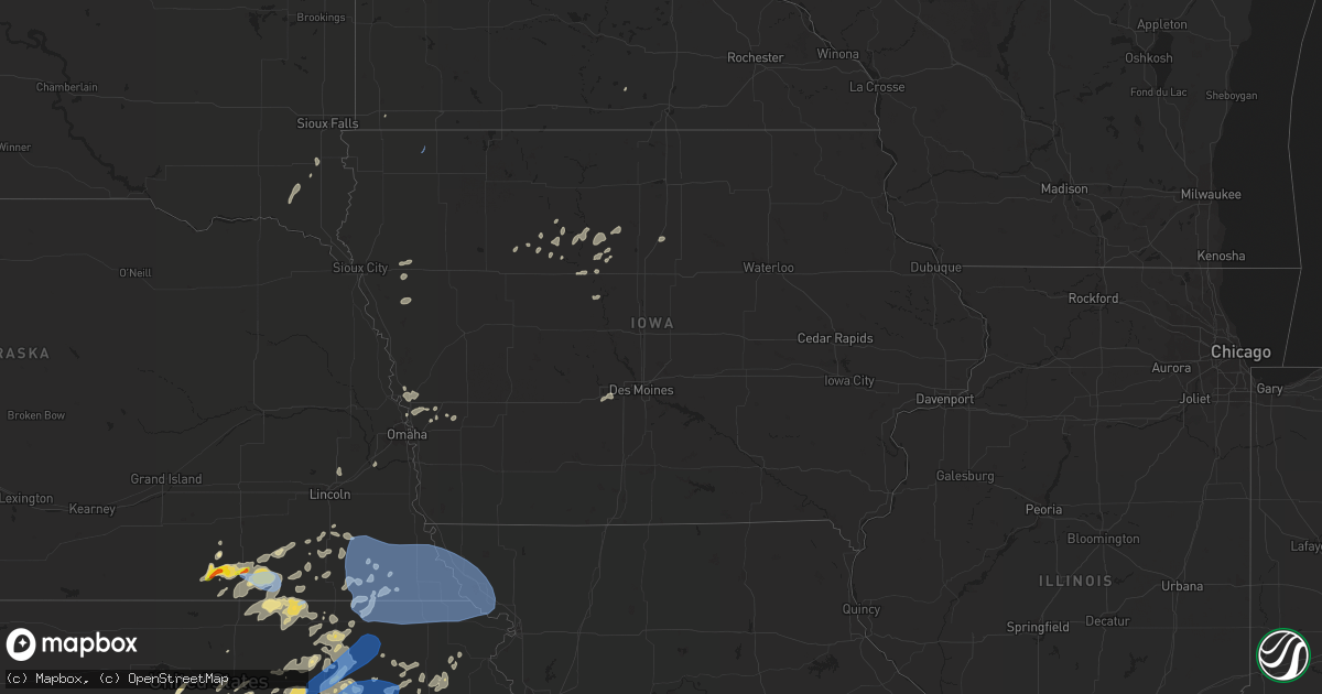
Hail Map in Iowa on August 20, 2021
Get this storm
August 20 map
$229
one time, instant access
Download today. No call, no setup
Keep the $229
Bought the map and want the full workflow? Apply the entire $229 to a subscription within 7 days. None of it is wasted.
Every map, not just this one
This buys you this map. Subscription and you get every map we run, in the markets you choose from a few cities to whole states to nationwide. Plus real-time alerts the moment a storm fires.
Contact data
Name, contact info, occupancy, even credit band for addresses in the footprint. You go from where it hit to who to call.
Become the source they trust
Unlimited branding weather history reports on demand. You already have the documented answer ready for the property owner, and you are the one who showed up with it.
Property data and RoofTrace estimates
Pull up any address you have got, its value and the exact code rules for that jurisdiction, straight from One Click Code. Then RoofTrace estimates the squares, pitch, and roof value, priced the way you price.
Storm reports in Iowa
Iowa
| Date | Description |
|---|---|
| 08/20/20216:22 PM CDT | Delayed report via social media. Large tree branch estimated at 10 inches in diameter broken. Some damage to corn crop also noted. |
| 08/20/20216:16 PM CDT | Large tree snapped. Also had 6 inch diameter tree branches down. |
| 08/20/20213:40 PM CDT | Delayed report. Emergency manager reports tornado damage to an outbuilding at a farm as well as damage to a couple trees. Drone video shows the tornado path through a c |
| 08/20/20214:46 AM CDT | At 946 PM CDT, a severe thunderstorm was located near Webster City, moving east at 35 mph. HAZARD...60 mph wind gusts. SOURCE...Radar indicated. IMPACT...Expect damage to roofs, siding, and trees. This severe thunderstorm will be near... Webster City around 955 PM CDT.Other locations in the path of this severe thunderstorm include BigWall Lake.This includes Interstate 35 between mile markers 140 and 154. |
| 08/20/20214:05 AM CDT | At 905 PM CDT, a severe thunderstorm was located over Eagle Grove, or 8 miles west of Clarion, moving east at 40 mph. HAZARD...60 mph wind gusts. SOURCE...Radar indicated. IMPACT...Expect damage to roofs, siding, and trees. This severe thunderstorm will be near... Clarion and Elm Lake around 920 PM CDT.Other locations in the path of this severe thunderstorm includeBelmond.This includes Interstate 35 between mile markers 156 and 164. |
| 08/20/20211:31 AM CDT | At 631 PM CDT, a severe thunderstorm was located near Anthon, or 17 miles west of Ida Grove, moving northeast at 40 mph. HAZARD...60 mph wind gusts and nickel size hail. SOURCE...Radar indicated. IMPACT...Expect damage to roofs, siding, and trees. This severe thunderstorm will be near... Battle Creek around 645 PM CDT. Ida Grove around 655 PM CDT. Holstein around 700 PM CDT.Other locations impacted by this severe thunderstorm include Oto. |
| 08/20/20211:13 AM CDT | At 612 PM CDT, a severe thunderstorm was located over Pierson, or 20 miles southwest of Cherokee, moving northeast at 30 mph. HAZARD...60 mph wind gusts and quarter size hail. SOURCE...Radar indicated. IMPACT...Hail damage to vehicles is expected. Expect wind damage to roofs, siding, and trees. This severe thunderstorm will be near... Washta around 625 PM CDT.Other locations in the path of this severe thunderstorm includeQuimby. |
| 08/19/20217:55 PM CDT | 4 in tree branch snapped - 2 branches. Also reported ponding of water in city streets. |
All States Impacted by Hail Map on August 20, 2021
Cities Impacted by Hail Map on August 20, 2021
- Bremen, KS
- Lincoln, KS
- Moundridge, KS
- Windom, KS
- Lyons, KS
- Buhler, KS
- Hutchinson, KS
- Inman, KS
- Mcpherson, KS
- Little River, KS
- Castle Hayne, NC
- Wilmington, NC
- Burrton, KS
- South Hutchinson, KS
- Haven, KS
- Partridge, KS
- Clay Center, KS
- Otis, KS
- Larned, KS
- Rush Center, KS
- Hollenberg, KS
- Washington, KS
- Morrowville, KS
- Salina, KS
- New Cambria, KS
- Hardy, IA
- Goldfield, IA
- Thor, IA
- Eagle Grove, IA
- Cortland, NE
- Firth, NE
- Kinsley, KS
- Eskridge, KS
- Fairbury, NE
- Alexandria, NE
- Hebron, NE
- Gilead, NE
- Snyder, TX
- Burlington, KS
- Le Roy, KS
- Western, NE
- Frankfort, KS
- Home, KS
- Belvidere, NE
- Everton, MO
- Davenport, NE
- Deshler, NE
- Oak, NE
- Carleton, NE
- Alta Vista, KS
- Junction City, KS
- White City, KS
- Dwight, KS
- Attica, KS
- Zenda, KS
- Sawyer, KS
- Isabel, KS
- Pratt, KS
- Cunningham, KS
- Spivey, KS
- Nashville, KS
- Kingman, KS
- Beloit, KS
- Solomon, KS
- Abilene, KS
- Sheffield, TX
- Dryden, TX
- Beatrice, NE
- Blue Springs, NE
- Soldier, KS
- Havensville, KS
- Circleville, KS
- Holton, KS
- Hope, KS
- Herington, KS
- Ramona, KS
- Lost Springs, KS
- Tampa, KS
- Dayton, IA
- Wakefield, KS
- Milford, KS
- Olsburg, KS
- Manhattan, KS
- Westmoreland, KS
- Edgar, NE
- Fluvanna, TX
- Nelson, NE
- Adams, NE
- Filley, NE
- Pickrell, NE
- Concordia, KS
- Mayetta, KS
- Denison, KS
- Valley Falls, KS
- Woolstock, IA
- Riley, KS
- Minneapolis, KS
- Delphos, KS
- Miltonvale, KS
- Lindsborg, KS
- Marquette, KS
- Waterville, KS
- Pierson, IA
- Kingsley, IA
- Moville, IA
- Shawnee, KS
- Kansas City, KS
- Bonner Springs, KS
- Lenexa, KS
- Plymouth, NE
- Jansen, NE
- Marysville, KS
- Blue Rapids, KS
- Barnes, KS
- Green, KS
- Randolph, KS
- Minden, IA
- Durham, KS
- Leonardville, KS
- Manson, IA
- Canton, KS
- Gypsum, KS
- Honey Creek, IA
- Neola, IA
- Onaga, KS
- Daykin, NE
- Omaha, NE
- Fort Calhoun, NE
- Ira, TX
- Offerle, KS
- Arlington, KS
- Pretty Prairie, KS
- Geneseo, KS
- Nickerson, KS
- Sterling, KS
- Selma, NC
- Clayton, NC
- Mahaska, KS
- Missouri Valley, IA
- Waycross, GA
- Lennox, SD
- Beresford, SD
- Lincolnville, KS
- Talmage, KS
- Mullinville, KS
- Haviland, KS
- Council, NC
- Riegelwood, NC
- Burchard, NE
- Lake Placid, FL
- Burdick, KS
- Tescott, KS
- Springfield, NE
- South Bend, NE
- Gretna, NE
- Hubbell, NE
- Underwood, IA
- Saint George, KS
- Parkers Prairie, MN
- Alexandria, MN
- Garfield, MN
- Miltona, MN
- Anthon, IA
- Ceresco, NE
- Lincoln, NE
- Clare, IA
- Bucklin, KS
- Beattie, KS
- Liberty, NE
- Summerfield, KS
- Oketo, KS
- Oakland, IA
- Hancock, IA
- Martell, NE
- Meade, KS
- Fowler, KS
- Endicott, NE
- Narka, KS
- Hanover, KS
- Haddam, KS
- Belleville, KS
- Chester, NE
- Steele City, NE
- Diller, NE
- Munden, KS
- Reynolds, NE
- Sylvan Grove, KS
- Nahunta, GA
- Axtell, KS
- Wamego, KS
- Alma, KS
- Luverne, MN
- Fonda, IA
- Strong City, KS
- Sharon, KS
- Saint Marys, KS
- Paxico, KS
- Maple Hill, KS
- Carnesville, GA
- Muscotah, KS
- Effingham, KS
- Falun, KS
- Duncombe, IA
- Table Rock, NE
- Steinauer, NE
- Reading, KS
- Bennington, KS
- Van Meter, IA
- Waukee, IA
- Adel, IA
- Harveyville, KS
- De Witt, NE
- Hallam, NE
- Clatonia, NE
- Tecumseh, NE
- Elk Creek, NE
- Vincent, IA
- Fort Dodge, IA
- Du Bois, NE
- Pawnee City, NE
- Lecompton, KS
- Perry, KS
- Lawrence, KS
- Toccoa, GA
- Livermore, IA
- Dakota City, IA
- Humboldt, IA
- Spearville, KS
- Wells, MN
- Webster City, IA
- Palmer, IA
- Pomeroy, IA
- Hoyt, KS
- Elon, NC
- Burlington, NC
- Pocahontas, IA
- Waynesville, GA
- Council Grove, KS
- Wilsey, KS
- Snow Hill, NC
- Emmett, KS
- Clarion, IA
- Marion, KS
- Stilwell, KS
- Kerkhoven, MN
- Bison, KS
- Hunter, KS
- Barnard, KS
- Andrews, TX
- Wymore, NE
- Admire, KS
- Shickley, NE
- Centerville, SD
- Bradgate, IA
- Smithland, IA
- Burlingame, KS
- Scranton, KS
- Delia, KS
- Fremont, NC
- Lecanto, FL
- Beverly Hills, FL
- Raleigh, NC
- Carbondale, KS
- Blountstown, FL
- Wakonda, SD
- Lyndon, KS
- Osage City, KS
- Olathe, KS
- Everest, KS
- Ozawkie, KS
- Meriden, KS
- Glasco, KS
- Palmer, KS
- Morganville, KS
- Aurora, KS
- El Dorado, KS
- Tobias, NE
- Wilber, NE
- Swanton, NE
- Gilmore City, IA
- Kenly, NC
- Lucama, NC
- Wilson, NC
- Fort Riley, KS
- Allen, KS
- Byron, NE
- Hampton, IA
- Dows, IA
- Latimer, IA
- Galva, KS
- Garfield, KS
- Hilliard, FL
- Rolfe, IA
- Clarkton, NC
- Sibley, IA
- Ashton, IA
- Chapman, KS
- Ogden, KS
- Enterprise, KS
- Belvue, KS
- Sterling, NE
- Baileyville, KS
- Falls City, NE
- Lewiston, NE
- Nemaha, NE
- Morrill, KS
- Johnson, NE
- Mound City, MO
- Dawson, NE
- Robinson, KS
- Bern, KS
- Sabetha, KS
- Verdon, NE
- Fairview, KS
- Forest City, MO
- Rulo, NE
- Seneca, KS
- Oregon, MO
- Stella, NE
- Salem, NE
- Hiawatha, KS
- Oneida, KS
- Crab Orchard, NE
- Virginia, NE
- Cook, NE
- Rock Port, MO
- Brownville, NE
- Maitland, MO
- Highland, KS
- Fairfax, MO
- Humboldt, NE
- White Cloud, KS
- Craig, MO
- Auburn, NE
- Shubert, NE
- Vermillion, KS
- Centralia, KS
- Sedgwick, KS
- Halstead, KS
- Newton, KS
- De Soto, KS
- Independence, MO
- Waldron, MO
- Kansas City, MO
- McLouth, KS
- Eudora, KS
- Overland Park, KS
- Liberty, MO
- Riverside, MO
- Basehor, KS
- Leawood, KS
- Tonganoxie, KS
- Linwood, KS
- Leavenworth, KS
- Prairie Village, KS
- Mission, KS
- Oskaloosa, KS
- Harper, KS
- Grygla, MN
- Thief River Falls, MN
- Gatzke, MN
- Goodridge, MN
- Erskine, MN
- Gonvick, MN
- Oklee, MN
- Plummer, MN
- Mcintosh, MN
- Trail, MN
- Carlos, MN
- Henning, MN
- Deer Creek, MN
- Climax, MN
- Buxton, ND
- Reynolds, ND
- Crookston, MN
- Fisher, MN
- Cummings, ND
- Hillsboro, ND
- Mayville, ND
- Ruskin, NE


