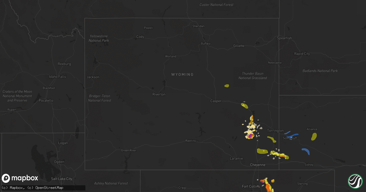
Hail Map in Wyoming on August 20, 2019
Get this storm
August 20 map
$229
one time, instant access
Download today. No call, no setup
Keep the $229
Bought the map and want the full workflow? Apply the entire $229 to a subscription within 7 days. None of it is wasted.
Every map, not just this one
This buys you this map. Subscription and you get every map we run, in the markets you choose from a few cities to whole states to nationwide. Plus real-time alerts the moment a storm fires.
Contact data
Name, contact info, occupancy, even credit band for addresses in the footprint. You go from where it hit to who to call.
Become the source they trust
Unlimited branding weather history reports on demand. You already have the documented answer ready for the property owner, and you are the one who showed up with it.
Property data and RoofTrace estimates
Pull up any address you have got, its value and the exact code rules for that jurisdiction, straight from One Click Code. Then RoofTrace estimates the squares, pitch, and roof value, priced the way you price.
Storm reports in Wyoming
Wyoming
| Date | Description |
|---|---|
| 08/20/20196:47 PM CDT | A local report indicates 1.00 inch wind near S DOUGLAS |
| 08/20/20196:40 PM CDT | Report received via facebook. Interstate 25 mile marker 94. |
| 08/20/20196:23 PM CDT | Report from mping: quarter |
| 08/20/20196:22 PM CDT | Report from mping: quarter |
| 08/20/20195:50 AM CDT | At 1050 PM MDT, severe thunderstorms were located along a line extending from 7 miles north of Box Butte Campground to 8 miles northwest of Hillsdale, moving south at 15 mph. HAZARD...70 mph wind gusts and quarter size hail. SOURCE...Radar indicated. IMPACT...Hail damage to vehicles is expected. Expect considerable tree damage. Wind damage is also likely to mobile homes, roofs, and outbuildings. Locations impacted include... Scottsbluff, Alliance, Kimball, Gering, Mitchell, Bridgeport, Bayard, Terrytown, Pine Bluffs, Minatare, Hemingford, La Grange, Burns, Dix, Albin, Oliver Campground, Wildcat Hills State Recreation Area, Northport, Angora and Wildcat Hills Campground.This includes the following highways... Interstate 80 in Wyoming between mile markers 387 and 402. Interstate 80 in Nebraska between mile markers 1 and 33. |
| 08/20/20195:07 AM CDT | At 1006 PM MDT, severe thunderstorms were located along a line extending from near Chadron Campground to near Whitaker, moving northeast at 10 mph. HAZARD...70 mph wind gusts and quarter size hail. SOURCE...Radar indicated. IMPACT...Hail damage to vehicles is expected. Expect considerable tree damage. Wind damage is also likely to mobile homes, roofs, and outbuildings. Locations impacted include... Scottsbluff, Torrington, Chadron, Gering, Mitchell, Terrytown, Morrill, Minatare, Hemingford, La Grange, Lyman, Yoder, Wildcat Hills State Recreation Area, Stegall, Wildcat Hills Campground, Hawk Springs, Box Butte Dam, Hawk Springs Campground, Hubbard Hill and Chadron Campground.This includes Interstate 25 in Wyoming between mile markers 28 and51. |
| 08/20/20194:49 AM CDT | At 948 PM MDT, a severe thunderstorm was located 9 miles southeast of Chugwater, or 30 miles south of Wheatland, moving east at 10 mph. HAZARD...60 mph wind gusts and quarter size hail. SOURCE...Radar indicated. IMPACT...Hail damage to vehicles is expected. Expect wind damage to roofs, siding, and trees. This severe thunderstorm will remain over mainly rural areas of southwestern Goshen, north central Laramie and southeastern Platte Counties. |
| 08/20/20194:25 AM CDT | At 925 PM MDT, a severe thunderstorm was located near Yoder, or 16 miles southwest of Torrington, moving east at 20 mph. HAZARD...60 mph wind gusts and half dollar size hail. SOURCE...Radar indicated. IMPACT...Hail damage to vehicles is expected. Expect wind damage to roofs, siding, and trees. Locations impacted include... Yoder, Huntley, Veteran and Hawk Springs. |
| 08/20/20193:04 AM CDT | At 804 PM MDT, a severe thunderstorm was located 11 miles southwest of Windy Peak, or 41 miles southwest of Douglas, moving east at 20 mph. HAZARD...60 mph wind gusts and quarter size hail. SOURCE...Radar indicated. IMPACT...Hail damage to vehicles is expected. Expect wind damage to roofs, siding, and trees. Locations impacted include... Windy Peak, Laramie Peak and Friend Park Campground. |
| 08/20/20192:25 AM CDT | At 725 PM MDT, a severe thunderstorm was located over Curtis Gulch Campground, or 25 miles south of Douglas, and is nearly stationary. HAZARD...60 mph wind gusts and half dollar size hail. SOURCE...Radar indicated. IMPACT...Hail damage to vehicles is expected. Expect wind damage to roofs, siding, and trees. Locations impacted include... Curtis Gulch Campground. |
| 08/20/20191:57 AM CDT | At 656 PM MDT, severe thunderstorms were located along a line extending from 11 miles east of Harris Park to 10 miles southwest of Bordeaux, moving east at 15 mph. HAZARD...Ping pong ball size hail. SOURCE...Trained weather spotters. IMPACT...People and animals outdoors will be injured. Expect damage to roofs, siding, windows, and vehicles. Locations impacted include... Wheatland, Chugwater, Chugcreek, Lakeview North, Bordeaux, Westview Circle, Y-O Ranch and Slater.This includes Interstate 25 in Wyoming between mile markers 52 and104. |
| 08/20/20191:43 AM CDT | At 642 PM MDT, severe thunderstorms were located along a line extending from Laramie Peak to near Westview Circle, moving west at 10 mph. HAZARD...60 mph wind gusts and half dollar size hail. SOURCE...Radar indicated. IMPACT...Hail damage to vehicles is expected. Expect wind damage to roofs, siding, and trees. Locations impacted include... Wheatland, Lakeview North, Westview Circle and Laramie Peak. This includes Interstate 25 in Wyoming between mile markers 79 and96. |
| 08/20/20191:27 AM CDT | At 627 PM MDT, a severe thunderstorm was located near Bordeaux, or 8 miles southeast of Wheatland, moving northeast at 20 mph. HAZARD...Half dollar size hail. SOURCE...Radar indicated. IMPACT...Damage to vehicles is expected. Locations impacted include... Wheatland, Slater, Chugcreek, Bordeaux and Y-O Ranch. This includes Interstate 25 in Wyoming between mile markers 63 and79. |
| 08/20/20191:12 AM CDT | At 612 PM MDT, a severe thunderstorm was located 8 miles northwest of Westview Circle, or 13 miles northwest of Wheatland, moving southwest at 5 mph. HAZARD...Ping pong ball size hail. SOURCE...Radar indicated. IMPACT...People and animals outdoors will be injured. Expect damage to roofs, siding, windows, and vehicles. Locations impacted include... Westview Circle. |
| 08/20/20191:04 AM CDT | At 604 PM MDT, a severe thunderstorm was located near Bordeaux, or 10 miles south of Wheatland, moving northeast at 20 mph. HAZARD...Ping pong ball size hail. SOURCE...Radar indicated. IMPACT...People and animals outdoors will be injured. Expect damage to roofs, siding, windows, and vehicles. Locations impacted include... Wheatland, Slater, Chugcreek, Bordeaux and Y-O Ranch. This includes Interstate 25 in Wyoming between mile markers 63 and78. |
| 08/20/20191:02 AM CDT | At 602 PM MDT, a severe thunderstorm was located near Westview Circle, or 12 miles west of Wheatland, and is nearly stationary. HAZARD...Half dollar size hail. SOURCE...Radar indicated. IMPACT...Damage to vehicles is expected. Locations impacted include... Westview Circle. |
| 08/20/201912:55 AM CDT | At 555 PM MDT, a severe thunderstorm was located 20 miles north of Rolling Hills, or 36 miles northwest of Douglas, moving southeast at 10 mph. HAZARD...Ping pong ball size hail. SOURCE...Radar indicated. IMPACT...People and animals outdoors will be injured. Expect damage to roofs, siding, windows, and vehicles. This severe thunderstorm will remain over mainly rural areas of northwestern Converse County. |
| 08/20/201912:53 AM CDT | At 553 PM MDT, a severe thunderstorm was located near Whitaker, or 22 miles north of Cheyenne, moving southwest at 5 mph. HAZARD...Ping pong ball size hail. SOURCE...Radar indicated. IMPACT...People and animals outdoors will be injured. Expect damage to roofs, siding, windows, and vehicles. Locations impacted include... Whitaker.This includes Interstate 25 in Wyoming between mile markers 22 and38. |
| 08/20/201912:51 AM CDT | At 551 PM MDT, a severe thunderstorm was located near Sibley Peak, or 22 miles north of Wheatland, moving north at 30 mph. HAZARD...Ping pong ball size hail. SOURCE...Radar indicated. IMPACT...People and animals outdoors will be injured. Expect damage to roofs, siding, windows, and vehicles. Locations impacted include... Glendo, Sibley Peak, Glendo Reservoir and Two Moon Campground. This includes Interstate 25 in Wyoming between mile markers 99 and118. |
| 08/20/201912:49 AM CDT | At 548 PM MDT, a severe thunderstorm was located 7 miles west of Westview Circle, or 12 miles west of Wheatland, and is nearly stationary. HAZARD...Half dollar size hail. SOURCE...Radar indicated. IMPACT...Damage to vehicles is expected. Locations impacted include... Westview Circle. |
| 08/20/201912:47 AM CDT | At 546 PM MDT, a severe thunderstorm was located near Douglas, moving east at 10 mph. HAZARD...Half dollar size hail. SOURCE...Radar indicated. IMPACT...Damage to vehicles is expected. Locations impacted include... Douglas.This includes Interstate 25 in Wyoming between mile markers 127 and140, and near mile marker 142. |
| 08/20/201912:42 AM CDT | At 542 PM MDT, a severe thunderstorm was located 18 miles south of Buffalo, moving east at 10 mph. HAZARD...Quarter size hail. SOURCE...Radar indicated. IMPACT...Damage to vehicles is expected. This severe thunderstorm will remain over mainly rural areas of central Johnson County.This includes Interstate 25 between mile markers 278 and 284. |
| 08/20/201912:34 AM CDT | At 534 PM MDT, a severe thunderstorm was located 14 miles west of Gun Barrel, or 25 miles north of Cheyenne, moving west at 10 mph. HAZARD...Half dollar size hail. SOURCE...Radar indicated. IMPACT...Damage to vehicles is expected. This severe thunderstorm will remain over mainly rural areas of north central Laramie County. |
| 08/20/201912:29 AM CDT | At 528 PM MDT, a severe thunderstorm was located 11 miles northwest of Lakeview North, or 14 miles northwest of Wheatland, moving east at 10 mph. HAZARD...Half dollar size hail. SOURCE...Radar indicated. IMPACT...Damage to vehicles is expected. This severe thunderstorm will remain over mainly rural areas of central Platte County.This includes Interstate 25 in Wyoming between mile markers 88 and101. |
| 08/20/201912:19 AM CDT | At 519 PM MDT, a severe thunderstorm was located 22 miles southeast of Edgerton, or 37 miles southwest of Wright, and is nearly stationary. HAZARD...Quarter size hail. SOURCE...Radar indicated. IMPACT...Damage to vehicles is expected. This severe thunderstorm will remain over mainly rural areas of northwestern Converse County. |
| 08/20/201912:00 AM CDT | Report on facebook of half dollar sized hail in albin. |
| 08/19/201911:52 PM CDT | At 452 PM MDT, a severe thunderstorm was located near Gun Barrel, or 35 miles northwest of Kimball, moving west at 5 mph. HAZARD...Half dollar size hail. SOURCE...Radar indicated. IMPACT...Damage to vehicles is expected. Locations impacted include... Gun Barrel and Meriden Rest Area. |
| 08/19/20197:40 PM CDT | A local report indicates 1.50 inch wind near 9 SW WHEATLAND |
| 08/19/20197:34 PM CDT | Storm chaser measured tennis ball sized hail. Hwy 34 mm42 near sybille creek. |
| 08/19/20197:00 PM CDT | Report received from platte county emergency manager. |
| 08/19/20197:00 PM CDT | Dan fitts report from twitter. |
All States Impacted by Hail Map on August 20, 2019
Cities Impacted by Hail Map on August 20, 2019
- Wheatland, WY
- Robinson, KS
- Hiawatha, KS
- Cairo, NE
- Hazard, NE
- Litchfield, NE
- Boelus, NE
- Loup City, NE
- Ravenna, NE
- Shelton, NE
- Rockville, NE
- Brainerd, MN
- Fort Ripley, MN
- Pierz, MN
- Wood River, NE
- Quinter, KS
- Fairborn, OH
- Rolla, MO
- Hoxie, KS
- Nunn, CO
- Ault, CO
- Pierce, CO
- Edgar Springs, MO
- Bushnell, NE
- Harrisburg, NE
- Douglas, WY
- Dannebrog, NE
- Saint Paul, NE
- Worthington, MO
- Queen City, MO
- Livonia, MO
- Grinnell, KS
- Gove, KS
- Bancroft, IA
- Denver, CO
- Herndon, VA
- Roggen, CO
- Park, KS
- La Salle, CO
- Evans, CO
- Greeley, CO
- Galeton, CO
- Gill, CO
- Eaton, CO
- Chase, KS
- Raymond, KS
- Briggsdale, CO
- Mason City, NE
- Oregon, MO
- Forest City, MO
- Titonka, IA
- Edina, MO
- Ellinwood, KS
- Fort Leonard Wood, MO
- Highland, KS
- Kimball, NE
- Burt, IA
- Albin, WY
- Rulo, NE
- White Cloud, KS
- Dublin, VA
- Keenesburg, CO
- Pleasanton, NE
- Maitland, MO
- Guernsey, WY
- Dunkirk, MD
- Upper Marlboro, MD
- Suitland, MD
- Andrews Air Force Base, MD
- Temple Hills, MD
- Chugwater, WY
- Strasburg, CO
- Yellow Springs, OH
- Capitol Heights, MD
- Washington, DC
- District Heights, MD
- Great Bend, KS
- Grainfield, KS
- Lu Verne, IA
- Craig, MO
- Novelty, MO
- Hurdland, MO
- Naval Anacost Annex, DC
- Troy, KS
- Wathena, KS
- Buffalo, MN
- Hays, KS
- Meriden, WY
- Lagrange, WY
- Steinauer, NE
- Sterling, VA
- Corwith, IA
- Kersey, CO
- Newburg, MO
- Dixon, MO
- Unionville, MO
- Merriman, NE
- Bucklin, KS
- Livermore, IA
- Sheridan, MO
- Falls City, NE
- Bridgeport, NE
- Garrett, WY
- Algona, IA
- College Park, MD
- Beltsville, MD
- Hyattsville, MD
- Saint James, MO
- Bushton, KS
- Offerle, KS
- Whittemore, IA
- Fenton, IA
- Lone Rock, IA
- Hiwassee, VA
- Radford, VA
- Savannah, MO
- Amazonia, MO
- Fillmore, MO
- Pine Bluffs, WY
- St John, KS
- Bayard, NE
- Foley, MN
- Verdon, NE
- Stella, NE
- Collyer, KS
- Elkins, WV
- Ewing, MO
- Graham, MO
- Barnard, MO
- Humboldt, NE
- Sterling, NE
- Cheyenne, WY
- Bethesda, MD
- Potomac, MD
- Rockville, MD
- Elk Creek, NE
- Tecumseh, NE
- Johnson, NE
- Beatrice, NE
- Kinsley, KS
- Fairfax, MO
- Perry, MI
- Morrice, MI
- Abingdon, VA
- Novinger, MO
- Falls Church, VA
- Arlington, VA
- Emden, MO
- Brashear, MO
- Kirksville, MO
- La Plata, MO
- Bethel, MO
- Philadelphia, MO
- Gibbs, MO
- Leonard, MO
- Knox City, MO
- Newark, MO
- Shelbyville, MO
- La Belle, MO
- Hudson, CO
- Hudson, KS
- Fairmont, NE
- Platteville, CO
- Grand Island, NE
- Lyman, NE
- Alda, NE
- Orchard, CO
- Farwell, NE
- Otter Lake, MI
- Otisville, MI
- Columbiaville, MI
- Millington, MI
- Salem, MO
- Auburn, NE
- Lakota, IA
- Buffalo, WY
- Kaycee, WY
- Lathrop, MO
- Turney, MO
- Ellsworth, NE
- Webberville, MI
- Oconto, NE
- Riner, VA
- Kahoka, MO
- Easton, MO
- Saint Joseph, MO
- Duke, MO
- Fairfax Station, VA
- Woodbridge, VA
- Bennett, CO
- Fowlerville, MI
- Baxter, MN
- Burns, WY
- Brentwood, MD
- Mount Rainier, MD
- Genoa, CO
- Dighton, KS
- Broken Bow, NE
- Geneseo, KS
- Mound City, MO
- Lorton, VA
- Alexandria, VA
- Springfield, VA
- Ansley, NE
- Milaca, MN
- Owosso, MI
- Pillager, MN
- Henderson, NE
- Wesley, IA
- Yoder, WY
- Claflin, KS
- Van Buren, MO
- Maysville, MO
- Bode, IA
- Lisco, NE
- Long Prairie, MN
- Great Falls, VA
- Merna, NE
- Hemingford, NE
- Marsland, NE
- Ottosen, IA
- McLean, VA
- Mitchell, NE
- Rock Port, MO
- Rozel, KS
- Plymouth, NE
- Western, NE
- Swanton, NE
- Gentry, MO
- Stanberry, MO
- Scottsbluff, NE
- Vienna, VA
- Reston, VA
- Bristol, VA
- Clifton, VA
- Glenrock, WY
- Glendo, WY
- Hawk Springs, WY
- Giltner, NE
- Doniphan, NE
- Angora, NE
- Harvard, NE
- Aurora, NE
- Morrill, NE
- Harrison, NE
- Minatare, NE
- Gering, NE
- Dalton, NE
- Lindon, CO
- Cokato, MN
- Howard Lake, MN
- Chillicothe, MO
- Williamsfield, IL
- Galesburg, IL
- Wataga, IL
- Burlington, IA
- Oneida, IL
- Victoria, IL
- East Peoria, IL
- Dunlap, IL
- Oquawka, IL
- Monmouth, IL
- Peoria Heights, IL
- Princeville, IL
- Brimfield, IL
- Seaton, IL
- Toulon, IL
- Mossville, IL
- Cameron, IL
- Edwards, IL
- Laura, IL
- Dahinda, IL
- Yates City, IL
- Henderson, IL
- East Galesburg, IL
- Little York, IL
- Knoxville, IL
- Alexis, IL
- Maquon, IL
- Gilson, IL
- Elmwood, IL
- Chillicothe, IL
- Metamora, IL
- Peoria, IL
- Edelstein, IL
- Gerlaw, IL
- Rock Island, IL
- Taylor Ridge, IL
- Reynolds, IL
- Milan, IL
- Hanna City, IL
- Trivoli, IL
- Glasford, IL
- Mount Pulaski, IL
- Delavan, IL
- Farmington, IL
- Hammond, IL
- Chestnut, IL
- Green Valley, IL
- Arthur, IL
- Cerro Gordo, IL
- San Jose, IL
- Ellisville, IL
- Canton, IL
- Pekin, IL
- Tuscola, IL
- Kingston Mines, IL
- Maroa, IL
- New Holland, IL
- La Place, IL
- Latham, IL
- Beason, IL
- Oreana, IL
- Forsyth, IL
- Tremont, IL
- Lovington, IL
- Warrensburg, IL
- Mapleton, IL
- Emden, IL
- Manito, IL
- London Mills, IL
- Decatur, IL
- Arcola, IL
- South Pekin, IL
- Argenta, IL
- Hartsburg, IL
- Kenney, IL
- Lincoln, IL
- Norris, IL
- Humboldt, IL
- Fairview, IL
- Pawnee, IL
- Chatham, IL
- Springfield, IL
- Pleasant Plains, IL
- Rochester, IL
- Petersburg, IL
- Edinburg, IL
- Cantrall, IL
- Sidell, IL
- Urbana, IL
- White Heath, IL
- Homer, IL
- De Land, IL
- Savoy, IL
- Bondville, IL
- Mansfield, IL
- Philo, IL
- Champaign, IL
- Metcalf, IL
- Monticello, IL
- Indianola, IL
- Fairmount, IL
- Sidney, IL
- Allerton, IL
- Seymour, IL
- Tolono, IL
- Ridge Farm, IL
- Chrisman, IL
- Batavia, IA
- Fairfield, IA
- Carman, IL
- Packwood, IA
- Mount Pleasant, IA
- Morning Sun, IA
- Olds, IA
- Winfield, IA
- Columbus Junction, IA
- New Boston, IL
- Danville, IA
- Middletown, IA
- Lockridge, IA
- Wapello, IA
- Gladstone, IL
- Hedrick, IA
- Brighton, IA
- Muscatine, IA
- Salem, IA
- New London, IA
- Wayland, IA
- Crawfordsville, IA
- West Burlington, IA
- Ottumwa, IA
- Libertyville, IA
- Donnellson, IA
- Stockport, IA
- West Point, IA
- Selma, IA
- Hillsboro, IA
- Birmingham, IA
- Douds, IA
- Eldon, IA
- Agency, IA
- Albia, IA
- Lovilia, IA
- Sylvia, KS
- Winona, KS
- Edson, KS
- Loretto, MN
- Maple Grove, MN
- Hamel, MN
- Minneapolis, MN


