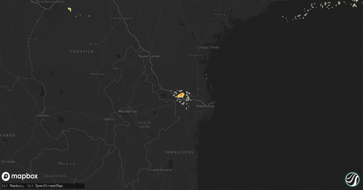
Hail Map on August 19, 2015
Get this storm
August 19 map
$229
one time, instant access
Download today. No call, no setup
Keep the $229
Bought the map and want the full workflow? Apply the entire $229 to a subscription within 7 days. None of it is wasted.
Every map, not just this one
This buys you this map. Subscription and you get every map we run, in the markets you choose from a few cities to whole states to nationwide. Plus real-time alerts the moment a storm fires.
Contact data
Name, contact info, occupancy, even credit band for addresses in the footprint. You go from where it hit to who to call.
Become the source they trust
Unlimited branding weather history reports on demand. You already have the documented answer ready for the property owner, and you are the one who showed up with it.
Property data and RoofTrace estimates
Pull up any address you have got, its value and the exact code rules for that jurisdiction, straight from One Click Code. Then RoofTrace estimates the squares, pitch, and roof value, priced the way you price.
States Impacted by Hail Map on August 19, 2015
Storm reports
Georgia
| Date | Description |
|---|---|
| 08/19/20155:59 PM CDT | Powerlines down in screven. |
| 08/19/20155:49 PM CDT | Tree down across road. |
| 08/19/20154:45 PM CDT | Trees and power lines reported down ay mitchell avenue and rood street in albany. Relayed by walb-tv. |
Louisiana
| Date | Description |
|---|---|
| 08/19/20155:40 PM CDT | A large tree was down over the road in the 10000 block of thornwood dr. Another tree fell on a house on thornwood dr. As well. Other large limbs were downed on ellerbe |
Mississippi
| Date | Description |
|---|---|
| 08/19/20153:30 PM CDT | A few trees were blown down... One tree was down on car along hwy 14. No inuries. |
| 08/19/20152:47 PM CDT | Trees and powerlines were blown down along blackjack road and goat ranch road near highway 16. |
Florida
| Date | Description |
|---|---|
| 08/19/20155:47 PM CDT | A few power poles were snapped near intersection of old hwy 37 and pebbledale rd. Time estimated by radar. |
| 08/19/20153:40 PM CDT | Wires were blown down onto a vechile along forest blvd. |
| 08/19/20153:36 PM CDT | Social media post of picture showing large tree down. Time of event estimated by radar. |
| 08/19/20153:34 PM CDT | A tree branch was blown down onto a moving vehicle at north terry parker drive and cesary blvd. |
| 08/19/20153:26 PM CDT | Social media post showing downed tree on gaillardia road. |
| 08/19/20153:20 PM CDT | Spotter estimated wind gusts to 60 mph near craig airfield. |
| 08/19/20153:15 PM CDT | A large tree was blown down near beach and kernan blvds. |
Michigan
| Date | Description |
|---|---|
| 08/19/20153:29 PM CDT | Wires and trees reported down in the mayville area |
| 08/19/20153:02 PM CDT | Tree downed in lapeer township |
| 08/19/20152:54 PM CDT | Large tree knocked over and damaged house at maryland and cook. |
| 08/19/20151:50 PM CDT | Tree down at chillson and marshall. |
| 08/19/20151:47 PM CDT | Tree down at pleasant valley and burgoyne |
Kentucky
| Date | Description |
|---|---|
| 08/19/20152:47 PM CDT | Tree reported down. |
| 08/19/201512:10 PM CDT | Tree fell on highway 30 between mile markers 7 and 8. |
Texas
| Date | Description |
|---|---|
| 08/19/20151:51 AM CDT | Pharr police department reports tree blown down by thunderstorm winds at 106 north palm and also at the intersection of jackson and ridge. |
| 08/19/20151:30 AM CDT | Mission police department reports powerlines down due to strong winds at inspiration and fm 495 and at 1413 doherty. Also big tree branches down at inspiration and fm 4 |
| 08/19/20151:03 AM CDT | Mission police department reports quarter-size hail throughout much of the city of mission. |
| 08/19/201512:35 AM CDT | Palmview police department reported golf ball size hail at the intersection of expressway 83 and la homa road. |
Tennessee
| Date | Description |
|---|---|
| 08/19/20156:40 PM CDT | Trees down near lenior city. |
| 08/19/20156:30 PM CDT | Several trees down in the kingston area. |
| 08/19/20153:07 PM CDT | A few small trees and power lines blown down. Location and time estimated from radar. |
North Carolina
| Date | Description |
|---|---|
| 08/19/20156:25 PM CDT | Tree down across wire rd and josey williams rd 4 miles wnw of linden. |
| 08/19/20156:05 PM CDT | Tree down across ross rd and bunnlevel erwin rd 4 miles west of erwin. |
| 08/19/20155:00 PM CDT | At least 5 trees were blown over by the storm in and near farmington. One of the roads where a tree fell was mallard road. |
| 08/19/20153:35 PM CDT | A few trees fell when the storm came through concord. Radar indicates greater wind max on the east side of the city after 430 pm. |
| 08/19/20152:23 PM CDT | Powerlines down and arcing across white farm road. A tree was down blocking the roadway near the reported downed powerlines. |
| 08/19/20152:09 PM CDT | A tree down on kingswood road. More trees down in this same area along nearby turnersburg highway. |
| 08/19/20151:56 PM CDT | A tree and a power line down on a garage. |
Cities Impacted by Hail Map on August 19, 2015
- Linden, NC
- Ozona, TX
- Tahoka, TX
- Post, TX
- Erwin, NC
- Rockwood, TN
- Ten Mile, TN
- Kingston, TN
- La Joya, TX
- Mission, TX
- Mcallen, TX
- Penitas, TX
- Dryden, TX
- Tell, TX
- Childress, TX
- Mocksville, NC
- Woodleaf, NC
- Cooleemee, NC
- Menard, TX
- Del Rio, TX
- Bunnlevel, NC
- Junction, TX
- Zolfo Springs, FL
- Eldorado, TX
- San Juan, TX
- Donna, TX
- Pharr, TX
- Alamo, TX
- Wilson, TX
- Hedley, TX
- Hallsboro, NC
- Clarkton, NC
- Whiteville, NC
- Marshall, TX
- Port Bolivar, TX
- Rio Grande City, TX
- Quanah, TX
- Beckville, TX
- Sonora, TX
- Abilene, TX
- Bartow, FL
- Bradley, FL
- Mulberry, FL
- Bowling Green, FL
- Concord, NC
- Spring City, TN
- Edinburg, TX
- Wagram, NC
- Houston, TX
- Paducah, TX
- Jacksonville, FL
- Cotton Valley, LA
- Ackerly, TX
- Grulla, TX
- Sullivan City, TX
- Statesville, NC
- Hiddenite, NC
- Stony Point, NC
- Brentwood, TN
- Franklin, TN
- Marathon, TX
- Weslaco, TX
- Ehrhardt, SC
- Gail, TX
- Benton, LA
- Bamberg, SC
- Barnhart, TX
- Sheffield, TX
- Summerville, SC
- Kannapolis, NC
- Rockwell, NC
- Fluvanna, TX
- Woodway, TX
- McGregor, TX
- Branchville, SC
- Anahuac, TX
- Wauchula, FL
- Henderson, TX
- Overton, TX
- Rome, GA
- Armuchee, GA
- Troup, TX
- Hilliard, FL
- Carthage, TX
- Summerville, GA
- Maplesville, AL
- Patterson, GA