Hail Map in North Carolina on August 17, 2012
Get this storm
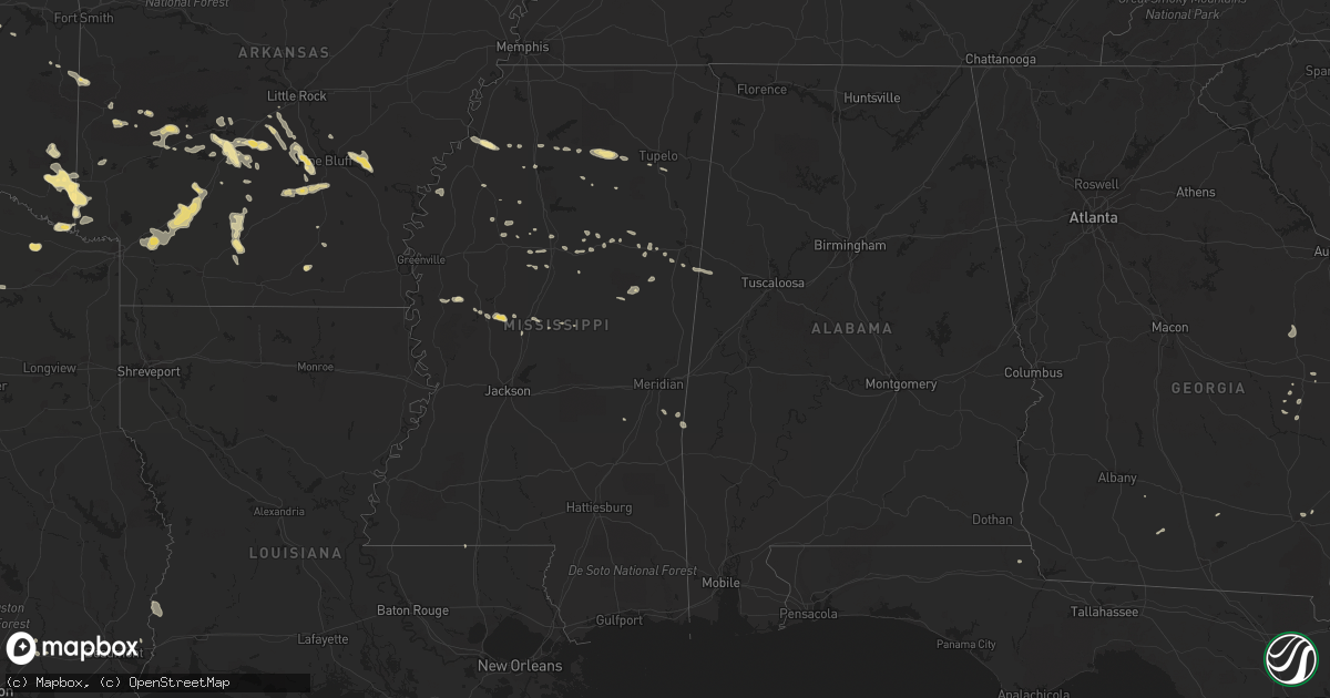
August 17 map
$229
one time, instant access
Download today. No call, no setup
Keep the $229
Bought the map and want the full workflow? Apply the entire $229 to a subscription within 7 days. None of it is wasted.
Every map, not just this one
This buys you this map. Subscription and you get every map we run, in the markets you choose from a few cities to whole states to nationwide. Plus real-time alerts the moment a storm fires.
Contact data
Name, contact info, occupancy, even credit band for addresses in the footprint. You go from where it hit to who to call.
Become the source they trust
Unlimited branding weather history reports on demand. You already have the documented answer ready for the property owner, and you are the one who showed up with it.
Property data and RoofTrace estimates
Pull up any address you have got, its value and the exact code rules for that jurisdiction, straight from One Click Code. Then RoofTrace estimates the squares, pitch, and roof value, priced the way you price.
Storm reports in North Carolina
North Carolina
| Date | Description |
|---|---|
| 08/17/20126:30 PM CDT | Four trees were reported down just off of rocky fort church road near u.s. Highway 1. |
| 08/17/20126:28 PM CDT | Several trees down within the city limits. |
| 08/17/20124:12 PM CDT | One tree was reported down across city lake drive near poplins grove church road. |
| 08/17/20124:12 PM CDT | One tree was reported down near the intersection of old parker road and hobe road. |
| 08/17/20122:59 PM CDT | Tree down on power lines. |
All States Impacted by Hail Map on August 17, 2012
Cities Impacted by Hail Map on August 17, 2012
- Bonham, TX
- Leonard, TX
- Dodd City, TX
- Celeste, TX
- Wolfe City, TX
- Ladonia, TX
- Red Rock, OK
- Marland, OK
- Allen, TX
- Wylie, TX
- Louise, MS
- Midway, TX
- Camden, SC
- Ridgeway, SC
- Needham, AL
- Butler, AL
- Okolona, AR
- Annona, TX
- Royse City, TX
- Rockwall, TX
- Oakwood, TX
- Haworth, OK
- Broken Bow, OK
- Eagletown, OK
- Foreman, AR
- Horatio, AR
- De Queen, AR
- Winthrop, AR
- Cameron, NC
- Sanford, NC
- Addison, TX
- Plano, TX
- Carrollton, TX
- Dallas, TX
- Lamont, OK
- Pineville, SC
- Sheridan, AR
- Alexander, AR
- Bauxite, AR
- Mabelvale, AR
- Hensley, AR
- Brooksville, MS
- Benton, AR
- Stuttgart, AR
- Altheimer, AR
- Camden, AR
- Chidester, AR
- Louann, AR
- Mount Holly, AR
- Cascilla, MS
- Holcomb, MS
- Flagler, CO
- Loving, NM
- Marietta, OK
- Thackerville, OK
- Malvern, AR
- Saint Michaels, MD
- Mena, AR
- Palo Pinto, TX
- Yazoo City, MS
- Merkel, TX
- Nocona, TX
- Saint Jo, TX
- Kellyville, OK
- Bristow, OK
- Hot Springs National Park, AR
- Cooper, TX
- Windom, TX
- Mosquero, NM
- Roxton, TX
- Quitman, TX
- Quinlan, TX
- Caddo Mills, TX
- Texarkana, AR
- Fort Worth, TX
- Anton, CO
- Oden, AR
- Patrick Afb, FL
- Satellite Beach, FL
- Saguache, CO
- Moffat, CO
- Ensign, KS
- Cimarron, KS
- Ness City, KS
- Burdett, KS
- Richardson, TX
- Weatherford, TX
- Millsap, TX
- Denham Springs, LA
- Greenwell Springs, LA
- Pine Grove, LA
- Clinton, LA
- Greensburg, LA
- Leola, AR
- Lipan, TX
- Amity, AR
- Bismarck, AR
- Clyde, TX
- Louisville, MS
- De Kalb, TX
- Ailey, GA
- Lancaster, TX
- Greenwood, MS
- Mineola, TX
- Winnsboro, TX
- Carthage, MS
- Kosciusko, MS
- Sulphur Springs, TX
- Benton, MS
- Royal, AR
- Enid, MS
- Toxey, AL
- Gilbertown, AL
- Vidalia, GA
- Caddo Gap, AR
- Bonnerdale, AR
- Norman, AR
- Glenwood, AR
- Jennings, OK
- Pine Bluff, AR
- White Hall, AR
- San Jon, NM
- Akron, CO
- Rison, AR
- Columbus, MS
- Bozman, MD
- Claiborne, MD
- Easton, MD
- Mcdaniel, MD
- Lancaster, SC
- Ashland, KS
- Tucumcari, NM
- Braman, OK
- Rosedale, LA
- Maringouin, LA
- Liberty Hill, SC
- Lovelady, TX
- Dayton, TX
- Liberty, TX
- Albany, TX
- Huntsville, TX
- Carrollton, AL
- Ponca City, OK
- Grapevine, AR
- Gordo, AL
- Greenville, TX
- Pooler, GA
- Donaldson, AR
- Dighton, KS
- Sorrento, LA
- Ranger, TX
- Singer, LA
- Banner, MS
- Bruce, MS
- Water Valley, MS
- Camden, MS
- Gainesville, TX
- Whitesboro, TX
- Kershaw, SC
- Heath Springs, SC
- Muenster, TX
- Lindsay, TX
- Claxton, GA
- Minden, LA
- Coila, MS
- White Castle, LA
- Cotton Valley, LA
- Pontotoc, MS
- Brashear, TX
- Campbell, TX
- Cumby, TX
- Lone Oak, TX
- Prescott, AR
- Gurdon, AR
- Hope, AR
- Emmet, AR
- Uvalda, GA
- Lyons, GA
- Saint George, SC
- Rowlett, TX
- Porum, OK
- Wills Point, TX
- Round O, SC
- Trenton, TX
- Enloe, TX
- Madisonville, TX
- Collinsville, TX
- Tioga, TX
- Springfield, GA
- Houlka, MS
- Cope, CO
- Kemp, TX
- Kaufman, TX
- Eupora, MS
- Hermitage, AR
- Merryville, LA
- Starks, LA
- Tuscaloosa, AL
- Metter, GA
- Sherman, TX
- Pinewood, SC
- Red Oak, TX
- Desoto, TX
- Kingsland, AR
- Star City, AR
- Cheshire, MA
- Ethelsville, AL
- Mount Vernon, TX
- Poyen, AR
- Prattsville, AR
- Lewisville, AR
- Fulton, AR
- Quitman, MS
- Tutwiler, MS
- Stewart, MS
- Healy, KS
- Galivants Ferry, SC
- Conway, SC
- Oxford, MS
- Thaxton, MS
- Randolph, MS
- Waldron, AR
- Sylvester, GA
- Farmersville, TX
- Blue Ridge, TX
- Deridder, LA
- Fort Lauderdale, FL
- Cordesville, SC
- Moncks Corner, SC
- Aynor, SC
- Scurry, TX
- Opelousas, LA
- Carrollton, MS
- Bazine, KS
- Cross, SC
- Indialantic, FL
- Wilburton, OK
- Folsom, NM
- Grenville, NM
- Norway, SC
- Glenmora, LA
- Oakdale, LA
- Forest Hill, LA
- Woodworth, LA
- Coahoma, MS
- Marks, MS
- Prosper, TX
- Starkville, MS
- Islandton, SC
- Tuscola, TX
- Oviedo, FL
- Orlando, FL
- Christmas, FL
- Baird, TX
- Seibert, CO
- Stigler, OK
- Caddo, TX
- Sebring, FL
- Hortense, GA
- Screven, GA
- Patterson, GA
- Hernandez, NM
- Abiquiu, NM
- Richmond Hill, GA
- Greenwood, FL
- Dry Creek, LA
- Kinder, LA
- Breckenridge, TX
- Vaughan, MS
- Ocate, NM
- Oakland, MS
- Pope, MS
- Queenstown, MD
- Anguilla, MS
- Hollandale, MS
- Mims, FL
- Duck Hill, MS
- Nashville, GA
- Twin City, GA
- Merritt Island, FL
- Montgomery, TX
- Mabank, TX
- Trinidad, TX
- Sherrill, AR
- Nara Visa, NM
- Forney, TX
- Lavon, TX
- Sunnyvale, TX
- French Camp, MS
- Sparkman, AR
- Anna, TX
- Crenshaw, MS
- Batesville, MS
- Sledge, MS
- Aliceville, AL
- Eutaw, AL
- Rose Hill, MS
- Blackshear, GA
- Sachse, TX
- Mckinney, TX
- Ignacio, CO
- College Station, TX
- Bryan, TX
- Arkadelphia, AR
- Warren, AR
- Franklin, LA
- Mount Ida, AR
- Monument, KS
- Bloomingdale, GA
- Savannah, GA
- Bryant, AR
- Gunnison, MS
- Riceboro, GA
- Mesquite, TX
- Aguilar, CO
- Trinidad, CO
- Walterboro, SC
- Dorchester, SC
- Cottageville, SC
- Cotopaxi, CO
- Ruffin, SC
- Loris, SC
- Medford, OK
- Tupelo, MS
- Sapulpa, OK
- Alcalde, NM
- Embudo, NM
- Gillham, AR
- Gordon, TX
- Moultrie, GA
- Pawnee, OK
- Cleveland, OK
- Mannford, OK
- Terlton, OK
- Maramec, OK
- Wadley, GA
- Kite, GA
- Midville, GA
- Swainsboro, GA
- Carthage, NC
- Goodman, MS
- Harleyville, SC
- Chandler, TX
- Murchison, TX
- Larue, TX
- Bonneau, SC
- Allendale, SC
- Martin, SC
- Fleming Island, FL
- Denison, TX
- Garland, TX
- Vaiden, MS
- Van Alstyne, TX
- Ridgeville, SC
- Pecan Gap, TX
- Plantersville, MS
- Shannon, MS
- Nettleton, MS
- Willis, TX
- West, MS
- Adams Run, SC
- Wister, OK
- Abilene, TX
- Quinton, OK
- Kinta, OK
- Crowley, LA
- Alcolu, SC
- Manning, SC
- Carthage, AR
- Terrell, TX
- Pinopolis, SC
- Dike, TX
- Lake Creek, TX
- Paris, TX
- Ben Franklin, TX
- Ralph, AL
- Fosters, AL
- Moundville, AL
- Egan, LA
- Elrod, AL
- Call, TX
- Moran, TX
- Pheba, MS
- Royal Oak, MD
- Wittman, MD
- Summerton, SC
- Coral Springs, FL
- Pompano Beach, FL
- Honey Grove, TX
- Princeton, TX
- Beggs, OK
- Holly Hill, SC
- Eutawville, SC
- Vance, SC
- Whitewright, TX
- Vero Beach, FL
- Goose Creek, SC
- Charleston, MS
- The Colony, TX
- Clyo, GA
- Taylor, MS
- Howe, TX
- Minter City, MS
- Rye, CO
- Walsenburg, CO
- Traskwood, AR
- Jamestown, SC
- Lake Charles, LA
- Houston, TX
- Dodge City, KS
- Heavener, OK
- Jacksonville, FL
- Durango, CO
- Mathiston, MS
- Winona, MS
- Marion, SC
- Meridian, OK
- Guthrie, OK
- Beeler, KS
- Poteau, OK
- Howe, OK
- Maben, MS
- Dundee, MS
- Lake Placid, FL
- Orange, TX
- Kilmichael, MS
- Kentwood, LA


