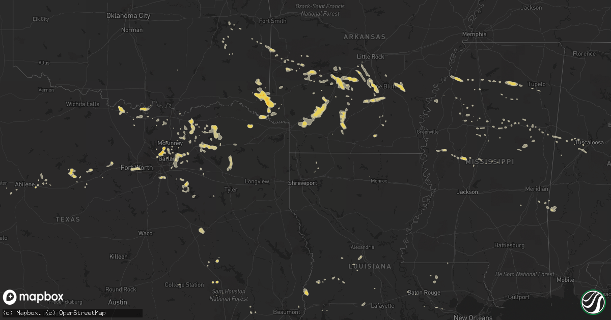
Hail Map on August 17, 2012
Get this storm
August 17 map
$229
one time, instant access
Download today. No call, no setup
Keep the $229
Bought the map and want the full workflow? Apply the entire $229 to a subscription within 7 days. None of it is wasted.
Every map, not just this one
This buys you this map. Subscription and you get every map we run, in the markets you choose from a few cities to whole states to nationwide. Plus real-time alerts the moment a storm fires.
Contact data
Name, contact info, occupancy, even credit band for addresses in the footprint. You go from where it hit to who to call.
Become the source they trust
Unlimited branding weather history reports on demand. You already have the documented answer ready for the property owner, and you are the one who showed up with it.
Property data and RoofTrace estimates
Pull up any address you have got, its value and the exact code rules for that jurisdiction, straight from One Click Code. Then RoofTrace estimates the squares, pitch, and roof value, priced the way you price.
States Impacted by Hail Map on August 17, 2012
Storm reports
Georgia
| Date | Description |
|---|---|
| 08/17/20124:45 PM CDT | Numerous reports of trees down and trees on power lines in and around augusta. Up to three thousand without power. |
| 08/17/20123:51 PM CDT | Two trees down on woodrow jernigan rd. |
| 08/17/20121:08 PM CDT | Trees and power lines down on waynesboro road in the ogeechee farms area. |
| 08/17/20121:05 PM CDT | Tree limbs down. Reported through nws chat. |
| 08/17/20121:04 PM CDT | 20 foot long tree branch broke off...nearly missing a house. |
| 08/17/20121:01 PM CDT | Tree blocking railroad ave at shipyard road. |
| 08/17/201212:59 PM CDT | Large tree fell on a house. |
| 08/17/201212:37 PM CDT | The public reported 1 tree down along poncell drive. |
| 08/17/201212:07 PM CDT | Law enforcement reported a power line down along dunlevie road. |
Louisiana
| Date | Description |
|---|---|
| 08/17/20128:01 AM CDT | Kmlu asos reported a 55 knot gust |
Alabama
| Date | Description |
|---|---|
| 08/17/20126:45 AM CDT | Two trees down in west blockton. |
| 08/17/20126:40 AM CDT | Three trees down along county road 24. |
| 08/17/20126:22 AM CDT | Tree down along stone hill lane. Corrected time. |
| 08/17/20126:20 AM CDT | Power lines down along windermere drive. Corrected time. |
| 08/17/20125:40 AM CDT | Tree down on sipsey valley road west of wesley chapel road. |
| 08/17/20125:22 AM CDT | Tree down along stonehill lane. |
| 08/17/20125:20 AM CDT | Power lines down along windermere drive. |
| 08/17/20125:12 AM CDT | Tree down on county road 26 between pine grove and carrollton. |
North Carolina
| Date | Description |
|---|---|
| 08/17/20126:30 PM CDT | Four trees were reported down just off of rocky fort church road near u.s. Highway 1. |
| 08/17/20126:28 PM CDT | Several trees down within the city limits. |
| 08/17/20124:12 PM CDT | One tree was reported down across city lake drive near poplins grove church road. |
| 08/17/20124:12 PM CDT | One tree was reported down near the intersection of old parker road and hobe road. |
| 08/17/20122:59 PM CDT | Tree down on power lines. |
Kansas
| Date | Description |
|---|---|
| 08/17/20123:31 AM CDT | The milo crop was stripped in some areas. |
Maine
| Date | Description |
|---|---|
| 08/16/20128:10 PM CDT | Large branches down |
New Hampshire
| Date | Description |
|---|---|
| 08/16/20128:00 PM CDT | Tents and stage received damage at the rochester music festival...no injuries |
| 08/16/20127:39 PM CDT | Large limbs down |
| 08/16/20127:16 PM CDT | Trees down on wires... Loudon rd |
Texas
| Date | Description |
|---|---|
| 08/16/201210:13 PM CDT | 1.5 inch hail at coit rd and spring creek pkwy |
| 08/16/201210:00 PM CDT | Half dollars in west plano |
| 08/16/20129:52 PM CDT | Park and ohio...lasted 6 minutes |
| 08/16/20129:45 PM CDT | Plano...preston and park area |
| 08/16/20128:58 PM CDT | Peas to aprx quarter |
| 08/16/20128:01 PM CDT | Gust 60 mph at lancaster awos klnc |
| 08/16/20127:35 PM CDT | At hamilton airport kmnz |
| 08/16/20127:20 PM CDT | Near beach st and i-30 |
Oklahoma
| Date | Description |
|---|---|
| 08/17/20128:10 AM CDT | A local report indicates 62 MPH wind near BROKEN BOW |
| 08/16/20128:35 PM CDT | Awning blown off building 2 east of broken bow on hwy 70 and tree down in same area |
| 08/16/20128:10 PM CDT | A local report indicates 62 MPH wind near BROKEN BOW |
Arkansas
| Date | Description |
|---|---|
| 08/17/20126:15 PM CDT | A local report indicates 1.00 inch wind near BURTSELL |
| 08/16/201211:30 PM CDT | Fire department reported quarter sized hail in sulphur springs. Correct time was 1130 pm cdt and not 1103 pm cdt as previously sent out. |
| 08/16/201211:03 PM CDT | Fire department reported quarter sized hail in sulphur springs. |
| 08/16/20128:10 PM CDT | Large oak tree fell on the front of a home. |
| 08/16/20127:40 PM CDT | Highway 299 blocked due to down trees |
| 08/16/20127:08 PM CDT | Trees and power lines down |
Nevada
| Date | Description |
|---|---|
| 08/16/20128:41 PM CDT | A local report indicates 62 MPH wind near KANE SPRINGS RAWS |
South Carolina
| Date | Description |
|---|---|
| 08/17/20125:30 PM CDT | Trees down near hwy 522 and hwy 9. Time estimated from radar. |
| 08/17/20125:20 PM CDT | Two trees were reported down near the intersection of south green sea road and williamson drive. |
| 08/17/20125:10 PM CDT | A large tree was reported down along highway 410 near u.s. 701 |
| 08/17/20124:30 PM CDT | Trees down on iron horse way and holiness lane about 1 mile northeast of cordesville. |
| 08/17/20124:11 PM CDT | Trees down. |
| 08/17/20124:10 PM CDT | Trees blocking both lanes of orangeburg road near grayback road. Time estimated based on radar. |
| 08/17/20123:55 PM CDT | Trees down near the intersection of bonnette road and shillingsbridge road. |
| 08/17/20123:40 PM CDT | Trees down. |
| 08/17/20123:27 PM CDT | Tree down onto revolutionary trail. |
| 08/17/20123:24 PM CDT | Tree down onto route 125. |
| 08/17/20123:21 PM CDT | Trees down in hendersonville. Time estimated based on radar. |
| 08/17/20123:20 PM CDT | Trees and powerlines down near the intersection of robertson blvd and bells highway. |
| 08/17/20123:00 PM CDT | Tree on car mile marker 125 i95. |
| 08/17/20123:00 PM CDT | Numerous trees down. |
| 08/17/20122:55 PM CDT | Tree on house on bacon hill road in pinewood. |
| 08/17/20122:52 PM CDT | Power lines down near pinewood. |
| 08/17/20122:26 PM CDT | Trees in roadway on hampton street in pinewood. |
Florida
| Date | Description |
|---|---|
| 08/17/20125:00 PM CDT | Skywarn spotter estimated winds of around 60 mph near the intersection of atlantic blvd and banks rd in margate. Some tree limbs downed with at least one hitting a car. |
| 08/17/201212:45 PM CDT | Broadcast media reports large tree fell down and smashed a car and damaged a home in the grove park neighborhood of jacksonville around 145 pm edt. Tree was partially r |
Cities Impacted by Hail Map on August 17, 2012
- Bonham, TX
- Leonard, TX
- Dodd City, TX
- Celeste, TX
- Wolfe City, TX
- Ladonia, TX
- Red Rock, OK
- Marland, OK
- Allen, TX
- Wylie, TX
- Louise, MS
- Midway, TX
- Camden, SC
- Ridgeway, SC
- Needham, AL
- Butler, AL
- Okolona, AR
- Annona, TX
- Royse City, TX
- Rockwall, TX
- Oakwood, TX
- Haworth, OK
- Broken Bow, OK
- Eagletown, OK
- Foreman, AR
- Horatio, AR
- De Queen, AR
- Winthrop, AR
- Cameron, NC
- Sanford, NC
- Addison, TX
- Plano, TX
- Carrollton, TX
- Dallas, TX
- Lamont, OK
- Pineville, SC
- Sheridan, AR
- Alexander, AR
- Bauxite, AR
- Mabelvale, AR
- Hensley, AR
- Brooksville, MS
- Benton, AR
- Stuttgart, AR
- Altheimer, AR
- Camden, AR
- Chidester, AR
- Louann, AR
- Mount Holly, AR
- Cascilla, MS
- Holcomb, MS
- Flagler, CO
- Loving, NM
- Marietta, OK
- Thackerville, OK
- Malvern, AR
- Saint Michaels, MD
- Mena, AR
- Palo Pinto, TX
- Yazoo City, MS
- Merkel, TX
- Nocona, TX
- Saint Jo, TX
- Kellyville, OK
- Bristow, OK
- Hot Springs National Park, AR
- Cooper, TX
- Windom, TX
- Mosquero, NM
- Roxton, TX
- Quitman, TX
- Quinlan, TX
- Caddo Mills, TX
- Texarkana, AR
- Fort Worth, TX
- Anton, CO
- Oden, AR
- Patrick Afb, FL
- Satellite Beach, FL
- Saguache, CO
- Moffat, CO
- Ensign, KS
- Cimarron, KS
- Ness City, KS
- Burdett, KS
- Richardson, TX
- Weatherford, TX
- Millsap, TX
- Denham Springs, LA
- Greenwell Springs, LA
- Pine Grove, LA
- Clinton, LA
- Greensburg, LA
- Leola, AR
- Lipan, TX
- Amity, AR
- Bismarck, AR
- Clyde, TX
- Louisville, MS
- De Kalb, TX
- Ailey, GA
- Lancaster, TX
- Greenwood, MS
- Mineola, TX
- Winnsboro, TX
- Carthage, MS
- Kosciusko, MS
- Sulphur Springs, TX
- Benton, MS
- Royal, AR
- Enid, MS
- Toxey, AL
- Gilbertown, AL
- Vidalia, GA
- Caddo Gap, AR
- Bonnerdale, AR
- Norman, AR
- Glenwood, AR
- Jennings, OK
- Pine Bluff, AR
- White Hall, AR
- San Jon, NM
- Akron, CO
- Rison, AR
- Columbus, MS
- Bozman, MD
- Claiborne, MD
- Easton, MD
- Mcdaniel, MD
- Lancaster, SC
- Ashland, KS
- Tucumcari, NM
- Braman, OK
- Rosedale, LA
- Maringouin, LA
- Liberty Hill, SC
- Lovelady, TX
- Dayton, TX
- Liberty, TX
- Albany, TX
- Huntsville, TX
- Carrollton, AL
- Ponca City, OK
- Grapevine, AR
- Gordo, AL
- Greenville, TX
- Pooler, GA
- Donaldson, AR
- Dighton, KS
- Sorrento, LA
- Ranger, TX
- Singer, LA
- Banner, MS
- Bruce, MS
- Water Valley, MS
- Camden, MS
- Gainesville, TX
- Whitesboro, TX
- Kershaw, SC
- Heath Springs, SC
- Muenster, TX
- Lindsay, TX
- Claxton, GA
- Minden, LA
- Coila, MS
- White Castle, LA
- Cotton Valley, LA
- Pontotoc, MS
- Brashear, TX
- Campbell, TX
- Cumby, TX
- Lone Oak, TX
- Prescott, AR
- Gurdon, AR
- Hope, AR
- Emmet, AR
- Uvalda, GA
- Lyons, GA
- Saint George, SC
- Rowlett, TX
- Porum, OK
- Wills Point, TX
- Round O, SC
- Trenton, TX
- Enloe, TX
- Madisonville, TX
- Collinsville, TX
- Tioga, TX
- Springfield, GA
- Houlka, MS
- Cope, CO
- Kemp, TX
- Kaufman, TX
- Eupora, MS
- Hermitage, AR
- Merryville, LA
- Starks, LA
- Tuscaloosa, AL
- Metter, GA
- Sherman, TX
- Pinewood, SC
- Red Oak, TX
- Desoto, TX
- Kingsland, AR
- Star City, AR
- Cheshire, MA
- Ethelsville, AL
- Mount Vernon, TX
- Poyen, AR
- Prattsville, AR
- Lewisville, AR
- Fulton, AR
- Quitman, MS
- Tutwiler, MS
- Stewart, MS
- Healy, KS
- Galivants Ferry, SC
- Conway, SC
- Oxford, MS
- Thaxton, MS
- Randolph, MS
- Waldron, AR
- Sylvester, GA
- Farmersville, TX
- Blue Ridge, TX
- Deridder, LA
- Fort Lauderdale, FL
- Cordesville, SC
- Moncks Corner, SC
- Aynor, SC
- Scurry, TX
- Opelousas, LA
- Carrollton, MS
- Bazine, KS
- Cross, SC
- Indialantic, FL
- Wilburton, OK
- Folsom, NM
- Grenville, NM
- Norway, SC
- Glenmora, LA
- Oakdale, LA
- Forest Hill, LA
- Woodworth, LA
- Coahoma, MS
- Marks, MS
- Prosper, TX
- Starkville, MS
- Islandton, SC
- Tuscola, TX
- Oviedo, FL
- Orlando, FL
- Christmas, FL
- Baird, TX
- Seibert, CO
- Stigler, OK
- Caddo, TX
- Sebring, FL
- Hortense, GA
- Screven, GA
- Patterson, GA
- Hernandez, NM
- Abiquiu, NM
- Richmond Hill, GA
- Greenwood, FL
- Dry Creek, LA
- Kinder, LA
- Breckenridge, TX
- Vaughan, MS
- Ocate, NM
- Oakland, MS
- Pope, MS
- Queenstown, MD
- Anguilla, MS
- Hollandale, MS
- Mims, FL
- Duck Hill, MS
- Nashville, GA
- Twin City, GA
- Merritt Island, FL
- Montgomery, TX
- Mabank, TX
- Trinidad, TX
- Sherrill, AR
- Nara Visa, NM
- Forney, TX
- Lavon, TX
- Sunnyvale, TX
- French Camp, MS
- Sparkman, AR
- Anna, TX
- Crenshaw, MS
- Batesville, MS
- Sledge, MS
- Aliceville, AL
- Eutaw, AL
- Rose Hill, MS
- Blackshear, GA
- Sachse, TX
- Mckinney, TX
- Ignacio, CO
- College Station, TX
- Bryan, TX
- Arkadelphia, AR
- Warren, AR
- Franklin, LA
- Mount Ida, AR
- Monument, KS
- Bloomingdale, GA
- Savannah, GA
- Bryant, AR
- Gunnison, MS
- Riceboro, GA
- Mesquite, TX
- Aguilar, CO
- Trinidad, CO
- Walterboro, SC
- Dorchester, SC
- Cottageville, SC
- Cotopaxi, CO
- Ruffin, SC
- Loris, SC
- Medford, OK
- Tupelo, MS
- Sapulpa, OK
- Alcalde, NM
- Embudo, NM
- Gillham, AR
- Gordon, TX
- Moultrie, GA
- Pawnee, OK
- Cleveland, OK
- Mannford, OK
- Terlton, OK
- Maramec, OK
- Wadley, GA
- Kite, GA
- Midville, GA
- Swainsboro, GA
- Carthage, NC
- Goodman, MS
- Harleyville, SC
- Chandler, TX
- Murchison, TX
- Larue, TX
- Bonneau, SC
- Allendale, SC
- Martin, SC
- Fleming Island, FL
- Denison, TX
- Garland, TX
- Vaiden, MS
- Van Alstyne, TX
- Ridgeville, SC
- Pecan Gap, TX
- Plantersville, MS
- Shannon, MS
- Nettleton, MS
- Willis, TX
- West, MS
- Adams Run, SC
- Wister, OK
- Abilene, TX
- Quinton, OK
- Kinta, OK
- Crowley, LA
- Alcolu, SC
- Manning, SC
- Carthage, AR
- Terrell, TX
- Pinopolis, SC
- Dike, TX
- Lake Creek, TX
- Paris, TX
- Ben Franklin, TX
- Ralph, AL
- Fosters, AL
- Moundville, AL
- Egan, LA
- Elrod, AL
- Call, TX
- Moran, TX
- Pheba, MS
- Royal Oak, MD
- Wittman, MD
- Summerton, SC
- Coral Springs, FL
- Pompano Beach, FL
- Honey Grove, TX
- Princeton, TX
- Beggs, OK
- Holly Hill, SC
- Eutawville, SC
- Vance, SC
- Whitewright, TX
- Vero Beach, FL
- Goose Creek, SC
- Charleston, MS
- The Colony, TX
- Clyo, GA
- Taylor, MS
- Howe, TX
- Minter City, MS
- Rye, CO
- Walsenburg, CO
- Traskwood, AR
- Jamestown, SC
- Lake Charles, LA
- Houston, TX
- Dodge City, KS
- Heavener, OK
- Jacksonville, FL
- Durango, CO
- Mathiston, MS
- Winona, MS
- Marion, SC
- Meridian, OK
- Guthrie, OK
- Beeler, KS
- Poteau, OK
- Howe, OK
- Maben, MS
- Dundee, MS
- Lake Placid, FL
- Orange, TX
- Kilmichael, MS
- Kentwood, LA