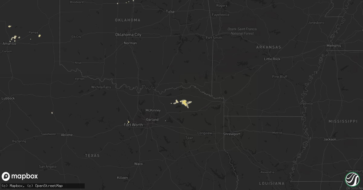
Hail Map in Texas on August 16, 2014
Get this storm
August 16 map
$229
one time, instant access
Download today. No call, no setup
Keep the $229
Bought the map and want the full workflow? Apply the entire $229 to a subscription within 7 days. None of it is wasted.
Every map, not just this one
This buys you this map. Subscription and you get every map we run, in the markets you choose from a few cities to whole states to nationwide. Plus real-time alerts the moment a storm fires.
Contact data
Name, contact info, occupancy, even credit band for addresses in the footprint. You go from where it hit to who to call.
Become the source they trust
Unlimited branding weather history reports on demand. You already have the documented answer ready for the property owner, and you are the one who showed up with it.
Property data and RoofTrace estimates
Pull up any address you have got, its value and the exact code rules for that jurisdiction, straight from One Click Code. Then RoofTrace estimates the squares, pitch, and roof value, priced the way you price.
Storm reports in Texas
Texas
| Date | Description |
|---|---|
| 08/16/20146:05 PM CDT | Trees and power lines down in rosalee area near hwy 909 and in bogata |
| 08/16/20144:53 PM CDT | A local report indicates 68 MPH wind near 7 ENE AMARILLO |
| 08/16/20144:51 PM CDT | A local report indicates 68 MPH wind near 7 ENE AMARILLO |
| 08/16/20144:08 PM CDT | Numerous powerlines down. Some power lines downed on cars at 5600 greenville ave...some vehicles possibly damaged there as well. |
| 08/16/20143:35 PM CDT | Roof off of feed store |
All States Impacted by Hail Map on August 16, 2014
Cities Impacted by Hail Map on August 16, 2014
- Friona, TX
- Ben Franklin, TX
- Cooper, TX
- Colby, KS
- Ludell, KS
- Atwood, KS
- Globe, AZ
- Equality, IL
- Junction, IL
- Mound Valley, KS
- Hereford, TX
- Groom, TX
- Pampa, TX
- Crane, TX
- Willcox, AZ
- Caney, KS
- Independence, KS
- Metropolis, IL
- Garber, OK
- Farwell, TX
- Laquey, MO
- Richland, MO
- Waynesville, MO
- Amarillo, TX
- Panhandle, TX
- McDonald, KS
- Stonefort, IL
- Fort Worth, TX
- Paducah, KY
- Brookport, IL
- Lordsburg, NM
- Animas, NM
- Muleshoe, TX
- Ogallala, NE
- Azle, TX
- Wann, OK
- Coffeyville, KS
- Tyro, KS
- Copan, OK
- Dewey, OK
- Fort Stockton, TX
- Hermann, MO
- Bogata, TX
- Dumas, TX
- Buckhorn, NM
- Hoxie, KS
- Aspermont, TX
- Tucumcari, NM
- Bartlesville, OK
- Deport, TX
- Paris, TX
- Lake Creek, TX
- Pattonville, TX
- Sulphur Bluff, TX
- Parsons, KS
- Dennis, KS
- Galesburg, KS
- Altamont, KS
- Cherryvale, KS
- Gem, KS
- Saint Robert, MO
- Fort Leonard Wood, MO
- Crocker, MO
- Quinlan, TX
- Garland, KS
- Bronaugh, MO
- Keystone, NE
- Omaha, IL
- Ladonia, TX
- Alpine, AZ
- Golconda, IL
- Scammon, KS
- Monument, KS
- Bovina, TX
- Oakley, KS
- Winona, KS
- Bazine, KS
- Saint David, AZ
- Dike, TX
- Ransom, KS
- Flemington, MO
- Jamestown, ND
- Fort Lauderdale, FL
- Quinter, KS
- Utica, KS
- Capitan, NM
- Saint Xavier, MT
- Billings, OK
- Mount Lemmon, AZ
- Oracle, AZ
- Lenapah, OK
- Liberty, KS
- Camp Crook, SD
- Karnak, IL
- West Paducah, KY
- Belknap, IL
- Grantsburg, IL
- Kevil, KY
- Barlow, KY
- Wickliffe, KY
- Grand Chain, IL
- La Center, KY
- Tombstone, AZ
- Benson, AZ
- Ness City, KS
- Hopkinsville, KY
- Rosiclare, IL
- Silver City, NM
- Mims, FL
- Cocoa, FL
- Hickory, KY
- Boaz, KY
- Vale, SD
- Hurley, NM
- Brownell, KS
- Dove Creek, CO
- Saint Paul, KS
- Erie, KS
- Tucson, AZ
- Lebanon, MO
- Fort Scott, KS
- Madrid, NE
- Rosebud, MT
- Roxton, TX
- Pecan Gap, TX
- Jennings, KS
- Ozark, IL
- Simpson, IL
- Humansville, MO
- Titusville, FL
- Stoutland, MO
- San Simon, AZ
- Houston, TX
- Mount Sterling, MO
- Morrison, MO
- Chamois, MO
- Cave In Rock, IL
- Steele, ND
- Enid, OK
- Buffalo, SD
- Harrisburg, IL
- Shawneetown, IL
- Ridgway, IL


