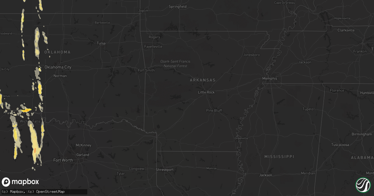
Hail Map in Kansas on August 15, 2013
Get this storm
August 15 map
$229
one time, instant access
Download today. No call, no setup
Keep the $229
Bought the map and want the full workflow? Apply the entire $229 to a subscription within 7 days. None of it is wasted.
Every map, not just this one
This buys you this map. Subscription and you get every map we run, in the markets you choose from a few cities to whole states to nationwide. Plus real-time alerts the moment a storm fires.
Contact data
Name, contact info, occupancy, even credit band for addresses in the footprint. You go from where it hit to who to call.
Become the source they trust
Unlimited branding weather history reports on demand. You already have the documented answer ready for the property owner, and you are the one who showed up with it.
Property data and RoofTrace estimates
Pull up any address you have got, its value and the exact code rules for that jurisdiction, straight from One Click Code. Then RoofTrace estimates the squares, pitch, and roof value, priced the way you price.
Storm reports in Kansas
Kansas
| Date | Description |
|---|---|
| 08/15/20136:56 PM CDT | A local report indicates 1.00 inch wind near MCPHERSON |
| 08/15/20136:48 PM CDT | A local report indicates 61 MPH wind near NEWTON AIRPORT |
| 08/15/20136:36 PM CDT | Law enforcement estimated winds of 50-60mph and golfball size hail. |
| 08/15/20136:29 PM CDT | A local report indicates 1.00 inch wind near 1 NW MCPHERSON |
| 08/15/20136:28 PM CDT | Small tree limbs knocked down estimating 50-60mph winds. |
| 08/15/20136:22 PM CDT | A local report indicates 1.75 inch wind near MCPHERSON |
| 08/15/20136:03 PM CDT | Fell between 603 and 607 pm cdt. Relayed via spotternetwork. |
| 08/15/20135:53 PM CDT | A local report indicates 60 MPH wind near 6 N MARION |
| 08/15/20135:45 PM CDT | Half inch to one inch hail found covering the ground. Relayed via spotternetwork. |
| 08/15/20135:30 PM CDT | Law enforcement reported golfball size hail in the town of falun. |
| 08/15/20135:30 PM CDT | A local report indicates 1.00 inch wind near 6 NE MARQUETTE |
| 08/15/20135:28 PM CDT | Herington middle school mesonet. |
| 08/15/20135:24 PM CDT | A local report indicates 1.00 inch wind near 3 N BROOKVILLE |
| 08/15/20135:20 PM CDT | Nickel to quarter size hail covering the ground |
| 08/15/20135:04 PM CDT | A local report indicates 1.00 inch wind near 5 SE BROOKVILLE |
| 08/15/20135:02 PM CDT | A local report indicates 60 MPH wind near 4 SE JUNCTION CITY |
| 08/15/20135:01 PM CDT | 3 inch diameter tree limb blown down. |
| 08/15/20135:00 PM CDT | Power lines and tree branches down throughout abilene. |
| 08/15/20134:58 PM CDT | A local report indicates 1.50 inch wind near 5 N BROOKVILLE |
| 08/15/20134:58 PM CDT | A local report indicates 60 MPH wind near JUNCTION CITY |
| 08/15/20134:54 PM CDT | A local report indicates 1.75 inch wind near 5 N BROOKVILLE |
| 08/15/20134:35 PM CDT | Quarter to dime size hail covering the ground near i-70 glendale exit. |
| 08/15/20134:15 PM CDT | A local report indicates 1.25 inch wind near WELLS |
| 08/15/20134:09 PM CDT | A local report indicates 1.75 inch wind near BEVERLY |
| 08/15/20133:49 PM CDT | A local report indicates 65 MPH wind near 6 WSW OAK HILL |
| 08/14/20138:50 PM CDT | A local report indicates 1.50 inch wind near 1 NW KINGMAN |
| 08/14/20138:40 PM CDT | A local report indicates 1.00 inch wind near 5 N WINONA |
| 08/14/20138:20 PM CDT | A local report indicates 1.00 inch wind near LEVANT |
| 08/14/20137:16 PM CDT | A local report indicates 1.00 inch wind near TOWANDA |
| 08/14/20137:12 PM CDT | Public reported ping pong ball size hail near benton. |
All States Impacted by Hail Map on August 15, 2013
Cities Impacted by Hail Map on August 15, 2013
- Paducah, TX
- Leonardville, KS
- Green, KS
- Clay Center, KS
- Riley, KS
- Fletcher, OK
- Hoxie, KS
- Canadian, TX
- Mobeetie, TX
- Moorefield, NE
- Cyril, OK
- Elgin, OK
- Marlow, OK
- Rush Springs, OK
- Lawton, OK
- Anadarko, OK
- Cement, OK
- Marion, KS
- Hillsboro, KS
- Mcpherson, KS
- Kingman, KS
- Marquette, KS
- Anthony, KS
- Cherokee, TX
- Curtis, NE
- Stockville, NE
- Jacksboro, TX
- Arnett, OK
- Olney, TX
- Newcastle, TX
- Alapaha, GA
- Wichita Falls, TX
- Bellevue, TX
- Henrietta, TX
- Oberlin, KS
- Junction City, KS
- Fort Riley, KS
- Milford, KS
- Breckenridge, TX
- Lehigh, KS
- Graford, TX
- San Saba, TX
- Windom, KS
- Moundridge, KS
- Inman, KS
- Little River, KS
- Harrold, TX
- Temple, OK
- Scotland, TX
- Jermyn, TX
- Bryson, TX
- Windthorst, TX
- Palo Pinto, TX
- Perrin, TX
- Attica, KS
- Harper, KS
- Pretty Prairie, KS
- Arlington, KS
- Spivey, KS
- Benton, KS
- Towanda, KS
- Solomon, KS
- Waycross, GA
- El Dorado, KS
- Winona, KS
- Colby, KS
- Enid, OK
- Santa Rosa, NM
- Peabody, KS
- Childress, TX
- Hollis, OK
- Dodson, TX
- Levant, KS
- Fay, OK
- Taloga, OK
- Thomas, OK
- Oakwood, OK
- Brookville, KS
- Ellsworth, KS
- Geneseo, KS
- Rosanky, TX
- Clyde, KS
- Santo, TX
- Minneapolis, KS
- Miltonvale, KS
- Wellington, TX
- Clovis, NM
- Flatonia, TX
- Electra, TX
- Bovina, TX
- Texico, NM
- Walters, OK
- Minco, OK
- Binger, OK
- Gracemont, OK
- Hinton, OK
- Calumet, OK
- Lookeba, OK
- Wheeler, TX
- Clifton, KS
- Linn, KS
- Comanche, OK
- Herington, KS
- White City, KS
- Falun, KS
- Beverly, KS
- Lindsborg, KS
- Lincoln, KS
- Tescott, KS
- Salina, KS
- Fleming Island, FL
- Quanah, TX
- Bennington, KS
- Voca, TX
- Brady, TX
- Briscoe, TX
- Durham, OK
- Randlett, OK
- Jacksonville, FL
- Seymour, TX
- Norwich, KS
- Olustee, OK
- Duke, OK
- Eldorado, OK
- Waukomis, OK
- Waurika, OK
- Seiling, OK
- Woodson, TX
- Webster, FL
- Bushnell, FL
- Helena, OK
- Isabella, OK
- Ringwood, OK
- Ames, OK
- Duncan, OK
- Apache, OK
- Saint Johns, FL
- Shamrock, TX
- Graham, TX
- South Bend, TX
- Alva, OK
- Friona, TX
- Mineral Wells, TX
- Bowie, TX
- Ringgold, TX
- Millsap, TX
- Gordon, TX
- Holliday, TX
- Loving, TX
- Sweetwater, OK
- Galva, KS
- Hutchinson, KS
- Higgins, TX
- Burrton, KS
- Buhler, KS
- Booker, TX
- Follett, TX
- Lipscomb, TX
- Crowell, TX
- Grandfield, OK
- Devol, OK
- Burkburnett, TX
- Vernon, TX
- Texola, OK
- Erick, OK
- Reydon, OK
- Rosalia, KS
- Iowa Park, TX
- Blackshear, GA
- Chillicothe, TX
- Elbing, KS
- Newton, KS
- Whitewater, KS
- Hope, KS
- Lost Springs, KS
- Ramona, KS
- Abilene, KS
- Enterprise, KS
- Potwin, KS
- Burns, KS
- Burlington, OK
- Amorita, OK
- Portales, NM
- Sabetha, KS
- Cedar Point, KS
- Throckmorton, TX
- Yeso, NM
- Fort Sumner, NM
- Hallettsville, TX
- Yoakum, TX
- Medicine Lodge, KS
- Waynoka, OK
- Quail, TX
- Eureka, KS
- Moultrie, GA
- Adel, GA
- Kingfisher, OK
- Omega, OK
- Watonga, OK
- Meno, OK
- Okeene, OK
- Hitchcock, OK
- Lincolnville, KS
- Blue Hill, NE
- Lawrence, NE
- Crawford, OK
- Fairview, KS
- Davidson, OK
- Fort Cobb, OK
- New Cambria, KS
- Brewster, KS
- Aurora, KS
- Cheney, KS
- Morganville, KS
- Gypsum, KS
- Loveland, OK
- Altus, OK
- Odell, TX
- Elmer, OK
- Bison, OK
- Assaria, KS
- Waverly, GA
- White Oak, GA
- Carrier, OK
- Lahoma, OK
- Hennessey, OK
- Drummond, OK
- Leon, KS
- Farwell, TX
- Concordia, KS
- Willow, OK
- Selden, KS
- Augusta, KS
- Mingus, TX
- Mclean, TX
- Zenda, KS
- Nash, OK
- Tampa, KS
- Durham, KS
- Fairview, OK
- Chester, OK
- Florence, KS
- Lovington, NM
- Glenvil, NE
- Richland Springs, TX
- Walton, KS
- Canton, KS
- Nashville, GA
- Woodbine, KS
- Hesston, KS
- Fairfield, NE
- Mangum, OK
- Red Rock, TX
- Oneida, KS
- Chattanooga, OK
- Lecanto, FL
- Goltry, OK
- Okarche, OK
- Saint Simons Island, GA
- Orange Park, FL
- Saint Augustine, FL
- Lyons, KS
- Hastings, OK
- Wichita, KS
- Halstead, KS
- East Palatka, FL
- Cunningham, KS
- Waldron, KS
- Hollister, OK
- Goessel, KS
- Willacoochee, GA
- Alma, GA
- Nicholls, GA
- Valley Center, KS
- Kechi, KS
- Snyder, OK
- Inland, NE
- El Reno, OK
- Bunnell, FL
- McDonald, KS
- Imperial, NE
- Enders, NE
- Tell, TX
- Cee Vee, TX
- Shattuck, OK
- Sutton, NE
- Ayr, NE
- Andover, KS
- Longford, KS
- Loving, NM
- Dover, OK
- Hardtner, KS
- Oklaunion, TX
- Brooksville, FL
- San Mateo, FL
- Sheppard Afb, TX
- Haddam, KS
- Rochelle, TX
- Murdock, KS


