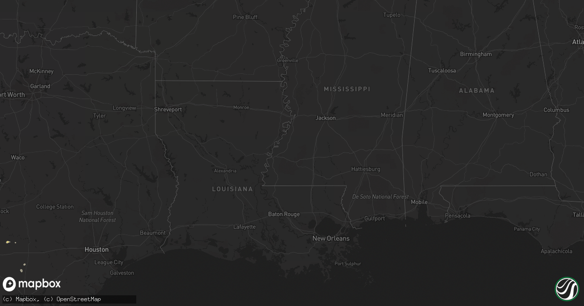
Hail Map on August 15, 2013
Get this storm
August 15 map
$229
one time, instant access
Download today. No call, no setup
Keep the $229
Bought the map and want the full workflow? Apply the entire $229 to a subscription within 7 days. None of it is wasted.
Every map, not just this one
This buys you this map. Subscription and you get every map we run, in the markets you choose from a few cities to whole states to nationwide. Plus real-time alerts the moment a storm fires.
Contact data
Name, contact info, occupancy, even credit band for addresses in the footprint. You go from where it hit to who to call.
Become the source they trust
Unlimited branding weather history reports on demand. You already have the documented answer ready for the property owner, and you are the one who showed up with it.
Property data and RoofTrace estimates
Pull up any address you have got, its value and the exact code rules for that jurisdiction, straight from One Click Code. Then RoofTrace estimates the squares, pitch, and roof value, priced the way you price.
Storm reports
Colorado
| Date | Description |
|---|---|
| 08/14/20137:45 PM CDT | Approximately 30 to 40 large trees across a 12 block area of east central denver were damaged by microburst wind gusts. Several large trees snapped near the base along |
Kansas
| Date | Description |
|---|---|
| 08/15/20136:56 PM CDT | A local report indicates 1.00 inch wind near MCPHERSON |
| 08/15/20136:48 PM CDT | A local report indicates 61 MPH wind near NEWTON AIRPORT |
| 08/15/20136:36 PM CDT | Law enforcement estimated winds of 50-60mph and golfball size hail. |
| 08/15/20136:29 PM CDT | A local report indicates 1.00 inch wind near 1 NW MCPHERSON |
| 08/15/20136:28 PM CDT | Small tree limbs knocked down estimating 50-60mph winds. |
| 08/15/20136:22 PM CDT | A local report indicates 1.75 inch wind near MCPHERSON |
| 08/15/20136:03 PM CDT | Fell between 603 and 607 pm cdt. Relayed via spotternetwork. |
| 08/15/20135:53 PM CDT | A local report indicates 60 MPH wind near 6 N MARION |
| 08/15/20135:45 PM CDT | Half inch to one inch hail found covering the ground. Relayed via spotternetwork. |
| 08/15/20135:30 PM CDT | A local report indicates 1.00 inch wind near 6 NE MARQUETTE |
| 08/15/20135:30 PM CDT | Law enforcement reported golfball size hail in the town of falun. |
| 08/15/20135:28 PM CDT | Herington middle school mesonet. |
| 08/15/20135:24 PM CDT | A local report indicates 1.00 inch wind near 3 N BROOKVILLE |
| 08/15/20135:20 PM CDT | Nickel to quarter size hail covering the ground |
| 08/15/20135:04 PM CDT | A local report indicates 1.00 inch wind near 5 SE BROOKVILLE |
| 08/15/20135:02 PM CDT | A local report indicates 60 MPH wind near 4 SE JUNCTION CITY |
| 08/15/20135:01 PM CDT | 3 inch diameter tree limb blown down. |
| 08/15/20135:00 PM CDT | Power lines and tree branches down throughout abilene. |
| 08/15/20134:58 PM CDT | A local report indicates 1.50 inch wind near 5 N BROOKVILLE |
| 08/15/20134:58 PM CDT | A local report indicates 60 MPH wind near JUNCTION CITY |
| 08/15/20134:54 PM CDT | A local report indicates 1.75 inch wind near 5 N BROOKVILLE |
| 08/15/20134:35 PM CDT | Quarter to dime size hail covering the ground near i-70 glendale exit. |
| 08/15/20134:15 PM CDT | A local report indicates 1.25 inch wind near WELLS |
| 08/15/20134:09 PM CDT | A local report indicates 1.75 inch wind near BEVERLY |
| 08/15/20133:49 PM CDT | A local report indicates 65 MPH wind near 6 WSW OAK HILL |
| 08/14/20138:50 PM CDT | A local report indicates 1.50 inch wind near 1 NW KINGMAN |
| 08/14/20138:40 PM CDT | A local report indicates 1.00 inch wind near 5 N WINONA |
| 08/14/20138:20 PM CDT | A local report indicates 1.00 inch wind near LEVANT |
| 08/14/20137:16 PM CDT | A local report indicates 1.00 inch wind near TOWANDA |
| 08/14/20137:12 PM CDT | Public reported ping pong ball size hail near benton. |
Florida
| Date | Description |
|---|---|
| 08/15/20135:05 PM CDT | Wires were reported down in the southside area. |
| 08/15/20134:52 PM CDT | Broadcast media and ema reported tree down on nelson street in the riverside area. |
Oklahoma
| Date | Description |
|---|---|
| 08/15/20135:25 PM CDT | Five inch diameter tree limbs down at sterling high school. |
| 08/15/20135:15 PM CDT | Four power poles snapped |
| 08/15/20135:00 PM CDT | Numerous 6-8 inch diameter tree limbs down. |
| 08/15/20134:52 PM CDT | A local report indicates 60 MPH wind near 1 N CYRIL |
| 08/15/20134:16 PM CDT | A local report indicates 1.00 inch wind near COGAR |
| 08/15/20133:40 PM CDT | Reported by rural mail carrier |
| 08/15/20133:30 PM CDT | A local report indicates 1.50 inch wind near 2 SSE GRANDFIELD |
| 08/15/20133:25 PM CDT | A local report indicates 1.00 inch wind near 2 S GRANDFIELD |
| 08/15/20133:35 AM CDT | A local report indicates 60 MPH wind near 6 SSW HOLLIS |
| 08/15/20131:25 AM CDT | A local report indicates 2.25 inch wind near 4 W SWEETWATER |
| 08/15/20131:20 AM CDT | A local report indicates 1.00 inch wind near 3 N SWEETWATER |
| 08/15/20131:00 AM CDT | Large trees down |
| 08/15/20131:00 AM CDT | A local report indicates 1.50 inch wind near REYDON |
| 08/15/201312:10 AM CDT | A local report indicates 1.00 inch wind near 10 NNE DURHAM |
| 08/14/201311:45 PM CDT | A local report indicates 1.00 inch wind near 6 E WAYNOKA |
| 08/14/201310:55 PM CDT | A local report indicates 1.00 inch wind near 8 NW ALVA |
Georgia
| Date | Description |
|---|---|
| 08/15/20134:45 PM CDT | Several trees limbs down with a storage shed destroyed. |
| 08/15/20134:45 PM CDT | Ema reported trees and powerlines down in st marys and also near kingsland. |
| 08/15/20134:35 PM CDT | Roof damaged was reported near sterling area west of brunswick. Time is approximate. |
| 08/15/20134:00 PM CDT | Trees reported down in the waverly area. Time based on radar imagery. |
| 08/15/20133:25 PM CDT | Wires reported down in the douglas area. |
| 08/15/20133:15 PM CDT | Tree down in douglas. |
| 08/15/20132:10 PM CDT | Small limbs were reported down in the waresboro community with estimated winds 40 to 50 mph. Time estimated by radar. |
Texas
| Date | Description |
|---|---|
| 08/15/20135:50 PM CDT | A large tree limb was blown down onto highway 190 approximately 3 miles east of san saba. |
| 08/15/20135:48 PM CDT | An awning was ripped off of a local business |
| 08/15/20135:27 PM CDT | A local report indicates 60 MPH wind near 2 E FREDONIA |
| 08/15/20135:06 PM CDT | Tree damage reported in woodson |
| 08/15/20134:30 PM CDT | A local report indicates 60 MPH wind near 6 SSE ELBERT |
| 08/15/20134:30 PM CDT | Thunderstorm winds caused tree and power line damage in brownwood. In addition...a small out building had its roof damaged. |
| 08/15/20133:45 PM CDT | A local report indicates 60 MPH wind near WESTOVER |
| 08/15/20133:45 PM CDT | A local report indicates 1.00 inch wind near WESTOVER |
| 08/15/20133:03 PM CDT | Numerous large pecan tree limbs down. |
| 08/15/20136:20 AM CDT | A local report indicates 59 MPH wind near SHEPPARD AFB |
| 08/15/20136:10 AM CDT | A local report indicates 1.00 inch wind near 10 S PADUCAH |
| 08/15/20135:16 AM CDT | Four power lines were blown completely over. |
| 08/15/20134:35 AM CDT | Multiple reports of wind damage in the windthorst area. Minor structural damage to barns and outbuildings and numerous downed trees. |
| 08/15/20134:25 AM CDT | Numerous 4 to 6 inch diameter tree limbs down. Time estimated from radar. |
| 08/15/20132:10 AM CDT | A local report indicates 1.75 inch wind near 7 NE BRISCOE |
| 08/14/20137:40 PM CDT | Recreational vehicle turned over on hwy 287 |
| 08/14/20137:00 PM CDT | Several 6 inch diameter tree limbs downed. |
| 08/14/20137:00 PM CDT | Utility pole downed on highway 148. |
New Mexico
| Date | Description |
|---|---|
| 08/14/20137:47 PM CDT | Ne clovis |
| 08/14/20137:38 PM CDT | A local report indicates 1.00 inch wind near 1 SW CLOVIS |
| 08/14/20137:33 PM CDT | A local report indicates 2.00 inch wind near CLOVIS |
| 08/14/20137:33 PM CDT | A local report indicates 2.00 inch wind near 1 ESE ARCH |
| 08/14/20137:31 PM CDT | Downtown clovis ping pong ball size hail |
| 08/14/20137:28 PM CDT | A local report indicates 1.00 inch wind near 2 E CLOVIS |
| 08/14/20137:24 PM CDT | East side of clovis |
| 08/14/20137:22 PM CDT | A local report indicates 1.00 inch wind near 2 ENE CLOVIS |
| 08/14/20137:20 PM CDT | A local report indicates 1.25 inch wind near 2 NE CLOVIS |
| 08/14/20137:17 PM CDT | A local report indicates 1.00 inch wind near 2 NE CLOVIS |
| 08/14/20137:00 PM CDT | A local report indicates 1.75 inch wind near 1 W PLEASANT HILL |
Cities Impacted by Hail Map on August 15, 2013
- Paducah, TX
- Leonardville, KS
- Green, KS
- Clay Center, KS
- Riley, KS
- Fletcher, OK
- Hoxie, KS
- Canadian, TX
- Mobeetie, TX
- Moorefield, NE
- Cyril, OK
- Elgin, OK
- Marlow, OK
- Rush Springs, OK
- Lawton, OK
- Anadarko, OK
- Cement, OK
- Marion, KS
- Hillsboro, KS
- Mcpherson, KS
- Kingman, KS
- Marquette, KS
- Anthony, KS
- Cherokee, TX
- Curtis, NE
- Stockville, NE
- Jacksboro, TX
- Arnett, OK
- Olney, TX
- Newcastle, TX
- Alapaha, GA
- Wichita Falls, TX
- Bellevue, TX
- Henrietta, TX
- Oberlin, KS
- Junction City, KS
- Fort Riley, KS
- Milford, KS
- Breckenridge, TX
- Lehigh, KS
- Graford, TX
- San Saba, TX
- Windom, KS
- Moundridge, KS
- Inman, KS
- Little River, KS
- Harrold, TX
- Temple, OK
- Scotland, TX
- Jermyn, TX
- Bryson, TX
- Windthorst, TX
- Palo Pinto, TX
- Perrin, TX
- Attica, KS
- Harper, KS
- Pretty Prairie, KS
- Arlington, KS
- Spivey, KS
- Benton, KS
- Towanda, KS
- Solomon, KS
- Waycross, GA
- El Dorado, KS
- Winona, KS
- Colby, KS
- Enid, OK
- Santa Rosa, NM
- Peabody, KS
- Childress, TX
- Hollis, OK
- Dodson, TX
- Levant, KS
- Fay, OK
- Taloga, OK
- Thomas, OK
- Oakwood, OK
- Brookville, KS
- Ellsworth, KS
- Geneseo, KS
- Rosanky, TX
- Clyde, KS
- Santo, TX
- Minneapolis, KS
- Miltonvale, KS
- Wellington, TX
- Clovis, NM
- Flatonia, TX
- Electra, TX
- Bovina, TX
- Texico, NM
- Walters, OK
- Minco, OK
- Binger, OK
- Gracemont, OK
- Hinton, OK
- Calumet, OK
- Lookeba, OK
- Wheeler, TX
- Clifton, KS
- Linn, KS
- Comanche, OK
- Herington, KS
- White City, KS
- Falun, KS
- Beverly, KS
- Lindsborg, KS
- Lincoln, KS
- Tescott, KS
- Salina, KS
- Fleming Island, FL
- Quanah, TX
- Bennington, KS
- Voca, TX
- Brady, TX
- Briscoe, TX
- Durham, OK
- Randlett, OK
- Jacksonville, FL
- Seymour, TX
- Norwich, KS
- Olustee, OK
- Duke, OK
- Eldorado, OK
- Waukomis, OK
- Waurika, OK
- Seiling, OK
- Woodson, TX
- Webster, FL
- Bushnell, FL
- Helena, OK
- Isabella, OK
- Ringwood, OK
- Ames, OK
- Duncan, OK
- Apache, OK
- Saint Johns, FL
- Shamrock, TX
- Graham, TX
- South Bend, TX
- Alva, OK
- Friona, TX
- Mineral Wells, TX
- Bowie, TX
- Ringgold, TX
- Millsap, TX
- Gordon, TX
- Holliday, TX
- Loving, TX
- Sweetwater, OK
- Galva, KS
- Hutchinson, KS
- Higgins, TX
- Burrton, KS
- Buhler, KS
- Booker, TX
- Follett, TX
- Lipscomb, TX
- Crowell, TX
- Grandfield, OK
- Devol, OK
- Burkburnett, TX
- Vernon, TX
- Texola, OK
- Erick, OK
- Reydon, OK
- Rosalia, KS
- Iowa Park, TX
- Blackshear, GA
- Chillicothe, TX
- Elbing, KS
- Newton, KS
- Whitewater, KS
- Hope, KS
- Lost Springs, KS
- Ramona, KS
- Abilene, KS
- Enterprise, KS
- Potwin, KS
- Burns, KS
- Burlington, OK
- Amorita, OK
- Portales, NM
- Sabetha, KS
- Cedar Point, KS
- Throckmorton, TX
- Yeso, NM
- Fort Sumner, NM
- Hallettsville, TX
- Yoakum, TX
- Medicine Lodge, KS
- Waynoka, OK
- Quail, TX
- Eureka, KS
- Moultrie, GA
- Adel, GA
- Kingfisher, OK
- Omega, OK
- Watonga, OK
- Meno, OK
- Okeene, OK
- Hitchcock, OK
- Lincolnville, KS
- Blue Hill, NE
- Lawrence, NE
- Crawford, OK
- Fairview, KS
- Davidson, OK
- Fort Cobb, OK
- New Cambria, KS
- Brewster, KS
- Aurora, KS
- Cheney, KS
- Morganville, KS
- Gypsum, KS
- Loveland, OK
- Altus, OK
- Odell, TX
- Elmer, OK
- Bison, OK
- Assaria, KS
- Waverly, GA
- White Oak, GA
- Carrier, OK
- Lahoma, OK
- Hennessey, OK
- Drummond, OK
- Leon, KS
- Farwell, TX
- Concordia, KS
- Willow, OK
- Selden, KS
- Augusta, KS
- Mingus, TX
- Mclean, TX
- Zenda, KS
- Nash, OK
- Tampa, KS
- Durham, KS
- Fairview, OK
- Chester, OK
- Florence, KS
- Lovington, NM
- Glenvil, NE
- Richland Springs, TX
- Walton, KS
- Canton, KS
- Nashville, GA
- Woodbine, KS
- Hesston, KS
- Fairfield, NE
- Mangum, OK
- Red Rock, TX
- Oneida, KS
- Chattanooga, OK
- Lecanto, FL
- Goltry, OK
- Okarche, OK
- Saint Simons Island, GA
- Orange Park, FL
- Saint Augustine, FL
- Lyons, KS
- Hastings, OK
- Wichita, KS
- Halstead, KS
- East Palatka, FL
- Cunningham, KS
- Waldron, KS
- Hollister, OK
- Goessel, KS
- Willacoochee, GA
- Alma, GA
- Nicholls, GA
- Valley Center, KS
- Kechi, KS
- Snyder, OK
- Inland, NE
- El Reno, OK
- Bunnell, FL
- McDonald, KS
- Imperial, NE
- Enders, NE
- Tell, TX
- Cee Vee, TX
- Shattuck, OK
- Sutton, NE
- Ayr, NE
- Andover, KS
- Longford, KS
- Loving, NM
- Dover, OK
- Hardtner, KS
- Oklaunion, TX
- Brooksville, FL
- San Mateo, FL
- Sheppard Afb, TX
- Haddam, KS
- Rochelle, TX
- Murdock, KS