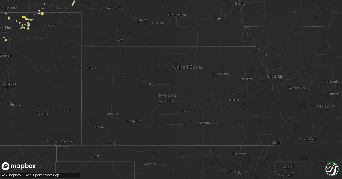
Hail Map on August 14, 2022
Get this storm
August 14 map
$229
one time, instant access
Download today. No call, no setup
Keep the $229
Bought the map and want the full workflow? Apply the entire $229 to a subscription within 7 days. None of it is wasted.
Every map, not just this one
This buys you this map. Subscription and you get every map we run, in the markets you choose from a few cities to whole states to nationwide. Plus real-time alerts the moment a storm fires.
Contact data
Name, contact info, occupancy, even credit band for addresses in the footprint. You go from where it hit to who to call.
Become the source they trust
Unlimited branding weather history reports on demand. You already have the documented answer ready for the property owner, and you are the one who showed up with it.
Property data and RoofTrace estimates
Pull up any address you have got, its value and the exact code rules for that jurisdiction, straight from One Click Code. Then RoofTrace estimates the squares, pitch, and roof value, priced the way you price.
States Impacted by Hail Map on August 14, 2022
Storm reports
Colorado
| Date | Description |
|---|---|
| 08/13/202211:00 PM CDT | At 400 PM MDT, a severe thunderstorm was located near Grover, or 33 miles southeast of Cheyenne, moving southeast at 25 mph. HAZARD...70 mph wind gusts and quarter size hail. SOURCE...Radar indicated. IMPACT...Expect considerable tree damage. Damage is likely to mobile homes, roofs, and outbuildings. Hail damage to vehicles is expected. This severe thunderstorm will remain over mainly rural areas of north central Weld County. |
| 08/13/202210:22 PM CDT | At 322 PM MDT, a severe thunderstorm was located 4 miles south of Rockport, or 21 miles south of Cheyenne, moving east at 10 mph. HAZARD...60 mph wind gusts and half dollar size hail. SOURCE...Radar indicated. IMPACT...Expect damage to roofs, siding, and trees. Hail damage to vehicles is expected. Locations impacted include... Rockport. |
Montana
| Date | Description |
|---|---|
| 08/13/202211:47 PM CDT | Asos station kmls miles city. |
Nebraska
| Date | Description |
|---|---|
| 08/14/20224:00 AM CDT | At 900 PM MDT, a severe thunderstorm was located near Antioch, or 11 miles east of Alliance, moving northeast at 20 mph. HAZARD...60 mph wind gusts and quarter size hail. SOURCE...Radar indicated. IMPACT...Hail damage to vehicles is expected. Expect wind damage to roofs, siding, and trees. Locations impacted include... Ellsworth, Antioch, Patterson Lake, Kincaid Lake, Kennedy Lake, Wild Horse Flats, Snow Lake, Miles Lake, Wickson Lake, Diamond Lake, Lakeside, Herman Lake, Jerry Lake, Krause Lake and Tralnor Lake.This includes the following highways... Highway 250 between mile markers 1 and 22. Highway 2 between mile markers 96 and 126. |
| 08/14/20223:51 AM CDT | At 851 PM MDT, severe thunderstorms were located along a line extending from 7 miles northeast of Box Butte Dam to near Wild Horse Butte to near Antioch, moving northeast at 20 mph. HAZARD...60 mph wind gusts. SOURCE...Radar indicated. IMPACT...Expect damage to roofs, siding, and trees. Locations impacted include... Alliance, Hemingford, Wild Horse Butte, Berea, Alliance Airport and Box Butte Dam. |
| 08/14/20222:56 AM CDT | At 755 PM MDT, severe thunderstorms were located along a line extending from Lake Minatare to 6 miles southwest of Chimney Rock State Park to near Redington, moving northeast at 15 mph. HAZARD...60 mph wind gusts and quarter size hail. SOURCE...Radar indicated. IMPACT...Hail damage to vehicles is expected. Expect wind damage to roofs, siding, and trees. Locations impacted include... Bridgeport, Bayard, Minatare, Lake Minatare Campground, Northport, Chimney Rock State Park, Bridgeport State Recreation Area, Angora, Kilpatrick Lake, The Intersection Of Highway 385 And 92, Court House And Jail Rocks, Moomaws Corner, Redington, Lake Minatare, The Intersection Of Highway 385 And L62, South Bayard Junction, Melbeta and McGrew. |
| 08/14/20222:12 AM CDT | At 712 PM MDT, a severe thunderstorm was located near Hay Springs, moving southeast at 20 mph. HAZARD...60 mph wind gusts and quarter size hail. SOURCE...Radar indicated. IMPACT...Hail damage to vehicles is expected. Expect wind damage to roofs, siding, and trees. Locations impacted include... Rushville, Hay Springs, Clinton, Lone Butte, Intersection of Beaver Creek Road and White Clay Creek Road, Intersection of Highway 87 and Antelope Road and Walgren Lake State Recreation Area.This includes the following highways... Highway 20 between mile markers 74 and 98. Highway 250 between mile markers 40 and 48. |
| 08/13/20229:53 PM CDT | A local report indicates 64 MPH wind near ALLIANCE |
| 08/13/20229:00 PM CDT | A local report indicates 60 MPH wind near 6 NE MINATARE |
| 08/13/20228:25 PM CDT | Trained spotter estimated 60 mph winds on the north side of hay springs. |
Arizona
| Date | Description |
|---|---|
| 08/14/20226:02 PM CDT | Power poles down along w patton rd. |
| 08/14/20225:26 PM CDT | Power pole |
| 08/14/20226:55 AM CDT | At 1153 AM MST, a severe thunderstorm was located near Cherry, or 8 miles southwest of Camp Verde along Interstate 17, moving southeast at 5 mph. HAZARD...Quarter size hail with 40 mph wind gusts. SOURCE...Radar indicated. IMPACT...Damage to vehicles is expected. This severe thunderstorm will be over Interstate 17 10 miles southwest of Camp Verde. |
| 08/14/20222:16 AM CDT | At 715 PM PDT, a severe thunderstorm was located over Overton, moving south at 25 mph. HAZARD...60 mph wind gusts. SOURCE...Radar indicated. IMPACT...Expect damage to roofs and trees. Locations impacted include... Overton, Moapa Town, Moapa Valley, Echo Bay, Valley Of Fire, Overton Beach, Echo Bay Campground, Logandale, Bunkerville and Lake Mead National Recreation Area.This includes Interstate 15 in Nevada between mile markers 90 and115. |
| 08/14/20221:30 AM CDT | At 630 PM MST, a severe thunderstorm was located 7 miles east of Dateland, or 42 miles northwest of Ajo, moving northeast at 10 mph. HAZARD...60 mph wind gusts and quarter size hail. SOURCE...Radar indicated. IMPACT...Hail damage to vehicles is expected. Expect wind damage to roofs, siding, and trees. Locations impacted include... Sentinel, Paloma and Dateland. This includes AZ Interstate 8 between mile markers 66 and 92. |
| 08/14/202212:14 AM CDT | At 514 PM MST, a severe thunderstorm was located near Sun Lakes, moving east at 15 mph. HAZARD...60 mph wind gusts and penny size hail. SOURCE...Radar indicated. IMPACT...Expect damage to roofs, siding, and trees. Locations impacted include... Mesa, Chandler, Gilbert, Tempe, Sun Lakes, Maricopa, Queen Creek, Chandler Heights, Gilbert City Hall, Tumbleweed Park, Chandler City Hall, San Tan Village Mall, Seville, Freestone Park and Bapchule.This includes the following highways...AZ Interstate 10 between mile markers 157 and 182.US Highway 60 between mile markers 184 and 185.AZ Route 87 between mile markers 146 and 171. |
| 08/13/202211:43 PM CDT | At 442 PM MST, a severe thunderstorm was located near Estrella Mountain Park, or 11 miles southeast of Avondale, moving northeast at 10 mph. HAZARD...60 mph wind gusts and quarter size hail. SOURCE...Radar indicated. IMPACT...Hail damage to vehicles is expected. Expect wind damage to roofs, siding, and trees. Locations impacted include... Phoenix, Avondale, Goodyear, Laveen, South Mountain Park, Phoenix International Raceway, South Phoenix, Estrella Mountain Park, Rainbow Valley and Komatke. |
| 08/13/202211:13 PM CDT | At 413 PM MST, a severe thunderstorm was located 9 miles south of Estrella Mountain Ranch, or 14 miles southeast of Buckeye, and is nearly stationary. HAZARD...60 mph wind gusts and penny size hail. SOURCE...Radar indicated. IMPACT...Expect damage to roofs, siding, and trees. Locations impacted include... Phoenix, Avondale, Goodyear, Buckeye, Tolleson, Cashion, Estrella, Litchfield Park, Palo Verde, Perryville, Liberty, Phoenix International Raceway, Estrella Sailport, Sonoran National Monument and Estrella Mountain Park.This includes the following highways...AZ Interstate 10 between mile markers 111 and 138.AZ Route 101 between mile markers 2 and 3.AZ Route 238 between mile markers 12 and 39. |
| 08/13/202210:58 PM CDT | At 358 PM MST, a severe thunderstorm was located near Beardsley, or near Sun City West, moving southeast at 20 mph. HAZARD...60 mph wind gusts and penny size hail. SOURCE...Radar indicated. IMPACT...Expect damage to roofs, siding, and trees. Locations impacted include... Phoenix, Glendale, Peoria, Surprise, Avondale, El Mirage, Youngtown, Sun City West, Waddell, Circle City, Sun City, Wittmann, Litchfield Park, Deer Valley Airport and White Tank Mountain Park.This includes the following highways...AZ Interstate 17 between mile markers 210 and 219.US Highway 60 between mile markers 121 and 156.AZ Route 101 between mile markers 3 and 25. |
| 08/13/202210:23 PM CDT | At 323 PM MST, a severe thunderstorm was located near Morristown, or near Circle City, moving northeast at 5 mph. HAZARD...60 mph wind gusts. SOURCE...Radar indicated. IMPACT...Expect damage to roofs, siding, and trees. Locations impacted include... Surprise, Wickenburg, Wittmann, Sun City West, Circle City, Lake Pleasant, Morristown, Beardsley and Vistancia.This includes the following highways...US Highway 60 between mile markers 93 and 141.AZ Route 74 between mile markers 1 and 24.AZ Route 303 between mile markers 117 and 132. |
| 08/13/202210:17 PM CDT | At 316 PM MST, a severe thunderstorm was located over Sycamore Creek, and is nearly stationary. HAZARD...60 mph wind gusts. SOURCE...Radar indicated. IMPACT...Expect damage to roofs, siding, and trees. Locations impacted include... Round Valley, Sycamore Creek, Sunflower, Ballantine Trailhead, Punkin Center and Tonto Basin.This includes the following highways...AZ Route 87 between mile markers 210 and 229.AZ Route 188 between mile markers 254 and 266. |
| 08/13/202210:09 PM CDT | At 308 PM MST, severe thunderstorms were located along a line extending from near Camp Creek to New River, and are nearly stationary. HAZARD...60 mph wind gusts. SOURCE...Radar indicated. IMPACT...Expect damage to roofs, siding, and trees. Locations impacted include... Scottsdale, Round Valley, New River, Sycamore Creek, Cave Creek, Carefree, Desert Mountain, Camp Creek, Rio Verde, Horseshoe Reservoir, Anthem and Seven Springs.This includes the following highways...AZ Interstate 17 between mile markers 224 and 241.AZ Route 87 near mile marker 213. |
| 08/13/20227:40 PM CDT | Large tree toppled and leaning on a home. |
| 08/13/20227:15 PM CDT | Power lines down. |
Tennessee
| Date | Description |
|---|---|
| 08/14/20226:33 AM CDT | At 1132 PM EDT, a severe thunderstorm was located 9 miles northwest of Walnut Hill, or 11 miles northwest of Bristol Va, moving southeast at 20 mph. HAZARD...60 mph wind gusts. SOURCE...Radar indicated. IMPACT...Expect damage to roofs, siding, and trees. Locations impacted include... Kingsport, Bristol Tn, Bristol Va, Walnut Hill, Colonial Heights, Spurgeon, Bluff City, Nickelsville, Tri-City Airport and Blountville.This includes the following highways... Interstate 81 in Tennessee between mile markers 58 and 75. Interstate 81 in Virginia between mile markers 1 and 8. |
| 08/13/202211:40 PM CDT | A few trees down. |
California
| Date | Description |
|---|---|
| 08/13/202210:22 PM CDT | At 322 PM PDT, a severe thunderstorm was located over Hwy S1 Between Lake Cuyamaca And Mount Laguna, or over Cuyamaca Rancho State Park, moving southwest at 20 mph. HAZARD...60 mph wind gusts. SOURCE...Radar indicated. IMPACT...Expect damage to roofs, siding, and trees. Locations impacted include... Mount Laguna, Cuyamaca Rancho State Park, Hwy S2 Between Shelter Valley And Agua Caliente, Hwy S2 Between Agua Caliente And Canebrake, Hwy S1 Between Lake Cuyamaca And Mount Laguna, Hwy 79 Between Julian And Lake Cuyamaca, Lake Cuyamaca, Pine Valley, Fish Creek Wash and Agua Caliente. |
| 08/13/202210:21 PM CDT | At 320 PM PDT/320 PM MST/, a severe thunderstorm was located over Arizona Village, or 11 miles northwest of Topock, moving south at 20 mph. This warning includes Needles and the Mohave Valley. HAZARD...60 mph wind gusts. SOURCE...Radar indicated. IMPACT...Expect damage to roofs and trees. Locations impacted include... Lake Havasu City, Topock, Needles, Mesquite Creek, Desert Hills, Arizona Village, Mojave Ranch Estates, Mohave Valley, Highway 95 And I-40 and Willow Valley.This includes the following highways... Interstate 40 in Arizona between mile markers 0 and 13. Interstate 40 in California between mile markers 112 and 155. |
| 08/13/20229:12 PM CDT | At 210 PM PDT, a severe thunderstorm was located 13 miles north of Essex, or 20 miles east of Mitchell Caverns, moving south at 20 mph. This storm will bring strong north crosswinds to Interstate 40. HAZARD...60 mph wind gusts. SOURCE...Radar indicated. IMPACT...Expect damage to roofs and trees. Locations impacted include... Mitchell Caverns, Highway 95 And I-40 and Essex. This includes Interstate 40 in California between mile markers 81 and133. |
| 08/13/20228:22 PM CDT | At 121 PM PDT, a severe thunderstorm was located 8 miles southeast of Joshua Tree, or 11 miles southwest of Twentynine Palms, and is nearly stationary. HAZARD...60 mph wind gusts and quarter size hail. SOURCE...Radar indicated. IMPACT...Hail damage to vehicles is expected. Expect wind damage to roofs, siding, and trees. Locations impacted include... Lost Horse-Keys Village. |
Kentucky
| Date | Description |
|---|---|
| 08/14/20223:50 AM CDT | At 850 PM EDT, a severe thunderstorm was located over Carrie, or over Hindman, moving southeast at 35 mph. HAZARD...60 mph wind gusts and quarter size hail. SOURCE...Radar indicated. IMPACT...Hail damage to vehicles is expected. Expect wind damage to roofs, siding, and trees. This severe thunderstorm will be near... Leburn around 855 PM EDT. Brinkley around 900 PM EDT. Bath around 905 PM EDT. Colson around 910 PM EDT.Other locations in the path of this severe thunderstorm includePolly. |
Virginia
| Date | Description |
|---|---|
| 08/13/202211:05 PM CDT | Several trees down. |
Cities Impacted by Hail Map on August 14, 2022
- Manville, WY
- Grover, CO
- Berthoud, CO
- Harrison, NE
- Kimball, NE
- Gordon, NE
- Dateland, AZ
- Garrett, WY
- Towner, ND
- Briggsdale, CO
- Williams, AZ
- Rifle, CO
- Ellsworth, NE
- Dix, NE
- Chandler, AZ
- Platteville, CO
- Marsland, NE
- Carr, CO
- Mead, CO
- Westhope, ND
- Golden Valley, AZ
- Padroni, CO
- Mayer, AZ
- Minatare, NE
- Ashby, NE
- Oshkosh, NE
- Bingham, NE
- Gilbert, AZ
- Hay Springs, NE
- Rushville, NE
- Chadron, NE
- Pine Ridge, SD
- Lakeside, NE
- Lewellen, NE
- Chappell, NE
- Taylorsville, NC
- Crown King, AZ
- Kingman, AZ
- Bristol, TN
- Bluff City, TN
- Ault, CO
- Longmont, CO
- Orchard, CO
- Laveen, AZ
- Florence, AZ
- Harrisburg, NE
- Hurley, NM
- Mohave Valley, AZ
- Gering, NE
- Melbeta, NE
- Bayard, NE
- Salome, AZ
- Merriman, NE
- Potter, NE
- Beemer, NE
- Kirkland, AZ
- Alliance, NE
- Wittmann, AZ
- New Raymer, CO