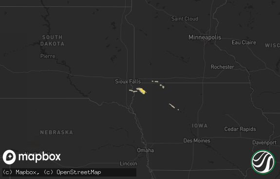
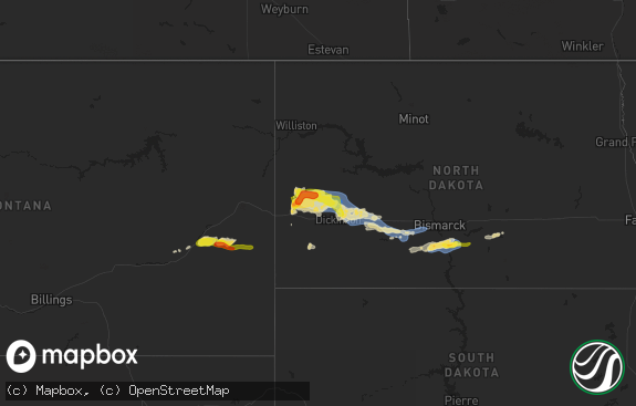
Hail Map in South Carolina on August 14, 2020
The weather event in South Carolina on August 14, 2020 includes Wind and Hail maps. 15 states and 318 cities were impacted and suffered possible damage. The total estimated number of properties impacted is 0.

Wind
Hail
0
Estimated number of impacted properties by a 1.00" hail or larger0
Estimated number of impacted properties by a 1.75" hail or larger0
Estimated number of impacted properties by a 2.50" hail or largerStorm reports in South Carolina
South Carolina
| Date | Description |
|---|---|
| 08/14/20206:00 PM CDT | Small tree down on bells hwy at tabor rd. Emergency manager reported that it was most likely caused by the outflow ahead of the thunderstorm. |
| 08/14/20205:26 PM CDT | Hampton county 911 reported a tree down on ridgecut rd. |
| 08/14/20204:55 PM CDT | Jasper county em reported trees fell on two homes in lakeview terrace off grays hwy. Trees fell on two homes nearby along malphrus rd near mark rd and carson rd. Severa |
| 08/14/20204:54 PM CDT | Tree in roadway on lakeview drive at lucas drive. Time estimated from radar. |
| 08/14/20204:50 PM CDT | Tree in roadway on haphazard rd at smiths crossing. Time estimated from radar. |
| 08/14/20204:50 PM CDT | Tree in roadway on mitchellville rd. Time estimated from radar. |
| 08/14/20204:45 PM CDT | Tree in roadway on kato bay road at crowfield way. Time estimated from radar. |
| 08/14/20201:17 AM CDT | At 617 PM EDT, a severe thunderstorm was located near Gillisonville, moving north at 30 mph. HAZARD...60 mph wind gusts and penny size hail. SOURCE...Law enforcement. IMPACT...Expect damage to trees and powerlines. Locations impacted include... Walterboro, Yemassee, Clarendon, Coosawhatchie, Gardens Corner, Grays, Ritter, Hendersonville, Islandton, Green Pond, Sheldon, Early Branch, Cummings, Gillisonville and McPhersonville.This warning includes I-95 in South Carolina between mile markers 27and 54. |
All States Impacted by Hail Map on August 14, 2020
Cities Impacted by Hail Map on August 14, 2020
- Farwell, MN
- Lowry, MN
- Alexandria, MN
- Glencoe, MN
- Stewart, MN
- Brownton, MN
- Sartell, MN
- Sauk Rapids, MN
- Saint Cloud, MN
- Saint Paul, MN
- Houlton, WI
- New Richmond, WI
- Stillwater, MN
- Minneapolis, MN
- Somerset, WI
- Willernie, MN
- Barnum, MN
- Cloquet, MN
- Carlton, MN
- Esko, MN
- Wrenshall, MN
- South Range, WI
- Holyoke, MN
- Superior, WI
- Foxboro, WI
- Deer Park, WI
- Amery, WI
- Osceola, WI
- Star Prairie, WI
- Marine On Saint Croix, MN
- La Crescent, MN
- Onalaska, WI
- La Crosse, WI
- Dakota, MN
- Jefferson, SD
- Elk Point, SD
- Ponca, NE
- Westfield, IA
- Fayette, OH
- Archbold, OH
- Wauseon, OH
- Norwich, ND
- Minot, ND
- Glenburn, ND
- Surrey, ND
- Minot Afb, ND
- Berthold, ND
- Ruso, ND
- Voltaire, ND
- Velva, ND
- Sawyer, ND
- Clayton, MI
- Hudson, MI
- Syracuse, KS
- Holly, CO
- Two Buttes, CO
- Granada, CO
- Walsh, CO
- Keyes, OK
- Elkhart, KS
- Goodwell, OK
- Richfield, KS
- Johnson, KS
- Manter, KS
- Merrill, IA
- Hinton, IA
- Platte Center, NE
- Columbus, NE
- Silver Creek, NE
- Osceola, NE
- Stromsburg, NE
- Bradshaw, NE
- Henderson, NE
- Sutton, NE
- Grafton, NE
- Polk, NE
- York, NE
- Benedict, NE
- Thurston, NE
- Walthill, NE
- Winnebago, NE
- Emerson, NE
- Geneva, NE
- Shickley, NE
- Saronville, NE
- Clay Center, NE
- Ong, NE
- Davenport, NE
- Edgar, NE
- Oak, NE
- Nelson, NE
- Deweese, NE
- Superior, NE
- Guide Rock, NE
- Lawrence, NE
- Barnard, KS
- Sylvan Grove, KS
- Jewell, KS
- Hunter, KS
- Glen Elder, KS
- Beloit, KS
- Wilson, KS
- Formoso, KS
- Mankato, KS
- Randall, KS
- Webber, KS
- Downs, KS
- Cawker City, KS
- Waldo, KS
- Luray, KS
- Lucas, KS
- Osborne, KS
- Dorrance, KS
- Hoisington, KS
- Bunker Hill, KS
- Claflin, KS
- McCracken, KS
- Ellis, KS
- Hays, KS
- Brownell, KS
- Arnold, KS
- Utica, KS
- Happy, TX
- Wayside, TX
- Claude, TX
- Clarendon, TX
- Amarillo, TX
- White Deer, TX
- Skellytown, TX
- Panhandle, TX
- Lafayette, MN
- Arlington, MN
- Winthrop, MN
- Green Isle, MN
- Gaylord, MN
- Hutchinson, MN
- Silver Lake, MN
- Lester Prairie, MN
- Albany, MN
- Melrose, MN
- Freeport, MN
- Anoka, MN
- Andover, MN
- Woodville, WI
- Baldwin, WI
- Hammond, WI
- River Falls, WI
- Gruver, TX
- Spearman, TX
- Guymon, OK
- Lyndon Station, WI
- Reedsburg, WI
- Mondovi, WI
- Arthur, ND
- Twin Valley, MN
- Ulen, MN
- Pelican Rapids, MN
- Sioux City, IA
- Texhoma, OK
- Lansford, ND
- Salix, IA
- Sloan, IA
- Fairmont, NE
- Glenvil, NE
- Fairfield, NE
- Harvard, NE
- McCool Junction, NE
- Norborne, MO
- Carrollton, MO
- Argusville, ND
- Casselton, ND
- Gardner, ND
- Sherwood, ND
- Harwood, ND
- Hunter, ND
- Grandin, ND
- Sparta, WI
- Le Mars, IA
- Hubbard, NE
- Black River Falls, WI
- Hudson, WI
- Lima, OH
- Ransom, KS
- Tipton, KS
- New Iberia, LA
- Gary, MN
- Tolley, ND
- Gackle, ND
- Fargo, ND
- Sunburg, MN
- Brooten, MN
- Richmond, MN
- Bangor, WI
- Norwalk, WI
- Tomah, WI
- Galesburg, ND
- Harrod, OH
- Bluffton, OH
- Monroe, NE
- Youngsville, LA
- Mohall, ND
- Burlington, ND
- Abbeville, LA
- Gibbon, MN
- Litchfield, MN
- Darwin, MN
- Cosmos, MN
- Borup, MN
- Amenia, ND
- David City, NE
- Erath, LA
- Sheldon, ND
- Enderlin, ND
- Hamburg, MN
- Mcadoo, TX
- Jeanerette, LA
- Chillicothe, MO
- Waubun, MN
- Mahnomen, MN
- Wakeeney, KS
- Hillpoint, WI
- Eden Valley, MN
- Detroit Lakes, MN
- Hillsboro, ND
- Wolverton, MN
- Evansville, MN
- Dassel, MN
- Hector, MN
- Buffalo Lake, MN
- Osseo, WI
- Baraboo, WI
- North Freedom, WI
- Burr Oak, KS
- Lincoln, KS
- Dickens, TX
- Lisbon, ND
- Butte, ND
- Frazee, MN
- Colfax, WI
- Wishek, ND
- Rockford, OH
- New Germany, MN
- Winsted, MN
- Dawn, MO
- Esbon, KS
- Silverton, TX
- Page, ND
- Fort Ransom, ND
- Nome, ND
- Kathryn, ND
- Verona, ND
- Litchville, ND
- Cokato, MN
- North Sioux City, SD
- Ruskin, NE
- Ellsworth, KS
- Jamesport, MO
- Oriska, ND
- Valley City, ND
- Erie, ND
- Plato, MN
- New London, MN
- Howard Lake, MN
- Champlin, MN
- Hager City, WI
- Bellwood, NE
- Orrick, MO
- Prole, IA
- Breckenridge, MO
- Hardeeville, SC
- Halstad, MN
- Shelly, MN
- New Ulm, MN
- Lake Elmo, MN
- Chelsea, MI
- Hope, ND
- Streeter, ND
- New Auburn, MN
- Jackson, NE
- Allerton, IA
- Allen, NE
- Bogard, MO
- Grass Lake, MI
- Hampton, NE
- Aurora, NE
- Manitou Beach, MI
- Addison, MI
- Coolidge, KS
- Wakefield, NE
- Homer, NE
- Waterbury, NE
- Jasper, MI
- Fredonia, ND
- Coffey, MO
- Gilman City, MO
- Defiance, OH
- Napoleon, OH
- Braymer, MO
- Indianola, IA
- New Virginia, IA
- Marion, ND
- Brooklyn, MI
- Onsted, MI
- Napoleon, MO
- Wellington, MO
- Fingal, ND
- Little Falls, MN
- Pittsford, MI
- Pampa, TX
- Lock Springs, MO
- Gallatin, MO
- Utica, MO
- Ludlow, MO
- Mooresville, MO
- Ridgeland, SC
- Leonard, ND
- Norwood Young America, MN
- Young America, MN


