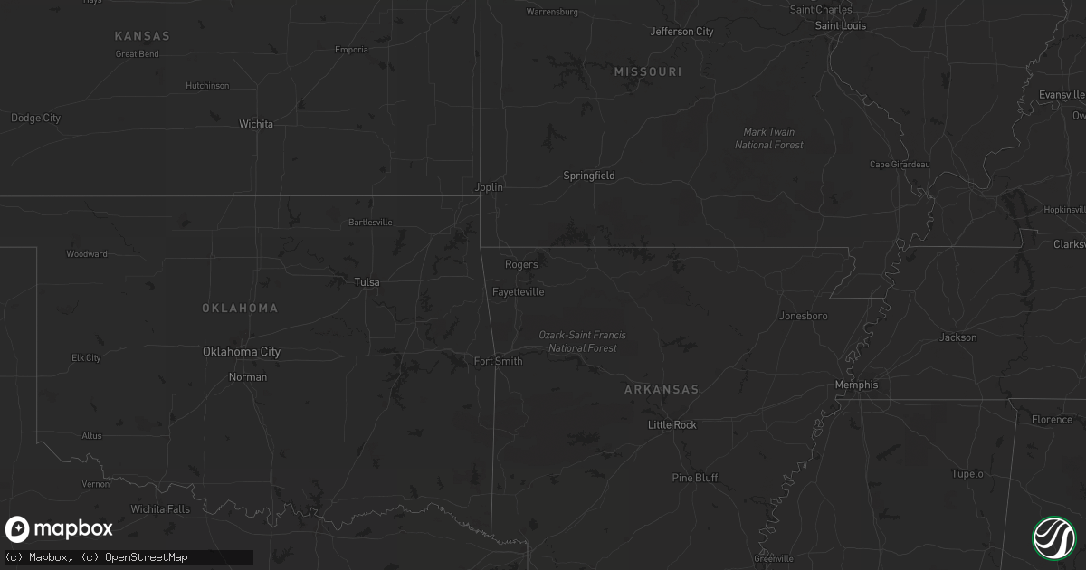
Hail Map in Colorado on August 14, 2013
Get this storm
August 14 map
$229
one time, instant access
Download today. No call, no setup
Keep the $229
Bought the map and want the full workflow? Apply the entire $229 to a subscription within 7 days. None of it is wasted.
Every map, not just this one
This buys you this map. Subscription and you get every map we run, in the markets you choose from a few cities to whole states to nationwide. Plus real-time alerts the moment a storm fires.
Contact data
Name, contact info, occupancy, even credit band for addresses in the footprint. You go from where it hit to who to call.
Become the source they trust
Unlimited branding weather history reports on demand. You already have the documented answer ready for the property owner, and you are the one who showed up with it.
Property data and RoofTrace estimates
Pull up any address you have got, its value and the exact code rules for that jurisdiction, straight from One Click Code. Then RoofTrace estimates the squares, pitch, and roof value, priced the way you price.
Storm reports in Colorado
Colorado
| Date | Description |
|---|---|
| 08/14/20136:46 PM CDT | A local report indicates 1.25 inch wind near 5 SSW BLACK FOREST |
| 08/14/20136:37 PM CDT | A local report indicates 1.00 inch wind near 10 NE COLORADO SPRINGS |
| 08/13/20139:18 PM CDT | Several large trees blown over in the town of sterling |
| 08/13/20139:15 PM CDT | A local report indicates 64 MPH wind near 2 W STERLING |
| 08/13/20138:55 PM CDT | A local report indicates 1.00 inch wind near 4 SW PUEBLO |
| 08/13/20138:54 PM CDT | A local report indicates 1.00 inch wind near 3 SW PUEBLO |
| 08/13/20138:47 PM CDT | Dents in car and shredded leaves on vegetation. |
| 08/13/20138:35 PM CDT | A local report indicates 1.00 inch wind near 3 N PUEBLO RESERVOIR |
| 08/13/20138:35 PM CDT | A local report indicates 1.00 inch wind near 2 SW PUEBLO WEST |
All States Impacted by Hail Map on August 14, 2013
Cities Impacted by Hail Map on August 14, 2013
- Tribune, KS
- Upton, WY
- Newcastle, WY
- Groom, TX
- Claude, TX
- Arriba, CO
- Flagler, CO
- Denton, GA
- Abernathy, TX
- Lubbock, TX
- Hale Center, TX
- Plainview, TX
- Deland, FL
- Manvel, TX
- Syracuse, KS
- Trinity, TX
- Alvarado, TX
- Venus, TX
- Corona, NM
- Bon Wier, TX
- Newton, TX
- Fitzgerald, GA
- Rosharon, TX
- Missouri City, TX
- Fresno, TX
- Chula, GA
- Ocilla, GA
- Tifton, GA
- Gruver, TX
- Jewett, TX
- Hay Springs, NE
- Chadron, NE
- Peyton, CO
- Colorado Springs, CO
- Hyannis, NE
- Burns, WY
- Cheyenne, WY
- Hemingford, NE
- Kimball, NE
- Odonnell, TX
- Goodwell, OK
- Guymon, OK
- Grover, CO
- Burwell, NE
- Tahoka, TX
- Usaf Academy, CO
- Wayside, TX
- Ellsworth, NE
- Ashby, NE
- Bingham, NE
- Franklin, TX
- West, TX
- Axtell, TX
- Elm Mott, TX
- Abbott, TX
- Eustis, FL
- Capitan, NM
- Normangee, TX
- Ocate, NM
- Wagon Mound, NM
- Smithfield, NE
- Panhandle, TX
- Varnville, SC
- Texhoma, OK
- Townsend, GA
- Pueblo, CO
- Happy, TX
- Fort Worth, TX
- Mansfield, TX
- Garita, NM
- Trementina, NM
- Kennedale, TX
- Richfield, KS
- Manter, KS
- Elkhart, KS
- Rolla, KS
- Seville, FL
- Houston, TX
- Tallahassee, FL
- Pollok, TX
- Alliance, NE
- Wolbach, NE
- Greeley, NE
- Scotia, NE
- Santo Domingo Pueblo, NM
- Pena Blanca, NM
- Pierson, FL
- Wilson, TX
- Donie, TX
- Richmond, TX
- Oviedo, FL
- Orlando, FL
- Gillette, WY
- Brooksville, FL
- Winnett, MT
- Wray, CO
- Haigler, NE
- Jacksonville, FL
- Green Pond, SC
- Tulia, TX
- New Raymer, CO
- Brownville, ME
- Marquez, TX
- Avondale, CO
- Las Vegas, NM
- Roy, MT
- Bertrand, NE
- Overton, NE
- Loomis, NE
- Bosque, NM
- Alvin, TX
- Pearland, TX
- Howey In The Hills, FL
- Clermont, FL
- Groveland, FL
- Stratford, TX
- Fritch, TX
- Alamo, GA
- McRae Helena, GA
- Arlington, TX
- Stinnett, TX
- Borger, TX
- Morse, TX
- Sunray, TX
- Cleveland, TX
- Kress, TX
- Caldwell, TX
- Anton, CO
- Saint Helena Island, SC
- Temple, TX
- Belton, TX
- Moody, TX
- Goodland, KS
- Crescent City, FL
- Johnson, KS
- Merriman, NE
- Guyton, GA
- Bloomingdale, GA
- Nolanville, TX
- Conchas Dam, NM
- Astor, FL
- Mertens, TX
- Hillsboro, TX
- Milford, TX
- Kempner, TX
- Estill, SC
- Barney, GA
- Savannah, GA
- Manitou Springs, CO
- Garnett, SC
- Keystone, NE
- New Deal, TX
- Georgetown, FL
- Pomona Park, FL
- Keyes, OK
- Walsh, CO
- Harker Heights, TX
- Killeen, TX
- Cloudcroft, NM
- White Sands Missile Range, NM
- Manzanola, CO
- Fowler, CO
- Olney Springs, CO
- Briggs, TX
- Florence, TX
- Bertram, TX
- Bunnell, FL
- Lufkin, TX
- Bushnell, NE
- Fort Hood, TX
- Glasgow, MT
- Levelland, TX
- Galena Park, TX
- Conroe, TX
- Lyons, CO
- Okatie, SC
- Zortman, MT
- Arthur, NE
- Vaughn, NM
- Teague, TX
- Wray, GA
- Calvert, TX
- Lindon, CO
- Dalhart, TX
- Nahunta, GA
- Littlefield, TX
- La Junta, CO
- Madisonville, TX
- Tumacacori, AZ
- Yemassee, SC
- Elsie, NE
- Granada, CO
- Pine Bluffs, WY
- Holland, TX
- Salado, TX
- Hazlehurst, GA
- Springer, NM
- Glennville, GA
- Broadus, MT
- Rosebud, TX
- Idalou, TX
- Colquitt, GA
- Bainbridge, GA
- Brinson, GA
- Broxton, GA
- Hampton, SC
- Beaufort, SC
- Paxton, NE
- Floydada, TX
- Vega, TX
- Burleson, TX
- Lillian, TX
- Early Branch, SC
- Masterson, TX
- Holly, CO
- Jesup, GA
- Saint Augustine, FL
- San Jose, NM
- Savage, MT
- Fort McCoy, FL
- De Leon Springs, FL
- Kings Bay, GA
- Sheridan Lake, CO
- Lovelady, TX
- Dixie, GA
- Harrison, NE
- Crawford, NE
- Madrid, NE
- Tybee Island, GA
- Abbeville, GA
- Malone, TX
- Pineland, SC
- Tillman, SC
- Brunswick, GA
- New Waverly, TX
- Bynum, TX
- Troy, TX
- Valrico, FL
- Dover, FL
- Orange City, FL
- Hilton Head Island, SC
- Amelia, NE
- Naylor, GA
- Valdosta, GA
- Darien, GA
- Thonotosassa, FL
- Tampa, FL
- Bluffton, SC
- Grass Range, MT
- Crosby, TX
- Dix, NE
- Penrose, CO


