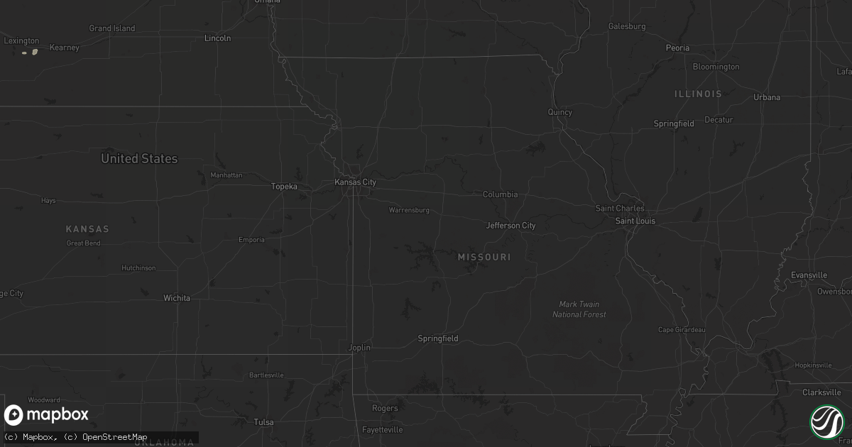
Hail Map on August 14, 2013
Get this storm
August 14 map
$229
one time, instant access
Download today. No call, no setup
Keep the $229
Bought the map and want the full workflow? Apply the entire $229 to a subscription within 7 days. None of it is wasted.
Every map, not just this one
This buys you this map. Subscription and you get every map we run, in the markets you choose from a few cities to whole states to nationwide. Plus real-time alerts the moment a storm fires.
Contact data
Name, contact info, occupancy, even credit band for addresses in the footprint. You go from where it hit to who to call.
Become the source they trust
Unlimited branding weather history reports on demand. You already have the documented answer ready for the property owner, and you are the one who showed up with it.
Property data and RoofTrace estimates
Pull up any address you have got, its value and the exact code rules for that jurisdiction, straight from One Click Code. Then RoofTrace estimates the squares, pitch, and roof value, priced the way you price.
States Impacted by Hail Map on August 14, 2013
Storm reports
Kansas
| Date | Description |
|---|---|
| 08/14/20134:00 PM CDT | A local report indicates 70 MPH wind near 6 NNE ELKHART |
| 08/14/20133:49 PM CDT | A local report indicates 63 MPH wind near ELKHART |
| 08/14/20133:45 PM CDT | Winds were estimated to be 60 to 70 mph. |
| 08/14/20133:00 PM CDT | A local report indicates 60 MPH wind near 6 SSE THE SAUNDERS ELEV |
| 08/14/20132:46 PM CDT | The hail was observed along highway 160. |
Texas
| Date | Description |
|---|---|
| 08/14/20136:57 PM CDT | A local report indicates 1.00 inch wind near 7 W STINNETT |
| 08/14/20136:55 PM CDT | A local report indicates 1.75 inch wind near 3 W STINNETT |
| 08/14/20136:43 PM CDT | A local report indicates 1.00 inch wind near MORSE |
| 08/14/20135:55 PM CDT | Horse trailers blown over by thunderstorm winds estimated at 60 mph. |
| 08/14/20133:30 PM CDT | Very strong thunderstorm winds over the westwood shores area of lake livingston. |
| 08/14/20131:21 AM CDT | Wind speed was estimated to be at least 60 mph |
| 08/13/201310:19 PM CDT | A local report indicates 1.75 inch wind near 4 E HALFWAY |
| 08/13/20139:51 PM CDT | A local report indicates 1.00 inch wind near 1 NNW PLAINVIEW |
| 08/13/20139:51 PM CDT | A local report indicates 60 MPH wind near 1 NNW PLAINVIEW |
| 08/13/20139:25 PM CDT | At hwy 207 crossing of prairie dog town fork of the red river. |
| 08/13/20139:00 PM CDT | A local report indicates 1.50 inch wind near CLAUDE |
| 08/13/20138:45 PM CDT | A local report indicates 60 MPH wind near 1 W CLAUDE |
| 08/13/20138:10 PM CDT | A local report indicates 1.00 inch wind near PANHANDLE |
| 08/13/20137:34 PM CDT | A local report indicates 65 MPH wind near 1 S BORGER |
| 08/13/20137:29 PM CDT | Quarter size hail reported in the lake meredith area. |
| 08/13/20137:29 PM CDT | A local report indicates 75 MPH wind near FRITCH |
| 08/13/20137:29 PM CDT | Damage to carports and weak structures in lake meredith area. Winds estimated at 75 mph. |
| 08/13/20137:25 PM CDT | A local report indicates 60 MPH wind near BORGER |
| 08/13/20137:21 PM CDT | Damage to several automobile wind shields. One spotter experienced severe damage to a new pickup truck from 2 inch diameter hail. |
| 08/13/20137:17 PM CDT | A local report indicates 1.75 inch wind near SANFORD |
Maine
| Date | Description |
|---|---|
| 08/14/201312:30 PM CDT | Trees down |
| 08/14/201312:30 PM CDT | Trees down |
Georgia
| Date | Description |
|---|---|
| 08/14/20136:50 PM CDT | Power line down second west street near highway 17. |
| 08/14/20136:46 PM CDT | Spotter reported a few trees down on highway 99 in meridian. |
| 08/14/20136:05 PM CDT | Dispatch received numerous reports of trees down across glynn county. |
| 08/14/20135:50 PM CDT | Tree was reported down at the intersection of knox road and ham road. |
| 08/14/20135:40 PM CDT | Trees and power lines down along highway 107 between snipesville and douglas highway. |
| 08/14/20135:40 PM CDT | Numerous trees reported down in hazlehurst. |
| 08/14/20133:15 PM CDT | Tree down near u.s. 84 and old naylor road. |
| 08/13/20137:45 PM CDT | One tree down on joe shingler road. |
Oklahoma
| Date | Description |
|---|---|
| 08/14/20134:50 PM CDT | Estimated 60 to 70 mph winds. Time estimated based on radar. |
Montana
| Date | Description |
|---|---|
| 08/13/20138:05 PM CDT | Hail size was mostly pea size but did have a few quarter size stones. |
Colorado
| Date | Description |
|---|---|
| 08/14/20136:46 PM CDT | A local report indicates 1.25 inch wind near 5 SSW BLACK FOREST |
| 08/14/20136:37 PM CDT | A local report indicates 1.00 inch wind near 10 NE COLORADO SPRINGS |
| 08/13/20139:18 PM CDT | Several large trees blown over in the town of sterling |
| 08/13/20139:15 PM CDT | A local report indicates 64 MPH wind near 2 W STERLING |
| 08/13/20138:55 PM CDT | A local report indicates 1.00 inch wind near 4 SW PUEBLO |
| 08/13/20138:54 PM CDT | A local report indicates 1.00 inch wind near 3 SW PUEBLO |
| 08/13/20138:47 PM CDT | Dents in car and shredded leaves on vegetation. |
| 08/13/20138:35 PM CDT | A local report indicates 1.00 inch wind near 3 N PUEBLO RESERVOIR |
| 08/13/20138:35 PM CDT | A local report indicates 1.00 inch wind near 2 SW PUEBLO WEST |
Wyoming
| Date | Description |
|---|---|
| 08/13/20137:25 PM CDT | A local report indicates 1.00 inch wind near 11 SSW UPTON |
South Carolina
| Date | Description |
|---|---|
| 08/14/20134:41 PM CDT | Tree down along parris island gateway road. Time estimated from radar. |
| 08/14/20133:31 PM CDT | Emergency manager relayed a report of greater than 1 inch hail in early branch. |
Florida
| Date | Description |
|---|---|
| 08/14/20135:52 PM CDT | Tree down across state road 100 in andalusia. |
| 08/14/20135:44 PM CDT | Flagler county dispatch reports a tree down across sawgrass road near bunnell. |
| 08/14/20135:27 PM CDT | Tree down across road on power lines at 31 porcupine drive in palm coast. |
| 08/14/20135:15 PM CDT | Emergency manager reports 2 or 3 trees blown into power lines at black point road and state road 100 west of bunnell. |
| 08/13/20137:15 PM CDT | Large tree down in arlington area blocking road. Time based on radar. |
Cities Impacted by Hail Map on August 14, 2013
- Tribune, KS
- Upton, WY
- Newcastle, WY
- Groom, TX
- Claude, TX
- Arriba, CO
- Flagler, CO
- Denton, GA
- Abernathy, TX
- Lubbock, TX
- Hale Center, TX
- Plainview, TX
- Deland, FL
- Manvel, TX
- Syracuse, KS
- Trinity, TX
- Alvarado, TX
- Venus, TX
- Corona, NM
- Bon Wier, TX
- Newton, TX
- Fitzgerald, GA
- Rosharon, TX
- Missouri City, TX
- Fresno, TX
- Chula, GA
- Ocilla, GA
- Tifton, GA
- Gruver, TX
- Jewett, TX
- Hay Springs, NE
- Chadron, NE
- Peyton, CO
- Colorado Springs, CO
- Hyannis, NE
- Burns, WY
- Cheyenne, WY
- Hemingford, NE
- Kimball, NE
- Odonnell, TX
- Goodwell, OK
- Guymon, OK
- Grover, CO
- Burwell, NE
- Tahoka, TX
- Usaf Academy, CO
- Wayside, TX
- Ellsworth, NE
- Ashby, NE
- Bingham, NE
- Franklin, TX
- West, TX
- Axtell, TX
- Elm Mott, TX
- Abbott, TX
- Eustis, FL
- Capitan, NM
- Normangee, TX
- Ocate, NM
- Wagon Mound, NM
- Smithfield, NE
- Panhandle, TX
- Varnville, SC
- Texhoma, OK
- Townsend, GA
- Pueblo, CO
- Happy, TX
- Fort Worth, TX
- Mansfield, TX
- Garita, NM
- Trementina, NM
- Kennedale, TX
- Richfield, KS
- Manter, KS
- Elkhart, KS
- Rolla, KS
- Seville, FL
- Houston, TX
- Tallahassee, FL
- Pollok, TX
- Alliance, NE
- Wolbach, NE
- Greeley, NE
- Scotia, NE
- Santo Domingo Pueblo, NM
- Pena Blanca, NM
- Pierson, FL
- Wilson, TX
- Donie, TX
- Richmond, TX
- Oviedo, FL
- Orlando, FL
- Gillette, WY
- Brooksville, FL
- Winnett, MT
- Wray, CO
- Haigler, NE
- Jacksonville, FL
- Green Pond, SC
- Tulia, TX
- New Raymer, CO
- Brownville, ME
- Marquez, TX
- Avondale, CO
- Las Vegas, NM
- Roy, MT
- Bertrand, NE
- Overton, NE
- Loomis, NE
- Bosque, NM
- Alvin, TX
- Pearland, TX
- Howey In The Hills, FL
- Clermont, FL
- Groveland, FL
- Stratford, TX
- Fritch, TX
- Alamo, GA
- McRae Helena, GA
- Arlington, TX
- Stinnett, TX
- Borger, TX
- Morse, TX
- Sunray, TX
- Cleveland, TX
- Kress, TX
- Caldwell, TX
- Anton, CO
- Saint Helena Island, SC
- Temple, TX
- Belton, TX
- Moody, TX
- Goodland, KS
- Crescent City, FL
- Johnson, KS
- Merriman, NE
- Guyton, GA
- Bloomingdale, GA
- Nolanville, TX
- Conchas Dam, NM
- Astor, FL
- Mertens, TX
- Hillsboro, TX
- Milford, TX
- Kempner, TX
- Estill, SC
- Barney, GA
- Savannah, GA
- Manitou Springs, CO
- Garnett, SC
- Keystone, NE
- New Deal, TX
- Georgetown, FL
- Pomona Park, FL
- Keyes, OK
- Walsh, CO
- Harker Heights, TX
- Killeen, TX
- Cloudcroft, NM
- White Sands Missile Range, NM
- Manzanola, CO
- Fowler, CO
- Olney Springs, CO
- Briggs, TX
- Florence, TX
- Bertram, TX
- Bunnell, FL
- Lufkin, TX
- Bushnell, NE
- Fort Hood, TX
- Glasgow, MT
- Levelland, TX
- Galena Park, TX
- Conroe, TX
- Lyons, CO
- Okatie, SC
- Zortman, MT
- Arthur, NE
- Vaughn, NM
- Teague, TX
- Wray, GA
- Calvert, TX
- Lindon, CO
- Dalhart, TX
- Nahunta, GA
- Littlefield, TX
- La Junta, CO
- Madisonville, TX
- Tumacacori, AZ
- Yemassee, SC
- Elsie, NE
- Granada, CO
- Pine Bluffs, WY
- Holland, TX
- Salado, TX
- Hazlehurst, GA
- Springer, NM
- Glennville, GA
- Broadus, MT
- Rosebud, TX
- Idalou, TX
- Colquitt, GA
- Bainbridge, GA
- Brinson, GA
- Broxton, GA
- Hampton, SC
- Beaufort, SC
- Paxton, NE
- Floydada, TX
- Vega, TX
- Burleson, TX
- Lillian, TX
- Early Branch, SC
- Masterson, TX
- Holly, CO
- Jesup, GA
- Saint Augustine, FL
- San Jose, NM
- Savage, MT
- Fort McCoy, FL
- De Leon Springs, FL
- Kings Bay, GA
- Sheridan Lake, CO
- Lovelady, TX
- Dixie, GA
- Harrison, NE
- Crawford, NE
- Madrid, NE
- Tybee Island, GA
- Abbeville, GA
- Malone, TX
- Pineland, SC
- Tillman, SC
- Brunswick, GA
- New Waverly, TX
- Bynum, TX
- Troy, TX
- Valrico, FL
- Dover, FL
- Orange City, FL
- Hilton Head Island, SC
- Amelia, NE
- Naylor, GA
- Valdosta, GA
- Darien, GA
- Thonotosassa, FL
- Tampa, FL
- Bluffton, SC
- Grass Range, MT
- Crosby, TX
- Dix, NE
- Penrose, CO