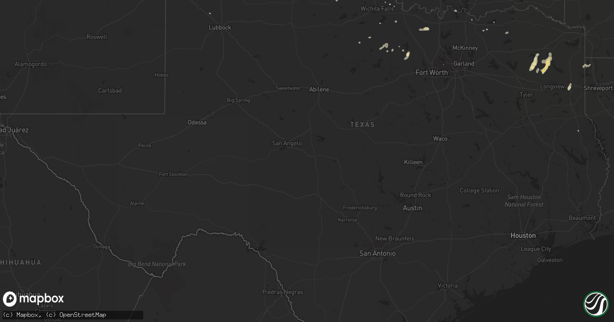
Hail Map in Texas on August 14, 2012
Get this storm
August 14 map
$229
one time, instant access
Download today. No call, no setup
Keep the $229
Bought the map and want the full workflow? Apply the entire $229 to a subscription within 7 days. None of it is wasted.
Every map, not just this one
This buys you this map. Subscription and you get every map we run, in the markets you choose from a few cities to whole states to nationwide. Plus real-time alerts the moment a storm fires.
Contact data
Name, contact info, occupancy, even credit band for addresses in the footprint. You go from where it hit to who to call.
Become the source they trust
Unlimited branding weather history reports on demand. You already have the documented answer ready for the property owner, and you are the one who showed up with it.
Property data and RoofTrace estimates
Pull up any address you have got, its value and the exact code rules for that jurisdiction, straight from One Click Code. Then RoofTrace estimates the squares, pitch, and roof value, priced the way you price.
Storm reports in Texas
Texas
| Date | Description |
|---|---|
| 08/14/20126:52 PM CDT | At kgyi |
| 08/14/20125:09 PM CDT | A local report indicates 65 MPH wind near SAMNORWOOD |
| 08/14/20124:35 PM CDT | A local report indicates 83 MPH wind near 1 ENE MCLEAN |
| 08/14/20124:32 PM CDT | 5 to 6 power poles snapped along interstate 40. Interstate exit sign blown down. |
| 08/14/20124:32 PM CDT | Large tree limbs down...power line down. |
| 08/14/20124:22 PM CDT | Large tree limbs down...power line down. |
| 08/14/20124:00 PM CDT | Small outbuildings shifted on foundations. 1 camping trailer overturned. 1 camping trailer moved. Fencing moved across roadway. |
| 08/13/20127:35 PM CDT | A silo was blown onto building in jacksboro. A gas station was also damaged. |
| 08/13/20127:20 PM CDT | Several trees uprooted and homes with roof and porch damage. |
| 08/13/20127:17 PM CDT | Estimated 55 to 60 mph |
| 08/13/20127:12 PM CDT | 62 mph winds reported near the intersection of hwy 91 and fm120 |
| 08/13/20127:08 PM CDT | A local report indicates 60 MPH wind near DENISON |
All States Impacted by Hail Map on August 14, 2012
Cities Impacted by Hail Map on August 14, 2012
- Sells, AZ
- Avera, GA
- Gibson, GA
- Gordonville, TX
- Irwinton, GA
- Toomsboro, GA
- Danville, GA
- Plant City, FL
- Dover, FL
- Annville, PA
- Grantville, PA
- Opp, AL
- Andalusia, AL
- Mechanicsburg, PA
- Carlisle, PA
- Jefferson, TX
- Vivian, LA
- Parrish, FL
- Buena Vista, GA
- Massey, MD
- Galena, MD
- Pampa, TX
- Wellsville, PA
- Dillsburg, PA
- Windthorst, TX
- Scotland, TX
- Kinston, AL
- Clarendon, TX
- Hedley, TX
- Skipperville, AL
- Clio, AL
- Ariton, AL
- Clayton, AL
- Clopton, AL
- Nogales, AZ
- Elizabethtown, NC
- Harrells, NC
- Hereford, AZ
- Tennille, GA
- Pittsburg, TX
- Shenandoah, VA
- Gilmer, TX
- Townsend, DE
- Millington, MD
- Clayton, DE
- Warwick, MD
- Picayune, MS
- Fayetteville, PA
- Chambersburg, PA
- Waynesboro, PA
- Mont Alto, PA
- Memphis, TX
- Childress, TX
- Elko, GA
- Cusseta, GA
- Carriere, MS
- Bridgeport, TX
- Poolville, TX
- Skellytown, TX
- Enterprise, AL
- New Brockton, AL
- Greencastle, PA
- Mercersburg, PA
- Saint Thomas, PA
- Mill Creek, PA
- Claude, TX
- Canyon, TX
- Hurtsboro, AL
- Hatchechubbee, AL
- Ore City, TX
- Windsor Mill, MD
- Woodstock, MD
- Cottondale, FL
- Marianna, FL
- Mifflintown, PA
- Port Royal, PA
- Lewistown, PA
- Oakland Mills, PA
- McAlisterville, PA
- Mifflin, PA
- Littlestown, PA
- Westminster, MD
- Hanover, PA
- Georgiana, AL
- Lithia, FL
- Glenmora, LA
- Warthen, GA
- Mitchell, GA
- Jacksboro, TX
- Luray, VA
- Greenville, AL
- Miami, TX
- Opelika, AL
- Salem, AL
- Bainbridge, PA
- Marietta, PA
- Elizabethtown, PA
- Wiggins, MS
- Perkinston, MS
- Marion, PA
- Canadian, TX
- Jonestown, PA
- Palmyra, PA
- Harrisburg, PA
- Auburn, AL
- Hummelstown, PA
- Tower City, PA
- White Marsh, MD
- Middle River, MD
- Chipley, FL
- Truckee, CA
- Tucson, AZ
- Lizella, GA
- Lumpkin, GA
- Rockbridge Baths, VA
- Towson, MD
- Gwynn Oak, MD
- Rosedale, MD
- Pikesville, MD
- Nottingham, MD
- Baltimore, MD
- Parkville, MD
- Somers, NY
- North Salem, NY
- Brewster, NY
- Purdys, NY
- Carmel, NY
- Croton Falls, NY
- Reisterstown, MD
- Leesburg, TX
- Stanley, VA
- Rosston, TX
- Muenster, TX
- Forestburg, TX
- Elba, AL
- Mobile, AL
- Wellington, TX
- Union Bridge, MD
- New Windsor, MD
- Mobeetie, TX
- Turkey, TX
- Oxford, FL
- Wildwood, FL
- The Villages, FL
- Chunchula, AL
- Saraland, AL
- Eight Mile, AL
- Winnsboro, TX
- Ida, LA
- Hosston, LA
- Vernon, TX
- Mauk, GA
- Wrightsville, GA
- Harrison, GA
- Eloy, AZ
- Hollis, OK
- Lewisberry, PA
- East Berlin, PA
- Dover, PA
- Omaha, TX
- Daingerfield, TX
- Hogansville, GA
- Wing, AL
- Florala, AL
- Paradise, TX
- Orlando, FL
- Springtown, TX
- Hereford, TX
- Sandersville, GA
- Olney, TX
- Seale, AL
- Pittsview, AL
- Banks, AL
- Harrisonburg, VA
- Sudlersville, MD
- Wilmer, AL
- Saint Cloud, FL
- Kenansville, FL
- Ruthton, MN
- West Augusta, VA
- Troy, AL
- Union Springs, AL
- Unadilla, GA
- Byromville, GA
- Midway, AL
- Omaha, GA
- Eglin Afb, FL
- Ozark, AL
- Denison, TX
- Lucedale, MS
- Davisboro, GA
- Marshall, TX
- Statesboro, GA
- Hinton, VA
- Forest Hill, LA
- Laveen, AZ
- Roberta, GA
- Brewton, AL
- Jackson, AL
- Franklin, AL
- Louisville, AL
- Phoenix, MD
- Monkton, MD
- Citronelle, AL
- Randallstown, MD
- Perry Hall, MD
- Lutherville Timonium, MD
- Mount Joy, PA
- Maytown, PA
- Goshen, VA
- Erick, OK
- Mandeville, LA
- McSherrystown, PA
- New Oxford, PA
- Taneytown, MD
- York Haven, PA
- Manchester, PA
- Mount Wolf, PA
- York, PA
- Moorefield, WV
- Dublin, GA
- Jeffersonville, GA
- East Dublin, GA
- Henrietta, TX
- New Smyrna Beach, FL
- Osteen, FL
- Whatley, AL
- Shallowater, TX
- Lapine, AL
- Grady, AL
- Allensville, PA
- Huntingdon, PA
- Finksburg, MD
- Upperco, MD
- Cockeysville, MD
- Glyndon, MD
- Stevenson, MD
- Joppa, MD
- Owings Mills, MD
- Gunpowder, MD
- Hampstead, MD
- Edgewood, MD
- Essex, MD
- Thompsontown, PA
- Arcadia, FL
- Semmes, AL
- Olton, TX
- Springlake, TX
- Oviedo, FL
- Camden, AL
- Butler, GA
- Gettysburg, PA
- Grove Hill, AL
- Wimauma, FL
- Metter, GA
- Warrenton, NC
- Live Oak, FL
- Miami, WV
- Hansford, WV
- Winifrede, WV
- Cabin Creek, WV
- Drybranch, WV
- Gallagher, WV
- Eskdale, WV
- McLain, MS
- Neely, MS
- Hancock, MD
- Warfordsburg, PA
- Paw Paw, WV
- Great Cacapon, WV
- Gainesville, TX
- Saint Jo, TX
- Abbottstown, PA
- Shamrock, TX
- Gray, GA
- Clarkton, NC
- Mims, FL
- Geneva, FL
- Dry Branch, GA
- Amado, AZ
- Warner Robins, GA
- Singers Glen, VA
- Gordon, GA
- Cooper, TX
- Ben Franklin, TX
- Kingston, OK
- Parkton, MD
- Sparks Glencoe, MD
- Wayside, TX
- Middlebrook, VA
- Raphine, VA
- Little River, AL
- Bonham, TX
- Mahopac, NY
- Ridgefield, CT
- Danbury, CT
- Evergreen, AL
- Saucier, MS
- McHenry, MS
- Dallas, TX
- Maricopa, AZ
- Red Level, AL
- Loranger, LA
- Amite, LA
- Husser, LA
- Franklinton, LA
- Mount Pleasant, TX
- Bonifay, FL
- Newcastle, TX
- Venus, FL
- Ardmore, OK
- Reynolds, GA
- Arabi, LA
- Dozier, AL
- Macon, NC
- Windom, TX
- Center, TX
- Petersburg, PA
- Titusville, FL
- Dearing, GA
- Wrens, GA
- Athens, OH
- New Marshfield, OH
- Wheeler, TX
- State College, PA
- Pennsylvania Furnace, PA
- Millerstown, PA
- Elliottsburg, PA
- Newport, PA
- Lady Lake, FL
- Lebanon, PA
- Keezletown, VA
- Wichita Falls, TX
- Samson, AL
- Graham, TX
- Bryson, TX
- Norlina, NC
- De Queen, AR
- Petrolia, TX
- McIntyre, GA
- Phenix City, AL
- Robeline, LA
- Provencal, LA


