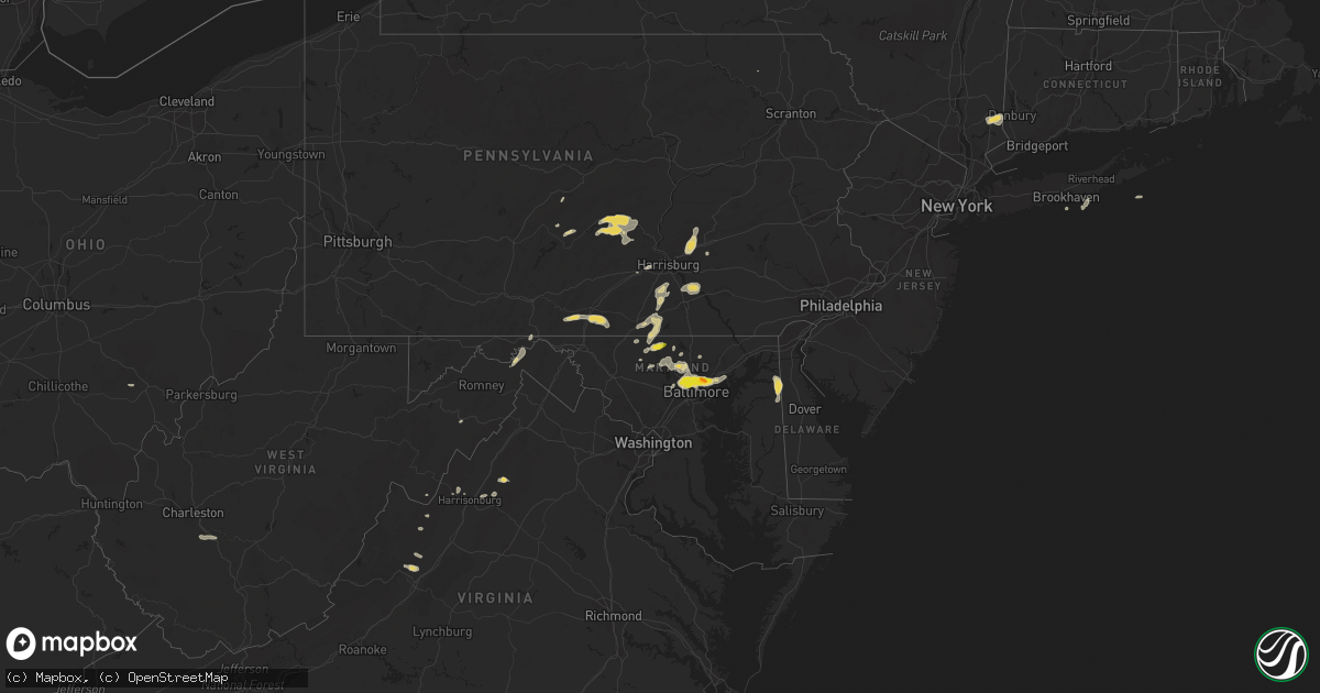
Hail Map on August 14, 2012
Get this storm
August 14 map
$229
one time, instant access
Download today. No call, no setup
Keep the $229
Bought the map and want the full workflow? Apply the entire $229 to a subscription within 7 days. None of it is wasted.
Every map, not just this one
This buys you this map. Subscription and you get every map we run, in the markets you choose from a few cities to whole states to nationwide. Plus real-time alerts the moment a storm fires.
Contact data
Name, contact info, occupancy, even credit band for addresses in the footprint. You go from where it hit to who to call.
Become the source they trust
Unlimited branding weather history reports on demand. You already have the documented answer ready for the property owner, and you are the one who showed up with it.
Property data and RoofTrace estimates
Pull up any address you have got, its value and the exact code rules for that jurisdiction, straight from One Click Code. Then RoofTrace estimates the squares, pitch, and roof value, priced the way you price.
States Impacted by Hail Map on August 14, 2012
Storm reports
Pennsylvania
| Date | Description |
|---|---|
| 08/13/20128:15 PM CDT | Tree on house in mifflintown and numerous trees down in area surrounding mifflintown |
Oklahoma
| Date | Description |
|---|---|
| 08/13/20127:25 PM CDT | Tree damage/large limbs |
California
| Date | Description |
|---|---|
| 08/14/20126:12 PM CDT | Runway 15 threshold wind speed of 58 knots or 67 mph. |
| 08/14/20126:05 PM CDT | Runway 023 wind speed of 52 knots or 60 mph. |
| 08/14/20125:50 PM CDT | Runway 04 left wind speeds of 51 knots or 59 mph. |
Alabama
| Date | Description |
|---|---|
| 08/14/20124:32 PM CDT | Multiple trees reported down across the western portion of dale county. |
| 08/14/20124:10 PM CDT | One large oak tree down on a house on railroad street in new brockton. |
Maryland
| Date | Description |
|---|---|
| 08/14/20126:04 PM CDT | A local report indicates 1.00 inch wind near 4 NNE WESTMINSTER |
| 08/14/20123:21 PM CDT | Multiple trees down on drake road. |
| 08/14/20123:19 PM CDT | Tree down across telephone lines near intersection of drake rd se and williams rd se |
| 08/13/20129:15 PM CDT | Tree down on west chesapeake ave at woodbine ave |
| 08/13/20129:14 PM CDT | Quarter size hail |
| 08/13/20129:14 PM CDT | A local report indicates 1.00 inch wind near 1 NE ROSSVILLE |
| 08/13/20129:10 PM CDT | A local report indicates 1.00 inch wind near 1 NE PIMLICO |
| 08/13/20129:09 PM CDT | A local report indicates 1.00 inch wind near 1 SW PERRY HALL |
| 08/13/20129:07 PM CDT | A local report indicates 1.00 inch wind near PIMLICO |
| 08/13/20129:00 PM CDT | Relayed via storm prediction center |
| 08/13/20128:15 PM CDT | Tree down on west chesapeake ave at woodbine ave |
Florida
| Date | Description |
|---|---|
| 08/14/20122:25 PM CDT | Off-duty nws employee reports a large tree down on san jose boulevard near the intersection of orange picker road in east mandarin. Time of damage based on radar data. |
New York
| Date | Description |
|---|---|
| 08/13/20127:25 PM CDT | Large tree blocking road on u.s. Route 11 |
| 08/13/20127:25 PM CDT | Small wood power pole down est 70-80 mph wind |
| 08/13/20127:20 PM CDT | Large tree blocking road on u.s. Route 11 |
| 08/13/20127:15 PM CDT | Numerous 6-12 inch branches down est 70-80 mph winds |
| 08/13/20127:05 PM CDT | Large branches down along route 392 |
West Virginia
| Date | Description |
|---|---|
| 08/14/20125:45 PM CDT | Tree knocked down across winchester ave near frenchys dr |
| 08/14/20123:40 PM CDT | A local report indicates 1.00 inch wind near 3 ENE MAGNOLIA |
| 08/14/20123:40 PM CDT | A local report indicates 1.00 inch wind near 3 E MAGNOLIA |
North Carolina
| Date | Description |
|---|---|
| 08/14/20123:50 PM CDT | One small tree down just outside the reception area for brights creek golf and equestrian community. |
| 08/14/20123:42 PM CDT | A tree was blown down on summer road. |
| 08/13/201210:20 PM CDT | Truck driver reported trees down on highway 158 between littleton and roanoke rapids. |
Montana
| Date | Description |
|---|---|
| 08/13/201211:13 PM CDT | 59 mph wind gust at the dot sensor near sieben flats on interstate 15. |
| 08/13/201210:45 PM CDT | Wind gust estimated near 60 mph. Power was out for about 3 hours. |
| 08/13/20129:53 PM CDT | 62 mph wind gust just north of black eagle. |
| 08/13/20129:50 PM CDT | 86 mph wind gust at millegan. |
| 08/13/20129:45 PM CDT | 3 inch tree limb broken off...and no power. |
| 08/13/20129:35 PM CDT | 60 mph wind gust with cold front passage. |
| 08/13/20129:28 PM CDT | 62 mph wind gust at the nws office. Power was out for a few minutes. Blowing dust. |
| 08/13/20129:23 PM CDT | 60 mph wind gust. Power out at the nws office in great falls. Visibility is 2 miles in blowing dust. |
| 08/13/20129:20 PM CDT | 70 mph wind gust. |
| 08/13/20129:20 PM CDT | 70 mph wind gust. |
| 08/13/20129:15 PM CDT | Estimated 65 mph in the augusta area. |
| 08/13/20129:00 PM CDT | 60 mph wind gust. |
| 08/13/20128:29 PM CDT | 66 mph wind gust measured near brady. |
| 08/13/20128:20 PM CDT | Estimated wind gusts to 60 mph in the fields. |
| 08/13/20128:12 PM CDT | 58 mph wind gust at the dot sensor just east of east glacier park. |
| 08/13/20128:00 PM CDT | Large trees downed at rising sun campground... East side of glacier national park. |
| 08/13/20127:44 PM CDT | 72 mph wind gust at the cut bank airport. |
| 08/13/20127:42 PM CDT | Estimated 70 mph winds lifting dust and debris |
| 08/13/20127:41 PM CDT | 67 mph wind gust at the cut bank airport. |
Massachusetts
| Date | Description |
|---|---|
| 08/14/20126:49 AM CDT | Eight inch diameter branch down on wooden fence on elm street |
| 08/14/20124:36 AM CDT | Large tree limbs down on bear hole road and prospect street. |
Virginia
| Date | Description |
|---|---|
| 08/14/20126:15 PM CDT | Quarter size hail was observed falling along anderson farm road for about 5 minutes. |
| 08/14/20126:13 PM CDT | Dime to quarter size hail fell along anderson farm road for five to ten minutes. |
| 08/14/20126:10 PM CDT | Dime to quarter size hail fell for close to 10 minutes along walkers creek road. |
| 08/14/20126:08 PM CDT | Numerous trees uprooted...with 30 foot tall pine tree snapped. |
| 08/14/20124:29 PM CDT | A local report indicates 1.00 inch wind near 1 SSW LURAY |
| 08/14/20124:29 PM CDT | A local report indicates 1.25 inch wind near 1 SE LEAKSVILLE |
| 08/14/20124:20 PM CDT | Tree down on simmers valley rdd |
| 08/14/20124:20 PM CDT | Tree down |
| 08/14/20124:08 PM CDT | Tree down across road and on power lines along 7000 block of hopkins gap rd west of harrisonburg...va. |
| 08/14/20122:00 PM CDT | Very strong winds. |
Georgia
| Date | Description |
|---|---|
| 08/14/20125:30 PM CDT | Several trees were blown down in western glascock county along state highway 123 and county line road west. The trees were mostly rotten. |
| 08/14/20125:25 PM CDT | Several trees down and many large limbs down...some blocking u.s. Hwy 221. |
| 08/14/20125:00 PM CDT | Numerous trees down in the sandersville and tenille areas. Areas south of tenille also affected. |
| 08/14/20124:57 PM CDT | Wmaz relayed a report of a barn destroyed along tennille-harrison road. |
| 08/14/20124:40 PM CDT | Numerous trees and power lines down. |
| 08/14/20124:05 PM CDT | Large tree fell on a house on charlie floyd rd. |
| 08/14/20123:50 PM CDT | Amateur radio operator relayed a report of several trees down over extreme southeast jones county. |
| 08/14/20123:40 PM CDT | Houston county ema relayed a report of two trees down in southern houston county. |
| 08/14/20123:30 PM CDT | Amateur radio operator relayed reports of several trees down across much of bibb county. |
| 08/14/20122:50 PM CDT | Several trees were blown down...some on power lines...along highway 96 east of butler toward reynolds. |
| 08/14/20122:50 PM CDT | Several trees down in reynolds. |
Texas
| Date | Description |
|---|---|
| 08/14/20126:52 PM CDT | At kgyi |
| 08/14/20125:09 PM CDT | A local report indicates 65 MPH wind near SAMNORWOOD |
| 08/14/20124:35 PM CDT | A local report indicates 83 MPH wind near 1 ENE MCLEAN |
| 08/14/20124:32 PM CDT | Large tree limbs down...power line down. |
| 08/14/20124:32 PM CDT | 5 to 6 power poles snapped along interstate 40. Interstate exit sign blown down. |
| 08/14/20124:22 PM CDT | Large tree limbs down...power line down. |
| 08/14/20124:00 PM CDT | Small outbuildings shifted on foundations. 1 camping trailer overturned. 1 camping trailer moved. Fencing moved across roadway. |
| 08/13/20127:35 PM CDT | A silo was blown onto building in jacksboro. A gas station was also damaged. |
| 08/13/20127:20 PM CDT | Several trees uprooted and homes with roof and porch damage. |
| 08/13/20127:17 PM CDT | Estimated 55 to 60 mph |
| 08/13/20127:12 PM CDT | 62 mph winds reported near the intersection of hwy 91 and fm120 |
| 08/13/20127:08 PM CDT | A local report indicates 60 MPH wind near DENISON |
Cities Impacted by Hail Map on August 14, 2012
- Sells, AZ
- Avera, GA
- Gibson, GA
- Gordonville, TX
- Irwinton, GA
- Toomsboro, GA
- Danville, GA
- Plant City, FL
- Dover, FL
- Annville, PA
- Grantville, PA
- Opp, AL
- Andalusia, AL
- Mechanicsburg, PA
- Carlisle, PA
- Jefferson, TX
- Vivian, LA
- Parrish, FL
- Buena Vista, GA
- Massey, MD
- Galena, MD
- Pampa, TX
- Wellsville, PA
- Dillsburg, PA
- Windthorst, TX
- Scotland, TX
- Kinston, AL
- Clarendon, TX
- Hedley, TX
- Skipperville, AL
- Clio, AL
- Ariton, AL
- Clayton, AL
- Clopton, AL
- Nogales, AZ
- Elizabethtown, NC
- Harrells, NC
- Hereford, AZ
- Tennille, GA
- Pittsburg, TX
- Shenandoah, VA
- Gilmer, TX
- Townsend, DE
- Millington, MD
- Clayton, DE
- Warwick, MD
- Picayune, MS
- Fayetteville, PA
- Chambersburg, PA
- Waynesboro, PA
- Mont Alto, PA
- Memphis, TX
- Childress, TX
- Elko, GA
- Cusseta, GA
- Carriere, MS
- Bridgeport, TX
- Poolville, TX
- Skellytown, TX
- Enterprise, AL
- New Brockton, AL
- Greencastle, PA
- Mercersburg, PA
- Saint Thomas, PA
- Mill Creek, PA
- Claude, TX
- Canyon, TX
- Hurtsboro, AL
- Hatchechubbee, AL
- Ore City, TX
- Windsor Mill, MD
- Woodstock, MD
- Cottondale, FL
- Marianna, FL
- Mifflintown, PA
- Port Royal, PA
- Lewistown, PA
- Oakland Mills, PA
- McAlisterville, PA
- Mifflin, PA
- Littlestown, PA
- Westminster, MD
- Hanover, PA
- Georgiana, AL
- Lithia, FL
- Glenmora, LA
- Warthen, GA
- Mitchell, GA
- Jacksboro, TX
- Luray, VA
- Greenville, AL
- Miami, TX
- Opelika, AL
- Salem, AL
- Bainbridge, PA
- Marietta, PA
- Elizabethtown, PA
- Wiggins, MS
- Perkinston, MS
- Marion, PA
- Canadian, TX
- Jonestown, PA
- Palmyra, PA
- Harrisburg, PA
- Auburn, AL
- Hummelstown, PA
- Tower City, PA
- White Marsh, MD
- Middle River, MD
- Chipley, FL
- Truckee, CA
- Tucson, AZ
- Lizella, GA
- Lumpkin, GA
- Rockbridge Baths, VA
- Towson, MD
- Gwynn Oak, MD
- Rosedale, MD
- Pikesville, MD
- Nottingham, MD
- Baltimore, MD
- Parkville, MD
- Somers, NY
- North Salem, NY
- Brewster, NY
- Purdys, NY
- Carmel, NY
- Croton Falls, NY
- Reisterstown, MD
- Leesburg, TX
- Stanley, VA
- Rosston, TX
- Muenster, TX
- Forestburg, TX
- Elba, AL
- Mobile, AL
- Wellington, TX
- Union Bridge, MD
- New Windsor, MD
- Mobeetie, TX
- Turkey, TX
- Oxford, FL
- Wildwood, FL
- The Villages, FL
- Chunchula, AL
- Saraland, AL
- Eight Mile, AL
- Winnsboro, TX
- Ida, LA
- Hosston, LA
- Vernon, TX
- Mauk, GA
- Wrightsville, GA
- Harrison, GA
- Eloy, AZ
- Hollis, OK
- Lewisberry, PA
- East Berlin, PA
- Dover, PA
- Omaha, TX
- Daingerfield, TX
- Hogansville, GA
- Wing, AL
- Florala, AL
- Paradise, TX
- Orlando, FL
- Springtown, TX
- Hereford, TX
- Sandersville, GA
- Olney, TX
- Seale, AL
- Pittsview, AL
- Banks, AL
- Harrisonburg, VA
- Sudlersville, MD
- Wilmer, AL
- Saint Cloud, FL
- Kenansville, FL
- Ruthton, MN
- West Augusta, VA
- Troy, AL
- Union Springs, AL
- Unadilla, GA
- Byromville, GA
- Midway, AL
- Omaha, GA
- Eglin Afb, FL
- Ozark, AL
- Denison, TX
- Lucedale, MS
- Davisboro, GA
- Marshall, TX
- Statesboro, GA
- Hinton, VA
- Forest Hill, LA
- Laveen, AZ
- Roberta, GA
- Brewton, AL
- Jackson, AL
- Franklin, AL
- Louisville, AL
- Phoenix, MD
- Monkton, MD
- Citronelle, AL
- Randallstown, MD
- Perry Hall, MD
- Lutherville Timonium, MD
- Mount Joy, PA
- Maytown, PA
- Goshen, VA
- Erick, OK
- Mandeville, LA
- McSherrystown, PA
- New Oxford, PA
- Taneytown, MD
- York Haven, PA
- Manchester, PA
- Mount Wolf, PA
- York, PA
- Moorefield, WV
- Dublin, GA
- Jeffersonville, GA
- East Dublin, GA
- Henrietta, TX
- New Smyrna Beach, FL
- Osteen, FL
- Whatley, AL
- Shallowater, TX
- Lapine, AL
- Grady, AL
- Allensville, PA
- Huntingdon, PA
- Finksburg, MD
- Upperco, MD
- Cockeysville, MD
- Glyndon, MD
- Stevenson, MD
- Joppa, MD
- Owings Mills, MD
- Gunpowder, MD
- Hampstead, MD
- Edgewood, MD
- Essex, MD
- Thompsontown, PA
- Arcadia, FL
- Semmes, AL
- Olton, TX
- Springlake, TX
- Oviedo, FL
- Camden, AL
- Butler, GA
- Gettysburg, PA
- Grove Hill, AL
- Wimauma, FL
- Metter, GA
- Warrenton, NC
- Live Oak, FL
- Miami, WV
- Hansford, WV
- Winifrede, WV
- Cabin Creek, WV
- Drybranch, WV
- Gallagher, WV
- Eskdale, WV
- McLain, MS
- Neely, MS
- Hancock, MD
- Warfordsburg, PA
- Paw Paw, WV
- Great Cacapon, WV
- Gainesville, TX
- Saint Jo, TX
- Abbottstown, PA
- Shamrock, TX
- Gray, GA
- Clarkton, NC
- Mims, FL
- Geneva, FL
- Dry Branch, GA
- Amado, AZ
- Warner Robins, GA
- Singers Glen, VA
- Gordon, GA
- Cooper, TX
- Ben Franklin, TX
- Kingston, OK
- Parkton, MD
- Sparks Glencoe, MD
- Wayside, TX
- Middlebrook, VA
- Raphine, VA
- Little River, AL
- Bonham, TX
- Mahopac, NY
- Ridgefield, CT
- Danbury, CT
- Evergreen, AL
- Saucier, MS
- McHenry, MS
- Dallas, TX
- Maricopa, AZ
- Red Level, AL
- Loranger, LA
- Amite, LA
- Husser, LA
- Franklinton, LA
- Mount Pleasant, TX
- Bonifay, FL
- Newcastle, TX
- Venus, FL
- Ardmore, OK
- Reynolds, GA
- Arabi, LA
- Dozier, AL
- Macon, NC
- Windom, TX
- Center, TX
- Petersburg, PA
- Titusville, FL
- Dearing, GA
- Wrens, GA
- Athens, OH
- New Marshfield, OH
- Wheeler, TX
- State College, PA
- Pennsylvania Furnace, PA
- Millerstown, PA
- Elliottsburg, PA
- Newport, PA
- Lady Lake, FL
- Lebanon, PA
- Keezletown, VA
- Wichita Falls, TX
- Samson, AL
- Graham, TX
- Bryson, TX
- Norlina, NC
- De Queen, AR
- Petrolia, TX
- McIntyre, GA
- Phenix City, AL
- Robeline, LA
- Provencal, LA