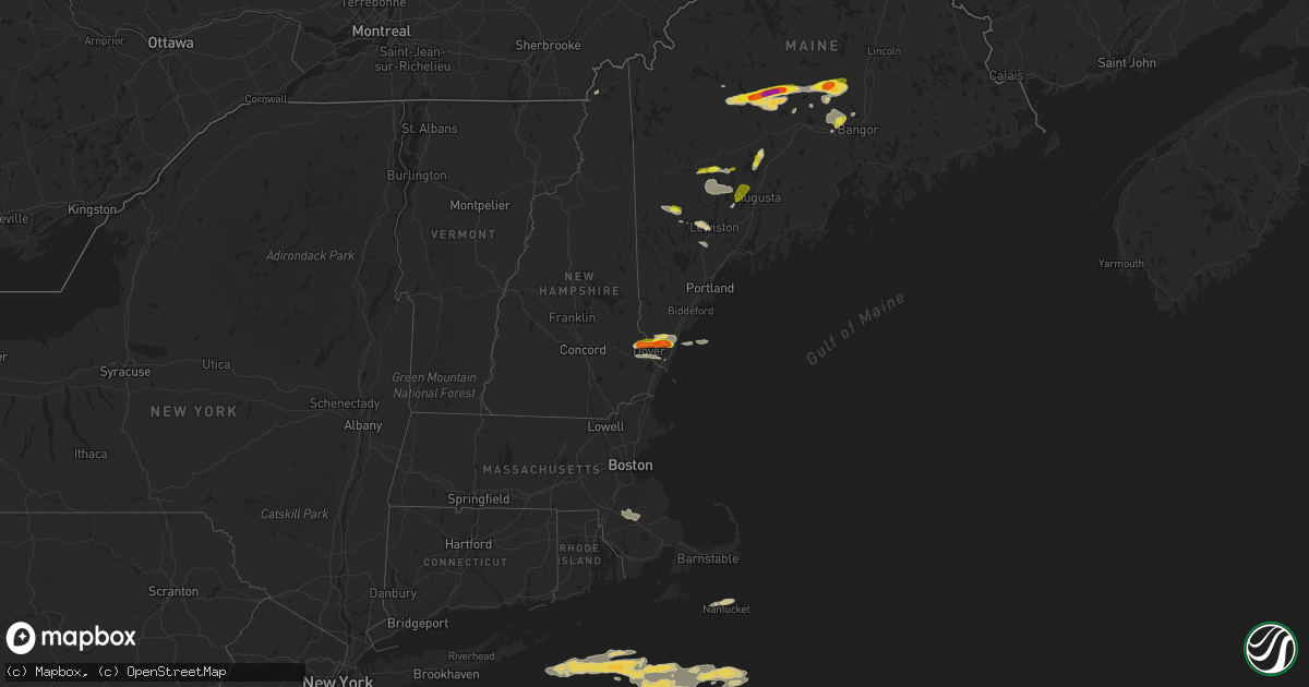
Hail Map on August 13, 2023
Get this storm
August 13 map
$229
one time, instant access
Download today. No call, no setup
Keep the $229
Bought the map and want the full workflow? Apply the entire $229 to a subscription within 7 days. None of it is wasted.
Every map, not just this one
This buys you this map. Subscription and you get every map we run, in the markets you choose from a few cities to whole states to nationwide. Plus real-time alerts the moment a storm fires.
Contact data
Name, contact info, occupancy, even credit band for addresses in the footprint. You go from where it hit to who to call.
Become the source they trust
Unlimited branding weather history reports on demand. You already have the documented answer ready for the property owner, and you are the one who showed up with it.
Property data and RoofTrace estimates
Pull up any address you have got, its value and the exact code rules for that jurisdiction, straight from One Click Code. Then RoofTrace estimates the squares, pitch, and roof value, priced the way you price.
States Impacted by Hail Map on August 13, 2023
Storm reports
Missouri
| Date | Description |
|---|---|
| 08/13/202311:45 AM CDT | A large oak tree was snapped off and fell into powerlines causing power outages. Several power poles were snapped off near the base and power lines were down blocking h |
| 08/13/202311:30 AM CDT | A large branch from a maple tree was down on two vehicles. No significant damage was reported to the vehicles. |
| 08/13/20239:01 AM CDT | Power line was downed in town. Another business reported a power outage. Time estimated by radar. |
| 08/13/20238:55 AM CDT | Power line reported down in braymer. |
| 08/13/202312:29 AM CDT | Tree down on a home near dora. |
| 08/12/202311:45 PM CDT | Corrects time of previous tstm wnd dmg report from 4 ssw wet glaize. A large oak tree was snapped off and fell into powerlines causing power outages. Several power pole |
| 08/12/202311:35 PM CDT | Awos station kozs camdenton awos. |
| 08/12/202311:30 PM CDT | Report of damage to a roof from thunderstorm winds. Time estimated via radar. |
| 08/12/202311:30 PM CDT | Corrects time of previous tstm wnd dmg report from camdenton. A large branch from a maple tree was down on two vehicles. No significant damage was reported to the vehic |
| 08/12/202311:12 PM CDT | Four to five inch tree limbs down. Time based on radar estimate. |
| 08/12/202311:01 PM CDT | Report from mping: 1-inch tree limbs broken; shingles blown off. |
| 08/12/202310:30 PM CDT | Report from mping: 3-inch tree limbs broken; power poles broken. |
| 08/12/202310:30 PM CDT | Tree down near 6th/church intersection - size approx. 18-24 in diameter. |
| 08/12/202310:20 PM CDT | *** 3 inj *** a large tree fell through the roof of a home into the living area. Several people were treated for minor injuries and released on site after being trapped |
| 08/12/20239:48 PM CDT | Several trees down and metal shop roof blown off south of aurora off tt highway. |
| 08/12/20239:20 PM CDT | Report from mping: quarter |
| 08/12/20239:15 PM CDT | Awos station khfj monett awos. |
| 08/12/20238:51 PM CDT | Quarter sized hail reported west of neosho along highway 86 in newton county. |
| 08/12/20237:14 PM CDT | Report from mping: 1-inch tree limbs broken. |
| 08/12/20237:06 PM CDT | Several tree limbs down some up to 8 in. In diameter. Reported via social media. Time estimated via radar. |
| 08/12/20237:02 PM CDT | Personal weather station recorded 65 mph wind gust. |
California
| Date | Description |
|---|---|
| 08/13/20236:44 PM CDT | [landspout] a landspout tornado was reported along the mojave river near barstow. Several spotter photos confirmed the landspout but no damage or injuries were reporte |
| 08/13/20235:56 PM CDT | Needles airport asos reported a peak wind gust of 59 mph. |
New Mexico
| Date | Description |
|---|---|
| 08/13/20235:24 PM CDT | Asos station ktcc tucumcari muni airport. |
| 08/13/20233:35 PM CDT | Awos station ksxu santa rosa airport. |
Kansas
| Date | Description |
|---|---|
| 08/13/20236:43 PM CDT | Tree and minor building damage from outflow winds. |
| 08/13/20235:52 PM CDT | A local report indicates 72 MPH wind near 3 NW Strong City |
| 08/13/20235:13 PM CDT | 6 inch tree limb down. Time estimated radar. |
| 08/12/202310:49 PM CDT | Adding additional information from previous report from arkansas city. Sporadic tree limbs and power lines down across town. |
| 08/12/202310:49 PM CDT | Transformer blown with power lines down... Tree on fire. |
| 08/12/202310:42 PM CDT | Delayed report. Also had pea size hail. |
| 08/12/202310:15 PM CDT | Estimated 50 to 60 mph winds. |
| 08/12/20238:02 PM CDT | A local report indicates 60 MPH wind near 2 W Chanute |
| 08/12/20237:21 PM CDT | Delayed report. Multiple 6 inch tree limbs or greater down throughout the town. Power lines down and hanging on some homes. Sheriff officer estimates 70 mph winds. |
| 08/12/20237:20 PM CDT | Personal weather station. |
| 08/12/20237:17 PM CDT | Estimated at least 70 mph wind gusts. Time estimated from radar. |
| 08/12/20237:10 PM CDT | Personal weather station. |
| 08/12/20237:01 PM CDT | Large 120 year old tree uprooted... Electric pole snapped. Time estimated from radar. |
New Hampshire
| Date | Description |
|---|---|
| 08/13/20233:34 PM CDT | Reported by weather spotter. A few trees down near riverlea farm. Time estimated by radar. |
| 08/13/20233:02 PM CDT | Reported by amateur radio. Time estimated by radar. |
| 08/13/20232:53 PM CDT | Reported by amateur radio. Tree down on us-3 just south of colebrook. |
| 08/13/20231:10 PM CDT | Reported by weather spotter. |
| 08/13/20231:00 PM CDT | Reported by weather spotter. |
| 08/13/20231:00 PM CDT | Corrects previous hail report from 2 nnw dover. Reported by weather spotter. |
| 08/13/20231:00 PM CDT | Corrects previous hail report from 2 nnw dover. Reported by weather spotter. |
| 08/13/202312:50 PM CDT | Reported by amateur radio. Time estimated by radar. |
| 08/13/202312:47 PM CDT | Spotter reported 60 year old pine tree blown over near nh 125... And a business sign was blown over. Time estimated by radar. |
| 08/13/202312:44 PM CDT | Reported by weather spotter. Delayed report: 1.25 inch hail reported. Time estimated by radar. |
Pennsylvania
| Date | Description |
|---|---|
| 08/12/20238:08 PM CDT | Line of trees snapped off and/or uprooted... With electrical line tangled along ice plan rd north of cresson... Pa. |
| 08/12/20238:05 PM CDT | Outside of loretto... Pa along syberton rd... Dozens of trees snapped off and uprooted. |
| 08/12/20237:55 PM CDT | Along stevens rd... North of culver... Pa... Multiple trees snapped off and/or uprooted. |
| 08/12/20237:45 PM CDT | Wide swath of trees snapped off and/or uprooted near dunam lake along rte 271. |
Minnesota
| Date | Description |
|---|---|
| 08/12/20237:15 PM CDT | Chasers sent video of a tornado on the ground approximately 5 minutes. |
Tennessee
| Date | Description |
|---|---|
| 08/13/20234:45 PM CDT | Trained spotter reports large branches and a few weak trees were blown down in southwest sections of the county. |
| 08/13/20233:48 PM CDT | Large tree limb down blocking rucker ln at confederate rd. |
| 08/13/20233:40 PM CDT | Tspotter photo of a tree down on swinging bridge rd in old hickory. |
| 08/13/20233:40 PM CDT | Nes reports 9259 customers without power. |
| 08/13/20233:28 PM CDT | Tspotter photo of a tree down at asheford crossing in antioch. |
| 08/13/20233:24 PM CDT | Tree down on carport in glencliff. |
| 08/13/20233:22 PM CDT | Tspotter photo of a tree down on power line in east nashville. |
| 08/13/20233:21 PM CDT | Tspotter photo of a large tree down blocking abbay drive. |
| 08/13/20233:20 PM CDT | Tspotter photo of tree down behind southern hills medical center. |
| 08/13/20233:17 PM CDT | Tspotter photo of a tree down in 12 south. |
| 08/13/20233:16 PM CDT | Large oak tree down blocking robin rd in oak hill. |
| 08/13/20233:14 PM CDT | Pine tree snapped in belle river area. |
| 08/13/20233:10 PM CDT | Tspotter photo of a tree down on a house in franklin. |
| 08/13/20233:06 PM CDT | Tspotter photo of a tree down blocking south berrrys chapel rd in hillsboro. |
| 08/13/20233:02 PM CDT | Tspotter photo of a tree down in yard of home on hicks road. |
| 08/13/20233:01 PM CDT | Tspotter photo of a tree down on hwy 70s near the lakes apartments in bellevue. |
| 08/13/20232:45 PM CDT | Facebook report of large tree branches down in clarksville. |
| 08/13/20232:44 PM CDT | Tspotter report of 3 large oak trees down at i-40 and highway 96. |
| 08/13/20232:10 PM CDT | Corrects previous flash flood report from erin. Scattered trees and power lines down across the county... Mainly in southeast portions between hwy 13 and hwy 231 near t |
| 08/13/20232:09 PM CDT | Report of large tree down blocking highway 120 between big rock and bumpus mills. |
| 08/13/20231:35 PM CDT | Multiple reports of trees down blocking roads and powerlines down across benton co. |
| 08/13/20231:15 PM CDT | Part of a roof blew off of a large barn... Large oak tree fell on a small barn. |
| 08/13/20231:03 PM CDT | Multiple trees down in cedar grove along highway 70 at he intersection of hwy 70/hwy 104 reported impassible multiple trees down across the county-multiple units dispat |
Alabama
| Date | Description |
|---|---|
| 08/13/20235:56 PM CDT | Several trees down in the warrior/smoke rise area of blount county. Winds estimated to be sub-severe. |
| 08/13/20235:55 PM CDT | A couple trees down on county highway 26 and fat dunn rd. Winds estimated to be sub-severe. |
| 08/13/20235:48 PM CDT | Report from social media of a downed tree near county road 126 and highway 75 north. Time estimated from radar. |
| 08/13/20235:10 PM CDT | Report of a tree down on county road 138 west of skyline. Time estimated by radar. |
| 08/13/20235:07 PM CDT | Report of a tree down on natural bridge rd completely blocking the road. Time estimated from radar. |
| 08/13/20234:56 PM CDT | Tree in the road at mitchell pines trail. Time estimated by radar. |
| 08/13/20234:56 PM CDT | Tree down in the road at county road 1545 near county road 4205. Time estimated by radar. |
| 08/13/20234:56 PM CDT | Tree down in the road at connor st se at hwy 31. Time estimated by radar. |
| 08/13/20234:51 PM CDT | Report of a tree down blocking the road on finley dr nw at the railroad. Time estimated by radar. |
| 08/13/20234:51 PM CDT | Report of trees and powerlines down at beltline rd and spring ave in decatur. Time estimated from radar. |
| 08/13/20234:48 PM CDT | Tree down on county road 1319 and county road 1419. Time estimated from radar. |
| 08/13/20234:45 PM CDT | Report of a tree down causing full road blockage. Power lines are also down. |
| 08/13/20234:21 PM CDT | Report from social media of a large tree down on a car port with a car underneath. Time estimated by radar. |
| 08/13/20234:16 PM CDT | A few trees and a power line down in the deatsville and titus areas. Time estimated via radar. |
| 08/13/20234:14 PM CDT | Report of a tree down near the 12000 block of highway 20 west of town creek. Time estimated by radar. |
| 08/13/20234:03 PM CDT | Report of a tree down near the 2000 block of new high school st. In leighton. |
| 08/13/20233:55 PM CDT | Tree down near river rd and ford rd northeast of muscle shoals. Time estimated by radar. |
| 08/13/20233:52 PM CDT | Report of a tree down near the 300 block of chickasaw dr in cherokee. |
| 08/13/20233:30 PM CDT | Tree down near natchez trace between county road 85 and county road 10 near cloverdale. Time estimated from radar. |
| 08/13/20233:18 PM CDT | Multiple trees down around ashville. Some trees on power lines... And one tree on a car in greensport. |
| 08/13/20231:27 PM CDT | Tree down on power lines on lyle ave. Winds estimated to be sub-severe. |
Maine
| Date | Description |
|---|---|
| 08/13/20234:34 PM CDT | Delayed report. Time estimated by radar. |
| 08/13/20234:34 PM CDT | Delayed report: several trees and wires down on and near garfield road in minot. Time estimated by radar. |
| 08/13/20234:32 PM CDT | Delayed report: tree down on phelan street. Reported by nws employee. Time estimated by radar. |
| 08/13/20234:28 PM CDT | Delayed report: tree down on north street... Road closed at time of report. Time estimated by radar. |
| 08/13/20233:34 PM CDT | Corrects previous hail report from 3 se wilton. Delayed report. Time estimated by radar. |
| 08/13/20233:31 PM CDT | Photos via social media show numerous trees down on powerlines. At least 20 trees are down or on powerlines between route 11a split and bradford general store. Power re |
| 08/13/20233:30 PM CDT | Tree down on power lines in bradford. |
| 08/13/20233:25 PM CDT | Multiple downed and split trees for about a mile along rt 11 near bradford. Time estimated from radar. |
| 08/13/20233:23 PM CDT | Trees fallen on power lines. Also flooding along one lane of kenduskeag rd in levant. |
| 08/13/20233:23 PM CDT | Photo via social media of ping pong ball sized hail in charleston. Time estimated by radar. |
| 08/13/20233:20 PM CDT | Tree down on road. Time estimated by radar. |
| 08/13/20233:16 PM CDT | 2 trees down. One on wires. Time estimated by radar. |
| 08/13/20233:14 PM CDT | Social media photo of quarter size hail. Time estimated by radar. |
| 08/13/20233:03 PM CDT | Trees and wires down near charleston. Timing based on radar. |
| 08/13/20232:45 PM CDT | A local report indicates 2.00 inch wind near Wellington |
| 08/13/20232:45 PM CDT | Very large tree across road; chainsaw needed to remove. |
| 08/13/20232:44 PM CDT | Tree down. Time estimated by radar. |
| 08/13/20232:43 PM CDT | Several smaller trees down across the town. |
| 08/13/20232:42 PM CDT | Time estimated by radar. Hail from photo on social media. |
| 08/13/20232:34 PM CDT | Corrects the time of previous reports of hail 3 se wilton. Delayed report. Time estimated by radar. |
| 08/13/20232:14 PM CDT | A local report indicates 1.75 inch wind near 3 N Wellington |
| 08/13/20232:13 PM CDT | Multiple trees down... Including a large tree down on a roof causing damage to a roof and solar panels. Tree limbs down on lines causing a power outage. |
| 08/13/20232:10 PM CDT | Corrects previous hail report from wellington. |
| 08/13/20232:09 PM CDT | A local report indicates 1.75 inch wind near 2 SSE Kingsbury |
| 08/13/20231:30 PM CDT | Time estimated by radar. |
| 08/13/20231:30 PM CDT | Dispatch reported a tree down on us 202... And blocking one lane. Time estimated by radar. |
| 08/13/20231:28 PM CDT | Half dollar size hail reported. Time estimated by radar. |
| 08/13/20231:26 PM CDT | Social media photos and videos of golf ball size hail in bingham. Time estimated by radar. |
| 08/13/202312:54 PM CDT | Powerlines down on agamanticus road. Time estimated by radar. |
| 08/13/202312:43 PM CDT | Delayed report: tree down near poland rd and rodman rd in auburn. Time estimated by radar. |
Texas
| Date | Description |
|---|---|
| 08/13/20235:28 PM CDT | A local report indicates 1.50 inch wind near Wolf Creek Park |
| 08/13/20235:16 PM CDT | Report from mping: quarter |
| 08/13/20233:56 PM CDT | Video received via social media of hail falling in stratford with leaves being stripped from trees. Mostly pea sized hail with some quarter sized mixed in. |
| 08/12/20239:08 PM CDT | Peak wind gust of 64 mph measured at 9:08 pm... Followed by 61 mph and 59 mph gusts... Then dropped below severe levels at 9:11 pm. |
| 08/12/20238:32 PM CDT | Peak wind gust of 73 mph measured at 8:32 pm... Followed by 67 mph and 58 mph gusts... Then dropped below severe levels at 8:35 pm. |
Massachusetts
| Date | Description |
|---|---|
| 08/13/20233:55 PM CDT | Tree downed partially blocking part of vernon st in middleborough. Relayed by amateur radio. |
| 08/13/20233:48 PM CDT | Tree down on howard st in south easton. Relayed by amateur radio. |
| 08/13/20233:45 PM CDT | Powerline wires downed in vicinity of broadway in raynham. Relayed by amateur radio. |
| 08/13/20233:20 PM CDT | Powerlines downed on old farm rd in easton. Relayed by amateur radio. |
| 08/13/20233:20 PM CDT | Large tree branch downed on powerlines near prospect st in easton. Relayed by amateur radio. |
| 08/13/20233:20 PM CDT | In south easton... A large pine tree was snapped near its base... Two smaller trees were downed... And power lines were downed at the intersection of olde farm road and |
| 08/13/20233:15 PM CDT | Tree down in vicinity of burt st in norton. Relayed by amateur radio. |
Oklahoma
| Date | Description |
|---|---|
| 08/13/20236:27 PM CDT | A local report indicates 1.75 inch wind near 5 SSE Arnett |
| 08/13/20236:27 PM CDT | Time estimated from radar. |
| 08/13/202310:50 AM CDT | At least a dozen buildings damaged from thunderstorm winds. Trees are also reported on cars and several power poles have been damaged. |
| 08/13/20231:08 AM CDT | Large branches down. |
| 08/13/202312:59 AM CDT | Corrects previous tstm wnd dmg report from locust grove with corrected time. Roof taken off a shop building with block wall partially collapsed. Several large trees lea |
| 08/13/202312:46 AM CDT | Roof taken off a shop building with block wall partially collapsed. Several large trees leaning or uprooted. |
| 08/13/202312:45 AM CDT | A local report indicates 60 MPH wind near 1 S Chouteau |
| 08/13/202312:35 AM CDT | A local report indicates 70 MPH wind near 1 SW Tiawah |
| 08/13/202312:35 AM CDT | Pics of tree damage sent in from viewers; time estimated by radar. |
| 08/13/202312:35 AM CDT | Mesonet station wyno wynona. |
| 08/13/202312:30 AM CDT | Numerous large tree limbs down with power outages. Winds estimated 60 to 70 mph. |
| 08/13/202312:23 AM CDT | A local report indicates 95 MPH wind near 3 NW Catoosa |
| 08/13/202312:23 AM CDT | Tree debris in roadway. |
| 08/13/202312:23 AM CDT | Tree in the road. |
| 08/13/202312:23 AM CDT | Tree debris in roadway. |
| 08/13/202312:22 AM CDT | Tree debris in roadway. |
| 08/13/202312:21 AM CDT | Tree debris in roadway. |
| 08/13/202312:20 AM CDT | Hangar damaged at gundys airport. Considerable tree damage and power lines down in the vicinity. Time estimated from radar. |
| 08/13/202312:20 AM CDT | Trees uprooted. |
| 08/13/202312:20 AM CDT | Asos station ktul tulsa. |
| 08/13/202312:20 AM CDT | Several power poles down. |
| 08/13/202312:20 AM CDT | A local report indicates 75 MPH wind near 2 E Owasso |
| 08/13/202312:20 AM CDT | Large tree blocking the road. Many large trees down in the area. |
| 08/13/202312:19 AM CDT | Power lines down. |
| 08/13/202312:18 AM CDT | Very large tree limb down on the ne corner of 56th and 169 in the large field. Tons of large limbs down along 76th street between county line and hwy 169 - biggest ones |
| 08/13/202312:17 AM CDT | Power lines down. |
| 08/13/202312:09 AM CDT | Power line down. |
| 08/13/202312:01 AM CDT | A local report indicates 65 MPH wind near 2 SSW Sand Springs |
| 08/12/202311:50 PM CDT | A local report indicates 59 MPH wind near 2 NNW Perkins |
| 08/12/202311:45 PM CDT | A local report indicates 59 MPH wind near 7 N Coyle |
| 08/12/202311:40 PM CDT | A local report indicates 67 MPH wind near 7 N Coyle |
| 08/12/202311:38 PM CDT | A local report indicates 70 MPH wind near 4 SSW Lake Carl Blackwe |
| 08/12/202311:35 PM CDT | Mesonet station oilt oilton. |
| 08/12/202311:30 PM CDT | A local report indicates 89 MPH wind near 4 SSE Marshall |
| 08/12/202311:28 PM CDT | A local report indicates 70 MPH wind near Langston |
| 08/12/202311:27 PM CDT | A local report indicates 70 MPH wind near Kremlin |
| 08/12/202311:20 PM CDT | A local report indicates 74 MPH wind near 4 SSE Marshall |
| 08/12/202310:50 PM CDT | Pole knocked over and leaning against power pole. |
| 08/12/202310:50 PM CDT | Power outage and tree damage. |
| 08/12/20239:49 PM CDT | A local report indicates 65 MPH wind near 7 W Hinton |
| 08/12/20239:45 PM CDT | A local report indicates 58 MPH wind near 7 W Hinton |
| 08/12/20239:44 PM CDT | 3-inch tree limbs broken. |
| 08/12/20238:53 PM CDT | Asos station kcsm clinton. |
| 08/12/20238:06 PM CDT | A local report indicates 1.00 inch wind near 8 N Fort Supply |
Cities Impacted by Hail Map on August 13, 2023
- Milan, TN
- Atwood, TN
- Mora, MO
- Sedalia, MO
- Friendship, TN
- Halls, TN
- Dyersburg, TN
- Smithton, MO
- Florence, MO
- Ionia, MO
- Cole Camp, MO
- Humboldt, TN
- Greenfield, TN
- Ripley, TN
- Gates, TN
- Barrington, NH
- Rochester, NH
- Berwick, ME
- Dover, NH
- Somersworth, NH
- Rollinsford, NH
- South Berwick, ME
- North Berwick, ME
- Cape Neddick, ME
- Wells, ME
- Bingham, ME
- Kingman, AZ
- Harmony, ME
- Athens, ME
- Guilford, ME
- Jay, ME
- Dixfield, ME
- Canton, ME
- Belgrade, ME
- Oakland, ME
- Smithfield, ME
- Farmington, ME
- Vienna, ME
- Norway, ME
- Dover Foxcroft, ME
- Garland, ME
- Carmel, ME
- Bangor, ME
- Levant, ME
- Ashland City, TN
- Charlotte, TN
- Cumberland Furnace, TN
- Vanleer, TN
- Dickson, TN
- White Bluff, TN
- Chapmansboro, TN
- Nashville, TN
- Pegram, TN
- Joelton, TN
- Whites Creek, TN
- Cunningham, TN
- Cumberland City, TN
- Erin, TN
- Charleston, ME
- Bradford, ME
- Milo, ME
- Winthrop, ME
- Readfield, ME
- Manchester, ME
- Stratford, TX
- Dalhart, TX
- Sunray, TX
- Gruver, TX
- Perryton, TX
- Wheeler, TX
- Mobeetie, TX
- Clarendon, TX
- Briscoe, TX
- Shamrock, TX
- Stinnett, TX
- Lincolnville, KS
- Burdick, KS
- Canadian, TX
- Strong City, KS
- Wilsey, KS
- Booker, TX
- Higgins, TX
- Emporia, KS
- Durham, OK
- Crawford, OK
- Arnett, OK
- Olpe, KS
- Clinton, ME
- Saint Albans, ME
- Monmouth, ME
- Oxford, ME
- Ardmore, TN
- Hedley, TX
- Waterford, ME
- Hope, KS
- Tampa, KS
- Ramona, KS
- Minot, ME
- Mechanic Falls, ME
- Nantucket, MA
- Wayne, ME
- Kents Hill, ME
- Leeds, ME
- Livermore, ME
- Turner, ME
- Livermore Falls, ME
- Buckfield, ME
- Poland, ME
- Auburn, ME
- Kittery, ME
- Beaverton, AL
- Sulligent, AL
- Blue Mountain, MS
- Ripley, MS
- New Portland, ME
- Solon, ME
- Cambridge, ME
- Sangerville, ME
- Eliot, ME
- Madbury, NH
- Durham, NH
- Lee, NH
- Fairfield, ME
- Corinth, ME
- Exeter, ME
- Tishomingo, MS
- Booneville, MS
- Gadsden, AL
- Iuka, MS
- Burnsville, MS
- Tiplersville, MS
- Falkner, MS
- Peru, ME
- Amarillo, TX
- Ashland, MS
- New Albany, MS
- Mclean, TX
- Dexter, ME
- Toney, AL
- Norton, MA
- South Easton, MA
- Raynham, MA
- Taunton, MA
- West Bridgewater, MA
- Bridgewater, MA
- Herington, KS
- Lost Springs, KS
- Ogunquit, ME
- Crossville, AL
- Collinsville, AL
- Lelia Lake, TX
- Pittsburg, NH
- Florence, AL
- Medina, TN
- Ashville, AL
- Pampa, TX
- Dolan Springs, AZ
- Gaylesville, AL
- Kenduskeag, ME
- Stetson, ME
- Hartford, KS
- Burlington, KS
- Tunnel Hill, GA
- Rocky Face, GA
- Dalton, GA
- Kansas City, MO
- Le Roy, KS
- Fort Supply, OK
- Wilmore, KS
- Lake City, KS
- Woodward, OK
- Neosho Falls, KS
- Colony, KS
- Buffalo, OK
- May, OK
- Fargo, OK
- Medicine Lodge, KS
- Sharon, KS
- Attica, KS
- Gridley, KS
- Piqua, KS
- Iola, KS
- Sayre, OK
- Hardtner, KS
- Elk City, OK
- Freedom, OK
- Kiowa, KS
- Neosho, MO
- Erie, KS
- Saint Paul, KS
- Miami, OK
- Quapaw, OK
- Pierce City, MO
- Monett, MO
- Custer City, OK
- Arapaho, OK
- Thomas, OK
- Weatherford, OK
- Geary, OK
- Hydro, OK
- Hinton, OK
- Watonga, OK
- Greenfield, OK
- Caldwell, KS
- Calumet, OK
- South Haven, KS
- El Reno, OK
- Okarche, OK
- Yukon, OK
- Piedmont, OK
- Bethany, OK
- Oklahoma City, OK
- Edmond, OK
- Jet, OK
- Nash, OK
- Enid, OK
- Kingfisher, OK
- Loyal, OK
- Dover, OK
- Hennessey, OK
- Galena, MO
- Cape Fair, MO
- Reeds Spring, MO
- Branson, MO
- Forsyth, MO
- Taneyville, MO
- Kissee Mills, MO
- Bradleyville, MO
- Rueter, MO
- Falcon, MO
- Lebanon, MO
- Richland, MO
- Crescent, OK
- Marshall, OK
- Mulhall, OK
- Coyle, OK
- Guthrie, OK
- Orlando, OK
- Stillwater, OK
- Kremlin, OK
- Pond Creek, OK
- Hunter, OK
- Garber, OK
- Lamont, OK
- Medford, OK
- Billings, OK
- Perry, OK
- Covington, OK
- Fairmont, OK
- Lucien, OK
- Drumright, OK
- Mannford, OK
- Jennings, OK
- Sapulpa, OK
- Bristow, OK
- Kellyville, OK
- Yale, OK
- Ripley, OK
- Cushing, OK
- Perkins, OK
- Agra, OK
- Sand Springs, OK
- Red Rock, OK
- Tonkawa, OK
- Theodosia, MO
- Thornfield, MO
- Ava, MO
- Rockaway Beach, MO
- Kirbyville, MO
- Powersite, MO
- Hollister, MO
- Laquey, MO
- Macks Creek, MO
- Camdenton, MO
- Eldridge, MO
- Roach, MO
- Montreal, MO
- Tulsa, OK
- Skiatook, OK
- Sperry, OK
- Morrison, OK
- Marland, OK
- Glencoe, OK
- Ralston, OK
- Pawnee, OK
- Fairfax, OK
- Maramec, OK
- Cedarcreek, MO
- Lead Hill, AR
- Protem, MO
- Isabella, MO
- Wasola, MO
- Glenwood, AL
- Strafford, MO
- Granby, MO
- Stark City, MO
- Miami, TX
- New Gloucester, ME
- Marshfield, MO
- Logan, NM
- Cheyenne, OK
- Bluff City, KS
- Milan, KS
- Aurora, MO
- Boaz, AL
- Laverne, OK
- Sarcoxie, MO
- Wentworth, MO
- Rock Spring, GA
- Crossville, IL
- Galesburg, KS
- Chanute, KS
- Alpine, TX
- Chelsea, OK
- Masterson, TX
- Rosston, OK
- Shattuck, OK
- Gage, OK
- Reydon, OK
- Skipperville, AL
- Ozark, AL
- Americus, KS
- Ash Grove, MO
- Miller, MO
- Mount Vernon, MO
- Everton, MO
- Texico, IL
- Iuka, IL
- Kell, IL
- Guntersville, AL
- Horton, AL
- Wellington, TX
- Resaca, GA
- Admire, KS
- Reading, KS
- Allen, KS
- Council Grove, KS
- Stotts City, MO
- Yates Center, KS
- Benedict, KS
- Fredonia, KS
- Toronto, KS
- Buffalo, KS
- Thayer, KS
- Vinita, OK
- Keenes, IL
- Bluford, IL
- La Harpe, KS
- Moran, KS
- Diamond, MO
- Sun City, KS
- Bruce, MS
- Arab, AL
- Ringgold, GA
- Bluejacket, OK
- Tuskegee, AL
- Woodville, AL
- Farley, MO
- Platte City, MO
- Verona, MO
- Crane, MO
- Follett, TX
- Stella, MO
- Sweetwater, OK
- Forest Home, AL
- Georgiana, AL
- Calhoun, GA
- Groom, TX
- Frankewing, TN
- Pulaski, TN
- Jones, OK
- Spencer, OK
- Afton, OK
- Dellrose, TN
- Oxford, KS
- Belle Plaine, KS
- Wellington, KS
- Winfield, KS
- Udall, KS
- Fairland, OK
- Nowata, OK
- Adrian, TX
- Cartersville, GA
- White, GA
- Seneca, MO
- Arcadia, OK
- Meridian, OK
- Elba, AL
- Goshen, AL
- Raymond, ME
- Burnt Prairie, IL
- Mooreland, OK
- Carmi, IL
- La Fayette, GA
- McCune, KS
- Girard, KS
- Walnut, KS
- Coldwater, KS
- Alva, OK
- Carter, OK
- Butler, OK
- Hatchechubbee, AL
- Hurtsboro, AL
- Johnsonville, IL
- Dix, IL
- Sims, IL
- Wayne City, IL
- Wyandotte, OK
- Pontotoc, MS
- Darrouzett, TX
- Holly Pond, AL
- Blountsville, AL
- Walnut Shade, MO
- Golden Gate, IL
- Fairfield, IL
- Barnhill, IL
- Mill Shoals, IL
- Tallassee, AL
- Cleveland, OK
- Owasso, OK
- Catoosa, OK
- Hominy, OK
- Gainesville, MO
- Yellville, AR
- Peel, AR
- Wynona, OK
- Terlton, OK
- Osage, OK
- Claremore, OK
- Wagoner, OK
- Inola, OK
- Broken Arrow, OK
- Chouteau, OK
- Pryor, OK
- Prue, OK
- Barnsdall, OK
- Collinsville, OK
- Vera, OK
- Ramona, OK
- Tahlequah, OK
- Peggs, OK
- Locust Grove, OK
- Hulbert, OK
- Salina, OK
- Rose, OK
- Proctor, OK
- Talala, OK
- Oologah, OK
- Kansas, OK
- Westville, OK
- Watts, OK
- Joplin, MO
- Noble, MO
- Adair, OK
- Niangua, MO
- Grove, OK
- Zalma, MO
- Gipsy, MO
- Bloomfield, MO
- Puxico, MO
- Big Cabin, OK
- Goodman, MO
- Parsons, KS
- Geuda Springs, KS
- Oran, MO
- Advance, MO
- Bell City, MO
- Okeene, OK
- Benton, MO
- Bertrand, MO
- Sikeston, MO
- Dexter, MO
- Dudley, MO
- Climax Springs, MO
- McGee, MO
- Waynesville, MO
- Morse, TX
- Wickliffe, KY
- Arkansas City, KS
- Luther, OK
- Wappapello, MO
- Barlow, KY
- Corinna, ME
- Wingo, KY
- Fulton, KY
- Clinton, KY
- Albertville, AL
- Dill City, OK
- Chaffee, MO
- La Center, KY
- Bardwell, KY
- Cunningham, KY
- Kevil, KY
- Paducah, KY
- West Paducah, KY
- Lebo, KS
- Bowling Green, KY
- Morgantown, KY
- Fancy Farm, KY