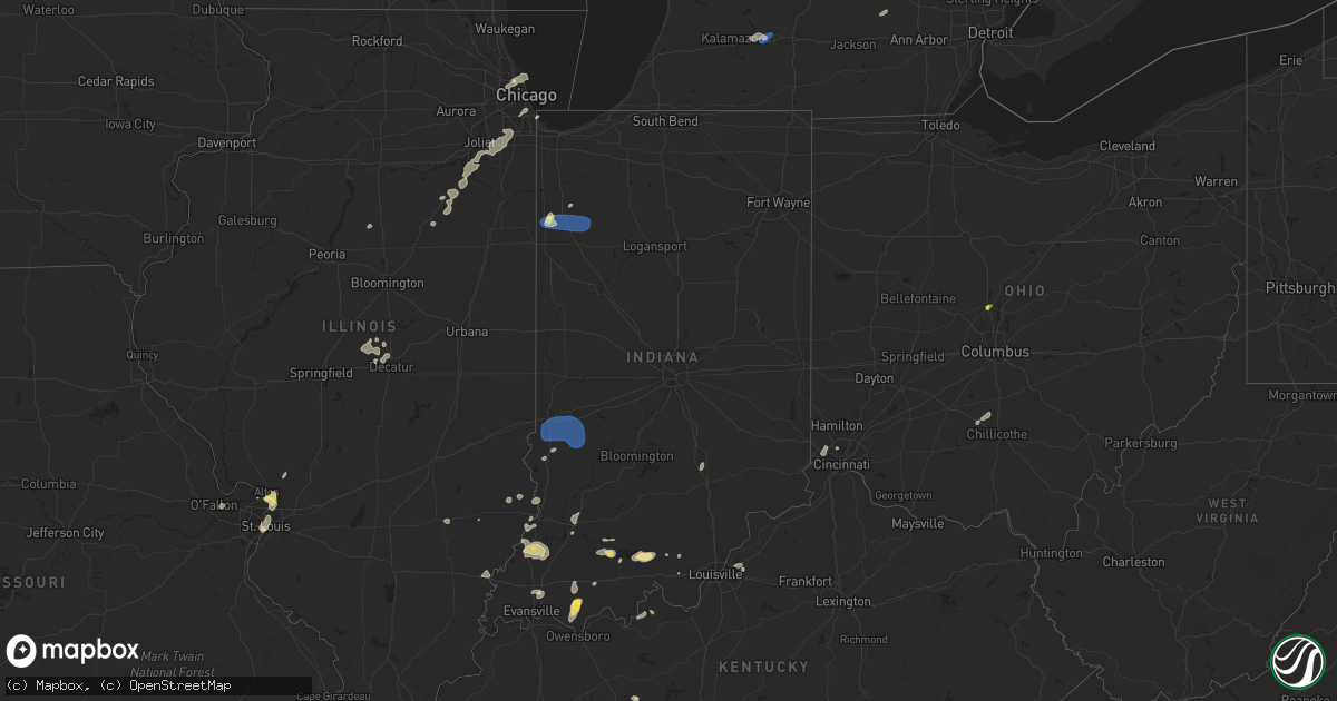
Hail Map in Indiana on August 12, 2025
Get this storm
August 12 map
$229
one time, instant access
Download today. No call, no setup
Keep the $229
Bought the map and want the full workflow? Apply the entire $229 to a subscription within 7 days. None of it is wasted.
Every map, not just this one
This buys you this map. Subscription and you get every map we run, in the markets you choose from a few cities to whole states to nationwide. Plus real-time alerts the moment a storm fires.
Contact data
Name, contact info, occupancy, even credit band for addresses in the footprint. You go from where it hit to who to call.
Become the source they trust
Unlimited branding weather history reports on demand. You already have the documented answer ready for the property owner, and you are the one who showed up with it.
Property data and RoofTrace estimates
Pull up any address you have got, its value and the exact code rules for that jurisdiction, straight from One Click Code. Then RoofTrace estimates the squares, pitch, and roof value, priced the way you price.
Storm reports in Indiana
Indiana
| Date | Description |
|---|---|
| 08/12/20256:07 PM CDT | Peak gust of 51 kt measured at awos station krzl rensselaer airport. |
| 08/12/20255:56 PM CDT | Photos shared via social media show multiple broken power poles and a rolled camper. Time estimated by radar. |
| 08/12/20255:56 PM CDT | Public report shared to social media of tree damage along county road 1000 south of in-114. Time estimated by radar. |
| 08/12/20255:54 PM CDT | Multiple trees damaged at curtis creek golf course west of rensselaer. Some trees snapped or uprooted... Numerous other trees with 6-12 inch branches broken. Time estim |
| 08/12/20255:36 PM CDT | Public report of quarter size hail northeast of morocco. Time estimated by radar. |
| 08/12/20255:33 PM CDT | Corrects previous non-tstm wnd dmg report from morocco. Picture shared on social media of a larger tree branch that was knocked down. Time estimated by radar. |
| 08/12/20255:33 PM CDT | Corrects previous non-tstm wnd dmg report from morocco. Picture shared on social media of a larger tree branch that |
| 08/12/20255:26 PM CDT | Terre haute regional airport. |
| 08/12/20253:53 PM CDT | Trees down. |
| 08/12/202512:45 PM CDT | Trees and powerlines downed at mooresville acres. |
| 08/11/20258:08 PM CDT | Trees down. |
| 08/11/20257:57 PM CDT | Tree reported down. |
All States Impacted by Hail Map on August 12, 2025
Cities Impacted by Hail Map on August 12, 2025
- McIntire, IA
- Stacyville, IA
- Whitehall, MI
- Riceville, IA
- Twin Lake, MI
- Chester, IA
- Alton, IL
- East Alton, IL
- Wood River, IL
- New Lenox, IL
- Manhattan, IL
- Washburn, IL
- Dorsey, IL
- Frankfort, IL
- Florissant, MO
- Bunker Hill, IL
- Dwight, IL
- Minonk, IL
- Benson, IL
- Saint Louis, MO
- West Alton, MO
- Granite City, IL
- East Saint Louis, IL
- Mokena, IL
- Madison, IL
- Lovejoy, IL
- Venice, IL
- Edwardsville, IL
- Wilmington, IL
- Elwood, IL
- Joliet, IL
- Hartford, IL
- Hammond, IN
- Chicago, IL
- East Carondelet, IL
- Tinley Park, IL
- Orland Park, IL
- Evergreen Park, IL
- Gardner, IL
- Oak Forest, IL
- Emington, IL
- Odell, IL
- Bradford, AR
- Maroa, IL
- Gustine, TX
- Jasper, IN
- Dubois, IN
- Kenney, IL
- Celestine, IN
- Rockport, IN
- Goldthwaite, TX
- Essex, IL
- Braidwood, IL
- Braceville, IL
- Mount Pulaski, IL
- Pontiac, IL
- Chestnut, IL
- Warrensburg, IL
- Jonesville, IN
- Columbus, IN
- Washington, IN
- Montgomery, IN
- Richland, IN
- Freeport, MI
- Hastings, MI
- Lake Odessa, MI
- Latham, IL
- Santa Anna, TX
- Coal City, IL
- Stone Park, IL
- Melrose Park, IL
- Elmwood Park, IL
- Lincolnwood, IL
- River Grove, IL
- Boonville, IN
- Chrisney, IN
- Tennyson, IN
- Kopperl, TX
- Hico, TX
- Menard, TX
- Forsyth, IL
- Hamilton, TX
- Del Rio, TX
- Taswell, IN
- Saint Peters, MO
- Birdseye, IN
- Cicero, IL
- Cleburne, TX
- Newberry, MI
- Decatur, IL
- Godley, TX
- Galesburg, MI
- Climax, MI
- Gatesville, TX
- Jonesboro, TX
- Paoli, IN
- English, IN
- Clifton, AZ
- Plano, TX
- Manistique, MI
- Silver City, NM
- Arenas Valley, NM
- Linwood, MI
- Augusta, MI
- San Saba, TX
- Kawkawlin, MI
- Midland, MI
- Auburn, MI
- Rio Vista, TX
- Marengo, IN
- Clifton, TX
- Hillsboro, TX
- Labelle, FL
- Palmyra, IN
- Glenwood, NM
- Buckhorn, NM
- Baskin, LA
- Brant, MI
- Elsie, MI
- Depauw, IN
- Llano, TX
- Grand Blanc, MI
- Burton, MI
- Flint, MI
- Pinconning, MI
- Burkett, TX
- Coleman, TX
- Otisville, MI
- Union Star, KY
- Corydon, IN
- Mason, TX
- Doss, TX
- Battle Creek, MI
- Bay City, MI
- Lapeer, MI
- Davison, MI
- Terre Haute, IN
- Lewis, IN
- Pimento, IN
- Riley, IN
- Brazil, IN
- Cory, IN
- Rising Star, TX
- Cross Plains, TX
- Brownwood, TX
- Morocco, IN
- Brook, IN
- Owosso, MI
- Henderson, MI
- Stephensport, KY
- Castell, TX
- Clay City, IL
- Flora, IL
- Dahlonega, GA
- Columbiaville, MI
- Chesaning, MI
- Clay City, IN
- Centerpoint, IN
- Coal City, IN
- Fair Oaks, IN
- Leakey, TX
- Inverness, FL
- Corunna, MI
- Hubbard, TX
- North Branch, MI
- Fostoria, MI
- Otter Lake, MI
- Mayville, MI
- Cleveland, GA
- Rensselaer, IN
- Rhodelia, KY
- Silverwood, MI
- Mount Ayr, IN
- Payson, AZ
- Olney, IL
- Hardinsburg, KY
- Webster, KY
- Bridgeport, IL
- Clifford, MI
- Channahon, IL
- Cisco, TX
- Flat Rock, IL
- Shelburn, IN
- Farmersburg, IN
- Burnet, TX
- Morgantown, KY
- Sullivan, IN
- New Franken, WI
- Crestwood, KY
- Louisville, KY
- Prospect, KY
- Marble Falls, TX
- Pembroke, GA
- Marlette, MI
- Kingston, MI
- Decker, MI
- Cannelton, IN
- Cass City, MI
- Breckenridge, MI
- Lawrenceville, IL
- Grayville, IL
- Ubly, MI
- Jetson, KY
- Dryden, TX
- Pewee Valley, KY
- Rome, IN
- Reno, NV
- Taloga, OK
- Putnam, OK
- Gregory, MI
- Stockbridge, MI
- Eckerman, MI
- Douglas, AZ
- Oaktown, IN
- Pine, AZ
- Allendale, IL
- Vincennes, IN
- Kinross, MI
- Brimley, MI
- Evansville, IN
- Patoka, IN
- Decker, IN
- Hazleton, IN
- East China, MI
- Princeton, IN
- Francisco, IN
- Chandler, IN
- Petersburg, IN
- Cincinnati, OH
- Sault Sainte Marie, MI
- Cleves, OH
- North Bend, OH
- Gentryville, IN
- Dragoon, AZ
- Dale, IN
- Loogootee, IN
- Clarksburg, OH
- Chillicothe, OH
- Frankfort, OH
- Huntingburg, IN
- Ferdinand, IN
- Williamsport, OH
- Custer, MT
- Delhi, LA
- Rayville, LA
- Forsyth, MT
- Bighorn, MT
- Delaware, OH
- Monon, IN
- Wolf Point, MT


