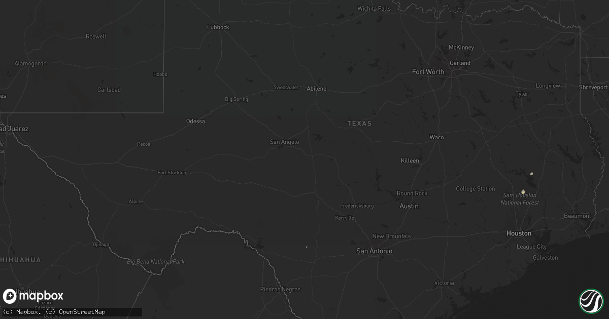
Hail Map in Texas on August 12, 2015
Get this storm
August 12 map
$229
one time, instant access
Download today. No call, no setup
Keep the $229
Bought the map and want the full workflow? Apply the entire $229 to a subscription within 7 days. None of it is wasted.
Every map, not just this one
This buys you this map. Subscription and you get every map we run, in the markets you choose from a few cities to whole states to nationwide. Plus real-time alerts the moment a storm fires.
Contact data
Name, contact info, occupancy, even credit band for addresses in the footprint. You go from where it hit to who to call.
Become the source they trust
Unlimited branding weather history reports on demand. You already have the documented answer ready for the property owner, and you are the one who showed up with it.
Property data and RoofTrace estimates
Pull up any address you have got, its value and the exact code rules for that jurisdiction, straight from One Click Code. Then RoofTrace estimates the squares, pitch, and roof value, priced the way you price.
Storm reports in Texas
Texas
| Date | Description |
|---|---|
| 08/12/20156:14 PM CDT | Straight line winds caused damage to a feed plant with a section of the roof torn away. Many large trees were down and 166 customers in the area were without power. |
| 08/12/20155:53 PM CDT | Wind gust measured by west texas mesonet station at fort lancaster. |
| 08/12/20155:40 PM CDT | Thunderstorm outflow winds blew down many large tree limbs |
| 08/12/20155:07 PM CDT | Widespread thunderstorm wind damage across brackettville...trees and powerlines blown down |
| 08/12/20154:55 PM CDT | Large trees blown down onto roads...powerlines blown down....roof blown off |
| 08/12/20154:35 PM CDT | Measured wind gust by awos at castroville municipal airport. |
| 08/12/20154:28 PM CDT | Measured wind gust of 50 mph blew some shingles off a roof near lake amistad. |
| 08/11/20157:12 PM CDT | Trees and powerlines blown down near fm 3081 at fm 1725 |
All States Impacted by Hail Map on August 12, 2015
Cities Impacted by Hail Map on August 12, 2015
- Goodridge, MN
- Grygla, MN
- Long Prairie, MN
- Erskine, MN
- Mentor, MN
- Strathcona, MN
- Middle River, MN
- Gatzke, MN
- Atwater, MN
- Gonvick, MN
- Leonard, MN
- Clearbrook, MN
- Bagley, MN
- Naytahwaush, MN
- Mahnomen, MN
- Fosston, MN
- Roseau, MN
- Littlefork, MN
- Nisswa, MN
- Solway, MN
- Gully, MN
- Cushing, MN
- Laporte, MN
- Park Rapids, MN
- Pillager, MN
- Pequot Lakes, MN
- Lake George, MN
- Bemidji, MN
- Staples, MN
- Nevis, MN
- Little Falls, MN
- Menahga, MN
- Shevlin, MN
- Motley, MN
- Brainerd, MN
- Baxter, MN
- Pine River, MN
- Akeley, MN
- Backus, MN
- Fort Ripley, MN
- Thief River Falls, MN
- Greenbush, MN
- Karlstad, MN
- Strandquist, MN
- Newfolden, MN
- Sebeka, MN
- New York Mills, MN
- New London, MN
- Ponsford, MN
- Winger, MN
- Brooks, MN
- Burtrum, MN
- Detroit Lakes, MN
- Oklee, MN
- Lake Bronson, MN
- Melrose, MN
- Perham, MN
- Freeport, MN
- Randall, MN
- Flensburg, MN
- Mcintosh, MN
- Wadena, MN
- Clarissa, MN
- Saint Hilaire, MN
- Red Lake Falls, MN
- Plummer, MN
- Eagle Bend, MN
- Sauk Centre, MN
- Callaway, MN
- Henning, MN
- Belgrade, MN
- Holdingford, MN
- Bowlus, MN
- Frazee, MN
- Avon, MN
- Carlos, MN
- Bluffton, MN
- Spicer, MN
- Grey Eagle, MN
- Osakis, MN
- Osage, MN
- Halma, MN
- Bejou, MN
- Parkers Prairie, MN
- Waubun, MN
- Rochert, MN
- Lancaster, MN
- Paynesville, MN
- Miltona, MN
- Hewitt, MN
- Grove City, MN
- Swanville, MN
- Browerville, MN
- Upsala, MN
- Verndale, MN
- Albany, MN
- Hackensack, MN
- Lengby, MN
- Deer Creek, MN
- Bertha, MN
- Ogema, MN
- Livingston, TX
- Onalaska, TX
- Iowa, LA
- Lake Charles, LA
- Midway, GA
- Badger, MN
- Boulder, MT
- Whitehall, MT
- Cook, MN
- International Falls, MN
- Salol, MN
- Hoodsport, WA
- Shelton, WA
- Duvall, WA
- Big Falls, MN
- Dayton, WA
- Lafitte, LA
- Barataria, LA
- Fort Pierce, FL
- Orr, MN
- Glen Ullin, ND
- Elgin, ND
- New Leipzig, ND
- Drake, ND
- Warroad, MN
- North Bend, WA
- Ranier, MN
- Seattle, WA
- Virginia, MN
- Woodinville, WA
- Redmond, WA
- Coldspring, TX
- Willis, TX
- New Waverly, TX
- Cleveland, TX
- Bowdon, ND
- Bellevue, WA
- Vero Beach, FL
- Brooten, MN
- Elrosa, MN
- Wannaska, MN
- Richmond Hill, GA
- Aldrich, MN
- Hallock, MN
- Uvalde, TX


