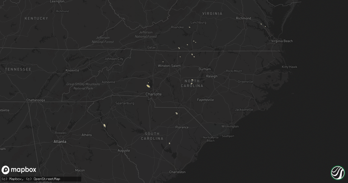
Hail Map in North Carolina on August 11, 2015
Get this storm
August 11 map
$229
one time, instant access
Download today. No call, no setup
Keep the $229
Bought the map and want the full workflow? Apply the entire $229 to a subscription within 7 days. None of it is wasted.
Every map, not just this one
This buys you this map. Subscription and you get every map we run, in the markets you choose from a few cities to whole states to nationwide. Plus real-time alerts the moment a storm fires.
Contact data
Name, contact info, occupancy, even credit band for addresses in the footprint. You go from where it hit to who to call.
Become the source they trust
Unlimited branding weather history reports on demand. You already have the documented answer ready for the property owner, and you are the one who showed up with it.
Property data and RoofTrace estimates
Pull up any address you have got, its value and the exact code rules for that jurisdiction, straight from One Click Code. Then RoofTrace estimates the squares, pitch, and roof value, priced the way you price.
Storm reports in North Carolina
North Carolina
| Date | Description |
|---|---|
| 08/11/20156:45 PM CDT | Tree down in carthage colony off fire tower rd. Time estimated by radar. |
| 08/11/20156:41 PM CDT | Trees down in the roadway. |
| 08/11/20156:40 PM CDT | Tree down on everette dowdy rd. Time estimated by radar. |
| 08/11/20154:36 PM CDT | Tree down at union grove church road... Time estimated by radar |
| 08/11/20154:33 PM CDT | Tree down at gordonton road... Time estimated by radar |
| 08/11/20154:33 PM CDT | Tree down at mccullock loop road... Time estimated by radar |
| 08/11/20154:33 PM CDT | Power lines down at hurdle mills road... Time estimated by radar |
| 08/11/20154:30 PM CDT | Four pine trees down. |
| 08/11/20154:20 PM CDT | One tree down on stoney creek school road |
| 08/11/20154:15 PM CDT | Reported one tree down and multiple branches down described as thick as an arm. Time radar estimated. |
| 08/11/20152:25 PM CDT | Several trees blown down. Time estimated from radar downburst signature. |
| 08/11/20151:41 PM CDT | Multiple trees down north of ruffin. Reported by wghp. |
| 08/10/20158:47 PM CDT | 1 tree down off wesley chapel rd. |
| 08/10/20158:26 PM CDT | Tree and powerlines down on topeka drive. Tree in roadway on beaver dam lane and old oak street. |
| 08/10/20158:23 PM CDT | Roof blown off mobile home and half a dozen trees down in keener. Time estimated by radar. |
| 08/10/20158:23 PM CDT | Trees down at kitty fork and mt moriah church road... Time estimated by radar |
| 08/10/20157:10 PM CDT | Trees down across roadway. |
All States Impacted by Hail Map on August 11, 2015
Cities Impacted by Hail Map on August 11, 2015
- Aurora, CO
- Englewood, CO
- Denver, CO
- Tyrone, OK
- Florence, AZ
- Call, TX
- Bon Wier, TX
- Kirbyville, TX
- Newton, TX
- Deridder, LA
- Vail, AZ
- Iva, SC
- Orange, TX
- Cameron, LA
- Bridge City, TX
- Port Arthur, TX
- Sherrills Ford, NC
- Maiden, NC
- Denver, NC
- Beaumont, TX
- Devers, TX
- Tucson, AZ
- El Campo, TX
- Douglas, AZ
- Georgiana, AL
- Larue, TX
- Brownsboro, TX
- Murchison, TX
- Chandler, TX
- Gila Bend, AZ
- Highlands, TX
- Channelview, TX
- Houston, TX
- La Porte, TX
- Crosby, TX
- Deer Park, TX
- Baytown, TX
- Tombstone, AZ
- Livingston, TX
- Kaplan, LA
- Crowley, LA
- Morse, LA
- Chandler, AZ
- Oracle, AZ
- Casa Grande, AZ
- Sulphur, LA
- Lake Charles, LA
- Hackberry, LA
- Iowa, LA
- Bell City, LA
- Gueydan, LA
- Fulshear, TX
- Wallis, TX
- Littleton, CO
- Leupp, AZ
- Flagstaff, AZ
- Eloy, AZ
- Rosenberg, TX
- Richmond, TX
- Coolidge, AZ
- Hereford, AZ
- Galena Park, TX
- South Houston, TX
- Pasadena, TX
- Blue River, OR
- Sugar Land, TX
- Hooker, OK
- Bedford, VA
- Sedalia, CO
- Athens, TX
- Leesville, LA
- Fort Polk, LA
- Corrigan, TX
- Huntington, TX
- Lufkin, TX
- Perryton, TX
- Goldston, NC
- Kemp, TX
- Stanley, NC
- Iron Station, NC
- Martinsville, VA
- Ridgeway, VA
- Rapid City, SD
- Hill City, SD
- Abbeville, LA
- Beasley, TX
- Wharton, TX
- East Bernard, TX
- Needville, TX
- Chinle, AZ
- Nederland, TX
- Port Neches, TX
- Pinon, AZ
- Java, VA
- Keeling, VA
- Winnie, TX
- Heber, AZ
- Merryville, LA
- Queen Creek, AZ
- Gilbert, AZ
- Willcox, AZ
- Miami, TX
- Red Rock, AZ
- Show Low, AZ
- Many, LA
- Pearland, TX
- Eagle Lake, TX
- Yanceyville, NC
- New Iberia, LA
- Broussard, LA
- Benson, AZ
- Marion Station, MD
- Malakoff, TX
- Cheraw, SC
- Patrick, SC
- Richey, MT
- Reidsville, NC
- Pocomoke City, MD
- Anacoco, LA
- Vinton, LA
- Rayne, LA
- Siler City, NC
- Bear Creek, NC
- Fort Lauderdale, FL
- Lacassine, LA
- Westlake, LA
- Dry Fork, VA
- Safford, AZ
- Cotopaxi, CO
- Williamsburg, VA
- Mineral, VA
- Manning, SC
- Liberty, TX
- Girdletree, MD
- Wallisville, TX
- Huntsville, TX
- Florien, LA
- Webster, TX
- Dayton, TX
- Stafford, TX
- Missouri City, TX
- Chatham, VA
- Sedona, AZ
- East Bend, NC


