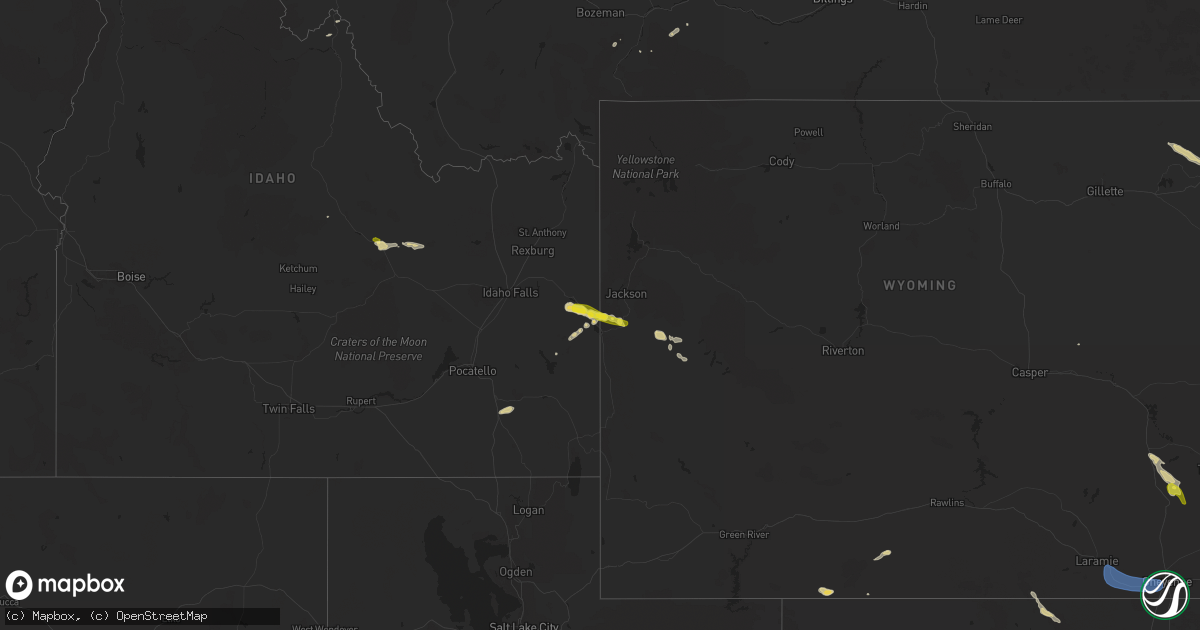
Hail Map on August 10, 2024
Get this storm
August 10 map
$229
one time, instant access
Download today. No call, no setup
Keep the $229
Bought the map and want the full workflow? Apply the entire $229 to a subscription within 7 days. None of it is wasted.
Every map, not just this one
This buys you this map. Subscription and you get every map we run, in the markets you choose from a few cities to whole states to nationwide. Plus real-time alerts the moment a storm fires.
Contact data
Name, contact info, occupancy, even credit band for addresses in the footprint. You go from where it hit to who to call.
Become the source they trust
Unlimited branding weather history reports on demand. You already have the documented answer ready for the property owner, and you are the one who showed up with it.
Property data and RoofTrace estimates
Pull up any address you have got, its value and the exact code rules for that jurisdiction, straight from One Click Code. Then RoofTrace estimates the squares, pitch, and roof value, priced the way you price.
States Impacted by Hail Map on August 10, 2024
Storm reports
Colorado
| Date | Description |
|---|---|
| 08/10/20245:48 PM CDT | Report from mping: quarter |
| 08/09/202411:53 PM CDT | Mesonet station co001 i-25 and c470. |
| 08/09/202411:45 PM CDT | Centennial airport. |
| 08/09/202411:28 PM CDT | Asos station kdro durango la plata cnty airport. |
Arizona
| Date | Description |
|---|---|
| 08/10/20245:50 PM CDT | ***delayed report*** report of one or more power poles down... Causing a power outage to the area. |
| 08/10/20242:50 PM CDT | ***delayed report*** multiple downed trees along with damage to structures in the quartzsite area. |
| 08/09/20247:45 PM CDT | Delayed report....overturned rv shared via facebook. Very high winds reported as well. Time estimated by radar. |
| 08/09/20247:30 PM CDT | Post event report from saturday evening. Roof shingle and window screen damage from facebook post with video. |
Wyoming
| Date | Description |
|---|---|
| 08/10/20244:40 PM CDT | Mesonet station pc280 riverside. |
| 08/10/20244:00 PM CDT | Airnow station an685 ne of pinedale. |
| 08/10/20242:28 PM CDT | Mesonet station up226 10.5 nw natural fort |
| 08/10/20242:12 PM CDT | Mesonet station kvdw vedauwoo |
| 08/10/20242:02 PM CDT | Mesonet station kvdw vedauwoo |
Idaho
| Date | Description |
|---|---|
| 08/10/20244:53 PM CDT | Time estimated based on radar. |
| 08/10/20244:51 PM CDT | Photo and video received via social media. Time estimated based on radar. |
| 08/10/20244:48 PM CDT | Mesonet station grai1. |
| 08/10/20242:35 PM CDT | *** 4 inj *** boat caught on palisades reservoir as severe thunderstorm moved overhead. Video captured heavy hail falling with some stones larger than quarters resultin |
| 08/10/20242:30 PM CDT | Bear lake em traveling through and sent picture of hail next to a quarter. |
| 08/10/20242:29 PM CDT | Hail up to quarter size reported at calamity campground. Time estimated based on radar. |
| 08/10/202412:40 AM CDT | Mesonet station lof inl specific manufacturing. |
Oklahoma
| Date | Description |
|---|---|
| 08/10/20246:45 AM CDT | Relayed image showing the roof of a carport blown off. Radar estimated time. |
| 08/10/20246:15 AM CDT | Delayed report. Relayed images showing multiple large trees uprooted and damage to outbuildings. Radar estimated time. |
| 08/10/20245:45 AM CDT | Delayed report. Relayed images showing the roof of a carport blown off. Radar estimated time. |
| 08/10/20245:45 AM CDT | Delayed report. Relayed images showing a house with portions of its roof decking blown off and other large tree limbs blown down. Radar estimated time. |
| 08/10/20245:45 AM CDT | Corrects previous tstm wnd dmg report from 5 sw lake thunderbird. Relayed image showing the roof of a carport blown off. Radar estimated time. |
Utah
| Date | Description |
|---|---|
| 08/10/20246:30 PM CDT | Mesonet station hdp central wasatch peaks - west. |
| 08/10/20245:55 PM CDT | Mesonet station cdmu1 cedar mountain. |
| 08/10/20245:45 PM CDT | Mesonet station vrh vernon hill. |
| 08/10/20245:30 PM CDT | Mesonet station pc367 e bearlake. |
| 08/10/20245:10 PM CDT | Mesonet station pc358 hansel valley. |
| 08/10/20244:55 PM CDT | Mesonet station dpg06 camel back mtn. |
| 08/10/20244:45 PM CDT | Mesonet station dpg02 callao gate. |
| 08/10/20244:20 PM CDT | Mesonet station utedl i-80 at mp 71 east delle. Also gusted to 61 mph 10 minutes prior with sustained winds of 40 mph. |
| 08/10/20244:10 PM CDT | Mesonet station utwdl i-80 at mp 68 west delle. |
| 08/10/20243:30 PM CDT | Mesonet station utsvc silver creek junction. |
| 08/10/20243:30 PM CDT | Mesonet station hdp central wasatch peaks - west. |
| 08/09/20248:30 PM CDT | Asos station kpuc price-carbon cnty rgnl arpt. |
California
| Date | Description |
|---|---|
| 08/09/20248:33 PM CDT | Moore upr observation site gusted to 60 mph with thunderstorm activity overhead. |
| 08/09/20247:12 PM CDT | ***delayed report*** awos station kblh 7 nnw ripley. |
Washington
| Date | Description |
|---|---|
| 08/09/20249:15 PM CDT | Multiple large branches down per facebook report. Also a mobile home with roof damage. Time estimated from radar. |
Montana
| Date | Description |
|---|---|
| 08/10/20246:57 PM CDT | Corrects previous tstm wnd gst report from 5 ene dillon. Asos station kdln dillon airport. Correct time of event. |
| 08/09/20247:02 PM CDT | Asos station kdln dillon airport. |
Cities Impacted by Hail Map on August 10, 2024
- Laramie, WY
- Walden, CO
- Cheraw, SC
- Rock Springs, WY
- Ajo, AZ
- Swan Valley, ID
- Livermore, CO
- Irwin, ID
- Bellvue, CO
- Clancy, MT
- Tooele, UT
- Cheyenne, WY
- Buford, WY
- Granite Canon, WY
- Tie Siding, WY
- Winston, MT
- Alpine, WY
- Edgewater, FL
- Fe Warren Afb, WY
- Jefferson City, MT
- Edenton, NC
- Jackson, WY
- McLeod, MT
- Livingston, MT
- Rawlins, WY
- Bondurant, WY
- Maple, NC
- Barco, NC
- Arimo, ID
- Downey, ID
- Lava Hot Springs, ID
- Fayetteville, NC
- Hanksville, UT
- Wheatland, WY
- Pinedale, WY
- Daniel, WY
- Fairmont, NC
- Wayan, ID
- Lumberton, NC
- Moore, ID
- Mackay, ID
- Orrum, NC
- Yoder, WY
- Hawk Springs, WY
- Bladenboro, NC
- Tucson, AZ
- Chugwater, WY
- White Sulphur Springs, MT
- Avon, MT
- Littleton, CO
- Marysville, MT
- Howe, ID
- Parker, CO
- Castle Rock, CO
- Oracle, AZ
- Antonito, CO
- Franktown, CO
- Salome, AZ
- Elizabeth, CO
- Lincoln, MT
- Kiowa, CO
- Marana, AZ
- Canyon Creek, MT
- Marblemount, WA
- Gibbonsville, ID
- Blanding, UT
- Round Mountain, TX
- Yucca, AZ
- De Beque, CO
- San Cristobal, NM
- Arroyo Hondo, NM
- Monticello, UT
- Questa, NM
- Vici, OK
- Seiling, OK
- Devils Tower, WY
- Hulett, WY
- Arnett, OK
- Sundance, WY
- Camargo, OK
- Taloga, OK
- Sharon, OK
- Oakwood, OK
- Chickasha, OK
- Cement, OK
- Verden, OK
- Anadarko, OK
- Lead, SD
- Mutual, OK
- Woodward, OK
- Minco, OK
- Blanchard, OK
- Alex, OK
- Washington, OK
- Mooreland, OK
- Mustang, OK
- Yukon, OK
- Freedom, OK
- Tuttle, OK
- Union City, OK
- Calumet, OK
- Geary, OK
- Newcastle, OK
- Noble, OK
- Lexington, OK
- Norman, OK
- Chester, OK
- Fairview, OK
- Purcell, OK