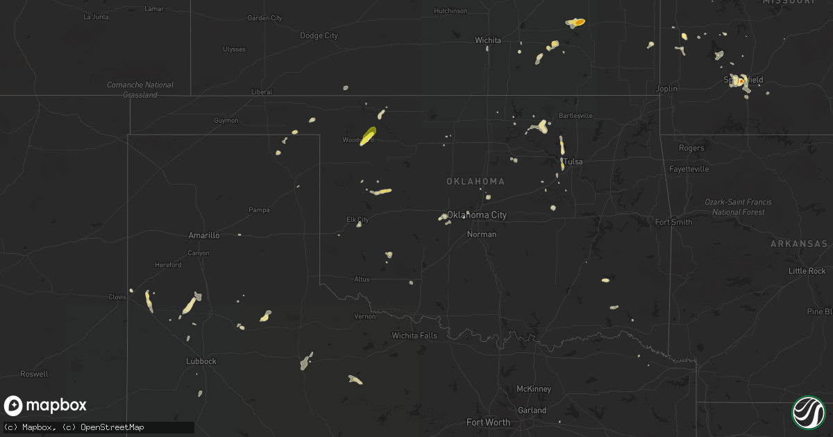
Hail Map in Oklahoma on August 10, 2018
Get this storm
August 10 map
$229
one time, instant access
Download today. No call, no setup
Keep the $229
Bought the map and want the full workflow? Apply the entire $229 to a subscription within 7 days. None of it is wasted.
Every map, not just this one
This buys you this map. Subscription and you get every map we run, in the markets you choose from a few cities to whole states to nationwide. Plus real-time alerts the moment a storm fires.
Contact data
Name, contact info, occupancy, even credit band for addresses in the footprint. You go from where it hit to who to call.
Become the source they trust
Unlimited branding weather history reports on demand. You already have the documented answer ready for the property owner, and you are the one who showed up with it.
Property data and RoofTrace estimates
Pull up any address you have got, its value and the exact code rules for that jurisdiction, straight from One Click Code. Then RoofTrace estimates the squares, pitch, and roof value, priced the way you price.
Storm reports in Oklahoma
Oklahoma
| Date | Description |
|---|---|
| 08/10/20184:17 PM CDT | Two structures received roof damage with shingles blown off. Pivot irrigation system blown over. Several tree limbs up to six inches in diameter snapped off trees. |
| 08/10/20184:05 PM CDT | Local mesonet measured 70mph wind gusts from the northeast. |
| 08/10/20183:40 PM CDT | A local report indicates 61 MPH wind near 2 N SAND SPRINGS |
| 08/10/20182:45 PM CDT | Public reported 60 to 70 mph winds just north of fairfax. Time estimated. |
| 08/10/20182:53 AM CDT | At 753 PM CDT, a severe thunderstorm was located 6 miles northwest of Cooperton, and is nearly stationary. HAZARD...60 mph wind gusts and quarter size hail. SOURCE...Radar indicated. IMPACT...Hail damage to vehicles is expected. Expect wind damage to roofs, siding, and trees. Locations impacted include... Gotebo. |
| 08/10/20181:40 AM CDT | At 640 PM CDT, severe thunderstorms were located along a line extending from 7 miles north of Cogar to near Oklahoma City, and are nearly stationary. HAZARD...60 mph wind gusts and quarter size hail. SOURCE...Radar indicated. IMPACT...Hail damage to vehicles is expected. Expect wind damage to roofs, siding, and trees. Locations impacted include... Southwestern Oklahoma City, El Reno, Mustang, Tuttle, Union City, Minco and Cogar. |
| 08/10/201812:36 AM CDT | At 536 PM CDT, a severe thunderstorm was located over southwestern Lawton, moving north at 10 mph. HAZARD...60 mph wind gusts and quarter size hail. SOURCE...Radar indicated. IMPACT...Hail damage to vehicles is expected. Expect wind damage to roofs, siding, and trees. Locations impacted include... Lawton, Medicine Park, Fort Sill, Lake Lawtonka and southeastern Wichita Mountains Wildlife Refuge. |
| 08/10/201812:25 AM CDT | At 525 PM CDT, a severe thunderstorm was located near Mcalester Regional Airport, moving south at 5 mph. HAZARD...60 mph wind gusts and nickel size hail. SOURCE...Radar indicated. IMPACT...Expect damage to roofs, siding, and trees. Locations in or near the path include... Mcalester... Krebs... Savanna... Alderson... Blanco... Mcalester Regional Airport... |
| 08/10/201812:22 AM CDT | At 521 PM CDT, a severe thunderstorm was located 7 miles northwest of Stanley, moving west at 5 to 10 mph. HAZARD...60 mph wind gusts and quarter size hail. SOURCE...Radar indicated. IMPACT...Hail damage to vehicles is expected. Expect wind damage to roofs, siding, and trees. This severe thunderstorm will remain over mainly rural areas of south central Pittsburg County. |
| 08/10/201812:17 AM CDT | At 517 PM CDT, a severe thunderstorm was located 4 miles southwest of Okfuskee, and is drifting slowly north. HAZARD...60 mph wind gusts and quarter size hail. SOURCE...Radar indicated. IMPACT...Hail damage to vehicles is expected. Expect wind damage to roofs, siding, and trees. Locations in or near the path include... Okfuskee... Mason... |
| 08/10/201812:09 AM CDT | At 509 PM CDT, a severe thunderstorm was located 5 miles north of Stanley, and is nearly stationary. HAZARD...60 mph wind gusts and quarter size hail. SOURCE...Radar indicated. IMPACT...Hail damage to vehicles is expected. Expect wind damage to roofs, siding, and trees. Locations in or near the path include... Sardis... |
| 08/09/201811:57 PM CDT | At 457 PM CDT, a severe thunderstorm was located near Mooreland, moving southwest at 25 mph. HAZARD...60 mph wind gusts and quarter size hail. SOURCE...Radar indicated. IMPACT...Hail damage to vehicles is expected. Expect wind damage to roofs, siding, and trees. Locations impacted include... Woodward, Mooreland and Sharon. |
| 08/09/201811:16 PM CDT | At 416 PM CDT, a severe thunderstorm was located near Freedom, moving southwest at 10 mph. HAZARD...60 mph wind gusts and quarter size hail. SOURCE...Radar indicated. IMPACT...Hail damage to vehicles is expected. Expect wind damage to roofs, siding, and trees. Locations impacted include... Freedom, Alabaster Caverns State Park and Camp Houston. |
| 08/09/201811:00 PM CDT | At 400 PM CDT, a severe thunderstorm was located 6 miles south of Elk City, moving southwest at 10 mph. HAZARD...60 mph wind gusts and quarter size hail. SOURCE...Radar indicated. IMPACT...Hail damage to vehicles is expected. Expect wind damage to roofs, siding, and trees. Locations impacted include... Elk City, Burns Flat and Canute. |
| 08/09/201810:54 PM CDT | At 354 PM CDT, a severe thunderstorm was located 3 miles southwest of Sand Springs, and is nearly stationary. HAZARD...60 mph wind gusts and nickel size hail. SOURCE...Radar indicated. IMPACT...Expect damage to roofs, siding, and trees. Locations in or near the path include... Tulsa... Sand Springs... Sapulpa... Kellyville... Gray... This includes Interstate 44 between mile markers 199 and 218. |
| 08/09/201810:52 PM CDT | At 352 PM CDT, a severe thunderstorm was located near Delhi, moving west at 10 mph. HAZARD...60 mph wind gusts and quarter size hail. SOURCE...Radar indicated. IMPACT...Hail damage to vehicles is expected. Expect wind damage to roofs, siding, and trees. Locations impacted include... Sayre, Erick and Delhi. |
| 08/09/201810:28 PM CDT | At 328 PM CDT, a severe thunderstorm was located 6 miles southeast of Glencoe, moving east at 5 mph. HAZARD...60 mph wind gusts and quarter size hail. SOURCE...Radar indicated. IMPACT...Hail damage to vehicles is expected. Expect wind damage to roofs, siding, and trees. Locations impacted include... Yale, Glencoe and Quay. |
| 08/09/201810:19 PM CDT | At 319 PM CDT, a severe thunderstorm was located 3 miles southwest of Cloudy, moving east at 5 mph. HAZARD...60 mph wind gusts and quarter size hail. SOURCE...Radar indicated. IMPACT...Hail damage to vehicles is expected. Expect wind damage to roofs, siding, and trees. Locations in or near the path include... Rattan... Cloudy... Oleta... Corinne... |
| 08/09/201810:17 PM CDT | At 317 PM CDT, a severe thunderstorm was located 6 miles east of Walnut Creek State Park, moving south at 10 mph. HAZARD...60 mph wind gusts and half dollar size hail. SOURCE...Radar indicated. IMPACT...Hail damage to vehicles is expected. Expect wind damage to roofs, siding, and trees. Locations in or near the path include... Tulsa... Sand Springs... Keystone State Park... Gray...This includes Interstate 44 between mile markers 217 and 220. |
| 08/09/20189:54 PM CDT | At 254 PM CDT, a severe thunderstorm was located 9 miles west of Skiatook, moving south at 10 mph. HAZARD...60 mph wind gusts and quarter size hail. SOURCE...Radar indicated. IMPACT...Hail damage to vehicles is expected. Expect wind damage to roofs, siding, and trees. Locations in or near the path include... Tulsa... Skiatook... Walnut Creek State Park... |
| 08/09/20189:40 PM CDT | At 240 PM CDT, a severe thunderstorm was located 7 miles northwest of Custer City, moving southeast at 15 mph. HAZARD...60 mph wind gusts and quarter size hail. SOURCE...Radar indicated. IMPACT...Hail damage to vehicles is expected. Expect wind damage to roofs, siding, and trees. Locations impacted include... Thomas and Custer City. |
| 08/09/20189:19 PM CDT | At 219 PM CDT, a severe thunderstorm was located 7 miles northeast of Butler, moving southeast at 15 mph. HAZARD...60 mph wind gusts and quarter size hail. SOURCE...Radar indicated. IMPACT...Hail damage to vehicles is expected. Expect wind damage to roofs, siding, and trees. This severe thunderstorm will remain over mainly rural areas of northwestern Custer and south central Dewey Counties. |
| 08/09/20189:18 PM CDT | At 217 PM CDT, severe thunderstorms were located 5 miles west of Wynona and 5 miles south of Barnsdall, and were nearly stationary. HAZARD...60 mph wind gusts and quarter size hail. SOURCE...Radar indicated. IMPACT...Hail damage to vehicles is expected. Expect wind damage to roofs, siding, and trees. Locations in or near the path include... Bartlesville... Pawhuska... Skiatook... Hominy... Barnsdall... Wynona... Avant... Bartlesville Municipal Airport... Osage Hills State Park... Okesa... Tallant... Pershing... Nelagoney... Wolco... |
All States Impacted by Hail Map on August 10, 2018
Cities Impacted by Hail Map on August 10, 2018
- Bourbon, MO
- Sullivan, MO
- Big Lake, TX
- Cimarron, NM
- Lovelady, TX
- Williams, AZ
- Farwell, TX
- Castleberry, AL
- Evergreen, AL
- Lucedale, MS
- Roosevelt, AZ
- Woodward, OK
- Mooreland, OK
- West Milton, OH
- Troy, OH
- Ludlow Falls, OH
- Fairfax, OK
- Ozona, TX
- Grenola, KS
- Paducah, TX
- Haskell, TX
- Weinert, TX
- Throckmorton, TX
- Lecompte, LA
- Laverne, OK
- Fort Mcdowell, AZ
- Troy, NC
- Star City, IN
- Lebanon, MO
- New London, NC
- Mico, TX
- Saint Charles, MO
- Glencoe, OK
- Stillwater, OK
- Payson, AZ
- Kress, TX
- Olton, TX
- Plainview, TX
- Friona, TX
- Muleshoe, TX
- Ash Fork, AZ
- Portland, MO
- Indianola, IL
- Bingham, IL
- Ramsey, IL
- Fillmore, IL
- Ozark, MO
- Iraan, TX
- Boerne, TX
- Fall River, KS
- Happy Jack, AZ
- Sedona, AZ
- Andalusia, AL
- Maryland Heights, MO
- Saint Louis, MO
- Syracuse, MO
- Otterville, MO
- Ionia, MO
- Defiance, MO
- Augusta, MO
- New Florence, MO
- Arcadia, OK
- Canute, OK
- Elk City, OK
- Biscoe, NC
- Carthage, NC
- West End, NC
- Toronto, KS
- Yates Center, KS
- Virgil, KS
- Fairmount, IL
- Fithian, IL
- Arcadia, KS
- Concordia, MO
- Skiatook, OK
- Sapulpa, OK
- Sand Springs, OK
- Springfield, MO
- Hiko, NV
- Arcola, IL
- Humboldt, IL
- Charleston, IL
- Lamar, MO
- Douglass, KS
- Cowden, IL
- Warrensburg, MO
- Leon, KS
- Prue, OK
- Globe, AZ
- Guthrie, OK
- Medaryville, IN
- Bolivar, MO
- Pleasant Hope, MO
- Cubero, NM
- Seligman, AZ
- Ponderosa, NM
- Eagle Springs, NC
- Robbins, NC
- Call, TX
- Custer City, OK
- Camden, AL
- Shelbyville, IL
- Perryton, TX
- Morocco, IN
- Russiaville, IN
- Butler, OK
- Goshen, AL
- Luverne, AL
- Severy, KS
- Piedmont, KS
- Clayton, OK
- Deer Park, TX
- Young, AZ
- Williamsport, OH
- New Holland, OH
- Ashland, KS
- Hurdland, MO
- Troy, AL
- Glenwood, AL
- Brookline, MO
- Tucson, AZ
- Cameron, NC
- El Reno, OK
- Howard, KS
- Abernathy, TX
- Pawhuska, OK
- Oklahoma City, OK
- Bethany, OK
- Tonto Basin, AZ
- Barnhart, TX
- Attica, IN
- Fouke, AR
- Crystal Springs, MS
- Terry, MS
- Utica, MS
- Higginsville, MO
- Corder, MO
- Rhineland, MO
- Baytown, TX
- La Porte, TX
- Seabrook, TX
- Sayre, OK
- Cincinnati, OH
- Wichita, KS
- Haysville, KS
- Hazlehurst, MS
- Church Point, LA
- Florence, MO
- Saint Ann, MO
- Bridgeton, MO
- Colorado City, AZ
- Floydada, TX
- Humansville, MO
- Dadeville, MO
- Jerico Springs, MO
- El Dorado Springs, MO
- Walnut Grove, MO
- Everton, MO
- Aldrich, MO
- Miami, AZ
- Amoret, MO
- Belen, NM
- Amherst, TX
- Chesterfield, MO
- Wildwood, MO
- Freedom, OK
- Greenwood, MO
- Pleasant Hill, MO
- Lees Summit, MO
- Hart, TX
- Hillsboro, IL
- Butler, IL
- Pleasanton, KS
- Amsterdam, MO
- Barnsdall, OK
- Beggs, OK
- Milo, MO
- Nevada, MO
- Ponca City, OK
- Hempstead, TX
- Waller, TX
- Prairie View, TX
- Okemah, OK
- Warner Robins, GA
- Montgomery, TX
- Holden, MO
- Saint Albans, MO
- Show Low, AZ
- Matador, TX
- Fordland, MO
- Sparta, MO
- Bruner, MO
- Seymour, MO
- Macy, IN
- Brewton, AL
- Rensselaer, IN
- Knob Noster, MO
- La Monte, MO
- Sweet Springs, MO
- Roann, IN
- Denver, IN
- Enterprise, UT
- Enid, OK
- Steedman, MO
- Scottsdale, AZ
- Cave Creek, AZ
- Los Alamos, NM
- White Rock, NM
- Oakland, IL
- East Carondelet, IL
- Dupo, IL
- Alabaster, AL
- Pelham, AL
- Burbank, OK
- Fountain Hills, AZ
- Dryden, TX
- Windsor, IL
- Richton, MS
- Montrose, MO
- Butler, MO
- Appleton City, MO
- Sheldon, MO
- Granite City, IL
- Collinsville, IL
- Saint Peters, MO
- Madison, IL
- O'Fallon, IL
- Phoenix, AZ
- Gotebo, OK
- Hobart, OK
- Roosevelt, OK
- Half Way, MO
- Circleville, OH
- Pacific, MO
- Bessemer, AL
- McCalla, AL
- Overgaard, AZ
- Wilson, TX
- Pasadena, TX
- Cache, OK
- Lawton, OK
- Stockton, AL
- Millersburg, OH
- Comstock, TX
- Wynona, OK
- Kellyville, OK
- Ralston, OK
- Ashburn, GA
- Lacombe, LA
- Saint Anne, IL
- Junction, TX
- Helena, AL
- Barnett, MO
- Melrose, NM
- Rattan, OK
- Groom, TX
- Hamilton, KS
- Tulia, TX
- Winamac, IN
- Vidor, TX
- Wright City, OK
- Mustang, OK
- Yukon, OK
- Black Canyon City, AZ
- Republic, MO
- Logansport, IN
- Seminary, MS
- Hattiesburg, MS
- Balko, OK
- Defuniak Springs, FL
- Ponce De Leon, FL
- Bristow, OK
- Mount Gilead, NC
- Star, NC
- Candor, NC
- Deepwater, MO
- Lowry City, MO
- Hermann, MO
- Houston, TX
- Highlands, TX
- Channelview, TX
- Annona, TX
- Clarksville, TX
- Twelve Mile, IN
- Lumberton, TX
- Silsbee, TX
- Rogersville, MO
- Palm Beach Gardens, FL
- Jupiter, FL
- Singer, LA
- Taylor, AR
- Mcalester, OK
- High Hill, MO
- Leedey, OK
- Taloga, OK
- Saint Stephens, AL
- Ballwin, MO
- Columbia City, IN
- Napoleon, MO
- Fieldton, TX
- Union City, OK
- Franklin, AL
- Chilhowee, MO
- Bois D Arc, MO
- Willard, MO
- Nixa, MO
- Eldon, MO
- Rockdale, TX
- Garden City, MO
- Minco, OK
- Paradise Valley, AZ
- Rocksprings, TX
- Canadian, TX
- Villa Ridge, MO
- Bovina, TX
- Vernon, CO
- Costilla, NM
- Silverton, TX
- El Dorado, AR
- Booker, TX
- Plaucheville, LA
- Tahoka, TX
- Mason, OH
- Paulden, AZ
- Miamiville, OH
- Terrace Park, OH
- Loveland, OH
- Camp Dennison, OH
- Milford, OH
- Farlington, KS
- Byram, MS
- Sedalia, MO
- Nilwood, IL
- Lake Charles, LA
- Sulphur, LA
- Wing, AL
- Eureka, MO
- Hale Center, TX
- Stockton, MO
- Wray, CO
- Gays, IL
- Crosby, MS
- Vass, NC
- Sanford, NC
- Jackson Springs, NC
- Buena Vista, NM
- Cambridge, KS
- Laurel Hill, FL
- Harrisonburg, LA
- Warwick, GA
- Arabi, GA
- Terrell, TX
- Francesville, IN
- Sullivan, IL
- Alva, OK
- Big Wells, TX
- Crystal City, TX
- Green Ridge, MO
- McIntosh, AL
- Stuart, FL
- Heber, AZ
- Pearl River, LA
- Ville Platte, LA
- Crosby, TX
- O'Fallon, MO
- Citronelle, AL
- Frankfort, IN
- Avery, TX
- Lahoma, OK


