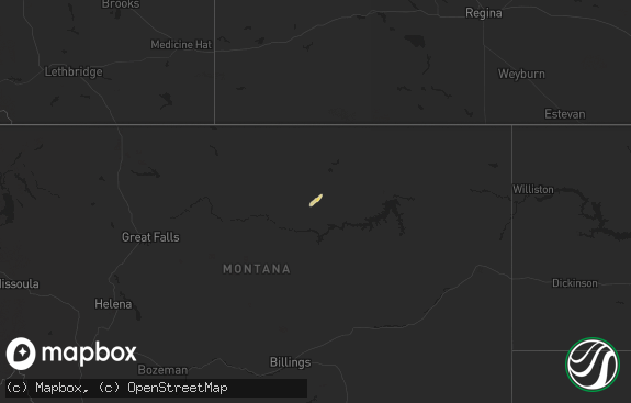
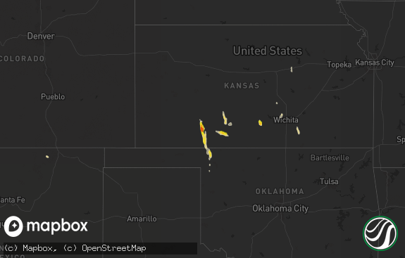
Hail Map in North Dakota on August 9, 2016
The weather event in North Dakota on August 9, 2016 includes Hail map. 15 states and 319 cities were impacted and suffered possible damage. The total estimated number of properties impacted is 2,841.

Hail
2,841
Estimated number of impacted properties by a 1.00" hail or larger1,117
Estimated number of impacted properties by a 1.75" hail or larger0
Estimated number of impacted properties by a 2.50" hail or largerStorm reports in North Dakota
North Dakota
| Date | Description |
|---|---|
| 08/09/20163:50 AM CDT | Several large branches down around town. |
| 08/09/20163:45 AM CDT | Peak wind measured at the highway 13 rwis station. |
| 08/09/20163:40 AM CDT | Large trees broken down or uprooted. Fencing blown down and metal stands tumbled at the ballpark. |
| 08/09/20163:10 AM CDT | Several large tree branches and limbs broken down around town. |
| 08/09/20162:55 AM CDT | Peak wind measured at the gwinner airport /kgwr/. |
| 08/09/20162:40 AM CDT | Several trees were blown down as were other large branches. |
| 08/09/20162:27 AM CDT | Measured at ndawn station |
| 08/09/20161:15 AM CDT | Some tree damage... 3-5 inch diameter branches down. |
| 08/09/201612:30 AM CDT | Emmons county deputy reported 1 storage building destroyed and 2 others heavily damaged. Fallen tree damaged a strong hardware store awning. Several snapped tree limbs |
| 08/09/201612:26 AM CDT | Peak wind reported at the ndsu ndawn observation site. |
| 08/09/201612:23 AM CDT | North dakota state university ndawn observation site. |
| 08/09/201612:20 AM CDT | A local report indicates 70 MPH wind near STRASBURG |
| 08/09/201612:18 AM CDT | Report of trees down and 4 to 6 inch tree limbs snapped. Power was also out at the time of call. |
| 08/09/201612:15 AM CDT | Winds ongoing at time of report. |
| 08/08/201611:50 PM CDT | A local report indicates 79 MPH wind near 8 N SELFRIDGE |
| 08/08/201611:17 PM CDT | Asos station bismarck nd /bis/. |
| 08/08/201610:42 PM CDT | Lots of ping pong ball size hail with 70 mph winds. 4 grain bins destroyed. Multiple trees down. 2.5 inches of rain. Time estimated from radar. |
| 08/08/201610:40 PM CDT | Arb observer. Davis weather set |
| 08/08/201610:30 PM CDT | Arb observer |
| 08/08/201610:02 PM CDT | Ongoing at the time of the call. |
| 08/08/20169:58 PM CDT | Report from tuesday evening. |
| 08/08/20169:54 PM CDT | . |
| 08/08/20169:41 PM CDT | Largest estimated size was quarter sized. Most below 1 inch diameter. |
| 08/08/20169:40 PM CDT | Arb observer. Davis weather set |
| 08/08/20169:30 PM CDT | Arb observer |
All States Impacted by Hail Map on August 9, 2016
Cities Impacted by Hail Map on August 9, 2016
- McIntosh, SD
- Watauga, SD
- Cleveland, OH
- Eureka, SD
- Hosmer, SD
- Cogswell, ND
- Peerless, MT
- Scobey, MT
- Coffee Creek, MT
- Glen Ullin, ND
- Almont, ND
- Otter, MT
- Herman, MN
- Campbell, MN
- Dawson, ND
- Oakes, ND
- Bowdle, SD
- Stockett, MT
- Great Falls, MT
- Webbers Falls, OK
- Warner, OK
- Muskogee, OK
- Hinsdale, MT
- Malta, MT
- Fort Peck, MT
- Atwater, MN
- Claire City, SD
- New Effington, SD
- Reva, SD
- Ludlow, SD
- Wheatland, WY
- Onamia, MN
- Lake Lillian, MN
- Wakpala, SD
- McLaughlin, SD
- Payson, AZ
- Lewistown, MT
- Denton, MT
- Ekalaka, MT
- Camp Crook, SD
- Capitol, MT
- Hammond, MT
- Crawford, NE
- Harrison, NE
- Kerkhoven, MN
- Cascade, MT
- Hankinson, ND
- Hermosa, SD
- Keystone, SD
- Wolf Creek, MT
- Sun River, MT
- Fallon, MT
- Stanford, MT
- Pierz, MN
- Hillman, MN
- Brainerd, MN
- Long Lake, SD
- Napoleon, ND
- Geraldine, MT
- Winifred, MT
- Ralph, SD
- Lodgepole, SD
- Reeder, ND
- Hettinger, ND
- Rosholt, SD
- Sisseton, SD
- Prescott, AZ
- Murdock, MN
- New London, MN
- Sunburg, MN
- Benson, MN
- Pennock, MN
- Brooten, MN
- Isabel, SD
- Timber Lake, SD
- Leola, SD
- Scranton, ND
- Pine River, MN
- Pequot Lakes, MN
- Westbrook, TX
- Roy, MT
- Custer, SD
- Kintyre, ND
- Lemmon, SD
- Whitewater, MT
- Raynesford, MT
- Geyser, MT
- Lloyd, MT
- Belt, MT
- Hays, MT
- Monarch, MT
- Hilger, MT
- Streeter, ND
- Keldron, SD
- Selfridge, ND
- Morristown, SD
- Whitney, NE
- Buffalo, SD
- Verona, ND
- Eureka, KS
- Wagoner, OK
- Glendive, MT
- Pollock, SD
- Herreid, SD
- Hague, ND
- Ashley, ND
- New Leipzig, ND
- Selby, SD
- Willmar, MN
- Raymond, MN
- Ellendale, ND
- Yucca, AZ
- Carson, ND
- White Sulphur Springs, MT
- Townsend, MT
- New Salem, ND
- Kinsey, MT
- Ismay, MT
- Milnor, ND
- Wyndmere, ND
- Broken Bow, OK
- Bullhead, SD
- Killdeer, ND
- Manning, ND
- Grassy Butte, ND
- Fairfield, ND
- Glasgow, MT
- Zortman, MT
- Java, SD
- Medina, ND
- Marysville, MT
- Lincoln, MT
- Meadow, SD
- Strasburg, ND
- Tappen, ND
- Zeeland, ND
- Linton, ND
- Wishek, ND
- Forsyth, MT
- Bartlett, KS
- Lidgerwood, ND
- Cayuga, ND
- Washburn, ND
- Rapid City, SD
- Mandan, ND
- Mayfield, KS
- Kandiyohi, MN
- Grove City, MN
- Litchfield, MN
- Solen, ND
- Flasher, ND
- Frederick, SD
- Floweree, MT
- Black Eagle, MT
- Graceville, MN
- Elgin, ND
- Forman, ND
- Dodson, MT
- Independence, KS
- Henryetta, OK
- Trail City, SD
- Rutland, ND
- Havana, ND
- Aitkin, MN
- Ironton, MN
- Deerwood, MN
- Merrifield, MN
- Crosby, MN
- Lowry, MN
- Farwell, MN
- Opheim, MT
- Richland, MT
- Saco, MT
- Wibaux, MT
- Roscoe, SD
- Peach Springs, AZ
- Clontarf, MN
- Hancock, MN
- Mentor, OH
- Gwinner, ND
- Lisbon, ND
- Swanville, MN
- Randall, MN
- Little Falls, MN
- Tahlequah, OK
- Park Hill, OK
- Sterling, ND
- Boyes, MT
- Prairie City, SD
- Glencross, SD
- Fullerton, ND
- Bowman, ND
- Mobridge, SD
- Forbes, ND
- Barnard, SD
- Mound City, SD
- Eagle Butte, SD
- Columbia, SD
- Glenham, SD
- Little Eagle, SD
- Westport, SD
- Bison, SD
- Peever, SD
- Spiro, OK
- Cameron, OK
- Veblen, SD
- Terry, MT
- Cyrus, MN
- Morris, MN
- Long Prairie, MN
- Browerville, MN
- Carter, MT
- Kensington, MN
- Alexandria, MN
- Hoffman, MN
- Brandon, MN
- Garfield, MN
- Vian, OK
- Alberta, MN
- Clancy, MT
- Ortonville, MN
- Correll, MN
- Braggs, OK
- Edgeley, ND
- Fort Davis, TX
- Lovington, NM
- Chadron, NE
- Shady Point, OK
- Apache Junction, AZ
- Chetopa, KS
- Beulah, ND
- Dumont, MN
- Hill City, SD
- Oral, SD
- Newcastle, WY
- Smithwick, SD
- Bellville, OH
- Mansfield, OH
- Neihart, MT
- Belgrade, MN
- Starbuck, MN
- Glenwood, MN
- Britton, SD
- Appleton, MN
- Holloway, MN
- Chokio, MN
- Sonoita, AZ
- Mcleod, ND
- Beach, ND
- Coahoma, TX
- Tolstoy, SD
- Beardsley, MN
- Fort Lauderdale, FL
- Highwood, MT
- Center, ND
- Mott, ND
- Cushing, MN
- Augusta, MT
- Columbus, KS
- Pine Bluffs, WY
- North Royalton, OH
- Beachwood, OH
- Strongsville, OH
- Independence, OH
- Fort Yates, ND
- Ipswich, SD
- Hecla, SD
- Sedona, AZ
- Wickliffe, OH
- Willoughby, OH
- Nisswa, MN
- Booneville, AR
- Stirum, ND
- Fayetteville, AR
- Danville, AR
- Choteau, MT
- Kirkland, AZ
- Rhame, ND
- Liberty, KS
- Baker, MT
- Medora, ND
- Chouteau, OK
- Witter, AR
- Perryville, AR
- Ulm, MT
- Greeley, CO
- Kersey, CO
- Lance Creek, WY
- Plainview, AR
- Okemah, OK
- Ola, AR
- Rothsay, MN
- Wolverton, MN
- Stuart, OK
- Mcalester, OK
- Oswego, KS
- Valier, MT
- Browns Valley, MN
- Huntsville, AR
- North Olmsted, OH
- North Ridgeville, OH
- Olmsted Falls, OH
- Columbia Station, OH
- Bagdad, AZ
- Wadena, MN
- Boley, OK
- Lakewood, OH
- Danvers, MN
- Sacred Heart, MN
- Elkins, AR
- Welch, OK
- Edna, KS
- Lake City, SD
- Clinton, MN
- Raleigh, ND
- Hamilton, MT
- Broadus, MT
- Biddle, MT
- Peetz, CO


