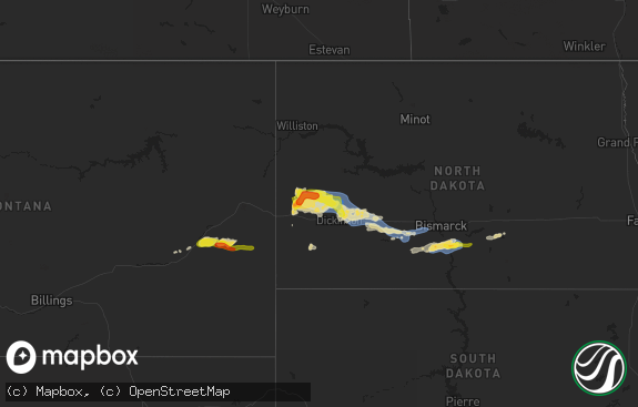
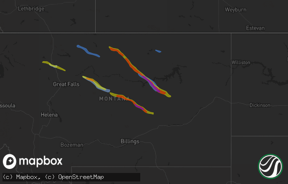
Hail Map in Ohio on August 7, 2013
The weather event in Ohio on August 7, 2013 includes Hail map. 22 states and 451 cities were impacted and suffered possible damage. The total estimated number of properties impacted is 25,440.

Hail
25,440
Estimated number of impacted properties by a 1.00" hail or larger0
Estimated number of impacted properties by a 1.75" hail or larger0
Estimated number of impacted properties by a 2.50" hail or largerStorm reports in Ohio
Ohio
| Date | Description |
|---|---|
| 08/07/20133:05 PM CDT | A local report indicates 1.00 inch wind near 1 N WINESBURG |
| 08/07/20132:53 PM CDT | A local report indicates 1.00 inch wind near CANTON |
| 08/07/20132:32 PM CDT | A local report indicates 1.00 inch wind near CANAL FULTON |
| 08/07/20132:08 PM CDT | Hail almost an inch and a quarter in diameter. |
| 08/07/20132:05 PM CDT | Ef1 tornado confirmed by nws storm survey team. Maximum winds estimated to be 95 mph. Path length approximately 1 mile. Path width approximately 50 yards. |
| 08/07/20132:01 PM CDT | Significant damage to a house. Possible tornado. |
| 08/07/20131:54 PM CDT | A local report indicates 1.00 inch wind near ORRVILLE |
| 08/07/201312:35 PM CDT | A local report indicates 1.00 inch wind near 2 SE GREEN SPRINGS |
| 08/07/201310:30 AM CDT | A local report indicates 1.00 inch wind near REPUBLIC |
All States Impacted by Hail Map on August 7, 2013
Cities Impacted by Hail Map on August 7, 2013
- Higgins, TX
- Canadian, TX
- Garrett, WY
- Bosler, WY
- Hugoton, KS
- Vinson, OK
- Custer, SD
- Belle Fourche, SD
- Homer City, PA
- Blairsville, PA
- Wallace, KS
- Lame Deer, MT
- Pine Ridge, SD
- Berryville, AR
- Weston, WY
- Lead, SD
- Covert, MI
- South Haven, MI
- Otter, MT
- Chicora, PA
- Karns City, PA
- West Sunbury, PA
- Allenport, PA
- Elco, PA
- Newell, PA
- Coal Center, PA
- Roscoe, PA
- California, PA
- Stockdale, PA
- Fayette City, PA
- Coloma, MI
- Hulett, WY
- Moorcroft, WY
- Granger, IN
- Galien, MI
- New Carlisle, IN
- Niles, MI
- La Porte, IN
- Rolling Prairie, IN
- Mishawaka, IN
- Notre Dame, IN
- South Bend, IN
- Buchanan, MI
- New Buffalo, MI
- Three Oaks, MI
- Oak Grove, AR
- Boise City, OK
- Pueblo, CO
- Kress, TX
- Ashland, MT
- Lawton, MI
- Decatur, MI
- Paw Paw, MI
- Hartford, MI
- Lawrence, MI
- Gillette, WY
- Clayton, NM
- Mountain View, AR
- Melbourne, AR
- Republic, OH
- Newcastle, WY
- Okarche, OK
- Trinidad, CO
- Sonora, TX
- Kirbyville, MO
- Omaha, AR
- Forsyth, MT
- Upton, WY
- Beaver, OK
- Balko, OK
- Weatherford, OK
- McConnellsburg, PA
- Fort Loudon, PA
- Worthington, PA
- Cowansville, PA
- East Brady, PA
- Templeton, PA
- Kittanning, PA
- Adrian, PA
- Eldorado, OK
- Eureka Springs, AR
- Boley, OK
- Castle, OK
- Paden, OK
- Colon, MI
- Sherwood, MI
- Leonidas, MI
- Indiana, PA
- Lake City, KS
- Grovertown, IN
- Plymouth, IN
- Gould, OK
- Plainwell, MI
- Kalamazoo, MI
- Burnt Cabins, PA
- Olney Springs, CO
- Falkville, AL
- Vega, TX
- Canute, OK
- Rosston, OK
- Town Creek, AL
- Mount Hope, AL
- Russellville, AL
- Cascade, MT
- Clarksburg, PA
- Aultman, PA
- Shelocta, PA
- Saltsburg, PA
- Clune, PA
- McIntyre, PA
- Kennebec, SD
- Presho, SD
- Cadiz, OH
- Adena, OH
- Rogers, AR
- Richfield, KS
- Rolla, KS
- Branson, CO
- Granite, OK
- Dacoma, OK
- Petrolia, PA
- Hillsboro, AL
- Tuscumbia, AL
- Athens, AL
- Elkmont, AL
- Butler, PA
- Kaycee, WY
- Moulton, AL
- Snyder, TX
- Fowler, CO
- Pontiac, IL
- Mertzon, TX
- Pell City, AL
- Lincoln, AL
- Riverside, AL
- Musselshell, MT
- Fairburn, SD
- Hermosa, SD
- Brooksville, FL
- Massena, IA
- Duke, OK
- Mangum, OK
- Bighorn, MT
- Slippery Rock, PA
- Boyers, PA
- Medford, OK
- Bluff City, KS
- Michigan City, IN
- Bangor, MI
- Boone, CO
- Vancourt, TX
- Hannibal, OH
- New Martinsville, WV
- Sardis, OH
- Clarington, OH
- Devils Tower, WY
- Boncarbo, CO
- Aguilar, CO
- Weston, CO
- Lampe, MO
- Shell Knob, MO
- Garfield, AR
- Keyes, OK
- Elkhart, KS
- Goodwell, OK
- Sedan, NM
- Ozona, TX
- Hooker, OK
- Booker, TX
- Lipscomb, TX
- Follett, TX
- Bremen, IN
- Rozet, WY
- Buffalo, OK
- Laverne, OK
- Starkville, MS
- Roosevelt, OK
- Marshall, AR
- Onia, AR
- Timbo, AR
- Turpin, OK
- Gregory, SD
- Miami, TX
- Plymouth, OH
- Willard, OH
- Tyrone, OK
- Scotts, MI
- Climax, MI
- Coffeeville, AL
- Thomasville, AL
- Cumberland Furnace, TN
- Cunningham, TN
- Old Town, FL
- Perryton, TX
- Jackson, AL
- San Angelo, TX
- Medina, OH
- Litchfield, OH
- Model, CO
- Arnett, OK
- Batesville, AR
- Magness, AR
- Newark, AR
- Campo, CO
- Walsh, CO
- Seward, PA
- Vintondale, PA
- North Lawrence, OH
- Dalton, OH
- Orrville, OH
- Deadwood, SD
- Vicksburg, MI
- Luther, OK
- Tulia, TX
- Smithville, OH
- Wooster, OH
- Abernathy, TX
- Shallowater, TX
- Ridgedale, MO
- Green Forest, AR
- Harrison, AR
- Hollister, MO
- Fayette, OH
- Hudson, MI
- Waldron, MI
- Morenci, MI
- Wauseon, OH
- Adrian, TX
- Dalhart, TX
- Watervliet, MI
- Benton Harbor, MI
- Goshen, IN
- Lakeville, IN
- Wakarusa, IN
- Gilbertown, AL
- Silas, AL
- Atwater, OH
- Deerfield, OH
- Rootstown, OH
- Rocky, OK
- Shattuck, OK
- Danville, KS
- Harper, KS
- Ralls, TX
- Lorenzo, TX
- Floydada, TX
- Waynoka, OK
- Hamlet, IN
- Ordway, CO
- Sugar City, CO
- Choctaw, OK
- Jones, OK
- Clyde, OH
- Fremont, OH
- Otsego, MI
- Cimarron, NM
- Locust Grove, AR
- Cheyenne, OK
- Big Cabin, OK
- Chelsea, OK
- Harrisville, PA
- Hilliards, PA
- Valparaiso, IN
- Campbell, AL
- Pittsford, MI
- Hillsdale, MI
- Osseo, MI
- Elk City, OK
- Butler, OK
- Hammon, OK
- Desha, AR
- Okemah, OK
- Ardmore, TN
- White Sulphur Springs, MT
- Great Falls, MT
- Dawson, PA
- Perryopolis, PA
- Chamberlain, SD
- Shubuta, MS
- Quitman, MS
- New Philadelphia, OH
- Dover, OH
- Glenrock, WY
- Forgan, OK
- Eldorado, TX
- Walkerton, IN
- Dawn, MO
- Hereford, TX
- Ohatchee, AL
- Shreve, OH
- Union Mills, IN
- Graymont, IL
- Dumas, TX
- Massillon, OH
- Spruce Pine, AL
- Guymon, OK
- Osceola, IN
- Elkhart, IN
- Lone Wolf, OK
- Leedey, OK
- Avonmore, PA
- Johnstown, PA
- Armagh, PA
- Lowell, AR
- Rural Valley, PA
- Concord, AR
- Drasco, AR
- Mercer, PA
- Grove City, PA
- Geraldine, AL
- Albertville, AL
- Girard, TX
- Mill Creek, IN
- Kingfisher, OK
- Caldwell, KS
- Union City, OK
- Ochelata, OK
- Dover, AR
- Beverly Shores, IN
- Noel, MO
- Bella Vista, AR
- Mount Pleasant, AR
- Fenelton, PA
- Dayton, PA
- Yatesboro, PA
- Quanah, TX
- Gravette, AR
- Canton, OH
- Reliance, SD
- Green Springs, OH
- Bellevue, OH
- Rockmart, GA
- Gotebo, OK
- Hobart, OK
- Fifty Six, AR
- Lexington, TN
- Darden, TN
- Lakewood, OH
- Cleveland, OH
- Springer, NM
- Sayre, OK
- Carney, OK
- Chandler, OK
- Bentleyville, PA
- Monongahela, PA
- Eighty Four, PA
- Gulfport, MS
- Watonga, OK
- Seville, OH
- Chippewa Lake, OH
- Olustee, OK
- Courtland, MS
- Water Valley, MS
- Birney, MT
- Fulton, MS
- Anthony, KS
- Oneonta, AL
- Hardesty, OK
- East Canton, OH
- Fostoria, OH
- New Riegel, OH
- Tiffin, OH
- Chillicothe, TX
- Cherokee, OK
- Holladay, TN
- Nappanee, IN
- Hanna, IN
- Argos, IN
- Geary, OK
- Corn, OK
- Scotts Hill, TN
- Decaturville, TN
- Springdale, AR
- Grenville, NM
- Dundee, OH
- Fredericksburg, OH
- Apple Creek, OH
- Alabaster, AL
- Calera, AL
- Waynesboro, MS
- Pulaski, TN
- Pettigrew, AR
- Westville, IN
- Wanatah, IN
- Dill City, OK
- Sentinel, OK
- Edgemont, SD
- Greenwich, OH
- New London, OH
- Greenfield, OK
- Fowler, KS
- Channing, TX
- Swanton, OH
- Vanleer, TN
- Parkhill, PA
- Dilltown, PA
- Spring Church, PA
- Coral, PA
- Apollo, PA
- New Florence, PA
- Mineral Point, PA
- South Fork, PA
- Wilmore, KS
- North Liberty, IN
- South Haven, KS
- Buffalo, WY
- Attica, OH
- Monroeville, OH
- Fayetteville, AR
- Hindsville, AR
- Seligman, MO
- Oglesby, IL
- Tonica, IL
- Crossville, AL
- Adair, OK
- Cordell, OK
- Collins, OH
- Cassville, MO
- Taloga, OK
- La Junta, CO
- Sweetwater, OK
- Danville, AL
- Wellston, OK
- Cullman, AL
- Sundance, WY
- Bloomville, OH
- Rome, GA
- Marshallville, OH
- Sterling, OH
- Creston, OH
- Rittman, OH
- Spur, TX
- Wakita, OK
- Manchester, OK
- Vici, OK
- Lenapah, OK
- Paden City, WV
- Proctor, WV
- East Sparta, OH
- Waynesburg, OH
- Crowell, TX
- Parrish, FL
- Fannettsburg, PA
- Fort Littleton, PA
- Cedartown, GA
- Mendon, MI
- Leslie, AR
- Sawyer, MI
- Meridian, MS
- Prospect, TN
- Newell, SD


