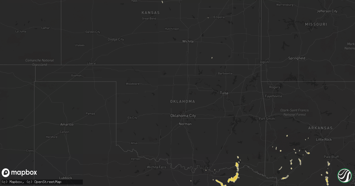
Hail Map on August 6, 2012
Get this storm
August 6 map
$229
one time, instant access
Download today. No call, no setup
Keep the $229
Bought the map and want the full workflow? Apply the entire $229 to a subscription within 7 days. None of it is wasted.
Every map, not just this one
This buys you this map. Subscription and you get every map we run, in the markets you choose from a few cities to whole states to nationwide. Plus real-time alerts the moment a storm fires.
Contact data
Name, contact info, occupancy, even credit band for addresses in the footprint. You go from where it hit to who to call.
Become the source they trust
Unlimited branding weather history reports on demand. You already have the documented answer ready for the property owner, and you are the one who showed up with it.
Property data and RoofTrace estimates
Pull up any address you have got, its value and the exact code rules for that jurisdiction, straight from One Click Code. Then RoofTrace estimates the squares, pitch, and roof value, priced the way you price.
States Impacted by Hail Map on August 6, 2012
Storm reports
Texas
| Date | Description |
|---|---|
| 08/06/20126:25 PM CDT | From paris pd... Downed power lines and tree limbs in road. Reported tree limbs were blocking roads. |
| 08/06/20123:36 PM CDT | Garage door reported blown in with street signs twisted at 1461 and 2478 in prosper |
| 08/06/20123:30 PM CDT | Several 4 inch diameter trees down |
| 08/06/20123:30 PM CDT | 60 mph wind gust from spotter in prosper |
| 08/06/20123:15 PM CDT | Power pole down and shingles off of roof. |
Virginia
| Date | Description |
|---|---|
| 08/06/20125:40 PM CDT | Large tree downed and blocking highway 14 |
Arizona
| Date | Description |
|---|---|
| 08/06/20124:45 PM CDT | Numerous power poles broken in half... At bigfields 7 homes damaged... Power out for 20 mile radius... No injuries |
| 08/06/20124:30 PM CDT | Multiple power poles down in sells |
| 08/05/201211:41 PM CDT | Wind gust to 66 mph at 932 pm mst. |
| 08/05/201211:32 PM CDT | A local report indicates 66 MPH wind near 6 NE NOGALES |
| 08/05/201210:14 PM CDT | Delayed report...pinal airpark |
| 08/05/20127:18 PM CDT | Roof damage in diamond bell ranch...numerous sheds damaged...8 inch brick wall on car. |
Florida
| Date | Description |
|---|---|
| 08/06/20124:40 PM CDT | There was damage to a couple of carports and fences. Small hail and minor flooding was also reported. Time is estimated. |
Louisiana
| Date | Description |
|---|---|
| 08/06/20126:20 PM CDT | Tree down chadwick area west monroe |
| 08/06/20125:55 PM CDT | Trees and power lines down |
| 08/06/20125:50 PM CDT | Power lines down on deloutre switch road |
| 08/06/20124:00 PM CDT | Trees down on dorcheat road |
| 08/06/20123:30 PM CDT | A large tree limb was blown into a passing vehicle traveling highway 9...shattering the windshield. The motorist was not injured. |
| 08/06/20123:30 PM CDT | Trees down near shongaloo |
| 08/05/20128:10 PM CDT | Scattered trees down southwest of town causing power outages and road blockages. Winds estimated by emergency manager to be 50 mph. |
Oklahoma
| Date | Description |
|---|---|
| 08/06/20124:58 PM CDT | A local report indicates 65 MPH wind near HUGO |
| 08/06/20124:58 PM CDT | A lot of trees and tree limbs down across hugo. Some trees blocking roadways. |
| 08/06/20123:50 PM CDT | A local report indicates 66 MPH wind near 5 SW BUTLER |
Georgia
| Date | Description |
|---|---|
| 08/06/20121:50 PM CDT | Fox31 news article reports large tree down in the road at the 1800 block of edgerly ave. |
Idaho
| Date | Description |
|---|---|
| 08/05/20127:40 PM CDT | Several fences and large trees blown down. One tree snapped at its base. Trampoline blown against fence. |
| 08/05/20127:00 PM CDT | A downburst confirmed by doppler radar associated with a collapsing thunderstorm tore off tree tops and reduced visibility to 1/4 mile. |
Arkansas
| Date | Description |
|---|---|
| 08/06/20125:26 PM CDT | Power out off hwy 32 |
| 08/06/20124:30 PM CDT | Trees reported down across hwy 133 near rodgers rd. |
| 08/06/20124:15 PM CDT | Trees reported down. |
| 08/06/20124:04 PM CDT | Trees down along hwy 160 with power outages reported in hermitage. |
| 08/06/20123:10 PM CDT | Large tree limbs reported down. |
| 08/06/20122:52 PM CDT | A tree was blown down on power lines north of gurdon. |
| 08/06/20122:52 PM CDT | A tree was blown down on highway 67 north of gurdon. |
| 08/06/20122:47 PM CDT | A plate glass window was blown out of a store. |
Nebraska
| Date | Description |
|---|---|
| 08/06/20126:30 PM CDT | A local report indicates 62 MPH wind near 4 E SCOTTSBLUFF |
| 08/05/20129:10 PM CDT | Emergency manager estimated thunderstorm wind gust speed to 60 mph along with some pea sized hai. |
| 08/05/20129:06 PM CDT | Off duty nws employee estimated 60 mph thunderstorm wind gust. |
North Carolina
| Date | Description |
|---|---|
| 08/06/20122:15 PM CDT | One tree blown over on davis drive. Time is approximate based on estimated time from observer and radar. |
Mississippi
| Date | Description |
|---|---|
| 08/06/20125:00 PM CDT | Tree down on experiment station rd near gallman. |
| 08/06/20124:50 PM CDT | Trees down and power outages in crystal springs. |
| 08/06/20124:25 PM CDT | Trees down at bluemoon dr and camp dantzler rd. |
| 08/06/20124:20 PM CDT | Trees down in byram/lake ridgelea area. Tree on car on w ridge dr and another tree fell on a patio on rod st |
| 08/06/20124:05 PM CDT | Tree down at 711 w capitol st |
| 08/06/20124:00 PM CDT | Tree down at wood st and peach orchard place. Another down at st ann and laurel st. |
| 08/06/20124:00 PM CDT | Large tree down at eatonville rd and sibs hobson. |
| 08/06/20124:00 PM CDT | At a downtown jackson office building. |
| 08/06/20123:50 PM CDT | Large tree limbs across moselle-oak grove rd. |
| 08/06/20123:45 PM CDT | Three trees down. One tree fell on vehicle on augusta rd. Road is blocked. Unknown injuries. |
| 08/06/20123:35 PM CDT | Reports of multiple trees down and some trees on powerlines in east brandon and pelahatchie area. Trees were also down on walters road near highway 43. |
Cities Impacted by Hail Map on August 6, 2012
- Sicily Island, LA
- Bassett, NE
- Jonesville, LA
- Harrisonburg, LA
- Ashton, NE
- Boelus, NE
- Farwell, NE
- Pottsboro, TX
- Denison, TX
- Independence, LA
- Loranger, LA
- Texarkana, AR
- Fulton, AR
- Hope, AR
- Taylor, NE
- Gibbon, NE
- Warren, AR
- Hermitage, AR
- Hendrix, OK
- Wolfe City, TX
- Stapleton, NE
- Arnold, NE
- Brooksville, FL
- Winter Garden, FL
- Arkadelphia, AR
- Biloxi, MS
- Sulphur, LA
- Schlater, MS
- Malvern, AR
- Amite, LA
- Greensburg, LA
- Callaway, NE
- Gothenburg, NE
- Mena, AR
- Commerce, TX
- Minden, NE
- Winnsboro, LA
- Columbia, LA
- Fort Necessity, LA
- North Platte, NE
- Tryon, NE
- Singer, LA
- Baton Rouge, LA
- Lucas, KS
- Isola, MS
- Hugo, OK
- Buna, TX
- Oconto, NE
- Long Pine, NE
- Calhoun, LA
- Bluffton, AR
- Woodworth, LA
- Farmerville, LA
- Downsville, LA
- Minden, LA
- Moorhead, MS
- Inverness, MS
- Rison, AR
- Itta Bena, MS
- Indianola, MS
- Belzoni, MS
- Delight, AR
- Ellisville, MS
- Prosper, TX
- Orange, TX
- Ferriday, LA
- Clayton, LA
- Saratoga, TX
- West Monroe, LA
- New Edinburg, AR
- Lucedale, MS
- Meadville, MS
- Bonham, TX
- Whitewright, TX
- Randolph, TX
- Trenton, TX
- Leonard, TX
- Bailey, TX
- Fort Worth, TX
- Hampton, AR
- Delhi, LA
- Eros, LA
- Halsey, NE
- Paris, TX
- Powderly, TX
- Arthur City, TX
- Elton, LA
- Bay Springs, MS
- Louin, MS
- Denham Springs, LA
- Tampa, FL
- Pecan Gap, TX
- Cooper, TX
- Ben Franklin, TX
- Roxton, TX
- Ladonia, TX
- Wisner, LA
- Moselle, MS
- Jacksboro, TX
- Scobey, MS
- Tillatoba, MS
- Cascilla, MS
- Overton, NE
- Loomis, NE
- Shelton, NE
- Meridian, MS
- Quitman, MS
- Wesley Chapel, FL
- Marion, LA
- Osborne, KS
- Sallis, MS
- Pelahatchie, MS
- Brandon, MS
- Morse, LA
- Jennings, LA
- Mermentau, LA
- Bonnerdale, AR
- Shongaloo, LA
- Haynesville, LA
- Dequincy, LA
- Clermont, FL
- Enterprise, LA
- Lisman, AL
- Foley, AL
- Pattonville, TX
- Lake Creek, TX
- Brookston, TX
- Mineral Springs, AR
- Nashville, AR
- Campbell, NE
- Saucier, MS
- Pearcy, AR
- Hot Springs National Park, AR
- Charleston, MS
- Oakland, MS
- Holcomb, MS
- Grant, OK
- Morton, MS
- Prescott, AR
- Purvis, MS
- El Dorado, AR
- Strong, AR
- Forest Hill, LA
- Kirbyville, TX
- Beaumont, TX
- Bladen, NE
- Gravelly, AR
- Magee, MS
- Mount Olive, MS
- Gurdon, AR
- Kilmichael, MS
- Butler, AL
- Jachin, AL
- Hilliard, FL
- Rattan, OK
- Fairhope, AL
- Lumberton, TX
- Dannebrog, NE
- Antlers, OK
- Lumberton, MS
- Waynesboro, TN
- Clifton, TN
- Minter City, MS
- Philipp, MS
- Doddsville, MS
- Greenwood, MS
- Baker, LA
- Zachary, LA
- Canton, MS
- Cape Coral, FL
- Orleans, NE
- Valley View, TX
- Era, TX
- Hattiesburg, MS
- Pennington, AL
- Ward, AL
- Bismarck, AR
- Amity, AR
- Vinton, LA
- Red Cloud, NE
- Vidor, TX
- Laurel, MS
- Sour Lake, TX
- Cottonwood Falls, KS
- Poplarville, MS
- Winona, MS
- Decatur, MS
- West, MS
- Cotton Valley, LA
- Elm Creek, NE
- Bertrand, NE
- Holdrege, NE
- Kountze, TX
- Durant, MS
- Ellsworth, KS
- Homer, LA
- Celina, TX
- Mckinney, TX
- Kearney, NE
- Port Allen, LA
- Stringer, MS
- Sylvan Grove, KS
- Cedar Vale, KS
- Jackson, MS
- Flowood, MS
- Heartwell, NE
- Franklinton, LA
- Pine Bluff, AR
- Caddo Gap, AR
- Atlanta, NE
- Chunky, MS
- Collinsville, MS
- New London, NC
- Haughton, LA
- Jacksonville, FL
- Sawyer, OK
- Spencerville, OK