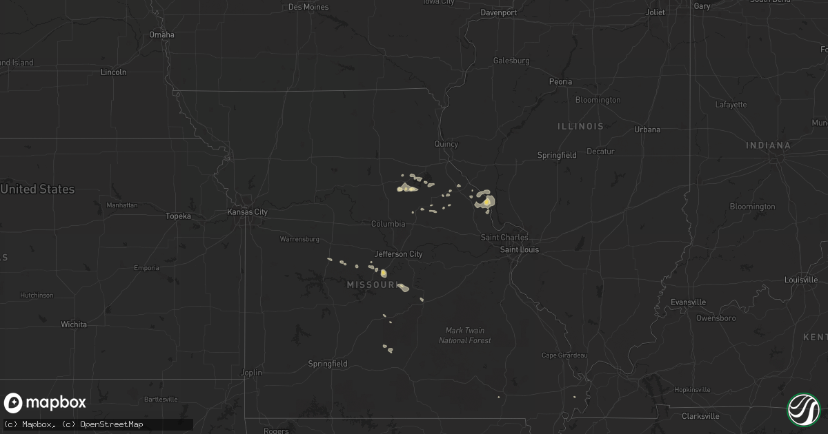
Hail Map in Minnesota on August 5, 2011
Get this storm
August 5 map
$229
one time, instant access
Download today. No call, no setup
Keep the $229
Bought the map and want the full workflow? Apply the entire $229 to a subscription within 7 days. None of it is wasted.
Every map, not just this one
This buys you this map. Subscription and you get every map we run, in the markets you choose from a few cities to whole states to nationwide. Plus real-time alerts the moment a storm fires.
Contact data
Name, contact info, occupancy, even credit band for addresses in the footprint. You go from where it hit to who to call.
Become the source they trust
Unlimited branding weather history reports on demand. You already have the documented answer ready for the property owner, and you are the one who showed up with it.
Property data and RoofTrace estimates
Pull up any address you have got, its value and the exact code rules for that jurisdiction, straight from One Click Code. Then RoofTrace estimates the squares, pitch, and roof value, priced the way you price.
Storm reports in Minnesota
Minnesota
| Date | Description |
|---|---|
| 08/05/20115:20 PM CDT | Trees down on power lines |
| 08/05/20115:15 PM CDT | A local report indicates 1.00 inch wind near BEMIDJI |
| 08/05/20115:05 PM CDT | 60 foot 10 inch diameter pine blown over |
| 08/05/20115:05 PM CDT | Stop light blown down...several trees down |
| 08/05/20115:00 PM CDT | Stop light blown down |
| 08/05/20114:27 PM CDT | A local report indicates 1.00 inch wind near 1 W LEONARD |
| 08/05/20113:24 PM CDT | 10 inch diameter spruce tree down on highway 48. |
All States Impacted by Hail Map on August 5, 2011
Cities Impacted by Hail Map on August 5, 2011
- Decherd, TN
- Kimball, SD
- Pukwana, SD
- Perryton, TX
- McIntosh, SD
- Isabel, SD
- Selfridge, ND
- Fallon, MT
- Preston, MS
- Bemidji, MN
- Mud Butte, SD
- Newell, SD
- Union Center, SD
- Keystone, SD
- New Leipzig, ND
- Elgin, ND
- Guymon, OK
- Bighorn, MT
- Bristow, NE
- Fairfax, SD
- Dalhart, TX
- Hammond, MT
- Bison, SD
- Lodgepole, SD
- Saint Bernard, LA
- Dumas, TX
- Camp Crook, SD
- Rhame, ND
- Ekalaka, MT
- Baker, MT
- Ideal, SD
- Witten, SD
- Winner, SD
- Nashville, TN
- Nesmith, SC
- Kingstree, SC
- Hermosa, SD
- Amelia, NE
- Atkinson, NE
- Tuttle, ND
- Enning, SD
- Wasta, SD
- Tumacacori, AZ
- Oxford, MS
- Banner, MS
- Bruce, MS
- Water Valley, MS
- Paris, MS
- Kyle, SD
- Meade, KS
- Plains, KS
- Howes, SD
- Dickinson, ND
- Sturgis, SD
- Paris, MO
- Santa Fe, MO
- Belfield, ND
- Ruffin, SC
- Newberry, SC
- Prosperity, SC
- Pomaria, SC
- Iliff, CO
- Peetz, CO
- Rapid City, SD
- Canadian, TX
- New Underwood, SD
- Wall, SD
- Cass Lake, MN
- Menlo, GA
- Macon, MS
- Laverne, OK
- Nebo, IL
- Clarksville, MO
- Moorcroft, WY
- Hulett, WY
- Devils Tower, WY
- Weston, WY
- Halstead, KS
- Hesston, KS
- Newton, KS
- Leon, KS
- Augusta, KS
- Sylvester, GA
- Warwick, GA
- Elkhart, KS
- Pine Ridge, SD
- South Heart, ND
- Gladstone, ND
- Medora, ND
- Forsyth, MT
- McLaughlin, SD
- Madison, MO
- Scenic, SD
- White Lake, SD
- Stickney, SD
- Bejou, MN
- Ellsworth, NE
- Great Falls, SC
- Winnsboro, SC
- Blackstock, SC
- Boyes, MT
- Russellville, AL
- Haleyville, AL
- Marsland, NE
- Hemingford, NE
- Rosebud, MT
- Ridgeway, SC
- Remer, MN
- Alzada, MT
- Belle Fourche, SD
- Vandalia, MO
- Lame Deer, MT
- Trail, MN
- Mcintosh, MN
- Manning, ND
- Vale, SD
- North, SC
- Isabella, MN
- Brimson, MN
- Camden, SC
- Terry, MT
- Alliance, NE
- Watauga, SD
- Independence, LA
- Tampa, FL
- Odessa, FL
- Madison, KS
- Bigfork, MN
- Bishopville, SC
- McBee, SC
- Bronson, FL
- Goodwell, OK
- Eagle Butte, SD
- Clinton, SC
- Bowman, ND
- Chamberlain, SD
- Woodworth, ND
- Campo, CO
- Lindsay, MT
- Meadow, SD
- Buffalo, SD
- Fairfield, ND
- Killdeer, ND
- Grassy Butte, ND
- Double Springs, AL
- Louisiana, MO
- Bowling Green, MO
- Nauvoo, AL
- Tignall, GA
- Lincolnton, GA
- Washington, GA
- Nisland, SD
- Canon, GA
- Royston, GA
- Elkton, FL
- Saint Augustine, FL
- Leonard, MN
- Spencer, NE
- Wagner, SD
- Lynch, NE
- Louisville, MS
- Flagler, CO
- Richland, MT
- Dupree, SD
- Lake City, FL
- Deer River, MN
- Graff, MO
- Mountain Grove, MO
- Ainsworth, NE
- Gate, OK
- Oklee, MN
- Texhoma, OK
- Trenton, AL
- Bowman, SC
- Hodges, SC
- Bagley, MN
- Clearbrook, MN
- Annada, MO
- Elsberry, MO
- Hamburg, IL
- Glenham, SD
- Batchtown, IL
- Timber Lake, SD
- Fairburn, SD
- Neeses, SC
- Guntown, MS
- Blue Springs, MS
- Dumas, MS
- Baldwyn, MS
- New Albany, MS
- Oacoma, SD
- Lower Brule, SD
- Lake City, SC
- Johnsonville, SC
- Pamplico, SC
- Salem, IL
- Cleveland, ND
- Stover, MO
- Wilton, ND
- Robinson, ND
- Milesville, SD
- Myrtle, MS
- Etta, MS
- Regent, ND
- Midland, SD
- Henley, MO
- Olean, MO
- Eldon, MO
- Eugene, MO
- Leesville, SC
- Batesburg, SC
- Balko, OK
- Lynchburg, SC
- Olanta, SC
- Stoutsville, MO
- Walsh, CO
- Sparks, NE
- Wanblee, SD
- Lavonia, GA
- Carnesville, GA
- Duluth, MN
- Middletown, MO
- Lefor, ND
- Richardton, ND
- Center, ND
- Clinton, LA
- Solway, MN
- Carrollton, IL
- Comer, GA
- Carlton, GA
- Gonvick, MN
- Circle, MT
- Bowman, GA
- Long Pine, NE
- Elloree, SC
- Eureka, KS
- Sequatchie, TN
- Jasper, TN
- Coffeeville, MS
- Cordesville, SC
- Huger, SC
- Bonneau, SC
- Thaxton, MS
- Richland, MO
- Columbus, MS
- Benton City, MO
- Guin, AL
- Shevlin, MN
- Scobey, MS
- Tillatoba, MS
- Winfield, AL
- Forgan, OK
- Kismet, KS
- Bushnell, NE
- Gregory, SD
- Dallas, SD
- Oakfield, GA
- Federal Dam, MN
- Eolia, MO
- Savage, MT
- Council Grove, KS
- Stuart, NE
- Otter, MT
- Decker, MT
- Danielsville, GA
- Colbert, GA
- Glen Ullin, ND
- Braman, OK
- Moncks Corner, SC
- Arriba, CO
- Kennebec, SD
- Springfield, LA
- Brooksville, MS
- Selby, SD
- New Salem, ND
- Johnston, SC
- Fayette, AL
- Eastanollee, GA
- Berry, AL
- Lemmon, SD
- Rantoul, KS
- Liberty Hill, SC
- Heath Springs, SC
- Hamill, SD
- Cassatt, SC
- Norway, SC
- Barnett, MO
- Meno, OK
- Crawford, MS
- Mexico, MO
- Capitol, MT
- Pearl River, LA
- Allen, KS
- Wakpala, SD
- Sanderson, FL
- Squaw Lake, MN
- Pontotoc, MS
- Santee, SC
- Mott, ND
- Lugoff, SC
- Vega, TX
- Hamilton, KS
- Belvidere, SD
- Nardin, OK
- Loganville, GA
- Saint Joe, AR
- Clinton, KY
- Williston, SC
- Carpenter, WY
- Grover, CO
- Bena, MN
- Elberton, GA
- Woodland, MS
- Becker, MN
- Big Lake, MN
- Walterboro, SC
- Nash, OK
- Curryville, MO
- Lamont, OK
- Florence, AL
- Cole Camp, MO
- Groveland, FL
- Bristol, FL
- Rolla, MO
- Silex, MO
- Kampsville, IL
- Aliceville, AL
- Presho, SD
- Rising Fawn, GA
- Trenton, GA
- Johnson, KS
- Laddonia, MO
- East Prairie, MO
- Lodge Grass, MT
- Garryowen, MT
- Hebron, ND
- Holliday, MO
- Goltry, OK
- Carrier, OK
- Eldridge, AL
- Callahan, FL
- Booneville, MS
- Vernon, AL
- Perry, MO
- Wagener, SC
- California, MO
- Russellville, MO
- Hathaway, MT
- Spearman, TX
- Reliance, SD
- Scranton, SC
- Coward, SC
- Dixon, MO
- Meta, MO
- Brinktown, MO
- New Raymer, CO
- Bethune, SC
- Foley, MO
- Buffalo, OK
- Salem, KY
- Springfield, CO
- Hemingway, SC
- Ocilla, GA
- Toccoa, GA
- Wing, ND
- Mandan, ND
- Bismarck, ND
- Holly Hill, SC
- Ponchatoula, LA
- Bovey, MN
- Hartsville, SC
- Cunningham, KS
- Andrews, SC
- Eldred, IL
- Rushville, NE
- Laquey, MO
- Blair, SC
- Pearlington, MS
- Saltillo, MS
- Carson, ND
- Cameron, SC
- Evans, GA
- Higgins, TX
- Strong City, KS
- Bankston, AL
- Caputa, SD
- Wellsville, MO
- Martinsburg, MO
- Versailles, MO
- McNeal, AZ
- Summerton, SC
- Chadron, NE
- Vienna, MO
- Bowersville, GA
- Hartville, MO
- Hickory Flat, MS
- Potts Camp, MS
- Poplar Bluff, MO
- Salters, SC
- Mahnomen, MN
- Pelion, SC
- Fort Pierre, SD
- Shuqualak, MS
- Solen, ND
- Brilliant, AL
- Buhler, KS


