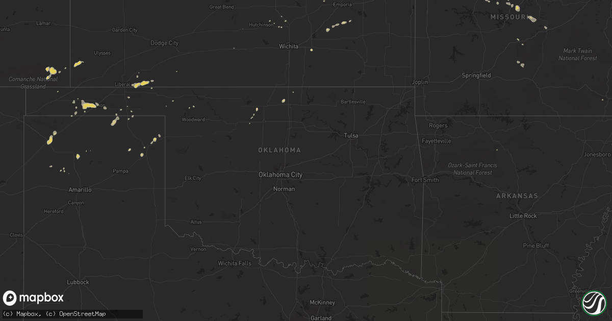
Hail Map on August 5, 2011
Get this storm
August 5 map
$229
one time, instant access
Download today. No call, no setup
Keep the $229
Bought the map and want the full workflow? Apply the entire $229 to a subscription within 7 days. None of it is wasted.
Every map, not just this one
This buys you this map. Subscription and you get every map we run, in the markets you choose from a few cities to whole states to nationwide. Plus real-time alerts the moment a storm fires.
Contact data
Name, contact info, occupancy, even credit band for addresses in the footprint. You go from where it hit to who to call.
Become the source they trust
Unlimited branding weather history reports on demand. You already have the documented answer ready for the property owner, and you are the one who showed up with it.
Property data and RoofTrace estimates
Pull up any address you have got, its value and the exact code rules for that jurisdiction, straight from One Click Code. Then RoofTrace estimates the squares, pitch, and roof value, priced the way you price.
States Impacted by Hail Map on August 5, 2011
Storm reports
South Dakota
| Date | Description |
|---|---|
| 08/05/20116:50 PM CDT | Roof blown off of structure. |
| 08/05/20116:40 PM CDT | Wind gusting to 50 to 60 mph with hail 3/8 inch. |
| 08/05/20116:40 PM CDT | Wind gusting to 50 to 60 mph with hail 3/8 inch. |
| 08/05/20116:30 PM CDT | Also had pea size hail. |
| 08/05/20116:18 PM CDT | Wind gust at faith asos. |
| 08/05/20116:10 PM CDT | A local report indicates 1.00 inch wind near 4 NNW FAIRBURN |
| 08/05/20116:00 PM CDT | A local report indicates 60 MPH wind near UNION CENTER |
| 08/05/20116:00 PM CDT | A local report indicates 85 MPH wind near 7 SSE MEADOW |
| 08/05/20115:50 PM CDT | A local report indicates 65 MPH wind near 7 SE MEADOW |
| 08/05/20115:47 PM CDT | A local report indicates 1.00 inch wind near 7 W HERMOSA |
| 08/05/20115:47 PM CDT | A local report indicates 1.50 inch wind near 2 SSW HERMOSA |
| 08/05/20115:43 PM CDT | 8 inch diameter tree branches broke |
| 08/05/20115:35 PM CDT | A local report indicates 1.50 inch wind near HAYWARD |
| 08/05/20115:35 PM CDT | 0.60 inches of rain. Ground is white from the hail. |
| 08/05/20115:30 PM CDT | Shredded leaves and car dents |
| 08/05/20115:00 PM CDT | Also had 30 to 40 mph winds. |
| 08/05/20115:00 PM CDT | Also had 30 mph winds. |
| 08/05/20115:00 PM CDT | A local report indicates 60 MPH wind near 10 S MUD BUTTE |
| 08/05/20115:00 PM CDT | 40 mph winds. |
| 08/05/20114:46 PM CDT | A local report indicates 60 MPH wind near 3 W ZEONA |
| 08/05/20114:30 PM CDT | A local report indicates 60 MPH wind near 13 E CASTLE ROCK |
| 08/05/20113:30 PM CDT | Also had 1.5 inch hail at 227 pm to 230 pm |
| 08/05/20113:27 PM CDT | Also had 60 mph winds |
| 08/05/20113:00 PM CDT | Marble size hail also. |
| 08/05/20113:00 PM CDT | Marble size hail also. |
| 08/05/201112:30 AM CDT | House shaking. |
| 08/05/201112:10 AM CDT | Several trees down. |
| 08/04/201111:50 PM CDT | Numerous trees down. |
| 08/04/201111:40 PM CDT | Thunderstorm winds blew pickup and attached trailer through 2 fences and into a ditch along highway 50. The winds also blew off the side and roof of a barn. |
| 08/04/201111:40 PM CDT | Large branches down. |
| 08/04/201111:10 PM CDT | A local report indicates 58 MPH wind near 2 W HAMILL |
| 08/04/20119:10 PM CDT | I-90 mile marker 172 |
| 08/04/20118:20 PM CDT | A local report indicates 60 MPH wind near 12 SE HAYES |
| 08/04/20118:17 PM CDT | A local report indicates 60 MPH wind near 9 SW HARDING |
| 08/04/20118:00 PM CDT | A local report indicates 60 MPH wind near 6 NNW KYLE |
| 08/04/20117:55 PM CDT | A local report indicates 65 MPH wind near 3 SE MCLAUGHLIN |
| 08/04/20117:45 PM CDT | A local report indicates 60 MPH wind near EAGLE BUTTE |
| 08/04/20117:25 PM CDT | A local report indicates 60 MPH wind near 14 W MILESVILLE |
| 08/04/20117:25 PM CDT | Wind gust of 60 to 70 mph. |
| 08/04/20117:15 PM CDT | Sdsu mesonet site. |
Texas
| Date | Description |
|---|---|
| 08/05/20116:46 PM CDT | 59 mph wind gust recorded at kdht at 646 pm |
Montana
| Date | Description |
|---|---|
| 08/05/20115:19 PM CDT | Accompanied by pea sized hail. |
| 08/05/20115:04 PM CDT | A local report indicates 60 MPH wind near 3 NW BILLINGS |
| 08/05/20113:18 PM CDT | Estimated 1 inch hail. Zero visibility. 45 to 50 mph wind. Along highway 16. |
Florida
| Date | Description |
|---|---|
| 08/05/20114:05 PM CDT | Public reported several large tree branches blown down. |
Missouri
| Date | Description |
|---|---|
| 08/05/20118:30 AM CDT | A thunderstorm wind gust caused damage to occur to a wooden swing set in the southern part of the city of ozark. |
Wyoming
| Date | Description |
|---|---|
| 08/05/20116:47 PM CDT | A local report indicates 1.00 inch wind near 9 NNW OSHOTO |
| 08/05/20114:59 PM CDT | Buffalo asos reported a 60 mph wind gust from a thunderstorm at 1559l |
North Dakota
| Date | Description |
|---|---|
| 08/05/20116:20 PM CDT | A local report indicates 1.75 inch wind near 1 SW ELGIN |
| 08/05/20116:15 PM CDT | A local report indicates 60 MPH wind near NEW SALEM |
| 08/05/20115:53 PM CDT | Estimated wind gusts of at least 60 mph. Zero visibility. Winds ongoing. Report relayed by warning point. |
| 08/05/20115:50 PM CDT | 2 to 3 inch diameter trees blown over. Winds estimated 65-70 mph. |
| 08/05/20115:45 PM CDT | 6 to 8 inch diameter trees snapped. Estimated 70 mile per hour winds. Strong winds lasted 10 to 15 minutes. 1.80 inch precipitation. |
| 08/05/20114:54 PM CDT | Law enforcement estimated 70 to 80 mph winds on i-94 east of dickinson. |
| 08/05/20114:47 PM CDT | A local report indicates 58 MPH wind near DICKINSON |
| 08/05/20114:35 PM CDT | 50-60 mph wind gust. |
| 08/05/20114:20 PM CDT | Relayed by media. |
| 08/05/20113:58 PM CDT | Relayed by media. |
| 08/05/20112:54 PM CDT | Also nickel size hail |
| 08/04/20117:32 PM CDT | Estimated 60 mph wind gust at horizon middle school. |
Tennessee
| Date | Description |
|---|---|
| 08/05/20113:40 PM CDT | A couple of trees down. |
Oklahoma
| Date | Description |
|---|---|
| 08/05/20116:30 PM CDT | Winds estimated at the intersection of garland and west chestnut in west enid |
| 08/05/20116:30 PM CDT | Delayed report of damage to large trees and light posts at the oakwood country club northwest of enid |
| 08/05/20116:20 PM CDT | 66 mph winds recorded at mesonet 3 sse of boise city at 620pm |
| 08/05/20116:06 PM CDT | Pole barn pushed 100 yards into house and debris scattered 0.25-0.50 miles past the house... Caused damage to the house and overturned a swingset. |
| 08/05/201112:55 AM CDT | Delayed report. |
| 08/04/20118:47 PM CDT | A local report indicates 60 MPH wind near 2 W GUYMON |
| 08/04/20118:20 PM CDT | School net site |
| 08/04/20117:58 PM CDT | 66 mph winds recorded at mesonet 3 sse of boise city at 620pm |
Georgia
| Date | Description |
|---|---|
| 08/05/20115:30 PM CDT | The fire chief of carnesville said many more trees and limbs were down from the storm in the royston and franklin springs area. |
| 08/05/20115:17 PM CDT | Two trees blown down on highway 191...two trees blown down highway 98...two trees blown down on highway 172. Also one tree blown down on power lines in carlton. |
| 08/05/20115:12 PM CDT | The fire chief for carnesville reported trees and large limbs down in the area east of carnesville |
Idaho
| Date | Description |
|---|---|
| 08/05/20116:30 PM CDT | A local report indicates 60 MPH wind near BERN |
South Carolina
| Date | Description |
|---|---|
| 08/05/20116:59 PM CDT | Tree down blocking horseford road. |
| 08/05/20116:55 PM CDT | Tree blown down on roadway at candle light road |
| 08/05/20116:40 PM CDT | Tree down on shortcut road. |
| 08/05/20114:57 PM CDT | Tree limbs down on good hope road east of norway. Public estimated winds above 60 mph. |
Nebraska
| Date | Description |
|---|---|
| 08/05/20113:30 AM CDT | Estimated 50 to 60 mph winds with locally heavy rain. |
Illinois
| Date | Description |
|---|---|
| 08/05/20112:15 PM CDT | One large tree down snapped power lines in downtown marissa. |
Minnesota
| Date | Description |
|---|---|
| 08/05/20115:20 PM CDT | Trees down on power lines |
| 08/05/20115:15 PM CDT | A local report indicates 1.00 inch wind near BEMIDJI |
| 08/05/20115:05 PM CDT | 60 foot 10 inch diameter pine blown over |
| 08/05/20115:05 PM CDT | Stop light blown down...several trees down |
| 08/05/20115:00 PM CDT | Stop light blown down |
| 08/05/20114:27 PM CDT | A local report indicates 1.00 inch wind near 1 W LEONARD |
| 08/05/20113:24 PM CDT | 10 inch diameter spruce tree down on highway 48. |
Cities Impacted by Hail Map on August 5, 2011
- Decherd, TN
- Kimball, SD
- Pukwana, SD
- Perryton, TX
- McIntosh, SD
- Isabel, SD
- Selfridge, ND
- Fallon, MT
- Preston, MS
- Bemidji, MN
- Mud Butte, SD
- Newell, SD
- Union Center, SD
- Keystone, SD
- New Leipzig, ND
- Elgin, ND
- Guymon, OK
- Bighorn, MT
- Bristow, NE
- Fairfax, SD
- Dalhart, TX
- Hammond, MT
- Bison, SD
- Lodgepole, SD
- Saint Bernard, LA
- Dumas, TX
- Camp Crook, SD
- Rhame, ND
- Ekalaka, MT
- Baker, MT
- Ideal, SD
- Witten, SD
- Winner, SD
- Nashville, TN
- Nesmith, SC
- Kingstree, SC
- Hermosa, SD
- Amelia, NE
- Atkinson, NE
- Tuttle, ND
- Enning, SD
- Wasta, SD
- Tumacacori, AZ
- Oxford, MS
- Banner, MS
- Bruce, MS
- Water Valley, MS
- Paris, MS
- Kyle, SD
- Meade, KS
- Plains, KS
- Howes, SD
- Dickinson, ND
- Sturgis, SD
- Paris, MO
- Santa Fe, MO
- Belfield, ND
- Ruffin, SC
- Newberry, SC
- Prosperity, SC
- Pomaria, SC
- Iliff, CO
- Peetz, CO
- Rapid City, SD
- Canadian, TX
- New Underwood, SD
- Wall, SD
- Cass Lake, MN
- Menlo, GA
- Macon, MS
- Laverne, OK
- Nebo, IL
- Clarksville, MO
- Moorcroft, WY
- Hulett, WY
- Devils Tower, WY
- Weston, WY
- Halstead, KS
- Hesston, KS
- Newton, KS
- Leon, KS
- Augusta, KS
- Sylvester, GA
- Warwick, GA
- Elkhart, KS
- Pine Ridge, SD
- South Heart, ND
- Gladstone, ND
- Medora, ND
- Forsyth, MT
- McLaughlin, SD
- Madison, MO
- Scenic, SD
- White Lake, SD
- Stickney, SD
- Bejou, MN
- Ellsworth, NE
- Great Falls, SC
- Winnsboro, SC
- Blackstock, SC
- Boyes, MT
- Russellville, AL
- Haleyville, AL
- Marsland, NE
- Hemingford, NE
- Rosebud, MT
- Ridgeway, SC
- Remer, MN
- Alzada, MT
- Belle Fourche, SD
- Vandalia, MO
- Lame Deer, MT
- Trail, MN
- Mcintosh, MN
- Manning, ND
- Vale, SD
- North, SC
- Isabella, MN
- Brimson, MN
- Camden, SC
- Terry, MT
- Alliance, NE
- Watauga, SD
- Independence, LA
- Tampa, FL
- Odessa, FL
- Madison, KS
- Bigfork, MN
- Bishopville, SC
- McBee, SC
- Bronson, FL
- Goodwell, OK
- Eagle Butte, SD
- Clinton, SC
- Bowman, ND
- Chamberlain, SD
- Woodworth, ND
- Campo, CO
- Lindsay, MT
- Meadow, SD
- Buffalo, SD
- Fairfield, ND
- Killdeer, ND
- Grassy Butte, ND
- Double Springs, AL
- Louisiana, MO
- Bowling Green, MO
- Nauvoo, AL
- Tignall, GA
- Lincolnton, GA
- Washington, GA
- Nisland, SD
- Canon, GA
- Royston, GA
- Elkton, FL
- Saint Augustine, FL
- Leonard, MN
- Spencer, NE
- Wagner, SD
- Lynch, NE
- Louisville, MS
- Flagler, CO
- Richland, MT
- Dupree, SD
- Lake City, FL
- Deer River, MN
- Graff, MO
- Mountain Grove, MO
- Ainsworth, NE
- Gate, OK
- Oklee, MN
- Texhoma, OK
- Trenton, AL
- Bowman, SC
- Hodges, SC
- Bagley, MN
- Clearbrook, MN
- Annada, MO
- Elsberry, MO
- Hamburg, IL
- Glenham, SD
- Batchtown, IL
- Timber Lake, SD
- Fairburn, SD
- Neeses, SC
- Guntown, MS
- Blue Springs, MS
- Dumas, MS
- Baldwyn, MS
- New Albany, MS
- Oacoma, SD
- Lower Brule, SD
- Lake City, SC
- Johnsonville, SC
- Pamplico, SC
- Salem, IL
- Cleveland, ND
- Stover, MO
- Wilton, ND
- Robinson, ND
- Milesville, SD
- Myrtle, MS
- Etta, MS
- Regent, ND
- Midland, SD
- Henley, MO
- Olean, MO
- Eldon, MO
- Eugene, MO
- Leesville, SC
- Batesburg, SC
- Balko, OK
- Lynchburg, SC
- Olanta, SC
- Stoutsville, MO
- Walsh, CO
- Sparks, NE
- Wanblee, SD
- Lavonia, GA
- Carnesville, GA
- Duluth, MN
- Middletown, MO
- Lefor, ND
- Richardton, ND
- Center, ND
- Clinton, LA
- Solway, MN
- Carrollton, IL
- Comer, GA
- Carlton, GA
- Gonvick, MN
- Circle, MT
- Bowman, GA
- Long Pine, NE
- Elloree, SC
- Eureka, KS
- Sequatchie, TN
- Jasper, TN
- Coffeeville, MS
- Cordesville, SC
- Huger, SC
- Bonneau, SC
- Thaxton, MS
- Richland, MO
- Columbus, MS
- Benton City, MO
- Guin, AL
- Shevlin, MN
- Scobey, MS
- Tillatoba, MS
- Winfield, AL
- Forgan, OK
- Kismet, KS
- Bushnell, NE
- Gregory, SD
- Dallas, SD
- Oakfield, GA
- Federal Dam, MN
- Eolia, MO
- Savage, MT
- Council Grove, KS
- Stuart, NE
- Otter, MT
- Decker, MT
- Danielsville, GA
- Colbert, GA
- Glen Ullin, ND
- Braman, OK
- Moncks Corner, SC
- Arriba, CO
- Kennebec, SD
- Springfield, LA
- Brooksville, MS
- Selby, SD
- New Salem, ND
- Johnston, SC
- Fayette, AL
- Eastanollee, GA
- Berry, AL
- Lemmon, SD
- Rantoul, KS
- Liberty Hill, SC
- Heath Springs, SC
- Hamill, SD
- Cassatt, SC
- Norway, SC
- Barnett, MO
- Meno, OK
- Crawford, MS
- Mexico, MO
- Capitol, MT
- Pearl River, LA
- Allen, KS
- Wakpala, SD
- Sanderson, FL
- Squaw Lake, MN
- Pontotoc, MS
- Santee, SC
- Mott, ND
- Lugoff, SC
- Vega, TX
- Hamilton, KS
- Belvidere, SD
- Nardin, OK
- Loganville, GA
- Saint Joe, AR
- Clinton, KY
- Williston, SC
- Carpenter, WY
- Grover, CO
- Bena, MN
- Elberton, GA
- Woodland, MS
- Becker, MN
- Big Lake, MN
- Walterboro, SC
- Nash, OK
- Curryville, MO
- Lamont, OK
- Florence, AL
- Cole Camp, MO
- Groveland, FL
- Bristol, FL
- Rolla, MO
- Silex, MO
- Kampsville, IL
- Aliceville, AL
- Presho, SD
- Rising Fawn, GA
- Trenton, GA
- Johnson, KS
- Laddonia, MO
- East Prairie, MO
- Lodge Grass, MT
- Garryowen, MT
- Hebron, ND
- Holliday, MO
- Goltry, OK
- Carrier, OK
- Eldridge, AL
- Callahan, FL
- Booneville, MS
- Vernon, AL
- Perry, MO
- Wagener, SC
- California, MO
- Russellville, MO
- Hathaway, MT
- Spearman, TX
- Reliance, SD
- Scranton, SC
- Coward, SC
- Dixon, MO
- Meta, MO
- Brinktown, MO
- New Raymer, CO
- Bethune, SC
- Foley, MO
- Buffalo, OK
- Salem, KY
- Springfield, CO
- Hemingway, SC
- Ocilla, GA
- Toccoa, GA
- Wing, ND
- Mandan, ND
- Bismarck, ND
- Holly Hill, SC
- Ponchatoula, LA
- Bovey, MN
- Hartsville, SC
- Cunningham, KS
- Andrews, SC
- Eldred, IL
- Rushville, NE
- Laquey, MO
- Blair, SC
- Pearlington, MS
- Saltillo, MS
- Carson, ND
- Cameron, SC
- Evans, GA
- Higgins, TX
- Strong City, KS
- Bankston, AL
- Caputa, SD
- Wellsville, MO
- Martinsburg, MO
- Versailles, MO
- McNeal, AZ
- Summerton, SC
- Chadron, NE
- Vienna, MO
- Bowersville, GA
- Hartville, MO
- Hickory Flat, MS
- Potts Camp, MS
- Poplar Bluff, MO
- Salters, SC
- Mahnomen, MN
- Pelion, SC
- Fort Pierre, SD
- Shuqualak, MS
- Solen, ND
- Brilliant, AL
- Buhler, KS