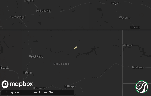
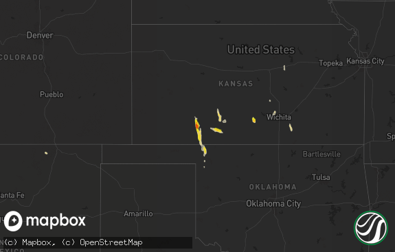
Hail Map in North Dakota on August 4, 2018
The weather event in North Dakota on August 4, 2018 includes Hail map. 15 states and 245 cities were impacted and suffered possible damage. The total estimated number of properties impacted is 0.

Hail
0
Estimated number of impacted properties by a 1.00" hail or larger0
Estimated number of impacted properties by a 1.75" hail or larger0
Estimated number of impacted properties by a 2.50" hail or largerStorm reports in North Dakota
North Dakota
| Date | Description |
|---|---|
| 08/04/20185:18 PM CDT | Mostly pea to dime size hail with a few as large as a quarter. Time estimated from radar. |
| 08/04/20183:08 AM CDT | At 808 PM CDT, a severe thunderstorm was located over Aneta, or 48 miles west of Grand Forks, moving east at 25 mph. HAZARD...Golf ball size hail and 60 mph wind gusts. SOURCE...Radar indicated. IMPACT...People and animals outdoors will be injured. Expect hail damage to roofs, siding, windows, and vehicles. Expect wind damage to roofs, siding, and trees. This severe thunderstorm will be near... Aneta around 810 PM CDT. Sharon around 830 PM CDT. Finley around 840 PM CDT. Sherbrooke around 855 PM CDT. Golden Lake around 900 PM CDT. |
| 08/04/20182:21 AM CDT | At 719 PM CDT, a severe thunderstorm was located near Pekin, or 35 miles southeast of Devils Lake, moving east at 25 mph. HAZARD...60 mph wind gusts and quarter size hail. SOURCE...Radar indicated. IMPACT...Hail damage to vehicles is expected. Expect wind damage to roofs, siding, and trees. This severe thunderstorm will be near... McVille around 735 PM CDT. Kloten around 750 PM CDT. Aneta around 805 PM CDT. |
| 08/04/201812:17 AM CDT | At 517 PM CDT, a severe thunderstorm was located 8 miles south of Hurdsfield, or 23 miles southeast of Mcclusky, moving east at 25 mph. HAZARD...60 mph wind gusts and quarter size hail. SOURCE...Radar indicated. IMPACT...Hail damage to vehicles is expected. Expect wind damage to roofs, siding, and trees. This severe thunderstorm will remain over mainly rural areas of southwestern Wells and northern Kidder Counties. |
| 08/03/20188:20 PM CDT | Shredded corn in fields along a swath one mile in width. Vicinity of sr 32/45 intersection. |
| 08/03/20188:05 PM CDT | Relayed by media via picture. |
| 08/03/20187:56 PM CDT | Image shared through social media shows crop damage due to widespread dime/nickel sized hail with reports of a few larger hail stones. Time estimated based on radar. |
| 08/03/20187:47 PM CDT | Image relayed through social media shows nickel and quarter sized hail stones. Time estimated from radar. |
All States Impacted by Hail Map on August 4, 2018
Cities Impacted by Hail Map on August 4, 2018
- Hazelton, ND
- Braddock, ND
- Rapid City, SD
- Fort Yates, ND
- Humboldt, SD
- Hartford, SD
- Sioux Falls, SD
- White Lake, SD
- Plankinton, SD
- Stickney, SD
- Bridgewater, SD
- Tuttle, ND
- Houston, TX
- Shevlin, MN
- Solway, MN
- Mitchell, SD
- Mount Vernon, SD
- Sharon, ND
- Aneta, ND
- Pekin, ND
- Mcville, ND
- Hurdsfield, ND
- Salem, SD
- Sanborn, IA
- Primghar, IA
- Valley City, ND
- Nora Springs, IA
- Mason City, IA
- Olivet, SD
- Parkston, SD
- Beresford, SD
- Wessington Springs, SD
- Napoleon, ND
- Kintyre, ND
- Cooks, MI
- Canistota, SD
- Hayes, SD
- Harrold, SD
- Fort Pierre, SD
- Pierre, SD
- Lower Brule, SD
- Chamberlain, SD
- Pukwana, SD
- North Creek, NY
- Olmstedville, NY
- Currie, MN
- Slayton, MN
- Avoca, MN
- Tappen, ND
- Streeter, ND
- Merriman, NE
- Hudson, SD
- Rock Valley, IA
- Rapid River, MI
- Sidney, NE
- Holland, MN
- Pipestone, MN
- Peetz, CO
- Lancaster, MN
- Hull, IA
- Brandon, SD
- Larchwood, IA
- Jamestown, ND
- Archer, IA
- Sheldon, IA
- Williams, MN
- Baudette, MN
- Buchanan, ND
- Finley, ND
- Tolna, ND
- Montrose, SD
- Ballston Spa, NY
- Dalton, NE
- Emery, SD
- Royal, IA
- Spencer, IA
- Greenville, IA
- Lodgepole, NE
- Cleveland, ND
- Shields, ND
- Paullina, IA
- Linn Grove, IA
- Peterson, IA
- Sutherland, IA
- Wells, MN
- Minnesota Lake, MN
- Ethan, SD
- Dimock, SD
- Walhalla, ND
- Neche, ND
- Kennedy, MN
- Karlstad, MN
- Freeman, SD
- Mizpah, MN
- Woonsocket, SD
- Baldwin, ND
- Medina, ND
- Gackle, ND
- Ellendale, MN
- Inwood, IA
- Hawarden, IA
- Fairview, SD
- Worthing, SD
- Sioux Center, IA
- Canton, SD
- Harrisburg, SD
- Tea, SD
- Lemmon, SD
- Hartland, MN
- Kimball, SD
- Byron, MN
- Alden, MN
- Robinson, ND
- High Rolls Mountain Park, NM
- East Grand Forks, MN
- Delavan, MN
- Hague, NY
- Putnam Station, NY
- Monroe, SD
- Parker, SD
- Linton, ND
- Marion, SD
- Tabor, SD
- Wing, ND
- Rushmore, MN
- Reading, MN
- Wilmont, MN
- Hinton, IA
- Roseau, MN
- Winnebago, MN
- Gurley, NE
- Spiritwood, ND
- Akron, IA
- Chatsworth, IA
- Brinson, GA
- Moorland, IA
- Somers, IA
- Blooming Prairie, MN
- Ypsilanti, ND
- Saint Ansgar, IA
- Lake Wilson, MN
- Alvarado, MN
- George, IA
- Doon, IA
- Alvord, IA
- Boyden, IA
- Lennox, SD
- Ireton, IA
- Valley Springs, SD
- Corsica, SD
- Heron Lake, MN
- Storden, MN
- Tyndall, SD
- Adrian, MN
- Lismore, MN
- Tripp, SD
- Wounded Knee, SD
- Lake Bronson, MN
- New Richland, MN
- Irene, SD
- Shepherd, TX
- Cleveland, TX
- Hayfield, MN
- Letcher, SD
- Artesian, SD
- Crook, CO
- Tuthill, SD
- Selfridge, ND
- Baltic, SD
- Menno, SD
- Hurley, SD
- Kensett, IA
- Grafton, IA
- Altha, FL
- Vernon Center, MN
- Madelia, MN
- Fort Thomas, KY
- Bellevue, KY
- Newport, KY
- Webb, IA
- Dickens, IA
- Calumet, IA
- Sioux Rapids, IA
- Hartley, IA
- Laurens, IA
- Canova, SD
- Rembrandt, IA
- Oberon, ND
- Sheyenne, ND
- Saint James, MN
- Everly, IA
- Lyle, MN
- Sneads, FL
- Grand Ridge, FL
- Sanborn, ND
- Ashton, IA
- Mcclusky, ND
- Denhoff, ND
- Huron, SD
- Bainbridge, GA
- Woodstock, MN
- Colton, SD
- Fair Haven, VT
- Ticonderoga, NY
- Whitehall, NY
- Gordon, NE
- Kasson, MN
- Jeffers, MN
- Windom, MN
- Regan, ND
- Mountain Lake, MN
- Emmetsburg, IA
- Ayrshire, IA
- Blountstown, FL
- Alcester, SD
- Adams, MN
- Storm Lake, IA
- Albert City, IA
- Chancellor, SD
- Kingsley, IA
- Marathon, IA
- Volin, SD
- Mapleton, MN
- Good Thunder, MN
- Pemberton, MN
- Garden City, MN
- Cody, NE
- Chappell, NE
- Dell Rapids, SD
- Warwick, ND
- Xenia, OH
- Lewisville, MN
- Stoneham, CO
- Goodrich, ND
- Glenville, MN
- Saint Michael, ND
- Havelock, IA
- Rock Rapids, IA
- Granville, IA
- Warren, MN
- Egan, SD
- Easton, MN
- Potter, NE
- Sturgis, SD
- Fort Meade, SD


