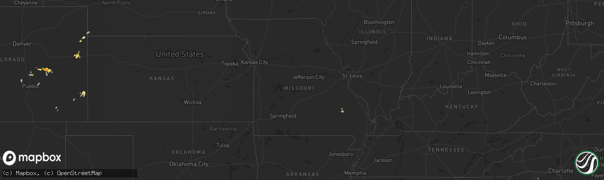
Hail Map in Missouri on July 29, 2025
The weather event in Missouri on July 29, 2025 includes Hail and Wind maps. 24 states and 1,107 cities were impacted and suffered possible damage. The total estimated number of properties impacted is 0.
Want more than just the map?
Turn this storm into a full workflow.
- Owner + property data so you know who to knock
- OnDemand branded weather history reports to win the "did we even have hail?" argument
- RoofTrace estimate so reps stop guessing numbers at the door
Bought this map? Upgrade within 7 days and we'll credit the $230. (10-15 min setup call)
Hail
Wind
0
Estimated number of impacted properties by a 1.00" hail or larger0
Estimated number of impacted properties by a 1.75" hail or larger0
Estimated number of impacted properties by a 2.50" hail or largerStorm reports in Missouri
Missouri
| Date | Description |
|---|---|
| 07/29/20256:20 PM CDT | Trees and power lines down near intersection of hwy c and hwy 60. |
| 07/29/20256:08 PM CDT | 3 trees down at highway d and jason avenue. |
| 07/29/20255:39 PM CDT | Photo sent by trained spotter shows a large... Healthy branch roughly 6 to 8 inches in diameter from maple tree snapped. Spotter also reported addit |
| 07/29/20255:39 PM CDT | Photo sent by trained spotter shows a large... Healthy branch roughly 6 to 8 inches in diameter from maple tree snapped. Spotter also reported additional large limbs sn |
| 07/29/20255:39 PM CDT | Photos show that the canopy at mr. Fuel travel center had large sections of blown off... With several trees in the surrounding vicinity snapped or uprooted. |
| 07/29/20255:12 PM CDT | Two trees down near clearwater lake. Time estimated from radar. |
| 07/28/20257:41 PM CDT | Dock flipped over and multiple trees snapped. |
All States Impacted by Hail Map on July 29, 2025
Cities Impacted by Hail Map on July 29, 2025
- Waterville, MN
- Waseca, MN
- Janesville, MN
- Morristown, MN
- Medford, MN
- Warsaw, MN
- Faribault, MN
- Round Lake, MN
- Bigelow, MN
- Laurens, IA
- Worthington, MN
- Inwood, IA
- Doon, IA
- Pocahontas, IA
- Rock Valley, IA
- Canton, SD
- Alvord, IA
- Fairview, SD
- Hull, IA
- George, IA
- Palmer, IA
- Spirit Lake, IA
- Lake Park, IA
- Manson, IA
- Clare, IA
- Boyden, IA
- Milford, IA
- Okoboji, IA
- Arnolds Park, IA
- Sheldon, IA
- Orange City, IA
- Sanborn, IA
- Terril, IA
- Hospers, IA
- Dickens, IA
- Granville, IA
- Paullina, IA
- Peterson, IA
- Royal, IA
- Primghar, IA
- Spencer, IA
- Graettinger, IA
- Ruthven, IA
- Sutherland, IA
- Emmetsburg, IA
- Hartley, IA
- Sioux Rapids, IA
- Greenville, IA
- Webb, IA
- Ayrshire, IA
- Gillett Grove, IA
- Linn Grove, IA
- Curlew, IA
- Marathon, IA
- Havelock, IA
- Ottosen, IA
- West Bend, IA
- Mallard, IA
- Rolfe, IA
- Albert City, IA
- Bode, IA
- Plover, IA
- Hardy, IA
- Livermore, IA
- Pomeroy, IA
- Humboldt, IA
- Dakota City, IA
- Blenheim, SC
- Galivants Ferry, SC
- Cylinder, IA
- Niceville, FL
- Latta, SC
- Hudson, SD
- Harris, IA
- Adel, GA
- Sioux Center, IA
- Archer, IA
- Hahira, GA
- Thomasville, GA
- Whittemore, IA
- Hardeeville, SC
- Bluffton, SC
- Cairo, GA
- Okatie, SC
- Boston, GA
- Fitzgerald, GA
- Tallahassee, FL
- Delhi, LA
- Panama City Beach, FL
- Bastrop, LA
- Crestview, FL
- Rayville, LA
- Green Pond, SC
- Forest Grove, MT
- Baskin, LA
- Holly, CO
- Ash, NC
- Wagon Mound, NM
- Bethune, CO
- Granada, CO
- Supply, NC
- Forsyth, MT
- Spartanburg, SC
- Glendale, SC
- Plant City, FL
- Dover, FL
- Valrico, FL
- Colorado Springs, CO
- Riceboro, GA
- Monroe, LA
- Kim, CO
- Springer, NM
- White Springs, FL
- Stratton, CO
- Cohagen, MT
- Kentwood, LA
- Marianna, FL
- West Monroe, LA
- Wray, CO
- Vernon, CO
- Hugo, CO
- Parks, NE
- Luverne, AL
- Perry, GA
- Amite, LA
- Presho, SD
- Jasper, FL
- Lake City, FL
- Oviedo, FL
- Townsend, GA
- Rosebud, MT
- Lyons, GA
- Carlisle, SC
- Lithia, FL
- Slocomb, AL
- Kennebec, SD
- Kathleen, GA
- Reliance, SD
- Ramah, CO
- Rush, CO
- Parrish, FL
- Bonaire, GA
- Boone, CO
- Haigler, NE
- Hawkinsville, GA
- Karval, CO
- Penrose, CO
- Warner Robins, GA
- Ideal, SD
- Hamill, SD
- Yoder, CO
- Calhan, CO
- Poplarville, MS
- Carriere, MS
- Silver Creek, MS
- Whatley, AL
- Arcadia, MO
- Annapolis, MO
- Hampton, AR
- Gregory, SD
- Mandaree, ND
- New Town, ND
- Oacoma, SD
- Chamberlain, SD
- Malvern, AR
- Wallace, KS
- Pueblo, CO
- Elba, AL
- Lamar, CO
- Burlington, CO
- Des Arc, MO
- Ordway, CO
- Frisco City, AL
- Roseglen, ND
- Miles City, MT
- Volborg, MT
- Jack, AL
- Herndon, KS
- Colorado City, CO
- Winner, SD
- Sharon Springs, KS
- Lloyd, MT
- Louisville, GA
- Angela, MT
- Kinsey, MT
- Patterson, MO
- Elloree, SC
- Oberlin, KS
- Berry, AL
- Santee, SC
- Culbertson, NE
- New Brockton, AL
- Killdeer, ND
- Pukwana, SD
- Atwood, KS
- Bonne Terre, MO
- Edson, KS
- Shawmut, MT
- Enders, NE
- Wauneta, NE
- North Platte, NE
- Opp, AL
- Winona, KS
- Monticello, MS
- Oak Vale, MS
- Winifred, MT
- Wilsall, MT
- Big Timber, MT
- Kimball, SD
- Platte, SD
- Burke, SD
- Thedford, NE
- McCook, NE
- Danbury, NE
- Stapleton, NE
- Hayes Center, NE
- Bonesteel, SD
- Fairfax, SD
- White Lake, SD
- Dickens, NE
- Wallace, NE
- Canova, SD
- Ponchatoula, LA
- Cameron, SC
- Thermopolis, WY
- Shoshoni, WY
- Buffalo, WY
- Sierraville, CA
- Loyalton, CA
- Pevely, MO
- Ismay, MT
- House Springs, MO
- Van Buren, MO
- Ellington, MO
- Aiken, SC
- Holyoke, CO
- Melville, MT
- Festus, MO
- Altoona, FL
- Champion, NE
- Reed Point, MT
- Chinook, MT
- Stockville, NE
- Fredericktown, MO
- Eureka, MO
- Likely, CA
- Syracuse, KS
- Benkelman, NE
- McDonald, KS
- Bird City, KS
- Max, NE
- Bennett, CO
- Casper, WY
- Arlington, CO
- Brewster, KS
- Cartwright, ND
- Hazen, ND
- Morris, GA
- Cuthbert, GA
- Oneill, NE
- Plankinton, SD
- New Holland, SD
- Mitchell, SD
- Mount Vernon, SD
- Corsica, SD
- Letcher, SD
- Harrison, SD
- Geddes, SD
- Stickney, SD
- Armour, SD
- Fulton, SD
- Ethan, SD
- Woonsocket, SD
- Dimock, SD
- Lake Andes, SD
- Parkston, SD
- Wagner, SD
- Delmont, SD
- Tripp, SD
- Alexandria, SD
- Kaycee, WY
- Fayette, AL
- Winfred, SD
- Elsie, NE
- La Place, LA
- Fremont, MO
- Taylor, NE
- Sargent, NE
- Powderville, MT
- Biddle, MT
- Windsor, SC
- Roy, MT
- Strasburg, CO
- Chatham, MS
- Hollandale, MS
- Greenville, MS
- Glen Allan, MS
- Haswell, CO
- Arnold, NE
- Loranger, LA
- Andalusia, AL
- Williston, SC
- Spencer, SD
- Emery, SD
- Bridgewater, SD
- Salem, SD
- Avon, SD
- Olivet, SD
- Tyndall, SD
- Kaylor, SD
- Freeman, SD
- Canistota, SD
- Scotland, SD
- Lynch, NE
- Lysite, WY
- Stratton, NE
- Butte, NE
- Montrose, SD
- Marion, SD
- Menno, SD
- Utica, SD
- Viborg, SD
- Yankton, SD
- Hurley, SD
- Fordyce, NE
- Saint Helena, NE
- Irene, SD
- Humboldt, SD
- Monroe, SD
- Crofton, NE
- Mission Hill, SD
- Parker, SD
- Lesterville, SD
- Tabor, SD
- Volin, SD
- Gayville, SD
- Wynot, NE
- Maxwell, NE
- Artesian, SD
- Fedora, SD
- Sugar City, CO
- Naper, NE
- Madison, SD
- Cheyenne, WY
- Boyes, MT
- Ekalaka, MT
- Hammond, MT
- Busby, MT
- Lame Deer, MT
- Fairfield, ND
- Medora, ND
- Dawson, GA
- Wentworth, SD
- Fulda, MN
- Poplar Bluff, MO
- Reading, MN
- Clearmont, WY
- Decker, MT
- Leary, GA
- Worthing, SD
- Chancellor, SD
- Lennox, SD
- Hartford, SD
- Wakonda, SD
- Tea, SD
- Beresford, SD
- Vermillion, SD
- Davis, SD
- Harrisburg, SD
- Centerville, SD
- Sioux Falls, SD
- Gillette, WY
- Pritchett, CO
- Buffalo Center, IA
- Montverde, FL
- Anselmo, NE
- Callaway, NE
- Okabena, MN
- Colton, SD
- Heron Lake, MN
- Brewster, MN
- Curtis, NE
- Rushmore, MN
- Palisade, NE
- Page, NE
- Verdigre, NE
- Orchard, NE
- Winnetoon, NE
- Royal, NE
- Creighton, NE
- Brunswick, NE
- Plainview, NE
- Neligh, NE
- Ewing, NE
- Clearwater, NE
- Osmond, NE
- Wausa, NE
- Mclean, NE
- Randolph, NE
- Pierce, NE
- Meadow Grove, NE
- Tilden, NE
- Norfolk, NE
- Battle Creek, NE
- Renner, SD
- Baltic, SD
- Crooks, SD
- Lyons, SD
- Garretson, SD
- Larchwood, IA
- Brandon, SD
- Hills, MN
- Valley Springs, SD
- Elk Point, SD
- Alcester, SD
- Burbank, SD
- Elm Creek, NE
- Odessa, NE
- Riverdale, NE
- Kearney, NE
- Axtell, NE
- Funk, NE
- Alzada, MT
- Belfield, ND
- Arapahoe, CO
- Pickstown, SD
- Ceylon, MN
- Glidden, IA
- Carroll, IA
- Madrid, NE
- Levant, KS
- Fairmont, MN
- Welcome, MN
- Parkman, WY
- Scranton, IA
- Brady, NE
- Jefferson, IA
- Rake, IA
- Gothenburg, NE
- Greenwood Springs, MS
- Marion, AL
- Broadus, MT
- Lake Mills, IA
- Leland, IA
- Waterbury, NE
- Jackson, NE
- Allen, NE
- Jefferson, SD
- Akron, IA
- Ponca, NE
- Westfield, IA
- Newcastle, NE
- Chatsworth, IA
- Hawarden, IA
- North Sioux City, SD
- Dakota City, NE
- Sioux City, IA
- South Sioux City, NE
- Merrill, IA
- Rock Rapids, IA
- Le Mars, IA
- Ireton, IA
- Lester, IA
- Dixon, NE
- Maskell, NE
- Winside, NE
- Carroll, NE
- Hoskins, NE
- Stanton, NE
- Gibbon, NE
- Mason City, NE
- Litchfield, NE
- Ansley, NE
- Arcadia, NE
- Loup City, NE
- North Loup, NE
- Ravenna, NE
- Scotia, NE
- Boelus, NE
- Saint Paul, NE
- Ord, NE
- Rockville, NE
- Farwell, NE
- Dannebrog, NE
- Elba, NE
- Ashton, NE
- Wessington Springs, SD
- Greeley, NE
- Wolbach, NE
- Howard, SD
- Beach, ND
- Lakefield, MN
- Cope, CO
- Spencer, NE
- Storm Lake, IA
- Dunnell, MN
- Cozad, NE
- Wilmont, MN
- Chester, SD
- Coleman, GA
- Burwell, NE
- Dell Rapids, SD
- Joice, IA
- Jackson, MN
- Caledonia, MS
- Gattman, MS
- Amory, MS
- Plevna, MT
- Baker, MT
- Willard, MT
- Merna, NE
- Sherburn, MN
- Thompson, IA
- Hulett, WY
- Hornick, IA
- Shellman, GA
- Termo, CA
- Sheridan, WY
- Rockwell City, IA
- Jolley, IA
- Kingsley, IA
- Dolliver, IA
- Fonda, IA
- Yale, IA
- Scarville, IA
- Stuart, NE
- Goodland, KS
- Brent, AL
- Bagley, IA
- Bronson, IA
- Reno, NV
- Roggen, CO
- Ogallala, NE
- Hilger, MT
- Broken Bow, NE
- Armstrong, IA
- Sundance, WY
- Douglas, WY
- El Paso, TX
- Northwood, IA
- Salix, IA
- Sergeant Bluff, IA
- Rock River, WY
- Fertile, IA
- Hanlontown, IA
- Forest City, IA
- Vona, CO
- Mason City, IA
- Clear Lake, IA
- Manly, IA
- Kensett, IA
- Otter, MT
- Panora, IA
- Smithland, IA
- Oto, IA
- Cleghorn, IA
- Brunsville, IA
- Remsen, IA
- Oyens, IA
- Marcus, IA
- Alton, IA
- Maurice, IA
- Hinton, IA
- Overton, NE
- Hubbard, NE
- Decatur, NE
- Whiting, IA
- Climbing Hill, IA
- Washta, IA
- Homer, NE
- Onawa, IA
- Anthon, IA
- Moville, IA
- Sloan, IA
- Lawton, IA
- Pierson, IA
- Macy, NE
- Correctionville, IA
- Walthill, NE
- Winnebago, NE
- Meriden, IA
- Larrabee, IA
- Castana, IA
- Cushing, IA
- Mapleton, IA
- Rodney, IA
- Ida Grove, IA
- Danbury, IA
- Calumet, IA
- Holstein, IA
- Battle Creek, IA
- Quimby, IA
- Cherokee, IA
- Aurelia, IA
- Galva, IA
- Pender, NE
- Wayne, NE
- Lyons, NE
- Oakland, NE
- Madison, NE
- West Point, NE
- Beemer, NE
- Wisner, NE
- Bancroft, NE
- Pilger, NE
- Clarkson, NE
- Craig, NE
- Howells, NE
- Snyder, NE
- Scribner, NE
- Dodge, NE
- North Bend, NE
- Hooper, NE
- Leigh, NE
- Bosler, WY
- Belle Fourche, SD
- Charles City, IA
- Rockford, IA
- Plymouth, IA
- Weirsdale, FL
- Bartlett, NE
- Alta, IA
- Wakefield, NE
- Macdoel, CA
- Ericson, NE
- Eufaula, AL
- Grafton, IA
- Birney, MT
- Banner, WY
- Wheatland, WY
- Emerson, NE
- Akron, CO
- Spalding, NE
- Cedar Rapids, NE
- Trent, SD
- Spearfish, SD
- Whitewood, SD
- Saint Onge, SD
- Lead, SD
- Shell Knob, MO
- Genoa, NE
- Fullerton, NE
- Klamath Falls, OR
- Primrose, NE
- Fort Dodge, IA
- Belgrade, NE
- Charter Oak, IA
- Schleswig, IA
- Denison, IA
- Fosters, AL
- Ralph, AL
- Knoxville, AL
- Tekamah, NE
- Mondamin, IA
- Herman, NE
- Uehling, NE
- Winslow, NE
- Modale, IA
- Missouri Valley, IA
- Nickerson, NE
- Arlington, NE
- Blair, NE
- Kennard, NE
- Fort Calhoun, NE
- Fremont, NE
- Omaha, NE
- Crescent, IA
- Elkhorn, NE
- Bennington, NE
- Ames, NE
- Washington, NE
- Valley, NE
- Arion, IA
- Defiance, IA
- Ute, IA
- Dow City, IA
- Pisgah, IA
- Little Sioux, IA
- Moorhead, IA
- Earling, IA
- Ricketts, IA
- Blencoe, IA
- Soldier, IA
- Dunlap, IA
- Woodbine, IA
- Arthur, IA
- Kiron, IA
- Deloit, IA
- Vail, IA
- Manilla, IA
- Odebolt, IA
- Sturgis, SD
- Deadwood, SD
- Stuart, IA
- Adel, IA
- Dallas Center, IA
- Amidon, ND
- Titonka, IA
- Burt, IA
- Johnston, IA
- Urbandale, IA
- Midway, AL
- Fenton, IA
- Nora Springs, IA
- Rock Falls, IA
- Wyola, MT
- Elkin, NC
- West Des Moines, IA
- Windsor Heights, IA
- Grimes, IA
- Waukee, IA
- Clive, IA
- Polk City, IA
- Morgan, GA
- Colby, KS
- Petersburg, NE
- Rudd, IA
- Marble Rock, IA
- Chugwater, WY
- Bozeman, MT
- Lagrange, WY
- Dayton, WY
- Albion, NE
- Saint Edward, NE
- Des Moines, IA
- Martell, NE
- Roca, NE
- Crete, NE
- Malcolm, NE
- Denton, NE
- Davey, NE
- Walton, NE
- Bennet, NE
- Waverly, NE
- Raymond, NE
- Lincoln, NE
- Elmwood, NE
- Ceresco, NE
- Ashland, NE
- Murdock, NE
- Springfield, NE
- Alvo, NE
- Valparaiso, NE
- Greenwood, NE
- Palmyra, NE
- Eagle, NE
- Gretna, NE
- Otoe, NE
- Unadilla, NE
- Louisville, NE
- Weeping Water, NE
- Avoca, NE
- Syracuse, NE
- South Bend, NE
- Pleasant Dale, NE
- Papillion, NE
- La Vista, NE
- Manley, NE
- Cedar Creek, NE
- Dunbar, NE
- Nehawka, NE
- Plattsmouth, NE
- Union, NE
- Nebraska City, NE
- Murray, NE
- Hanna, WY
- Belgrade, MT
- Merino, CO
- Nashua, IA
- Webber, KS
- Logan, IA
- Torrington, WY
- Walnut Cove, NC
- Townsend, MT
- Three Forks, MT
- Norwalk, IA
- Underwood, IA
- Council Bluffs, IA
- Ranchester, WY
- Canon, GA
- Carnesville, GA
- Royston, GA
- Carlisle, IA
- State Center, IA
- Marshalltown, IA
- Danielsville, GA
- Rhodes, IA
- Laurel, IA
- Liscomb, IA
- Melbourne, IA
- Albion, IA
- Haverhill, IA
- Colo, IA
- Clemons, IA
- Conrad, IA
- Union, IA
- Saint Anthony, IA
- Le Grand, IA
- Garwin, IA
- Gilman, IA
- Newton, IA
- Ferguson, IA
- Beaman, IA
- Reinbeck, IA
- Holland, IA
- Grundy Center, IA
- Dike, IA
- Gladbrook, IA
- Zearing, IA
- Traer, IA
- Morrison, IA
- Montour, IA
- Tama, IA
- Chelsea, IA
- Toledo, IA
- Lincoln, IA
- Clutier, IA
- Bellevue, NE
- Fort Meade, SD
- Harlowton, MT
- Griswold, IA
- Fishtail, MT
- Malvern, IA
- Ionia, IA
- Franklin, LA
- Ralston, IA
- Whitehall, MT
- Cardwell, MT
- Macedonia, IA
- Kellogg, IA
- Hancock, IA
- Thurman, IA
- Minden, IA
- Treynor, IA
- McClelland, IA
- Tabor, IA
- Pacific Junction, IA
- Yoder, WY
- Henderson, IA
- Oakland, IA
- Glenwood, IA
- Hastings, IA
- Silver City, IA
- Lodge Grass, MT
- Atlantic, IA
- Belle Plaine, IA
- Hull, GA
- Athens, GA
- Exira, IA
- Brayton, IA
- Avoca, IA
- Emerson, IA
- Carson, IA
- Red Oak, IA
- Greene, IA
- Casey, IA
- Adair, IA
- Philipsburg, MT
- Fort Atkinson, IA
- Waucoma, IA
- Elberon, IA
- Toston, MT
- Cedar Falls, IA
- Hudson, IA
- La Porte City, IA
- Waterloo, IA
- Denver, IA
- Dysart, IA
- Buckingham, IA
- Vining, IA
- Tripoli, IA
- Janesville, IA
- Waverly, IA
- Readlyn, IA
- Newhall, IA
- Van Horne, IA
- Keystone, IA
- Rowley, IA
- Garrison, IA
- Independence, IA
- Vinton, IA
- Raymond, IA
- Brandon, IA
- Fairbank, IA
- Shellsburg, IA
- Walker, IA
- Center Point, IA
- Dunkerton, IA
- Mount Auburn, IA
- Jesup, IA
- Blairstown, IA
- Evansdale, IA
- Luzerne, IA
- Dewar, IA
- Urbana, IA
- Gilbertville, IA
- Atkins, IA
- Palo, IA
- Westside, IA
- Wall Lake, IA
- Arcadia, IA
- Breda, IA
- Auburn, IA
- Lake City, IA
- Harlan, IA
- Manning, IA
- Templeton, IA
- Aspinwall, IA
- Audubon, IA
- Irwin, IA
- Kirkman, IA
- Persia, IA
- Lidderdale, IA
- Panama, IA
- Westphalia, IA
- Halbur, IA
- Neola, IA
- Portsmouth, IA
- Shelby, IA
- Churdan, IA
- Gray, IA
- Kimballton, IA
- Elk Horn, IA
- Walnut, IA
- Dedham, IA
- Coon Rapids, IA
- Grand Junction, IA
- Bayard, IA
- Rippey, IA
- Ogden, IA
- Hamlin, IA
- Jamaica, IA
- Guthrie Center, IA
- Dana, IA
- Boone, IA
- Marne, IA
- Beaver, IA
- Dawson, IA
- Perry, IA
- Lewis, IA
- Anita, IA
- Wiota, IA
- Cumberland, IA
- Elliott, IA
- Menlo, IA
- Linden, IA
- Villisca, IA
- Massena, IA
- Corning, IA
- Bridgewater, IA
- Grant, IA
- Fontanelle, IA
- Minburn, IA
- Dexter, IA
- Greenfield, IA
- Woodward, IA
- Orient, IA
- Prescott, IA
- Redfield, IA
- Creston, IA
- Mankato, KS
- Marengo, IA
- Hartwick, IA
- Humboldt, NE
- Table Rock, NE
- Sumner, IA
- Lawler, IA
- Auburn, NE
- Lexington, NE
- Eddyville, NE
- Coin, IA
- Shenandoah, IA
- Northboro, IA
- Oelwein, IA
- Hazleton, IA
- Oran, IA
- Aurora, IA
- Coggon, IA
- Quasqueton, IA
- Winthrop, IA
- Bouton, IA
- Earlham, IA
- Macksburg, IA
- Winterset, IA
- De Soto, IA
- Van Meter, IA
- Grover, CO
- Clarinda, IA
- Oconto, NE
- Blanchard, IA
- Dyersville, IA
- Elmo, MO
- Clearmont, MO
- Solon, IA
- Shambaugh, IA
- New Market, IA
- Miller, NE
- Burlington Junction, MO
- Bedford, IA
- Braddyville, IA
- Macon, MS
- Hopkins, MO
- Graham, MO
- Elyria, NE
- Farley, IA
- Brooksville, MS
- Hazard, NE
- Pickering, MO
- Maryville, MO
- Story, WY
- Seymour, TX
- Moorcroft, WY
- Mechanicsville, IA
- Skidmore, MO
- Nye, MT
- Conception Junction, MO
- Ravenwood, MO
- Silver Creek, NE
- Tipton, IA
- Hawkeye, IA
- Maquoketa, IA
- West Liberty, IA
- Atalissa, IA
- Nichols, IA
- Parnell, MO
- Bellevue, IA
- Lamoni, IA
- Decatur, IA
- Savanna, IL
- Andrew, IA
- Preston, IA
- Spragueville, IA
- Muscatine, IA
- Davis City, IA
- Alva, WY
- Shelby, NE
- Osceola, NE
- Farragut, IA
- Absarokee, MT
- Hanover, IL
- Marion, IA
- Alburnett, IA
- Toddville, IA
- Elizabeth, IL
- Miles, IA
- Brooklyn, IA
- Arnold, CA
- Lovilia, IA
- Knoxville, IA
- Hamilton, IA
- Grinnell, IA
- Lisbon, IA
- Ely, IA
- Beulah, WY
- West Branch, IA
- Sabula, IA
- Aladdin, WY
- Malcom, IA
- Yutan, NE
- Lyman, NE
- Hawk Springs, WY
- Morrill, NE
- Stockton, IL
- Waterloo, NE
- Pine Bluffs, WY
- Leighton, IA
- Mount Carroll, IL
- Chadwick, IL
- New Sharon, IA
- Long Barn, CA
- Lanark, IL
- Ottumwa, IA
- Deep River, IA
- What Cheer, IA
- Delta, IA
- Rose Hill, IA
- Oskaloosa, IA
- Milledgeville, IL
- Hedrick, IA
- Sigourney, IA
- Maysville, MO
- McFall, MO
- Agency, IA
- Zwingle, IA
- Monmouth, IA
- Wyoming, IA
- Baldwin, IA
- La Motte, IA
- De Witt, IA
- Delmar, IA
- Charlotte, IA
- Lost Nation, IA
- Oxford Junction, IA
- Goose Lake, IA
- Bryant, IA
- Clinton, IA
- Ollie, IA
- Hayesville, IA
- Ludell, KS
- Packwood, IA
- Manderson, WY
- Libertyville, IA
- Eldon, IA
- Birmingham, IA
- Fairfield, IA
- Bonaparte, IA
- Keosauqua, IA


