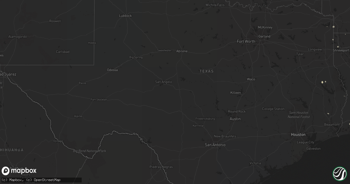
Hail Map in Texas on July 29, 2018
Get this storm
July 29 map
$229
one time, instant access
Download today. No call, no setup
Keep the $229
Bought the map and want the full workflow? Apply the entire $229 to a subscription within 7 days. None of it is wasted.
Every map, not just this one
This buys you this map. Subscription and you get every map we run, in the markets you choose from a few cities to whole states to nationwide. Plus real-time alerts the moment a storm fires.
Contact data
Name, contact info, occupancy, even credit band for addresses in the footprint. You go from where it hit to who to call.
Become the source they trust
Unlimited branding weather history reports on demand. You already have the documented answer ready for the property owner, and you are the one who showed up with it.
Property data and RoofTrace estimates
Pull up any address you have got, its value and the exact code rules for that jurisdiction, straight from One Click Code. Then RoofTrace estimates the squares, pitch, and roof value, priced the way you price.
Storm reports in Texas
Texas
| Date | Description |
|---|---|
| 07/29/20186:00 PM CDT | Em reports several tress down and a turned over dog kennel/outbuilding. |
| 07/29/20186:27 AM CDT | At 1127 PM CDT, a severe thunderstorm was located 12 miles east of Campo, or 22 miles north of Boise City, moving southeast at 30 mph. HAZARD...60 mph wind gusts and half dollar size hail. SOURCE...Radar indicated. IMPACT...Minor damage to roofs, siding, and trees is possible. Hail damage to vehicles is expected. Locations impacted include... Keyes, Griggs and Sturgis. |
| 07/29/20185:07 AM CDT | At 1007 PM MDT, a severe thunderstorm was located 14 miles northwest of Hayden, or 21 miles northwest of Amistad, moving southeast at 20 mph. HAZARD...60 mph wind gusts and half dollar size hail. SOURCE...Radar indicated. IMPACT...Hail damage to vehicles is expected. Expect wind damage to roofs, siding, and trees. Locations impacted include... Amistad and Hayden. |
| 07/29/20184:55 AM CDT | A local report indicates 59 MPH wind near 3 NW SEYMOUR |
| 07/29/20184:00 AM CDT | At 858 PM CDT, a severe thunderstorm was located 5 miles west of Quitaque, or 6 miles southwest of Caprock Canyon State Park, moving southeast at 25 mph. A 66mph wind gust was recorded at the Silverton West Texas Mesonet at 850PM. HAZARD...70 mph wind gusts and nickel size hail. SOURCE...West Texas Mesonet indicated. IMPACT...Expect considerable tree damage. Damage is likely to mobile homes, roofs, and outbuildings. Locations impacted include... Turkey, Caprock Canyon State Park, Quitaque, and Flomot. |
| 07/29/20183:55 AM CDT | Corrects previous tstm wnd gst report from 3 ene odell. Mesonet station olst2... 3 ene odell. |
| 07/29/20183:16 AM CDT | At 816 PM CDT, a severe thunderstorm was located over Clarendon, moving southeast at 15 mph. HAZARD...60 mph wind gusts and nickel size hail. SOURCE...Radar indicated. IMPACT...Minor damage to roofs, siding, and trees is possible. Locations impacted include... Clarendon, Hedley and Lelia Lake. |
| 07/29/20182:51 AM CDT | Measured by the ttu mesonet. Intermittent severe gusts from 0233 - 0246. |
| 07/29/20182:24 AM CDT | At 723 PM CDT, a severe thunderstorm was located 6 miles northwest of Howardwick, or 12 miles north of Clarendon, moving southeast at 10 mph. HAZARD...60 mph wind gusts and quarter size hail. SOURCE...Radar indicated. IMPACT...Minor damage to roofs, siding, and trees is possible. Hail damage to vehicles is expected. Locations impacted include... Clarendon, Howardwick and Greenbelt Lake. |
| 07/29/201812:30 AM CDT | Late report of thunderstorm wind gust and an inch of rain. |
| 07/28/201811:08 PM CDT | At 407 PM CDT, severe thunderstorms were located along a line extending from near Zwolle to near Tenaha, moving south at 25 mph. HAZARD...60 mph wind gusts. SOURCE...Radar indicated. IMPACT...Expect damage to roofs, siding, and trees. Locations impacted include... Center, Milam, Many, San Augustine, Zwolle, Hemphill, Tenaha, Timpson, Garrison, Joaquin, Converse, Melrose, Patroon, Martinsville, Bland Lake, Neuville, Rosevine, Macune, Shelbyville and Oak Grove. |
| 07/28/20188:50 PM CDT | A local report indicates 66 MPH wind near 7 ESE SILVERTON |
| 07/28/20188:21 PM CDT | 1 car flipped over 4 miles east of clarendon on hwy 287 |
| 07/28/20188:20 PM CDT | 1 car flipped over 4 miles west of clarendon on hwy 287 |
| 07/28/20188:17 PM CDT | Tree knocked down on power line |
| 07/28/20188:13 PM CDT | At 113 PM CDT, severe thunderstorms were located along a line extending from near Linden to 6 miles northeast of Canfield, moving south at 25 mph. HAZARD...70 mph wind gusts and penny size hail. SOURCE...Radar indicated. IMPACT...Expect considerable tree damage. Damage is likely to mobile homes, roofs, and outbuildings. Locations impacted include... Atlanta, Stamps, Lewisville, Vivian, Jefferson, Linden, Queen City, Plain Dealing, Oil City, Fouke, Bradley, Hosston, Rodessa, Belcher, Ida, Gilliam, Bivins, Lodi, Smithland and Ravanna. |
| 07/28/20188:13 PM CDT | A local report indicates 60 MPH wind near CLARENDON |
All States Impacted by Hail Map on July 29, 2018
Cities Impacted by Hail Map on July 29, 2018
- Miami, TX
- Hartford, AR
- Huntington, AR
- Greeley, CO
- La Salle, CO
- Evans, CO
- Weldona, CO
- Orchard, CO
- Lawton, OK
- Carnegie, OK
- Limon, CO
- Genoa, CO
- Woodrow, CO
- Bosler, WY
- Garrett, WY
- Hammon, OK
- Pleasanton, NE
- Mason City, NE
- Amherst, NE
- Kingfisher, OK
- Okarche, OK
- Watonga, OK
- Omega, OK
- Buford, WY
- Rock River, WY
- Granite Canon, WY
- Tie Siding, WY
- Laramie, WY
- Livermore, CO
- Kyle, SD
- Torrington, WY
- Belvidere, SD
- Eads, CO
- Arriba, CO
- Manter, KS
- Granada, CO
- Hugoton, KS
- Sheridan Lake, CO
- Akron, CO
- Kit Carson, CO
- Cope, CO
- Guymon, OK
- Anton, CO
- Holly, CO
- Vona, CO
- Cheyenne Wells, CO
- Flagler, CO
- Syracuse, KS
- Seibert, CO
- Lindon, CO
- Johnson, KS
- Richfield, KS
- Rolla, KS
- Belle Fourche, SD
- Wheatland, WY
- Cheyenne, WY
- Rush, CO
- Agate, CO
- Seiling, OK
- Longdale, OK
- Canton, OK
- Lusk, WY
- Manzanola, CO
- Rocky Ford, CO
- Edgemont, SD
- Snyder, CO
- Merino, CO
- Boone, CO
- Olney Springs, CO
- Fowler, CO
- Sargent, NE
- Walsh, CO
- Branson, CO
- Eunice, LA
- Merriman, NE
- Martin, SD
- Allen, SD
- Wanblee, SD
- Porcupine, SD
- Clifton, AZ
- Casper, WY
- Fort Collins, CO
- Laverne, OK
- Milton, FL
- Fairview, OK
- Okeene, OK
- Isabella, OK
- Ringwood, OK
- Cleo Springs, OK
- Weatherford, OK
- Thomas, OK
- Custer City, OK
- Eaton, CO
- Arnett, OK
- Wayne, OK
- Little River, AL
- Lexington, NE
- Elwood, NE
- Bertrand, NE
- Smithfield, NE
- Batchelor, LA
- Albin, WY
- Hawk Springs, WY
- Meriden, WY
- Yoder, WY
- Lagrange, WY
- Franklinton, LA
- Denhoff, ND
- Burns, WY
- Hillsdale, WY
- Alva, OK
- Waynoka, OK
- Shawnee, OK
- Mcloud, OK
- Tecumseh, OK
- Fort Supply, OK
- Buffalo, OK
- Stringtown, OK
- Rocky Ford, GA
- Sylvania, GA
- Deer Trail, CO
- Jay Em, WY
- Apache, OK
- Metter, GA
- Pine Bluffs, WY
- Aline, OK
- Kiowa, CO
- Oelrichs, SD
- Chadron, NE
- Rapid City, SD
- Amado, AZ
- Taloga, OK
- Bloomburg, TX
- Texarkana, TX
- Doddridge, AR
- Globe, AZ
- Miami, AZ
- Windsor, CO
- New Raymer, CO
- Grover, CO
- Nunn, CO
- Fountain, FL
- Clayton, NM
- Otis, CO
- Deadwood, SD
- Spearfish, SD
- Lead, SD
- Capitol, MT
- Coolidge, KS
- Trinidad, CO
- Maysville, OK
- Lelia Lake, TX
- Hedley, TX
- Jeffrey City, WY
- Anadarko, OK
- Fort Cobb, OK
- Carpenter, WY
- Brush, CO
- Stoneham, CO
- Fort Morgan, CO
- Hillrose, CO
- Elkhart, KS
- Model, CO
- Yoder, CO
- Simla, CO
- Lander, WY
- Byers, CO
- Strasburg, CO
- Fort Huachuca, AZ
- Pingree, ND
- Calhan, CO
- Bennett, CO
- Ramah, CO
- Woodworth, ND
- Bark River, MI
- Cheyenne, OK
- Burkeville, TX
- Rogers City, MI
- Newell, SD
- Stratton, CO
- Bethune, CO
- Hydro, OK
- Corn, OK
- Harrisburg, NE
- Ault, CO
- Briggsdale, CO
- Saint Onge, SD
- Stamford, NE
- Long Island, KS
- Beaver City, NE
- Almena, KS
- Bowie, AZ
- Willcox, AZ
- San Simon, AZ
- Olla, LA
- Aimwell, LA
- Valentine, NE
- Lamar, CO
- Keenesburg, CO
- Platteville, CO
- Gilcrest, CO
- Loveland, CO
- Wellington, CO
- Severance, CO
- Kersey, CO
- Roggen, CO
- Hudson, CO
- Milliken, CO
- Johnstown, CO
- Lucerne, CO
- Elbert, CO
- Laporte, CO
- Colorado Springs, CO
- Livingston, LA
- Holden, LA
- Bellvue, CO
- Stonewall, OK
- Tupelo, OK
- Milburn, OK
- Clarendon, TX
- Plain Dealing, LA
- Atmore, AL
- Chester, OK
- Oakwood, OK
- Taylor, AR
- Hill City, SD
- Elfrida, AZ
- Inez, KY
- Crookston, MN
- Euclid, MN
- Pueblo, CO
- Fountain, CO
- May, OK
- Patterson, LA
- Dacoma, OK
- Amistad, NM
- Buffalo Gap, SD
- Custer, SD
- Marion, LA
- Oklahoma City, OK
- Red Feather Lakes, CO
- Centennial, WY
- Purcell, OK
- Buffalo, SD
- Silverton, TX
- Century, FL
- Minden, NE
- Kearney, NE
- Shattuck, OK
- Vilas, CO
- Two Buttes, CO
- Springfield, CO
- Hitchcock, OK
- Claypool, AZ
- Chugwater, WY
- Breeden, WV
- Harts, WV
- Dunlow, WV
- Wilsondale, WV
- Rudyard, MI
- Kinross, MI
- Keyes, OK
- Smithwick, SD
- Litchville, ND
- Belfield, ND
- McDavid, FL
- Elgin, AZ
- Wetumka, OK
- Holdenville, OK
- Cope, SC
- Orangeburg, SC
- Hot Springs, SD
- Robeline, LA
- Hennessey, OK
- Arcadia, NE
- Westerville, NE
- Ansley, NE
- Comstock, NE
- Campo, CO
- Sturgis, SD
- Nemo, SD
- Whitewood, SD
- Calumet, OK
- Anamoose, ND
- Woodville, MS
- Hooker, OK
- Detroit Lakes, MN
- Hereford, AZ
- Bushnell, NE
- Benson, AZ
- Hazard, NE
- Riverdale, NE
- Manville, WY
- Boise City, OK
- Oral, SD
- Pine Ridge, SD
- Cottonport, LA
- Plaucheville, LA
- Thermopolis, WY
- Coldwater, KS
- Leopolis, WI
- Lahoma, OK
- Enid, OK
- Konawa, OK
- Prairie View, KS
- Oxford, NE
- Enterprise, AL
- Pavillion, WY
- Riverton, WY
- Shoshoni, WY
- Bradley, OK
- Chireno, TX
- Stephenson, MI
- Natchitoches, LA
- Las Vegas, NV
- Blue Diamond, NV
- Fargo, OK
- El Reno, OK
- Gruver, TX
- Perryton, TX
- Hardesty, OK
- Spearman, TX
- Goodwell, OK
- Tuttle, OK
- Seminole, OK
- Lindsay, OK
- Marksville, LA
- Tishomingo, OK
- Jean, NV
- Lost Springs, WY
- Lance Creek, WY
- Norman, OK
- Pittsburg, OK
- Forgan, OK
- Alex, OK
- Amber, OK
- Blanchard, OK
- Honobia, OK
- Memphis, TX
- Broken Bow, OK
- Colony, OK
- Mena, AR
- Leedey, OK
- Yukon, OK
- Chipley, FL
- Sells, AZ
- Muldrow, OK
- Mountain View, OK
- Lake Charles, LA
- Heartwell, NE
- Louisa, KY
- Macomb, OK
- Brimley, MI
- Dafter, MI
- Booker, TX
- Warren, MN
- Wewoka, OK
- Doerun, GA
- Sasakwa, OK
- Lookeba, OK
- Kadoka, SD
- Long Valley, SD
- Sweetwater, OK
- Reydon, OK
- Cut Off, LA
- Harrisville, MI
- Newcastle, OK
- Washington, OK
- Helena, OK
- Goltry, OK
- Grenville, NM
- Folsom, NM
- Blair, OK
- Edison, NE
- Westlake, LA
- Sulphur, LA
- Garrison, ND
- Millen, GA
- Douglassville, TX
- Cozad, NE
- Ashland, KS
- Dawson, ND
- Rosston, OK
- Green Valley, AZ
- Tumacacori, AZ
- Tickfaw, LA
- Beaver, OK
- Jefferson, TX
- Vivian, LA
- Jeanerette, LA
- Minatare, NE
- Broken Bow, NE
- Woodward, OK
- Wapanucka, OK
- Fairmont, OK
- Mooreland, OK
- Sharon, OK
- Joes, CO
- Pauls Valley, OK
- Byars, OK
- Cary, NC
- Silsbee, TX
- Pampa, TX
- Opelousas, LA
- Gage, OK
- Sault Sainte Marie, MI
- Pickford, MI
- Meno, OK
- Trout, LA
- Cordell, OK
- Nacogdoches, TX
- Longville, LA
- Presho, SD
- Draper, SD
- Wood, SD
- Shreveport, LA
- Ames, OK
- Carmen, OK
- Church Point, LA
- Crestone, CO
- Animas, NM
- Follett, TX
- Scenic, SD
- Kingsland, GA
- Matheson, CO
- Union Center, SD
- Sublette, KS
- Olar, SC
- Tombstone, AZ
- Oberlin, LA
- Kinder, LA
- Union City, OK
- Cherokee, OK
- Ninnekah, OK
- Rush Springs, OK
- Eros, LA
- Calhoun, LA
- Glendo, WY
- Quitman, GA
- Briscoe, TX
- Vancleave, MS
- Singer, LA
- Maud, OK
- Mikado, MI
- Lake City, KS
- Scottsbluff, NE
- Balko, OK
- Hermosa, SD
- Callaway, NE
- Bairoil, WY
- Fe Warren Afb, WY
- Hanna, WY
- Pierce, CO
- Carr, CO
- Timnath, CO
- Hugo, CO


